Luxfords Wood

Wood, Forest in Sussex Horsham

England

Luxfords Wood

Mockford Farm Mockford Farm, dating back to Medieval times; photo taken looking west from near Parkminster Farm, in Spring 2005
Mockford Farm Credit: Graham Pritchard

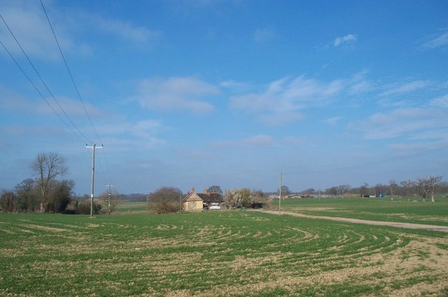
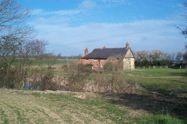
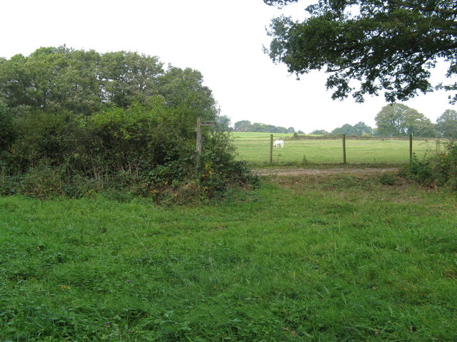
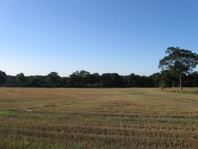
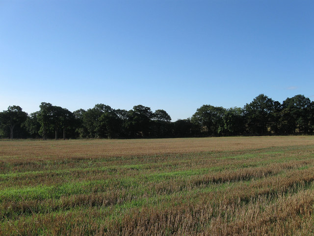
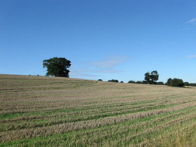
Luxfords Wood is a picturesque woodland located in the county of Sussex, England. Covering an area of approximately 100 acres, this enchanting forest is nestled within the South Downs National Park, offering visitors a tranquil and immersive experience in nature.

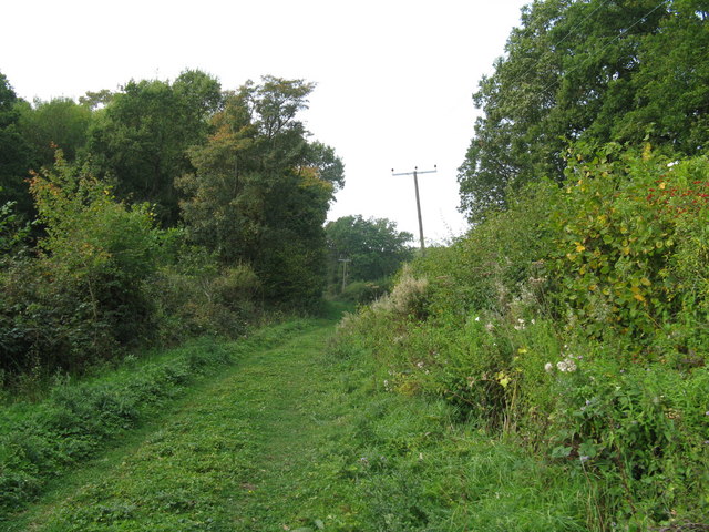
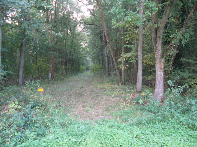
The woodland is predominantly composed of native broadleaf trees, such as oak, beech, and birch, creating a diverse and vibrant ecosystem. Luxfords Wood is known for its rich biodiversity, with numerous species of flora and fauna thriving within its boundaries. Bluebells carpet the forest floor in the spring, creating a stunning display of vibrant colors, while various ferns, mosses, and wildflowers can be found throughout the year.

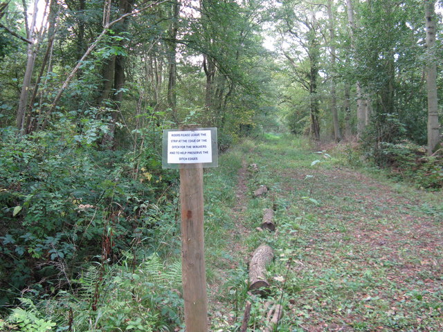
The wood is crisscrossed by a network of well-maintained footpaths, providing visitors with the opportunity to explore its natural beauty at their own pace. These paths wind through the forest, leading to hidden glades, secluded ponds, and ancient trees, offering a sense of discovery around every corner. The peaceful ambiance of Luxfords Wood also makes it a popular spot for birdwatching, as many species of woodland birds can be spotted throughout the year.

Luxfords Wood is managed by the local conservation authority, ensuring the preservation of its natural heritage. Visitors are encouraged to respect the woodland's fragile ecosystem by sticking to designated paths and refraining from littering. The wood is open to the public year-round, with no entry fee, allowing nature enthusiasts and outdoor lovers to enjoy its beauty and serenity whenever they please.

If you have any feedback on the listing, please let us know in the comments section below.

Luxfords Wood Images

Images are sourced within 2km of 50.968468/-0.31279621 or Grid Reference TQ1820. Thanks to Geograph Open Source API. All images are credited.

Mockford Farm Mockford Farm, dating back to Medieval times; photo taken looking west from near Parkminster Farm, in Spring 2005
Mockford Farm
Mockford Farm, dating back to Medieval times; photo taken looking west from near Parkminster Farm, in Spring 2005
Mockford Farm Mockford Farm, dating back to Medieval times.
Mockford Farm
Mockford Farm, dating back to Medieval times.
Footpath heading SW beside Conifer windbreak
Roof of barn at Parkminster Farm On the horizon are the communication masts at Truleigh Hill on the South Downs
Roof of barn at Parkminster Farm
On the horizon are the communication masts at Truleigh Hill on the South Downs
Wooden mushroom farm at Mockford
Multi coloured cattle on Swains Farm
Power lines beside bridleway west of Greentree Farm
Track through Wymarks Wood
Broken waymarker indicating change of direction
Ideal solution for walkers
Mockford as seen from footpath to the west
Tree stump alongside field on Swains Farm
Pond Field The name of the field according to the 1840 tithe map. The pond once occupied the north east corner of the field but has long been filled in. The track on the left hand side of the field is the former drive to Godshill Farm which burnt down in 1966.
Pond Field
The name of the field according to the 1840 tithe map. The pond once occupied the north east corner of the field but has long been filled in. The track on the left hand side of the field is the former drive to Godshill Farm which burnt down in 1966.
Coneyburry Field The name of the field according to the 1840 tithe map and as its name suggests the site of a former warren. The field has been extended to include Little Meadow to the south and Housewood Field and Barn Field to the west. A footpath should run through this part of the field but there was no way through the maize at either this end or the southern entrance near Mockford.
Coneyburry Field
The name of the field according to the 1840 tithe map and as its name suggests the site of a former warren. The field has been extended to include Little Meadow to the south and Housewood Field and Barn Field to the west. A footpath should run through this part of the field but there was no way through the maize at either this end or the southern entrance near Mockford.
House Meadow The name of the field according to the 1840 tithe map, the house concerned being Parkminster Farm whose roof can just be seen through the trees.
House Meadow
The name of the field according to the 1840 tithe map, the house concerned being Parkminster Farm whose roof can just be seen through the trees.
The Six Acres The name of the field according to the 1840 tithe map. The field boundary at the far end marks the parish boundary between Cowfold and Shermanbury.
The Six Acres
The name of the field according to the 1840 tithe map. The field boundary at the far end marks the parish boundary between Cowfold and Shermanbury.
The Seven Acres The name of the field according to the 1840 tithe map viewed from the footpath that links Henfield Road with Littleworth.
The Seven Acres
The name of the field according to the 1840 tithe map viewed from the footpath that links Henfield Road with Littleworth.
Mares Field/Little Snares Hill The name of the fields according to the 1840 tithe map with Mares Field being closest to the camera. Both have been extended to include a number of other fields that are on or line the northern slope of this small ridge.
Mares Field/Little Snares Hill
The name of the fields according to the 1840 tithe map with Mares Field being closest to the camera. Both have been extended to include a number of other fields that are on or line the northern slope of this small ridge.
Show me another place!

Luxfords Wood is located at Grid Ref: TQ1820 (Lat: 50.968468, Lng: -0.31279621)

Administrative County: West Sussex

District: Horsham

Police Authority: Sussex

What 3 Words

///dribble.gosh.sneezing. Near Partridge Green, West Sussex

Related Wikis

Littleworth, West Sussex

Littleworth is a hamlet in the Horsham District of West Sussex, England. It lies on the Partridge Green to Maplehurst road 2.9 miles (4.7 km) north of...

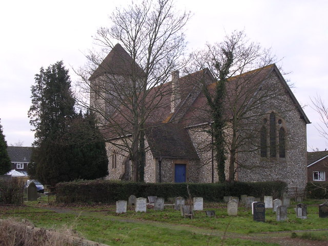
St Michael and All Angels Church, Partridge Green

St Michael and All Angels Church is a late nineteenth-century church in the settlement of Partridge Green in the parish of West Grinstead in West Sussex...
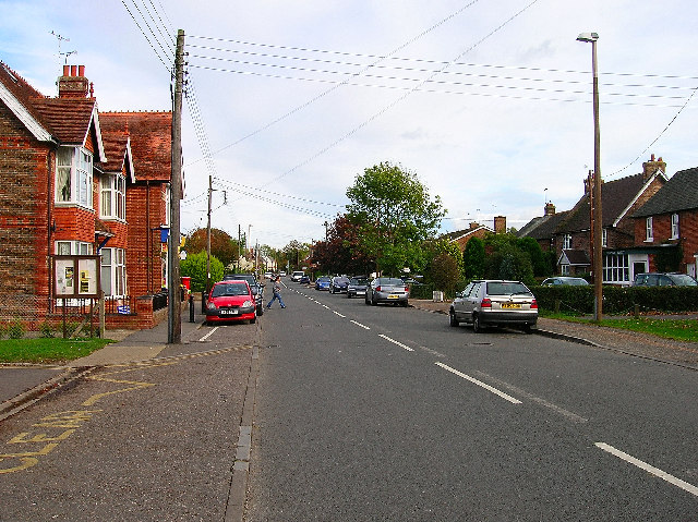
Partridge Green

Partridge Green is a village in the Horsham District of West Sussex, England. It lies on the B2135 road 2.5 miles (4 km) north-west of Henfield. It is...

Dark Star Brewing Company

Dark Star is a brewery in Partridge Green, Sussex, England. == History == Dark Star Brewery was established in 1994, brewing in the cellar of the Evening...

Henfield (electoral division)

Henfield is an electoral division of West Sussex in the United Kingdom and returns one member to sit on West Sussex County Council. The current County...

Partridge Green railway station

Partridge Green was a railway station on the Steyning Line which served the village of Partridge Green. The station closed as a result of the Beeching...

Shrine of Our Lady of Consolation

The Shrine of Our Lady of Consolation or Church of Our Lady of Consolation and Saint Francis is a Roman Catholic parish church in West Grinstead, in West...

West Grinstead

West Grinstead is a village and civil parish in the Horsham District of West Sussex, England. It lies just off the B2135 road four miles (6.3 km) northwest...

Nearby Amenities

Located within 500m of 50.968468,-0.31279621
Bus Stop
The Green Man
Naptan AtcoCode: 4400HR0452
Naptan Bearing: N
Naptan BusStopType: CUS
Naptan CommonName: The Green Man
Naptan Indicator: o/s pub
Naptan Landmark: The Green Man (Public House)
Naptan NaptanCode: wsxawjta
Naptan Street: Jolesfield
Naptan Verified: yes
Public Transport: platform
Source: naptan_import
Lat/Long: 50.9656621/-0.3100039
Bus Stop
The Green Man
Naptan AtcoCode: 4400HR0453
Naptan Bearing: S
Naptan BusStopType: CUS
Naptan CommonName: The Green Man
Naptan Indicator: opp pub
Naptan Landmark: The Green Man (Public House)
Naptan NaptanCode: wsxawjtd
Naptan Street: Jolesfield
Naptan Verified: yes
Public Transport: platform
Source: naptan_import
Lat/Long: 50.9658179/-0.3098909
Little Mill
Bus: yes
Naptan AtcoCode: 4400HR1050
Naptan Bearing: E
Naptan BusStopType: CUS
Naptan CommonName: Little Mill
Naptan Indicator: adj
Naptan Landmark: Hail & Ride
Naptan NaptanCode: wsxgawpm
Naptan Street: Mill Lane
Naptan Verified: no
Public Transport: platform
Source: naptan_import
Lat/Long: 50.9704553/-0.3073621
Little Mill
Bus: yes
Naptan AtcoCode: 4400HR1051
Naptan Bearing: W
Naptan BusStopType: CUS
Naptan CommonName: Little Mill
Naptan Indicator: opp
Naptan Landmark: Hail & Ride
Naptan NaptanCode: wsxgawpt
Naptan Street: Mill Lane
Naptan Verified: no
Public Transport: platform
Source: naptan_import
Lat/Long: 50.9703955/-0.3074031
Barrier: kissing_gate
Lat/Long: 50.967475/-0.3089831
Jolesfield Common
Place: hamlet
Lat/Long: 50.9681221/-0.3093728
Barrier: kissing_gate
Lat/Long: 50.9674596/-0.3099819
Barrier: stile
Lat/Long: 50.9675272/-0.3070084
Barrier: stile
Lat/Long: 50.9704528/-0.3074439
Historic: memorial
Memorial: war_memorial
Lat/Long: 50.9707131/-0.3117383
Needs Farm
Place: isolated_dwelling
Lat/Long: 50.971037/-0.313487
Joles Farm
Place: farm
Lat/Long: 50.9654184/-0.307934
The data included in this document is from www.openstreetmap.org. The data is made available under ODbL.

Have you been to Luxfords Wood?

Leave your review of Luxfords Wood below (or comments, questions and feedback).