Foster's Copse

Wood, Forest in Sussex Horsham

England

Foster's Copse

Houses at Gardeners Green, Rusper, West Sussex On the outskirts of the village of Rusper. This is a private estate of houses. This is an example of ribbon development along the existing rural roads. Viewed from Horsham Road looking N.
Houses at Gardeners Green, Rusper, West Sussex Credit: Pete Chapman

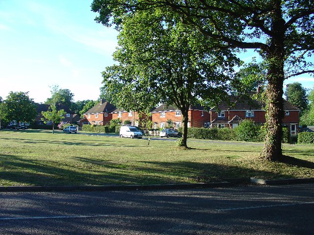
Foster's Copse is a charming woodland located in the county of Sussex, England. Spanning over acres of pristine land, this copse is a haven for nature enthusiasts and outdoor lovers alike. The copse is nestled in the heart of Sussex, surrounded by picturesque countryside and rolling hills, making it an idyllic retreat for those seeking tranquility and natural beauty.

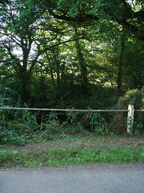
The copse is primarily composed of a mixture of deciduous and coniferous trees, creating a diverse and vibrant ecosystem. Towering oak, beech, and chestnut trees dominate the landscape, providing shade and shelter for a variety of wildlife. The forest floor is adorned with a rich carpet of ferns, wildflowers, and moss, creating a tapestry of colors and textures.

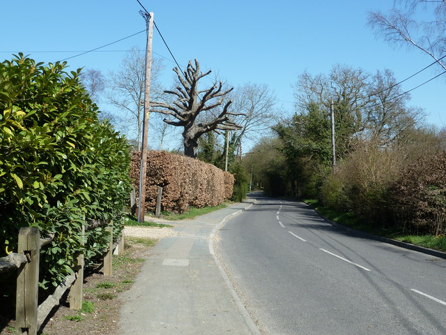
Foster's Copse offers a network of well-maintained trails that wind through the woodland, providing ample opportunities for hiking, walking, and exploring. The paths meander through sun-dappled glades, over babbling brooks, and across wooden bridges, offering a delightful experience for visitors of all ages.

The copse is also home to a diverse range of wildlife. Birdwatchers can spot species such as woodpeckers, owls, and songbirds, while lucky visitors may even catch a glimpse of elusive deer, foxes, and rabbits. The copse is a designated Site of Special Scientific Interest, highlighting its importance for conservation and biodiversity.

Foster's Copse is easily accessible, with ample parking and facilities for visitors. Whether seeking a peaceful stroll, a family picnic, or the opportunity to reconnect with nature, Foster's Copse is a must-visit destination for anyone wanting to experience the beauty of Sussex's woodlands.

If you have any feedback on the listing, please let us know in the comments section below.

Foster's Copse Images

Images are sourced within 2km of 51.111372/-0.30759736 or Grid Reference TQ1836. Thanks to Geograph Open Source API. All images are credited.

Houses at Gardeners Green, Rusper, West Sussex On the outskirts of the village of Rusper. This is a private estate of houses. This is an example of ribbon development along the existing rural roads. Viewed from Horsham Road looking N.
Houses at Gardeners Green, Rusper, West Sussex
On the outskirts of the village of Rusper. This is a private estate of houses. This is an example of ribbon development along the existing rural roads. Viewed from Horsham Road looking N.
Barn at Coombers Farm, Faygate, West Sussex Many of the farms marked on the map in this area have now become solely residential properties, with no indication of any farming activity. Coombers Farm, however, has this sturdy (and used) modern style barn.
Barn at Coombers Farm, Faygate, West Sussex
Many of the farms marked on the map in this area have now become solely residential properties, with no indication of any farming activity. Coombers Farm, however, has this sturdy (and used) modern style barn.
Tributary of River Mole, Near Coombers Farm, Faygate, West Sussex. The River Mole is one of the main rivers in the area. This is a very young tributary. The stream runs through a narrow strip of trees for around 2km at this point. See the River Mole again in grid square TQ2337.
Tributary of River Mole, Near Coombers Farm, Faygate, West Sussex.
The River Mole is one of the main rivers in the area. This is a very young tributary. The stream runs through a narrow strip of trees for around 2km at this point. See the River Mole again in grid square TQ2337.
Gardeners Green, Rusper The last residential development in Rusper, going towards Horsham.
Gardeners Green, Rusper
The last residential development in Rusper, going towards Horsham.
Pond at Baldhorns Park Farm with small reservoir just below the source of the River Mole at Rusper.
Pond at Baldhorns Park
Farm with small reservoir just below the source of the River Mole at Rusper.
Eye-catching, Baldhorns Park Unusual mirror sculpture with super reflections of surrounding vegetation.
Eye-catching, Baldhorns Park
Unusual mirror sculpture with super reflections of surrounding vegetation.
Ponds at Baldhorns Park Spring sunshine on the landscaped ponds at Baldhorns Park in the Weald south of Rusper.
Ponds at Baldhorns Park
Spring sunshine on the landscaped ponds at Baldhorns Park in the Weald south of Rusper.
River Mole at Baldhorns Park Arcadian scene on the Mole about 1 mile below its source at Rusper.
River Mole at Baldhorns Park
Arcadian scene on the Mole about 1 mile below its source at Rusper.
Baldhorns Park Farm Wealden farm near the source of the River Mole at Rusper.
Baldhorns Park Farm
Wealden farm near the source of the River Mole at Rusper.
Stile at Baldhorns Park Farm On the footpath between the farm and Rusper which crosses fields used for grazing.
Stile at Baldhorns Park Farm
On the footpath between the farm and Rusper which crosses fields used for grazing.
Sheep at Baldhorns Park Farm A bowser and sheep grazing on the Wealden field south of Rusper.
Sheep at Baldhorns Park Farm
A bowser and sheep grazing on the Wealden field south of Rusper.
Due North to Rusper Grassy footpath from Baldhorns Park to Rusper, crossing grassland with little surface drainage. A chestnut tree by the path is just coming into leaf.
Due North to Rusper
Grassy footpath from Baldhorns Park to Rusper, crossing grassland with little surface drainage. A chestnut tree by the path is just coming into leaf.
Baldhorns Copse Footpath to Rusper passing through an avenue of trees.
Baldhorns Copse
Footpath to Rusper passing through an avenue of trees.
Gardeners Green off Horsham road A small pleasant triangular shaped estate on the outskirts of Rusper.
Gardeners Green off Horsham road
A small pleasant triangular shaped estate on the outskirts of Rusper.
Pollarded Oak on Horsham Road
Steeres Hill, Rusper
Footpath FP1569 West-southwest from Wimland Road
Footpath FP1569
West-southwest from Wimland Road
Footpath FP1569 East-northeast off Wimland Road
Footpath FP1569
East-northeast off Wimland Road
Show me another place!

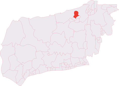
Foster's Copse is located at Grid Ref: TQ1836 (Lat: 51.111372, Lng: -0.30759736)

Administrative County: West Sussex

District: Horsham

Police Authority: Sussex

What 3 Words

///confined.broadens.manager. Near Warnham, West Sussex

Related Wikis

Warnham SSSI

Warnham SSSI is a 28.5-hectare (70-acre) geological Site of Special Scientific Interest north of Horsham in West Sussex. It is a Geological Conservation...

Shiremark Mill, Capel

Shiremark Mill, also known as Kingsfold Mill or Capel Mill was a listed Smock mill at Capel, Surrey, England, which was burnt down in 1972. == History... ==

Graylands

Graylands is a hamlet in the Horsham district of West Sussex, England. The largely rural hamlet is located north of Holbrook beyond the A264. It is bordered...

Old Holbrook

Old Holbrook (formerly known as Northlands) is a hamlet in the Horsham district of West Sussex, England. This rural hamlet is located north of the Horsham...

Holbrook (electoral division)

Holbrook is an electoral division of West Sussex in the United Kingdom and returns one member to sit on West Sussex County Council. The current County...

Bohunt Horsham

Bohunt Horsham is a coeducational all-through school located in Horsham, West Sussex, England. The school opened to 120 students in Year 7 in 2019 in temporary...

Rusper

Rusper is a village and civil parish in the Horsham District of West Sussex, England. It lies 4.1 miles (6.6 km) north of the town of Horsham and 4.2 miles...

Warnham railway station

Warnham railway station serves the village of Warnham in West Sussex, England. It is 33 miles 46 chains (54.0 km) measured from London Waterloo (although...

Nearby Amenities

Located within 500m of 51.111372,-0.30759736
Barrier: stile
Lat/Long: 51.1128857/-0.3121532
Nunnery Farm
Place: farm
Lat/Long: 51.1136498/-0.3036692
Cripplegate
Place: locality
Lat/Long: 51.1113532/-0.3144091
Barrier: stile
Lat/Long: 51.1130804/-0.3130929
Curtis Farm
Place: farm
Lat/Long: 51.1092034/-0.3032519
Power: pole
Lat/Long: 51.1150513/-0.3099974
Power: pole
Lat/Long: 51.1139404/-0.3101543
Power: pole
Lat/Long: 51.1127754/-0.3103218
Power: pole
Lat/Long: 51.1119703/-0.3095928
Power: pole
Lat/Long: 51.1111312/-0.3088483
Power: pole
Lat/Long: 51.1100395/-0.3078786
Power: pole
Lat/Long: 51.1089196/-0.3068817
Power: pole
Lat/Long: 51.1085011/-0.3071153
Power: pole
Lat/Long: 51.1077004/-0.3075471
Power: pole
Lat/Long: 51.108815/-0.3061521
Power: pole
Lat/Long: 51.1087022/-0.3053912
Power: pole
Lat/Long: 51.1085911/-0.3046608
The data included in this document is from www.openstreetmap.org. The data is made available under ODbL.

Have you been to Foster's Copse?

Leave your review of Foster's Copse below (or comments, questions and feedback).