Archer's Wood

Wood, Forest in Huntingdonshire Huntingdonshire

England

Archer's Wood

A1(M) southbound, climbing Stangate Hill towards Alconbury The junction ahead marks the point where the Old North Road, via Huntingdon, Royston and Ware, diverged from the Great North Road that took a more westerly course.
A1(M) southbound, climbing Stangate Hill towards Alconbury Credit: Christopher Hilton

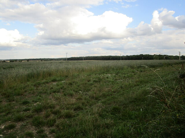
Archer's Wood, located in Huntingdonshire, is a picturesque forest that covers a sprawling area of land. This woodland is named after the legendary English archer, Robin Hood, who is said to have frequented the area during his adventures.

The forest boasts a diverse and rich ecosystem, with a variety of flora and fauna that call it home. Towering oak and beech trees dominate the landscape, their canopies creating a dense and enchanting forest floor. The wood is also home to an array of plant species, including bluebells, ferns, and wild garlic, which add bursts of color and fragrance throughout the seasons.

Archer's Wood is a haven for wildlife enthusiasts, as it provides a habitat for a wide range of animals. Deer, badgers, foxes, and rabbits are commonly spotted, while birdwatchers can delight in the presence of woodpeckers, owls, and various species of songbirds. The forest is also known for its population of red kites, a majestic bird of prey that soars through the skies, captivating all who witness its flight.

This woodland is not only a sanctuary for nature but also a popular destination for recreational activities. Visitors can explore the numerous walking trails and enjoy the tranquility of the forest, immersing themselves in its natural beauty. Its well-maintained paths and picnic areas make it an ideal spot for a family outing or a peaceful retreat from the bustle of everyday life.

Archer's Wood truly embodies the essence of an idyllic woodland, offering a serene escape into nature for locals and visitors alike.

If you have any feedback on the listing, please let us know in the comments section below.

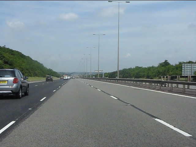
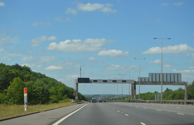
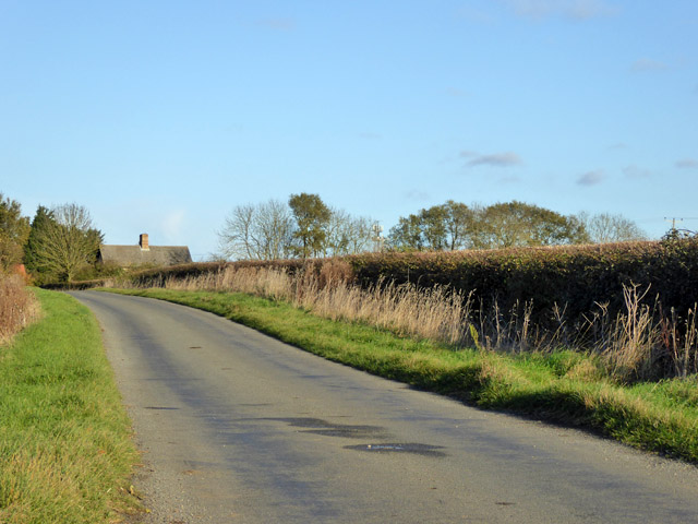
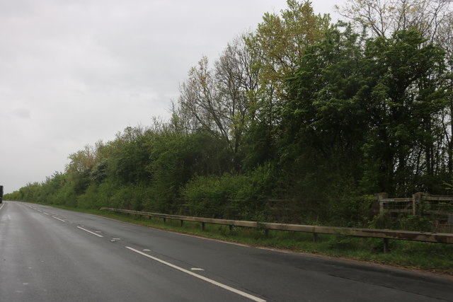
Archer's Wood Images

Images are sourced within 2km of 52.415029/-0.27220414 or Grid Reference TL1781. Thanks to Geograph Open Source API. All images are credited.

A1(M) southbound, climbing Stangate Hill towards Alconbury The junction ahead marks the point where the Old North Road, via Huntingdon, Royston and Ware, diverged from the Great North Road that took a more westerly course.
A1(M) southbound, climbing Stangate Hill towards Alconbury
The junction ahead marks the point where the Old North Road, via Huntingdon, Royston and Ware, diverged from the Great North Road that took a more westerly course.
Looking towards the Old Quarter The Old Quarter is an area of woodland.
Looking towards the Old Quarter
The Old Quarter is an area of woodland.
A1(M) - gantries on Stangate Hill No messages today - traffic is flowing smoothly. In the opposite direction signs are displayed for the A1 - A14 junction.
A1(M) - gantries on Stangate Hill
No messages today - traffic is flowing smoothly. In the opposite direction signs are displayed for the A1 - A14 junction.
A1(M), Stangate Hill The A1 is the longest numbered road in the UK at 410 miles long. It connects London with Edinburgh, via the east of England. 
For much of its path it follows the Great North Road the old coaching route between London and Edinburgh. Several sections of the route are classified as motorway A1(M). The modern A1 bypasses the towns the Great North Road passed through and is dual carriageway for most of its route through England.
A1(M), Stangate Hill
The A1 is the longest numbered road in the UK at 410 miles long. It connects London with Edinburgh, via the east of England. For much of its path it follows the Great North Road the old coaching route between London and Edinburgh. Several sections of the route are classified as motorway A1(M). The modern A1 bypasses the towns the Great North Road passed through and is dual carriageway for most of its route through England.
A1(M) near Coppingford The road continues to run straight, almost north.
A1(M) near Coppingford
The road continues to run straight, almost north.
A1(M) at Stargate Hill
Gantry, A1(M) The A1 is the longest numbered road in the UK at 410 miles long. It connects London with Edinburgh, via the east of England. 
For much of its path it follows the Great North Road the old coaching route between London and Edinburgh. Several sections of the route are classified as motorway A1(M). The modern A1 bypasses the towns the Great North Road passed through and is dual carriageway for most of its route through England.
Gantry, A1(M)
The A1 is the longest numbered road in the UK at 410 miles long. It connects London with Edinburgh, via the east of England. For much of its path it follows the Great North Road the old coaching route between London and Edinburgh. Several sections of the route are classified as motorway A1(M). The modern A1 bypasses the towns the Great North Road passed through and is dual carriageway for most of its route through England.
Road towards Coppingford From the Buckworth direction.
Road towards Coppingford
From the Buckworth direction.
Old Great North Road, Alconbury Running for some miles alongside the new North Road, the A1(M).
Old Great North Road, Alconbury
Running for some miles alongside the new North Road, the A1(M).
A1(M) approaching J15 The A1 is the longest numbered road in the UK at 410 miles long. It connects London with Edinburgh, via the east of England. 
For much of its path it follows the Great North Road the old coaching route between London and Edinburgh. Several sections of the route are classified as motorway A1(M). The modern A1 bypasses the towns the Great North Road passed through and is dual carriageway for most of its route through England.
A1(M) approaching J15
The A1 is the longest numbered road in the UK at 410 miles long. It connects London with Edinburgh, via the east of England. For much of its path it follows the Great North Road the old coaching route between London and Edinburgh. Several sections of the route are classified as motorway A1(M). The modern A1 bypasses the towns the Great North Road passed through and is dual carriageway for most of its route through England.
Gantry, A1(M) The A1 is the longest numbered road in the UK at 410 miles long. It connects London with Edinburgh, via the east of England. 
For much of its path it follows the Great North Road the old coaching route between London and Edinburgh. Several sections of the route are classified as motorway A1(M). The modern A1 bypasses the towns the Great North Road passed through and is dual carriageway for most of its route through England.
Gantry, A1(M)
The A1 is the longest numbered road in the UK at 410 miles long. It connects London with Edinburgh, via the east of England. For much of its path it follows the Great North Road the old coaching route between London and Edinburgh. Several sections of the route are classified as motorway A1(M). The modern A1 bypasses the towns the Great North Road passed through and is dual carriageway for most of its route through England.
A1(M) - 1 mile to J15 The A1 is the longest numbered road in the UK at 410 miles long. It connects London with Edinburgh, via the east of England. 
For much of its path it follows the Great North Road the old coaching route between London and Edinburgh. Several sections of the route are classified as motorway A1(M). The modern A1 bypasses the towns the Great North Road passed through and is dual carriageway for most of its route through England.
A1(M) - 1 mile to J15
The A1 is the longest numbered road in the UK at 410 miles long. It connects London with Edinburgh, via the east of England. For much of its path it follows the Great North Road the old coaching route between London and Edinburgh. Several sections of the route are classified as motorway A1(M). The modern A1 bypasses the towns the Great North Road passed through and is dual carriageway for most of its route through England.
Gantry, A1(M) The A1 is the longest numbered road in the UK at 410 miles long. It connects London with Edinburgh, via the east of England. 
For much of its path it follows the Great North Road the old coaching route between London and Edinburgh. Several sections of the route are classified as motorway A1(M). The modern A1 bypasses the towns the Great North Road passed through and is dual carriageway for most of its route through England.
Gantry, A1(M)
The A1 is the longest numbered road in the UK at 410 miles long. It connects London with Edinburgh, via the east of England. For much of its path it follows the Great North Road the old coaching route between London and Edinburgh. Several sections of the route are classified as motorway A1(M). The modern A1 bypasses the towns the Great North Road passed through and is dual carriageway for most of its route through England.
J15, A1(M) The A1 is the longest numbered road in the UK at 410 miles long. It connects London with Edinburgh, via the east of England. 
For much of its path it follows the Great North Road the old coaching route between London and Edinburgh. Several sections of the route are classified as motorway A1(M). The modern A1 bypasses the towns the Great North Road passed through and is dual carriageway for most of its route through England.
J15, A1(M)
The A1 is the longest numbered road in the UK at 410 miles long. It connects London with Edinburgh, via the east of England. For much of its path it follows the Great North Road the old coaching route between London and Edinburgh. Several sections of the route are classified as motorway A1(M). The modern A1 bypasses the towns the Great North Road passed through and is dual carriageway for most of its route through England.
Ordnance Survey Benchmark - Sawtry, Manor House Farm Ordnance Survey Benchmark (OSBM) used for levelling height above Ordnance Datum (OD).
Height: 10.4089m OD (Newlyn). Mark verified by the Ordnance Survey in 1966. Description: NBM BLDG MANOR HOUSE FM C NE FACE. 0.7m above ground. 3rd Order BM.

Context: <a href="https://www.geograph.org.uk/photo/4798324">TL1782 : Ordnance Survey Benchmark - Sawtry, Manor House Farm</a>
Ordnance Survey Benchmark - Sawtry, Manor House Farm
Ordnance Survey Benchmark (OSBM) used for levelling height above Ordnance Datum (OD). Height: 10.4089m OD (Newlyn). Mark verified by the Ordnance Survey in 1966. Description: NBM BLDG MANOR HOUSE FM C NE FACE. 0.7m above ground. 3rd Order BM. Context: TL1782 : Ordnance Survey Benchmark - Sawtry, Manor House Farm
Ordnance Survey Benchmark - Sawtry, Manor House Farm Ordnance Survey Benchmark (OSBM) used for levelling height above Ordnance Datum (OD).
Height: 10.4089m OD (Newlyn). Mark verified by the Ordnance Survey in 1966. Description: NBM BLDG MANOR HOUSE FM C NE FACE. 0.7m above ground. 3rd Order BM.

Close-up: <a href="https://www.geograph.org.uk/photo/4798314">TL1782 : Ordnance Survey Benchmark - Sawtry, Manor House Farm</a>
Ordnance Survey Benchmark - Sawtry, Manor House Farm
Ordnance Survey Benchmark (OSBM) used for levelling height above Ordnance Datum (OD). Height: 10.4089m OD (Newlyn). Mark verified by the Ordnance Survey in 1966. Description: NBM BLDG MANOR HOUSE FM C NE FACE. 0.7m above ground. 3rd Order BM. Close-up: TL1782 : Ordnance Survey Benchmark - Sawtry, Manor House Farm
Ordnance Survey Benchmark - Coppingford, Hill Top Farm Ordnance Survey Benchmark (OSBM) used for levelling height above Ordnance Datum (OD).
Height: 47.9085m OD (Newlyn). Mark verified by the Ordnance Survey in 1966. Description: BLDG W SIDE RD SE ANG S FACE. 0.4m above ground. 3rd Order BM.

The mark was replaced by a new benchmark (NBM) on an adjacent building to the North, but remained in use.  The adjacent building was recently demolished. <a href="https://www.geograph.org.uk/photo/1452191">TL1680 : Bench Mark at Hill Top Farm</a>

Context: <a href="https://www.geograph.org.uk/photo/4798529">TL1680 : Ordnance Survey Benchmark - Coppingford, Hill Top Farm</a>
Ordnance Survey Benchmark - Coppingford, Hill Top Farm
Ordnance Survey Benchmark (OSBM) used for levelling height above Ordnance Datum (OD). Height: 47.9085m OD (Newlyn). Mark verified by the Ordnance Survey in 1966. Description: BLDG W SIDE RD SE ANG S FACE. 0.4m above ground. 3rd Order BM. The mark was replaced by a new benchmark (NBM) on an adjacent building to the North, but remained in use. The adjacent building was recently demolished. TL1680 : Bench Mark at Hill Top Farm Context: TL1680 : Ordnance Survey Benchmark - Coppingford, Hill Top Farm
Ordnance Survey Benchmark - Coppingford, Hill Top Farm Ordnance Survey Benchmark (OSBM) used for levelling height above Ordnance Datum (OD).
Height: 47.9085m OD (Newlyn). Mark verified by the Ordnance Survey in 1966. Description: BLDG W SIDE RD SE ANG S FACE. 0.4m above ground. 3rd Order BM.

The mark was replaced by a new benchmark (NBM) on an adjacent building to the North, but remained in use.  The adjacent building was recently demolished. <a href="https://www.geograph.org.uk/photo/1452191">TL1680 : Bench Mark at Hill Top Farm</a>

Close-up: <a href="https://www.geograph.org.uk/photo/4798518">TL1680 : Ordnance Survey Benchmark - Coppingford, Hill Top Farm</a>
Ordnance Survey Benchmark - Coppingford, Hill Top Farm
Ordnance Survey Benchmark (OSBM) used for levelling height above Ordnance Datum (OD). Height: 47.9085m OD (Newlyn). Mark verified by the Ordnance Survey in 1966. Description: BLDG W SIDE RD SE ANG S FACE. 0.4m above ground. 3rd Order BM. The mark was replaced by a new benchmark (NBM) on an adjacent building to the North, but remained in use. The adjacent building was recently demolished. TL1680 : Bench Mark at Hill Top Farm Close-up: TL1680 : Ordnance Survey Benchmark - Coppingford, Hill Top Farm
Show me another place!

Archer's Wood is located at Grid Ref: TL1781 (Lat: 52.415029, Lng: -0.27220414)

Administrative County: Cambridgeshire

District: Huntingdonshire

Police Authority: Cambridgeshire

What 3 Words

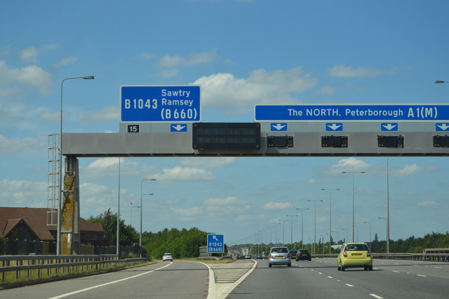
///pops.pacifist.staples. Near Sawtry, Cambridgeshire

Nearby Locations

Archer's Wood

Related Wikis

Huntingdonshire

Huntingdonshire (; abbreviated Hunts) is a local government district of Cambridgeshire and a historic county of England. The district council is based...

Aversley Wood

Aversley Wood is a 62.3 hectares (154 acres) biological Site of Special Scientific Interest south-west of Sawtry in Cambridgeshire. It is owned and managed...

Coppingford

Coppingford is a village and former civil parish, now in the parish of Upton and Coppingford, in Cambridgeshire, England. Coppingford lies approximately...

Monks Wood

Monks Wood is a 157-hectare (390-acre) National Nature Reserve north-west of Huntingdon in Cambridgeshire, and a Nature Conservation Review site, Grade...

Sawtry Village Academy

Sawtry Village Academy (formerly Sawtry Community College) is a mixed secondary school and sixth form located in the village of Sawtry, Cambridgeshire...

Upton, Huntingdonshire

Upton is a village and former civil parish, now in the parish of Upton and Coppingford, in the Huntingdonshire district, in the county of Cambridgeshire...

Sawtry Abbey

Sawtry Abbey was a Cistercian abbey located between Sawtry and Woodwalton in Cambridgeshire, England. The abbey was founded in 1147 by Simon II de Senlis...

Sawtry

Sawtry () is a village and civil parish in Cambridgeshire, England. Sawtry lies approximately 8 miles (13 km) north of Huntingdon. Sawtry is situated within...

Nearby Amenities

Located within 500m of 52.415029,-0.27220414
Created By: Merkaartor 0.12
Lat/Long: 52.4181128/-0.277233
Phone
Check Date: 2023-12-22
Emergency: phone
Lat/Long: 52.4139626/-0.266111
Phone
Check Date: 2023-12-22
Emergency: phone
Lat/Long: 52.4139049/-0.2668212
Power: pole
Lat/Long: 52.4120565/-0.2688994
Power: pole
Lat/Long: 52.4121171/-0.2749021
Power: pole
Lat/Long: 52.4121122/-0.2734832
Power: pole
Lat/Long: 52.4120451/-0.2671211
Power: pole
Lat/Long: 52.4120779/-0.270573
Power: pole
Lat/Long: 52.4121154/-0.2773564
Power: pole
Lat/Long: 52.4121076/-0.2722209
Power: pole
Lat/Long: 52.4121056/-0.2760958
Information: board
Operator: Woodland Trust
Tourism: information
Lat/Long: 52.417555/-0.2780666
Parking
Verge parking
Lat/Long: 52.4178617/-0.2778492
Bench
Lat/Long: 52.4138634/-0.2744692
Bench
Lat/Long: 52.4147403/-0.2741742
Bench
Lat/Long: 52.4150339/-0.2771716
The data included in this document is from www.openstreetmap.org. The data is made available under ODbL.

Have you been to Archer's Wood?

Leave your review of Archer's Wood below (or comments, questions and feedback).