Nimbleton Plantation

Wood, Forest in Lincolnshire West Lindsey

England

Nimbleton Plantation

Undulating farmland south of Thoresway: aerial 2023
Undulating farmland south of Thoresway: aerial 2023 Credit: Chris

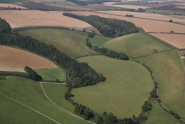
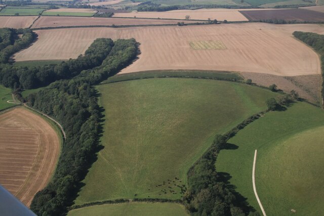
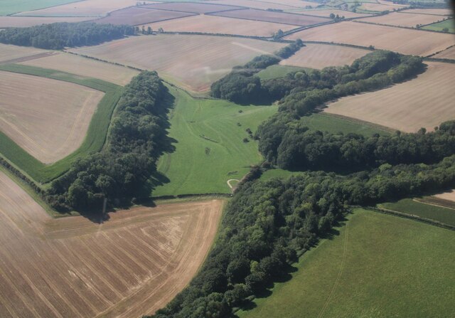
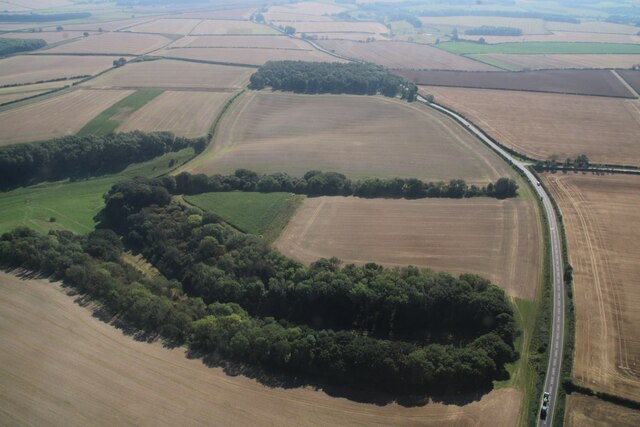
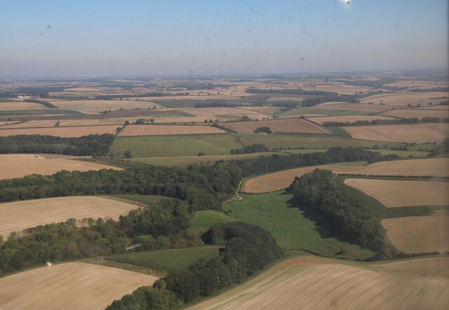
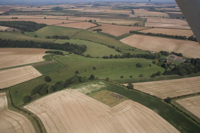
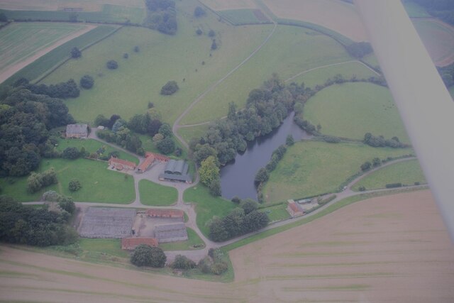
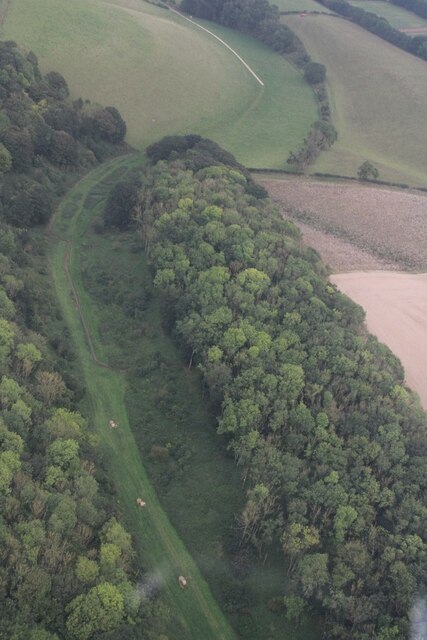
Nimbleton Plantation is a picturesque woodland area located in Lincolnshire, England. Spanning over a vast area, it is known as one of the region's most enchanting and well-preserved forests. The plantation is situated amidst the rolling hills and lush countryside that Lincolnshire is famous for, offering visitors a tranquil and idyllic setting.

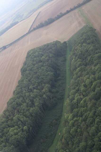
The woodland of Nimbleton Plantation is predominantly composed of various species of trees, including oak, beech, and pine, creating a diverse and beautiful landscape. The dense canopy of trees provides ample shade and contributes to the area's serene atmosphere. It is a haven for nature lovers and outdoor enthusiasts, attracting visitors from all walks of life.

The plantation is home to an array of wildlife, including deer, foxes, and a plethora of bird species. Nature enthusiasts can enjoy birdwatching and potentially spot rare and migratory birds that frequent the area. The forest also boasts a variety of wildflowers and plants, adding bursts of color and fragrance to the surroundings.

Nimbleton Plantation offers numerous walking trails and paths, allowing visitors to explore the woods at their leisure. Whether it's a leisurely stroll or a more adventurous hike, there are options available for every skill level. The plantation also offers designated picnic areas and benches, providing the perfect opportunity to relax and enjoy a meal amidst the natural beauty.

Overall, Nimbleton Plantation in Lincolnshire is a captivating woodland retreat, offering visitors a chance to immerse themselves in nature's splendor. Its serene ambiance, diverse flora and fauna, and well-maintained trails make it a must-visit destination for anyone seeking a peaceful and rejuvenating escape.

If you have any feedback on the listing, please let us know in the comments section below.

Nimbleton Plantation Images

Images are sourced within 2km of 53.429071/-0.24303354 or Grid Reference TF1693. Thanks to Geograph Open Source API. All images are credited.

Undulating farmland south of Thoresway: aerial 2023
Farm at Stainton le Vale: aerial 2023 South Farm.
Farm at Stainton le Vale: aerial 2023
South Farm.
Plantations at Stainton le Vale: aerial 2023 (1) Dales Bottom left, Half Moon centre, Cowdyke and Stainton Plantations top right.
Plantations at Stainton le Vale: aerial 2023 (1)
Dales Bottom left, Half Moon centre, Cowdyke and Stainton Plantations top right.
Plantations at Stainton le Vale: aerial 2023 (2) Dales Bottom left and Spring Ride left, Half Moon right.
Plantations at Stainton le Vale: aerial 2023 (2)
Dales Bottom left and Spring Ride left, Half Moon right.
Plantations at Stainton le Vale: aerial 2023 (3) Black Holt left, Dales Bottom, Spring Ride and Nursery right.
Plantations at Stainton le Vale: aerial 2023 (3)
Black Holt left, Dales Bottom, Spring Ride and Nursery right.
Plantations at Stainton le Vale: aerial 2023 (4) Nursery Plantations, with Goody Orchin at the top.
Plantations at Stainton le Vale: aerial 2023 (4)
Nursery Plantations, with Goody Orchin at the top.
Plantations at Stainton le Vale: aerial 2023 (5) Black Holt right, Nursery Plantations left, Spring Ride and Dales Bottom centre.
Plantations at Stainton le Vale: aerial 2023 (5)
Black Holt right, Nursery Plantations left, Spring Ride and Dales Bottom centre.
Stainton Hall, Stainton le Vale: aerial 2023
Earthworks on a field at Stainton le Vale: aerial 2023 (1)
Earthworks on a field at Stainton le Vale: aerial 2023 (2)
Stainton le Vale: aerial 2023
Cowdyke and Stainton Plantations, Stainton le Vale: aerial 2023 (1)
Cowdyke and Stainton Plantations, Stainton le Vale: aerial 2023 (2)
Votive offerings at Lud's Well, Stainton-le-Vale
The decline of the "tin tabernacle" in Stainton le Vale, 2023 (1) A former Primitive Methodist chapel, it can be seen in slightly happier times (2009) in <a href="https://www.geograph.org.uk/photo/1497384">TF1794 : The 'tin tabernacle'</a>. In 2015 it looked like <a href="https://www.geograph.org.uk/photo/4437141">TF1794 : The old village hall in Stainton-le-Vale</a>, when it seemed to have enjoyed a brief revival as a village hall.

Sadly, very few such buildings remain.
The decline of the "tin tabernacle" in Stainton le Vale, 2023 (1)
A former Primitive Methodist chapel, it can be seen in slightly happier times (2009) in TF1794 : The 'tin tabernacle'. In 2015 it looked like TF1794 : The old village hall in Stainton-le-Vale, when it seemed to have enjoyed a brief revival as a village hall. Sadly, very few such buildings remain.
The decline of the "tin tabernacle" in Stainton le Vale, 2023 (2) A former Primitive Methodist chapel, it can be seen in slightly happier times (2009) in <a href="https://www.geograph.org.uk/photo/1497384">TF1794 : The 'tin tabernacle'</a>. In 2015 it looked like <a href="https://www.geograph.org.uk/photo/4437141">TF1794 : The old village hall in Stainton-le-Vale</a>, when it seemed to have enjoyed a brief revival as a village hall.

Sadly, very few such buildings remain.
The decline of the "tin tabernacle" in Stainton le Vale, 2023 (2)
A former Primitive Methodist chapel, it can be seen in slightly happier times (2009) in TF1794 : The 'tin tabernacle'. In 2015 it looked like TF1794 : The old village hall in Stainton-le-Vale, when it seemed to have enjoyed a brief revival as a village hall. Sadly, very few such buildings remain.
Stubble field south west of Thoresway
Minor road towards Binbrook Heading east.
Minor road towards Binbrook
Heading east.
Show me another place!

Nimbleton Plantation is located at Grid Ref: TF1693 (Lat: 53.429071, Lng: -0.24303354)

Administrative County: Lincolnshire

District: West Lindsey

Police Authority: Lincolnshire

What 3 Words

///erupt.edicts.matchbox. Near Wold Newton, Lincolnshire

Nearby Locations

Nimbleton Plantation

Related Wikis

Parts of Lindsey

The Parts of Lindsey are a traditional division of Lincolnshire, England, covering the northern part of the county. The Isle of Axholme, which is on the...

Stainton le Vale

Stainton le Vale is a village in the civil parish of Thoresway in the West Lindsey district of Lincolnshire, England. It is situated about 6 miles (9...

Orford Priory

Orford Priory was a priory of Premonstratensian canonesses in Stainton le Vale, Lincolnshire, England, and one of nine within the historical county. The...

Kirmond le Mire

Kirmond le Mire is a small village and civil parish in the West Lindsey district of Lincolnshire, England. It is situated on the B1203 road, 6 miles (10...

Thoresway

Thoresway is a village and civil parish in the West Lindsey district of Lincolnshire, England. It is 1.5 miles (2.4 km) west from the B1225 road, 4 miles...

RAF Binbrook

Royal Air Force Binbrook or RAF Binbrook is a former Royal Air Force station located near Binbrook, Lincolnshire, England. The old domestic site (married...

Tealby

Tealby is a village and civil parish in the West Lindsey district of Lincolnshire, England, situated on the edge of the Lincolnshire Wolds and 3 miles...

Brookenby

Brookenby is a village and civil parish in the West Lindsey district of Lincolnshire, England. The village is situated 7 miles (11 km) north-east from...

Have you been to Nimbleton Plantation?

Leave your review of Nimbleton Plantation below (or comments, questions and feedback).