Alder Copse

Wood, Forest in Sussex Horsham

England

Alder Copse

Waitrose and John Lewis - off Albion Way The photo shows the upper level of the car park. There is a level below this as well.
Waitrose and John Lewis - off Albion Way Credit: Ian Cunliffe

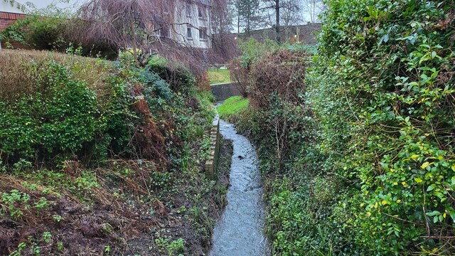
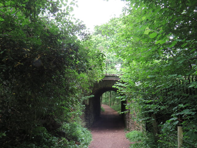
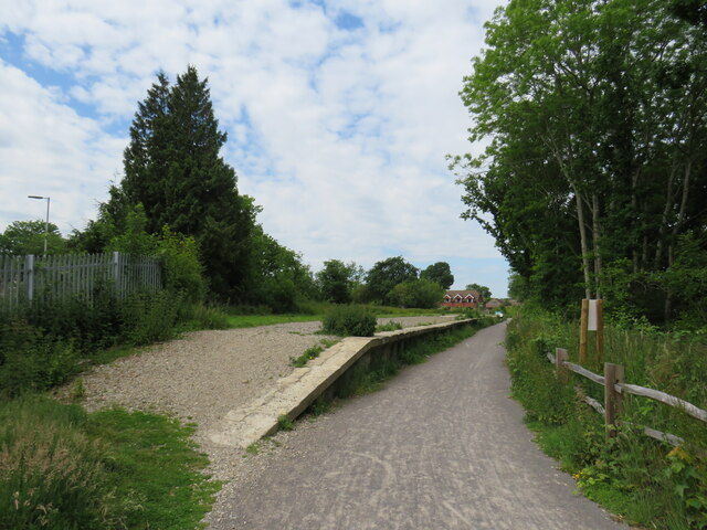
Alder Copse, located in Sussex, is a serene and picturesque wood that encompasses an area of lush greenery and stunning natural beauty. Nestled within the South Downs National Park, this enchanting forest is a haven for nature enthusiasts and provides a peaceful retreat from the hustle and bustle of everyday life.

The copse is predominantly composed of alder trees, which give it its name. These trees thrive in the damp and marshy conditions found in the area, creating a unique and diverse ecosystem. The dense canopy of alder trees provides shade and shelter for a variety of flora and fauna, making it a perfect habitat for numerous species of birds, insects, and small mammals.

Visitors to Alder Copse can enjoy a leisurely stroll along the well-maintained footpaths that wind through the forest, immersing themselves in the tranquil ambiance and immensity of nature. The woodland floor is adorned with a carpet of vibrant wildflowers, creating a stunning spectacle during the spring and summer months.

Nature enthusiasts can also indulge in birdwatching, as the copse is home to a plethora of bird species such as woodpeckers, thrushes, and warblers. In addition, the forest offers ample opportunities for wildlife spotting, with sightings of deer, foxes, and badgers being relatively common.

Alder Copse is a cherished natural gem in Sussex, providing an idyllic setting for outdoor activities, picnics, or simply a peaceful escape into nature. Its enchanting beauty and rich biodiversity make it a must-visit destination for those seeking solace and tranquility amidst the wonders of the natural world.

If you have any feedback on the listing, please let us know in the comments section below.
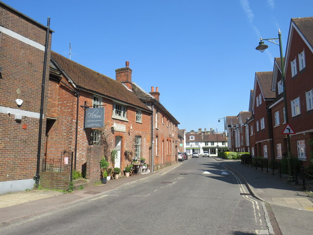
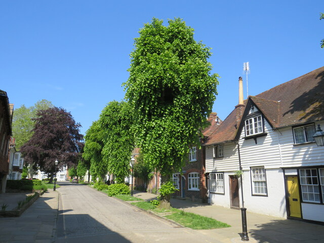
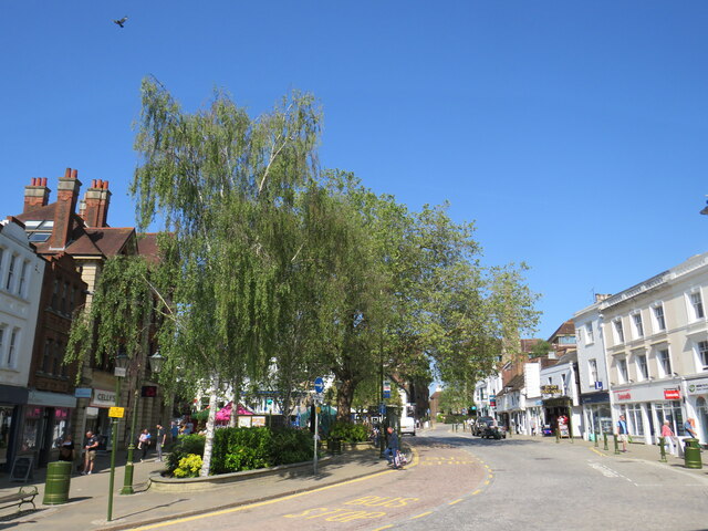
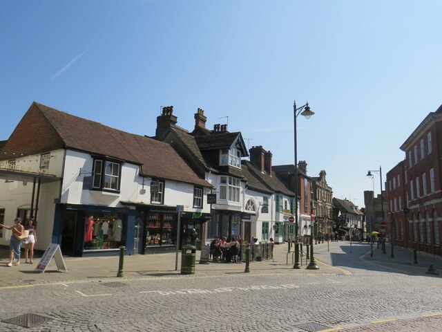
Alder Copse Images

Images are sourced within 2km of 51.058644/-0.34699368 or Grid Reference TQ1530. Thanks to Geograph Open Source API. All images are credited.

Waitrose and John Lewis - off Albion Way The photo shows the upper level of the car park. There is a level below this as well.
Waitrose and John Lewis - off Albion Way
The photo shows the upper level of the car park. There is a level below this as well.
River Arun Overflow stream that maybe the original River Arun route. A higher level canal was cut for the mill.

River info : <span class="nowrap"><a title="https://en.wikipedia.org/wiki/River_Arun" rel="nofollow ugc noopener" href="https://en.wikipedia.org/wiki/River_Arun">Link</a><img style="margin-left:2px;" alt="External link" title="External link - shift click to open in new window" src="https://s1.geograph.org.uk/img/external.png" width="10" height="10"/></span>
River Arun
Overflow stream that maybe the original River Arun route. A higher level canal was cut for the mill. River info : LinkExternal link
Streets of Horsham Junction of Curzon Avenue and Vale Drive.
Streets of Horsham
Junction of Curzon Avenue and Vale Drive.
Waitrose and John Lewis store
Worthing Road, Horsham A pedestrianised section of Worthing Road, in the centre of Horsham, a town in West Sussex.
Worthing Road, Horsham
A pedestrianised section of Worthing Road, in the centre of Horsham, a town in West Sussex.
Horsham Bus Station A purpose-built bus terminus in Horsham, a town in West Sussex.  The bus station is quite small, accommodating just five buses, but has seating for waiting passengers.
Horsham Bus Station
A purpose-built bus terminus in Horsham, a town in West Sussex. The bus station is quite small, accommodating just five buses, but has seating for waiting passengers.
The Forum, Horsham The Forum is a public open space in Horsham, a town in West Sussex.
The Forum, Horsham
The Forum is a public open space in Horsham, a town in West Sussex.
Blackhorse Way, Horsham Blackhorse Way is a street in Horsham, a town in West Sussex.
Blackhorse Way, Horsham
Blackhorse Way is a street in Horsham, a town in West Sussex.
South Street, Horsham A short parade of shops in South Street, in the centre of Horsham.  The shop nearest the camera is a café.
South Street, Horsham
A short parade of shops in South Street, in the centre of Horsham. The shop nearest the camera is a café.
Causeway, Horsham Causeway is a residential street close to the town centre in Horsham, West Sussex.
Causeway, Horsham
Causeway is a residential street close to the town centre in Horsham, West Sussex.
Carfax, Horsham Carfax is a street in the centre of Horsham, a town in West Sussex.
Carfax, Horsham
Carfax is a street in the centre of Horsham, a town in West Sussex.
Carfax, Horsham Carfax is a street in the centre of Horsham, a market town in West Sussex.
Carfax, Horsham
Carfax is a street in the centre of Horsham, a market town in West Sussex.
Bandstand in Horsham A bandstand in Carfax, a street in the centre of Horsham.
Bandstand in Horsham
A bandstand in Carfax, a street in the centre of Horsham.
Train at Christ's Hospital station, near Horsham A train passing through Christ's Hospital station, near Horsham in West Sussex.  The train is a Class 377 "Electrostar" electric multiple unit.  The railway here is electrified using the third rail system.
Train at Christ's Hospital station, near Horsham
A train passing through Christ's Hospital station, near Horsham in West Sussex. The train is a Class 377 "Electrostar" electric multiple unit. The railway here is electrified using the third rail system.
Christ's Hospital station, near Horsham The entrance to Christ's Hospital railway station, near Horsham in West Sussex.  The single-storey station building dates from the 1970s.  It replaced the original station which was much larger and more grand.
Christ's Hospital station, near Horsham
The entrance to Christ's Hospital railway station, near Horsham in West Sussex. The single-storey station building dates from the 1970s. It replaced the original station which was much larger and more grand.
Converted goods shed, Christ's Hospital station, near Horsham The Old Goods Shed at Christ's Hospital station, near Horsham in West Sussex.  As its name suggests, this building was originally a goods shed built for railway use.  Having been derelict for a number of years, it has recently been redeveloped as affordable housing.
Converted goods shed, Christ's Hospital station, near Horsham
The Old Goods Shed at Christ's Hospital station, near Horsham in West Sussex. As its name suggests, this building was originally a goods shed built for railway use. Having been derelict for a number of years, it has recently been redeveloped as affordable housing.
Downs Link at Christ's Hospital, near Horsham A recently-opened section of the Downs Link, passing beneath the Arun Valley Line just north of Christ's Hospital station.  The path also forms part of route 223 of the National Cycle Network.
Downs Link at Christ's Hospital, near Horsham
A recently-opened section of the Downs Link, passing beneath the Arun Valley Line just north of Christ's Hospital station. The path also forms part of route 223 of the National Cycle Network.
Disused platform at Christ's Hospital station, near Horsham This platform at Christ's Hospital railway station was used by trains to and from Guildford, until the line closed in the 1960s.  The trackbed alongside the platform now forms part of the Downs Link path, which is also part of route 223 of the National Cycle Network.
Disused platform at Christ's Hospital station, near Horsham
This platform at Christ's Hospital railway station was used by trains to and from Guildford, until the line closed in the 1960s. The trackbed alongside the platform now forms part of the Downs Link path, which is also part of route 223 of the National Cycle Network.
Show me another place!

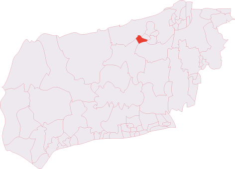
Alder Copse is located at Grid Ref: TQ1530 (Lat: 51.058644, Lng: -0.34699368)

Administrative County: West Sussex

District: Horsham

Police Authority: Sussex

What 3 Words

///engine.orange.nights. Near Horsham, West Sussex

Nearby Locations

Alder Copse

Related Wikis

Horsham Tanbridge & Broadbridge Heath (electoral division)

Horsham Tanbridge & Broadbridge Heath is an electoral division of West Sussex in England, and returns one member to sit on West Sussex County Council....

Tanbridge House School

Tanbridge House School is a coeducational secondary school located in Horsham, West Sussex, England. Its current head master is Mr Sheridan who started...

Horsham Cricket Club

Horsham Cricket Club is one of the oldest cricket clubs in the world and represents the Sussex market town of Horsham in the Sussex Cricket League, along...

Broadbridge Heath F.C.

Broadbridge Heath Football Club is a football club based in Broadbridge Heath, near Horsham, in West Sussex, England. They are currently members of the...

Horsham Unitarian Church

Horsham Unitarian Church (formerly Horsham General Baptist Chapel) is a Unitarian chapel in Horsham in the English county of West Sussex. It was founded...

Rising Universe

Rising Universe, more commonly known locally as the Shelley Fountain, was a large kinetic water sculpture in Horsham, West Sussex, England. It was created...
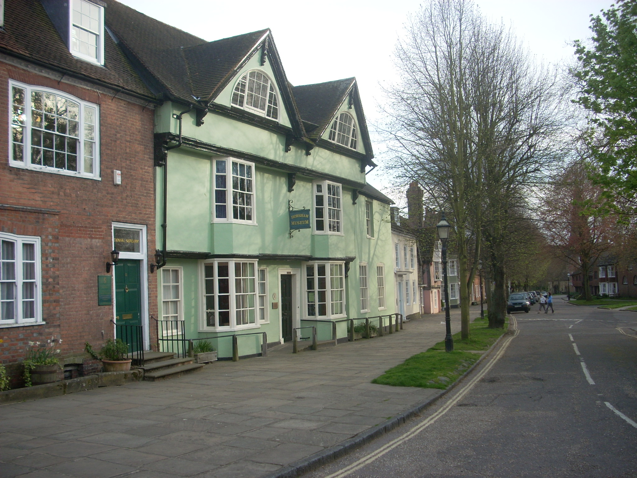
Horsham Museum

Horsham Museum is a museum at Horsham, West Sussex, in South East England. It was founded in August 1893 by volunteers of the Free Christian (now Unitarian...

Horsham Town Hall

Horsham Town Hall is a municipal building in the Market Square in Horsham, West Sussex. It is a Grade II listed building. == History == The earliest mention...

Nearby Amenities

Located within 500m of 51.058644,-0.34699368
Source: Landsat photo
Lat/Long: 51.0560473/-0.3514146
Source: Landsat photo
Lat/Long: 51.0566953/-0.3444761
Mini Roundabout
Direction: clockwise
Lat/Long: 51.0591971/-0.3421816
Bus Stop
Fellcott Close
Bus: yes
Naptan AtcoCode: 4400HO0317
Naptan Bearing: E
Naptan CommonName: Fellcott Close
Naptan Indicator: opp Fellcott Close
Naptan Landmark: Fellcott Close
Naptan Street: Hills Farm Lane
Naptan Verified: no
Public Transport: platform
Source: naptan_import
Lat/Long: 51.0597684/-0.3500283
Post Box
Brand: Royal Mail
Brand Wikidata: Q638098
Collection Plate: CP1
Collection Times: Mo-Fr 16:45; Sa 07:00
Last Checked: 2021-06-06
Operator: Royal Mail
Operator Wikidata: Q638098
Post Box Type: pillar
Ref: RH12 204
Royal Cypher: EIIR
Royal Cypher Wikidata: Q33102113
Source: survey
Lat/Long: 51.0589422/-0.3416977
Bus Stop
Fellcott Way
Bus: yes
Naptan AtcoCode: 4400HO0039
Naptan Bearing: E
Naptan CommonName: Fellcott Way
Naptan Indicator: adj Fellcott Way
Naptan Landmark: Fellcott Way
Naptan NaptanCode: wsxapmtm
Naptan Street: Hills Farm Lane
Naptan Verified: no
Public Transport: platform
Shelter: no
Source: naptan_import
Lat/Long: 51.059842/-0.348799
Post Box
Brand: Royal Mail
Brand Wikidata: Q638098
Collection Times: Mo-Fr 09:00; Sa 07:00
Operator: Royal Mail
Operator Wikidata: Q638098
Post Box Type: pillar
Ref: RH12 234D
Royal Cypher: EIIR
Royal Cypher Wikidata: Q33102113
Lat/Long: 51.0598287/-0.3494409
Post Box
Collection Times: Mo-Fr 09:00; Sa 07:00
Post Box Type: lamp
Ref: RH12 237
Royal Cypher: EIIR
Royal Cypher Wikidata: Q33102113
Lat/Long: 51.0581344/-0.3454465
Bus Stop
Post Office
Bus: yes
Naptan AtcoCode: 4400HO0035
Naptan Bearing: NE
Naptan CommonName: Post Office
Naptan Indicator: opp. Tower Close
Naptan Landmark: Tower Close
Naptan NaptanCode: wsxapmta
Naptan Street: Tower Hill
Naptan Verified: no
Public Transport: platform
Source: naptan_import
Lat/Long: 51.0546177/-0.3453668
Bus Stop
Blackbridge Lane
Bus: yes
Naptan AtcoCode: 4400HO0037
Naptan Bearing: W
Naptan CommonName: Blackbridge Lane
Naptan Indicator: opp Shandys Close
Naptan Landmark: Blackbridge Lane
Naptan NaptanCode: wsxapmtg
Naptan Street: Hills Farm Lane
Naptan Verified: no
Public Transport: platform
Source: naptan_import
Lat/Long: 51.0599372/-0.3432124
Bus Stop
Blackbridge Lane
Bus: yes
Naptan AtcoCode: 4400HO0038
Naptan Bearing: E
Naptan CommonName: Blackbridge Lane
Naptan Indicator: adj Shandys Close
Naptan Landmark: Blackbridge Lane
Naptan NaptanCode: wsxapmtj
Naptan Street: Hills Farm Lane
Naptan Verified: no
Public Transport: platform
Source: naptan_import
Lat/Long: 51.0601593/-0.344575
Bus Stop
Stoneybrook
Bus: yes
Naptan AtcoCode: 4400HO0040
Naptan Bearing: SW
Naptan CommonName: Stoneybrook
Naptan Indicator: adj Stoneybrook
Naptan Landmark: Stoneybrook
Naptan NaptanCode: wsxapmtp
Naptan Street: Hills Farm Lane
Naptan Verified: no
Public Transport: platform
Source: naptan_import
Lat/Long: 51.0619616/-0.3508451
Bus Stop
Blackbridge Lane
Bus: yes
Naptan AtcoCode: 4400HO0253
Naptan Bearing: S
Naptan CommonName: Blackbridge Lane
Naptan Indicator: opp Arunside
Naptan Landmark: Arunside
Naptan NaptanCode: wsxatdjt
Naptan Street: Blackbridge Lane
Naptan Verified: no
Public Transport: platform
Source: naptan_import
Lat/Long: 51.0613961/-0.3417172
Bus Stop
Blackbridge Lane Shops
Bus: yes
Naptan AtcoCode: 4400HO0254
Naptan Bearing: W
Naptan CommonName: Blackbridge Lane Shops
Naptan Indicator: o/s Rowena Court
Naptan Landmark: Longfield Road
Naptan NaptanCode: wsxatdjw
Naptan Street: Blackbridge Lane
Naptan Verified: no
Public Transport: platform
Source: naptan_import
Lat/Long: 51.0588803/-0.3408579
Bus Stop
Blackbridge Lane Shops
Bus: yes
Naptan AtcoCode: 4400HO0267
Naptan Bearing: E
Naptan CommonName: Blackbridge Lane Shops
Naptan Indicator: opp Post Office
Naptan Landmark: Three Acres
Naptan NaptanCode: wsxdptgt
Naptan Street: Blackbridge Lane
Naptan Verified: no
Public Transport: platform
Source: naptan_import
Lat/Long: 51.0589748/-0.3409332
Bus Stop
Stoneybrook
Bus: yes
Naptan AtcoCode: 4400HO0316
Naptan Bearing: N
Naptan CommonName: Stoneybrook
Naptan Indicator: opp Stoneybrook
Naptan Landmark: Stoneybrook
Naptan Street: Hills Farm Lane
Naptan Verified: no
Public Transport: platform
Shelter: yes
Source: naptan_import
Lat/Long: 51.0615603/-0.3513857
Barrier: cycle_barrier
Bicycle: yes
Foot: yes
Lat/Long: 51.0614681/-0.3415848
Power: pole
Lat/Long: 51.0550321/-0.3496527
Power: pole
Lat/Long: 51.0560706/-0.3490519
Parthings
Place: farm
Lat/Long: 51.0551411/-0.3511897
Bench
Material: wood
Lat/Long: 51.0616082/-0.3523003
Bench
Material: wood
Lat/Long: 51.0610665/-0.3528392
Akshar News & Food Stores
Addr City: Horsham
Addr Country: GB
Addr Housenumber: 102
Addr Postcode: RH12 1SA
Addr Street: Blackbridge Lane
Fhrs Id: 406290
Shop: convenience
Lat/Long: 51.0587894/-0.3418941
Waste Basket
Waste: dog_excrement
Lat/Long: 51.0598889/-0.3434367
Recycling
Location: overground
Recycling Shoes: yes
Recycling Type: container
Lat/Long: 51.0598891/-0.3434565
Washout Hydrant
Fire Hydrant
Emergency: fire_hydrant
Fire Hydrant Type: underground
Survey Date: 2018-11-11
Water Source: main
Lat/Long: 51.062299/-0.3491612
Washout Hydrant
Fire Hydrant
Emergency: fire_hydrant
Fire Hydrant Type: underground
Survey Date: 2018-11-11
Water Source: main
Lat/Long: 51.06237/-0.3497723
Candy curls
Addr City: Horsham
Addr Housenumber: 102a
Addr Postcode: RH12 1SA
Addr Street: Blackbridge Lane
Phone: +44 1403 268543
Shop: hairdresser
Lat/Long: 51.0587755/-0.3417903
Erica's Florist
Phone: +44 1403 217553
Shop: florist
Website: https://www.ericasflorist.com/
Lat/Long: 51.0587596/-0.3416833
The Needles
Place: locality
Lat/Long: 51.0587994/-0.3403264
Bicycle Parking: stands
Capacity: 6
Construction Amenity: bicycle_parking
Lat/Long: 51.057794/-0.3523186
Bench
Material: wood
Lat/Long: 51.0606158/-0.3533083
Barrier: cycle_barrier
Foot: yes
Material: metal
Lat/Long: 51.0602987/-0.347397
Bench
Backrest: yes
Lat/Long: 51.0613577/-0.3434208
Bench
Lat/Long: 51.0591884/-0.351679
Bench
Lat/Long: 51.0589937/-0.3508122
Bench
Lat/Long: 51.0591403/-0.3491346
Defibrillator
Defibrillator Location: Attached to wall outside the building
Emergency: defibrillator
Lat/Long: 51.0591814/-0.3407788
Sven-Paul
Capacity: 2
Man Made: charge_point
Operator: Pod Point
Operator Wikidata: Q42888154
Ref: PG-407226
Socket Type2: 2
Socket Type2 Output: 7 kW
Lat/Long: 51.0575305/-0.3513996
The data included in this document is from www.openstreetmap.org. The data is made available under ODbL.

Have you been to Alder Copse?

Leave your review of Alder Copse below (or comments, questions and feedback).