Pachesham Park

Wood, Forest in Surrey Mole Valley

England

Pachesham Park

Field south of Ashtead Woods Road
Field south of Ashtead Woods Road Credit: James Emmans

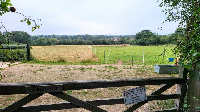
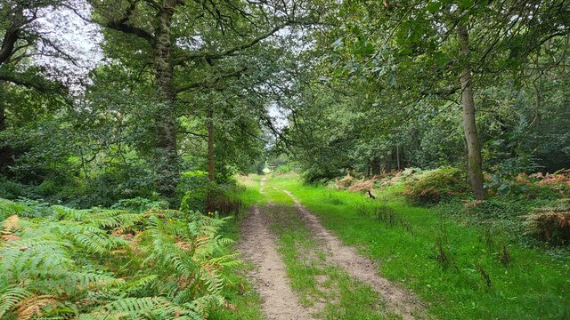
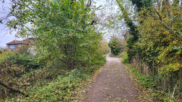
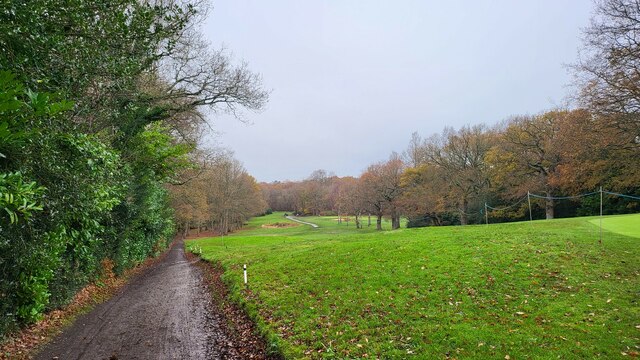
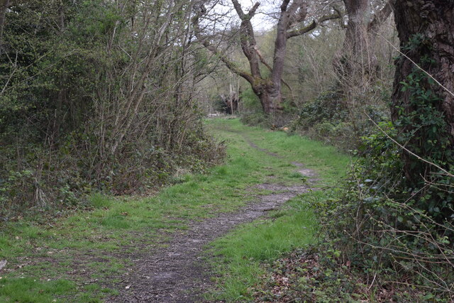
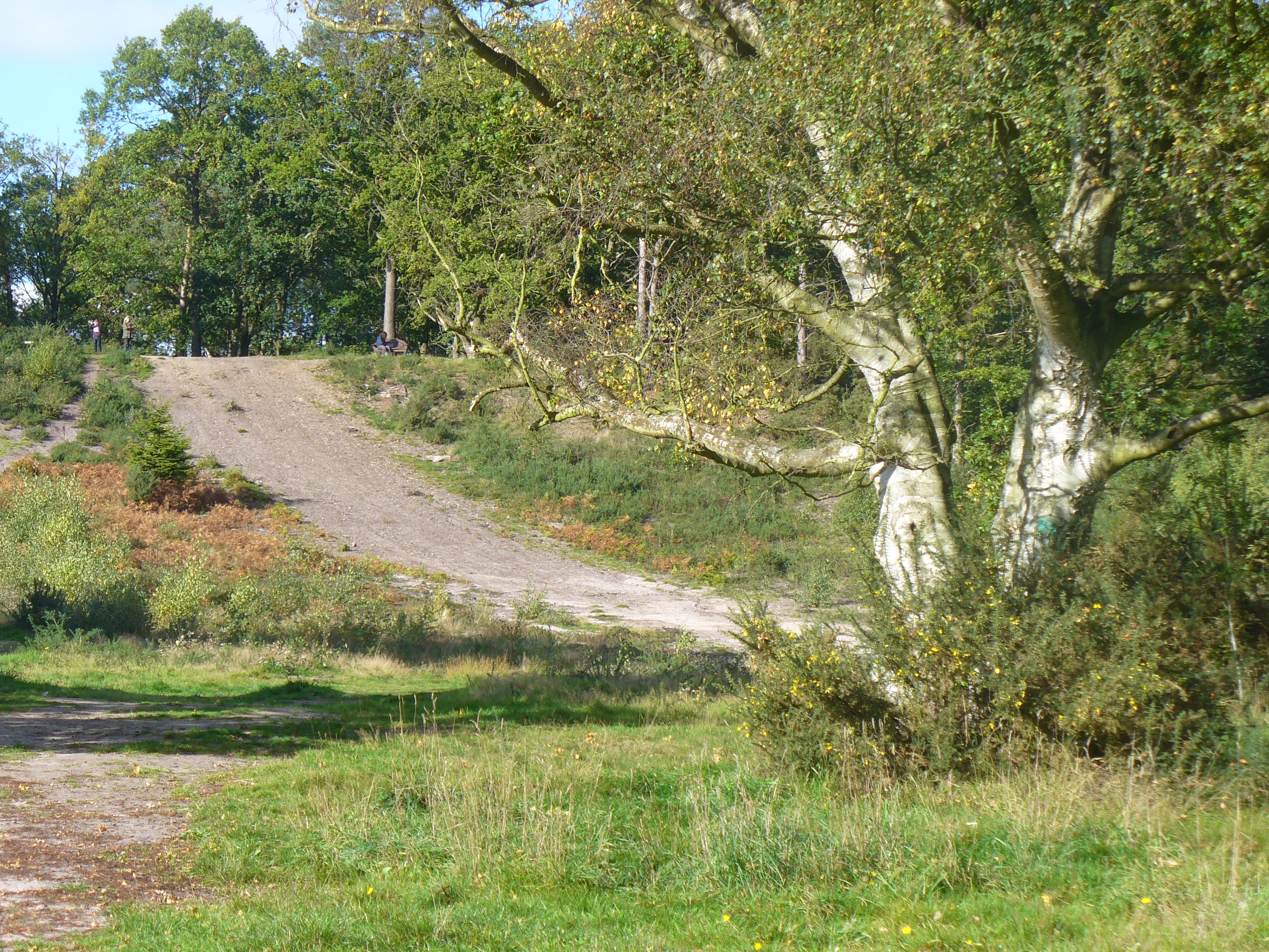
Pachesham Park is a picturesque woodland located in Surrey, England. Covering an area of approximately 30 acres, the park is renowned for its beautiful wood and forest scenery. It is a popular destination for both local residents and visitors who seek tranquility and natural beauty.

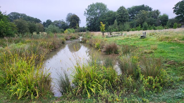
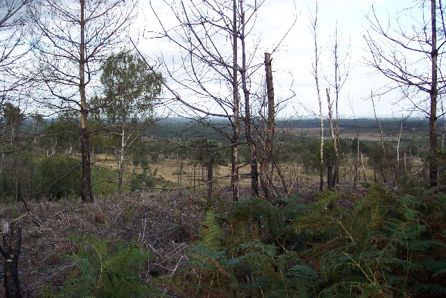
The park is home to a wide variety of trees, including oak, beech, and pine, which create a vibrant and diverse ecosystem. The dense foliage provides shade and a cool atmosphere, making it an ideal spot for leisurely walks and picnics on warm summer days.

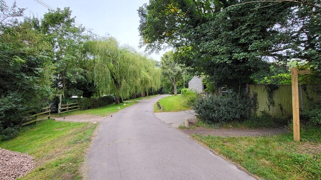
The park is crisscrossed by a network of well-maintained footpaths, allowing visitors to explore the woodland and discover its hidden gems. Along the trails, there are numerous benches and resting points where one can sit and admire the stunning surroundings.

Wildlife enthusiasts will also find Pachesham Park to be a haven for various species. Squirrels can frequently be spotted darting between the trees, while birdwatchers may catch a glimpse of woodpeckers or nuthatches. The park's serene atmosphere provides an ideal habitat for these creatures, making it a popular destination for nature lovers.

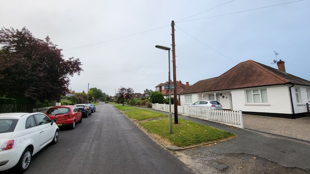
Pachesham Park is easily accessible, with ample parking available for visitors. The park's management ensures that it remains clean and well-maintained, providing a safe and enjoyable environment for all. With its tranquil setting and natural charm, Pachesham Park is a must-visit destination for those seeking an escape from the hustle and bustle of everyday life.

If you have any feedback on the listing, please let us know in the comments section below.

Pachesham Park Images

Images are sourced within 2km of 51.320227/-0.33760808 or Grid Reference TQ1559. Thanks to Geograph Open Source API. All images are credited.

Field south of Ashtead Woods Road
Woodland track on Ashtead Common 495 acres common and national nature reserve, owned and run by the City of London Corporation. SSSI status due to rear invertebrates and an important breeding area for birds
Woodland track on Ashtead Common
495 acres common and national nature reserve, owned and run by the City of London Corporation. SSSI status due to rear invertebrates and an important breeding area for birds
Footpath crossing Ashstead Woods Road
Rye Meadows Wetlands Managed area next to the Rye Brook to improve wildlife and reduce flooding.

<span class="nowrap"><a title="https://www.ryemeadows.org.uk/" rel="nofollow ugc noopener" href="https://www.ryemeadows.org.uk/">Link</a><img style="margin-left:2px;" alt="External link" title="External link - shift click to open in new window" src="https://s1.geograph.org.uk/img/external.png" width="10" height="10"/></span>
Rye Meadows Wetlands
Managed area next to the Rye Brook to improve wildlife and reduce flooding. LinkExternal link
Northern end of West Farm Avenue
Railway line towards Leatherhead Station Photo taken from the railway bridge for the Kingston Road which was a part of an improved road becoming the B2430. The original road was a narrow windy road with a railway crossing.
Railway line towards Leatherhead Station
Photo taken from the railway bridge for the Kingston Road which was a part of an improved road becoming the B2430. The original road was a narrow windy road with a railway crossing.
River Land close to Randalls Road
The Leatherhead Golf Club The golf club is on the parkland of Pachesham Manor.
The Leatherhead Golf Club
The golf club is on the parkland of Pachesham Manor.
Woodland Road The M25 passes over the semi-rural A245.
Woodland Road
The M25 passes over the semi-rural A245.
Leatherhead Commercial site, awaiting redevelopment.
Leatherhead
Commercial site, awaiting redevelopment.
Leatherhead Community Hub Located beside Kingston Road.
Leatherhead Community Hub
Located beside Kingston Road.
The Molebridge Practice Located beside Kingston Road.
The Molebridge Practice
Located beside Kingston Road.
Leatherhead B&Q Located between Oxshott Road and Kingston Road, the latter truncated by the building of the M25 Motorway.
Leatherhead B&Q
Located between Oxshott Road and Kingston Road, the latter truncated by the building of the M25 Motorway.
Leatherhead Tesco Located beside Oxshott Road.
Leatherhead Tesco
Located beside Oxshott Road.
M25 Motorway Seen from Oxshott Road, close to junction 9.
M25 Motorway
Seen from Oxshott Road, close to junction 9.
Fire and Iron Gallery Fire and Iron Gallery was founded in 1982 as part of Rowhurst Forge.

Fire and Iron represents 200 British and international makers working in technically diverse ways with iron, steel, stainless steel, aluminium, zinc, copper, bronze, brass, tin, pewter, silver, gold, titanium and scrap metal.
Fire and Iron Gallery
Fire and Iron Gallery was founded in 1982 as part of Rowhurst Forge. Fire and Iron represents 200 British and international makers working in technically diverse ways with iron, steel, stainless steel, aluminium, zinc, copper, bronze, brass, tin, pewter, silver, gold, titanium and scrap metal.
Beasts in the Wood Some of the outdoor artworks produced at the Fire and Iron forge.
Beasts in the Wood
Some of the outdoor artworks produced at the Fire and Iron forge.
Path into woodland, on Ashtead Common
Show me another place!

Pachesham Park is located at Grid Ref: TQ1559 (Lat: 51.320227, Lng: -0.33760808)

Administrative County: Surrey

District: Mole Valley

Police Authority: Surrey

What 3 Words

///policy.reveal.edge. Near Leatherhead, Surrey

Related Wikis

Ashtead Common

Ashtead Common, nearly 495 acres (c. 200 ha), is a wooded area open to the public, to the north of the village of Ashtead in Surrey, England. It is owned...

Prince's Coverts

Prince's Coverts is an area of 864 acres (3.50 km2; 1.350 sq mi) of managed woodland in Oxshott, Surrey, England, to which there is public access. It is...

Therfield School

Therfield School is a coeducational secondary school and sixth form located in Leatherhead, Surrey, England. Therfield School sixth form teaches courses...

Oxshott

Oxshott is a suburban village in the borough of Elmbridge in Surrey, England. Oxshott includes hilly acidic heath which is partly wooded (see Esher Commons...

Ashtead railway station

Ashtead railway station is in Ashtead, Surrey, England. It is 16 miles 19 chains (26.1 km) down the line from London Waterloo. == History == Designed by...

Colony Bog and Bagshot Heath

Colony Bog and Bagshot Heath is a 1,130.5-hectare (2,794-acre) biological Site of Special Scientific Interest between Camberley and Woking in Surrey, England...

The Rye (brook)

The Rye is a stream rising east of Ashtead and flowing into the River Mole near Leatherhead, Surrey. == Course == The Rye Brook flows westwards across...

Epsom and Ashtead Commons

Epsom and Ashtead Commons are a 360.4-hectare (891-acre) biological Site of Special Scientific Interest on the outskirts of Epsom and Ashtead in Surrey...

Nearby Amenities

Located within 500m of 51.320227,-0.33760808
Power: tower
Lat/Long: 51.3245831/-0.3373266
Power: tower
Lat/Long: 51.3237249/-0.3404509
Power: tower
Lat/Long: 51.323072/-0.3429688
Bus Stop
Pachesham Park
Naptan AtcoCode: 40004408227A
Naptan Bearing: NW
Naptan BusStopType: CUS
Naptan CommonName: Pachesham Park
Naptan Indicator: opp
Naptan Landmark: Pachesham Park
Naptan NaptanCode: surgptdm
Naptan Street: Oxshott Road
Naptan Verified: no
Physically Present: no
Public Transport: platform
Source: naptan_import
Lat/Long: 51.3180997/-0.3382825
Bus Stop
Pachesham Park
Naptan AtcoCode: 40004408227B
Naptan Bearing: SE
Naptan CommonName: Pachesham Park
Naptan Indicator: adj
Naptan Landmark: Pachesham Park
Naptan NaptanCode: surdatdt
Naptan Street: Oxshott Road
Naptan Verified: no
Public Transport: platform
Source: naptan_import
Lat/Long: 51.3181459/-0.3380913
Crossing
Crossing: unmarked
Crossing Island: no
Kerb: lowered
Tactile Paving: yes
Lat/Long: 51.3199965/-0.3415753
Barrier: stile
Lat/Long: 51.3160361/-0.3360464
Barrier: stile
Lat/Long: 51.3162152/-0.3373435
Man Made: tower
Tower Type: communication
Lat/Long: 51.3161622/-0.340413
Man Made: tower
Tower Type: communication
Lat/Long: 51.31622/-0.3399369
Man Made: tower
Tower Type: communication
Lat/Long: 51.3162214/-0.3405839
Man Made: tower
Tower Type: communication
Lat/Long: 51.3164447/-0.3401276
Post Box
Collection Times: Mo-Fr 16:00; Sa 11:30
Operator: Royal Mail
Post Box Mounting: pier
Post Box Type: lamp
Ref: KT22 38
Royal Cypher: EIIR
Royal Cypher Wikidata: Q33102113
Lat/Long: 51.3196247/-0.3416765
Post Box
Collection Times: Mo-Fr 09:00; Sa 07:00
Operator: Royal Mail
Post Box Type: pillar
Ref: KT22 91D
Royal Cypher: GR
Royal Cypher Wikidata: Q33102273
Lat/Long: 51.3220549/-0.334684
Crossing
Crossing: unmarked
Crossing Island: no
Kerb: lowered
Tactile Paving: yes
Lat/Long: 51.3199147/-0.3415746
The data included in this document is from www.openstreetmap.org. The data is made available under ODbL.

Have you been to Pachesham Park?

Leave your review of Pachesham Park below (or comments, questions and feedback).