Stoke Wood

Wood, Forest in Surrey Elmbridge

England

Stoke Wood

The Leatherhead Golf Club The golf club is on the parkland of Pachesham Manor.
The Leatherhead Golf Club Credit: James Emmans

Stoke Wood is a charming woodland located in the county of Surrey, England. Spanning over an area of approximately 900 acres, it is a popular destination for nature enthusiasts and outdoor lovers alike. The wood is situated near the village of Stoke D'Abernon, just a short distance from the bustling town of Cobham.

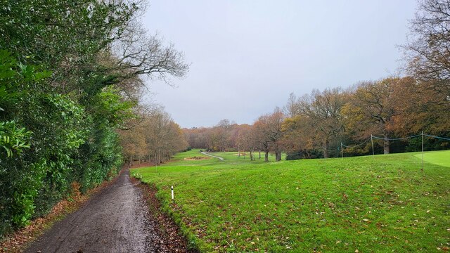
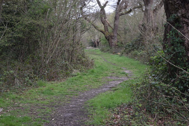
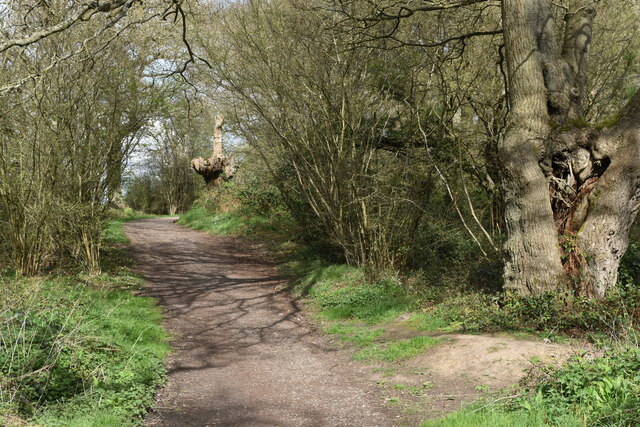
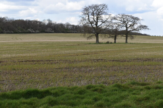
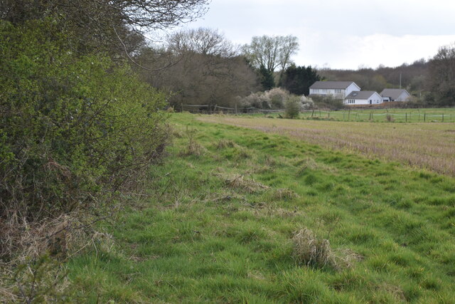
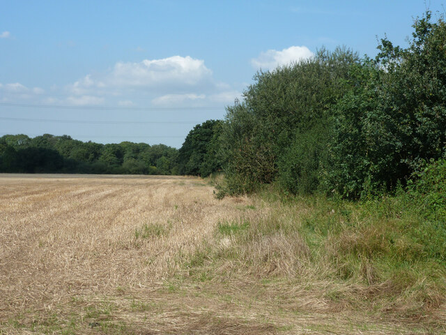
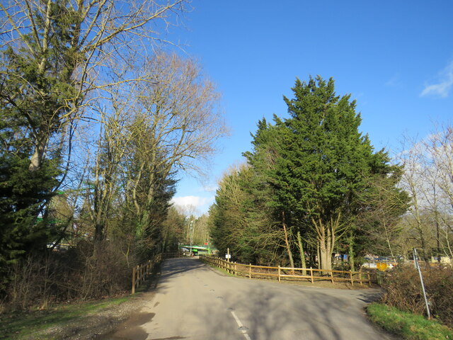
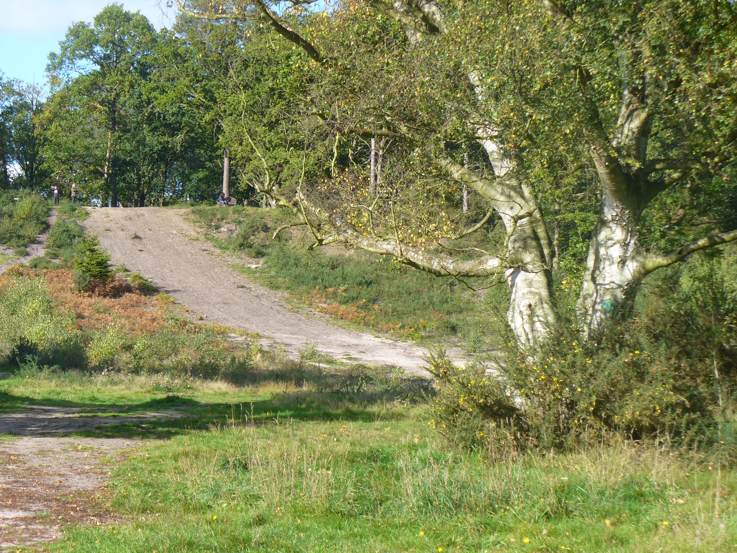
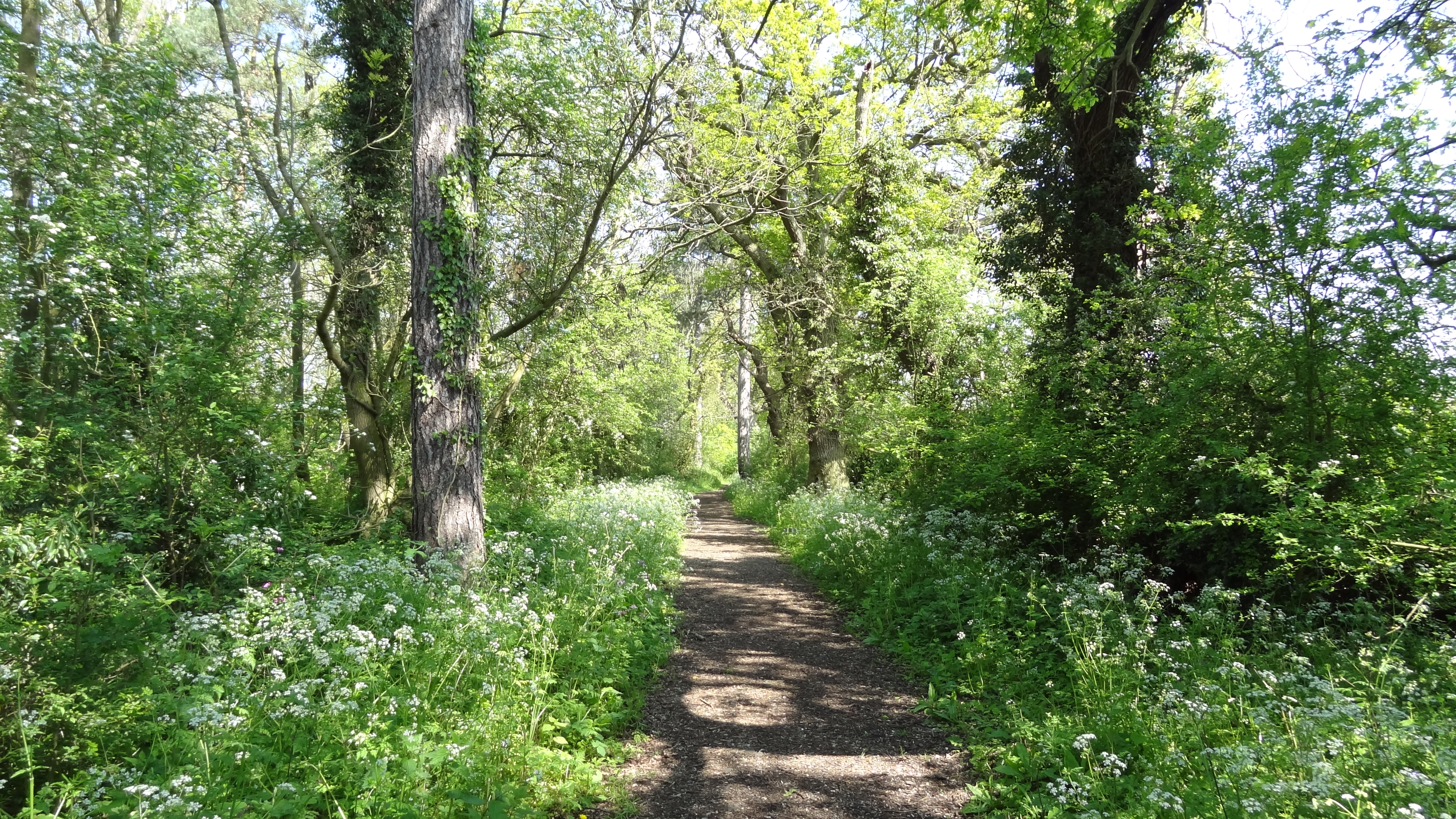
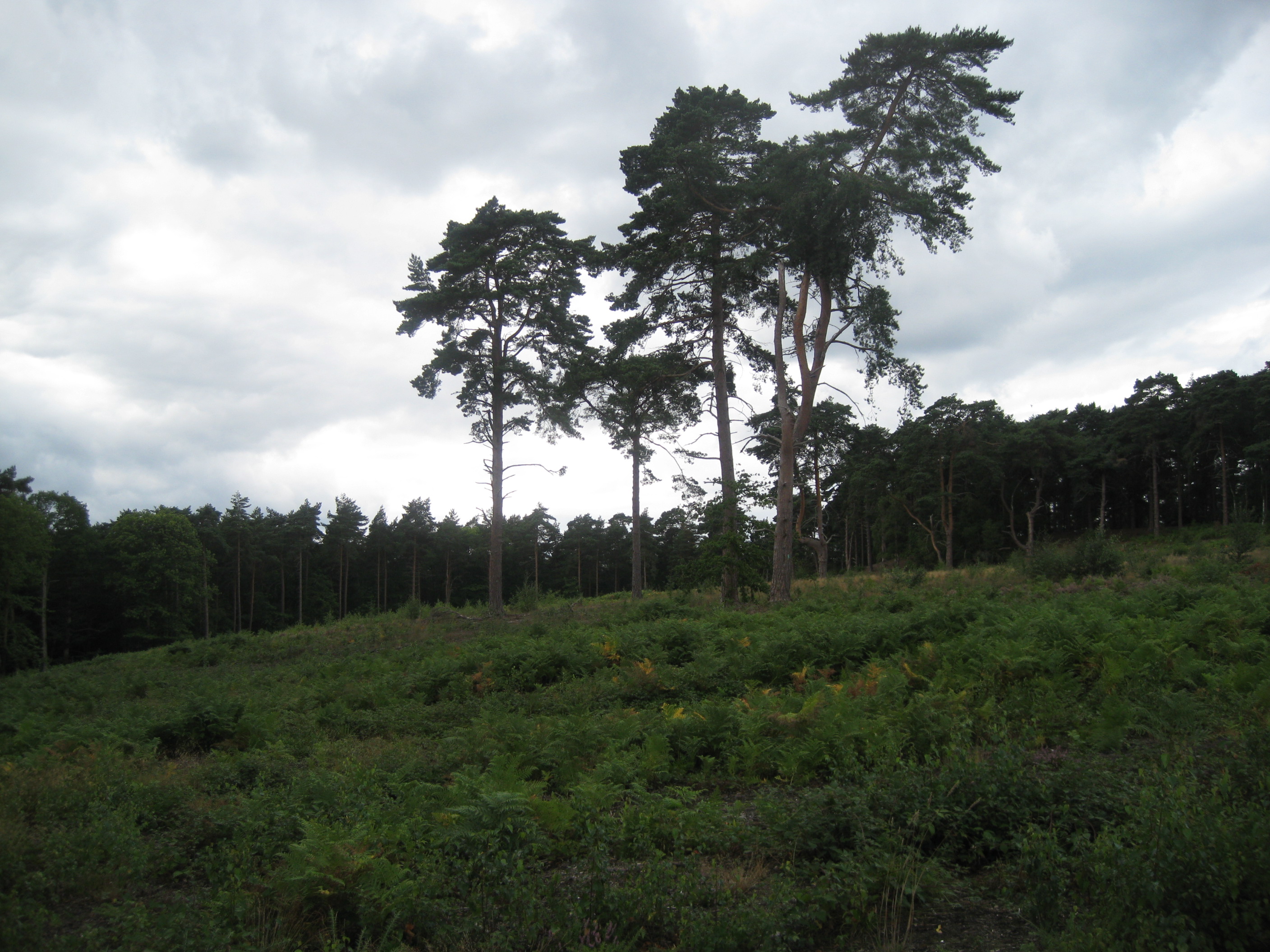
As you venture into Stoke Wood, you will be greeted by a diverse range of trees, including oak, beech, and birch. The woodland is known for its tranquil and serene atmosphere, making it an ideal spot for peaceful walks or picnics amidst nature. The forest floor is adorned with a variety of wildflowers and ferns, creating a vibrant and picturesque setting.

Stoke Wood is also home to a wide array of wildlife, making it a haven for nature conservation. Visitors may be lucky enough to spot woodland creatures such as deer, foxes, badgers, and numerous bird species. The wood is a designated Site of Special Scientific Interest, highlighting its ecological importance.

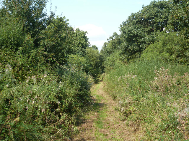
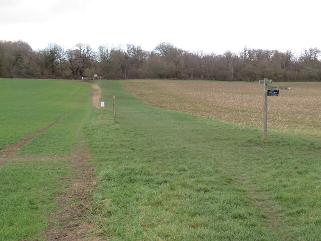
The wood is crisscrossed by an extensive network of footpaths and bridleways, allowing visitors to explore its beauty at their own pace. These paths are well-maintained and provide access to various parts of the woodland, including the enchanting bluebell glades that bloom in the spring.

Stoke Wood offers a tranquil escape from the hustle and bustle of everyday life, providing visitors with an opportunity to connect with nature and experience the beauty of Surrey's woodlands. Whether you are a nature enthusiast, a photographer, or simply seeking a peaceful retreat, Stoke Wood is sure to captivate and inspire.

If you have any feedback on the listing, please let us know in the comments section below.

Stoke Wood Images

Images are sourced within 2km of 51.33451/-0.33971858 or Grid Reference TQ1560. Thanks to Geograph Open Source API. All images are credited.

The Leatherhead Golf Club The golf club is on the parkland of Pachesham Manor.
The Leatherhead Golf Club
The golf club is on the parkland of Pachesham Manor.
Path into woodland, on Ashtead Common
Very muddy path on Ashtead Common
Oxshott railway station  Oxshott railway station entrance seen from the car park. The station opened in 1885 and is operated and served by South Western Railway.
Oxshott railway station
Oxshott railway station entrance seen from the car park. The station opened in 1885 and is operated and served by South Western Railway.
View across field to Rushett Farm
Bridleway on edge of Ashtead Common
Farmland between Ashtead Common and the A243
View along outer edge of woodland at Ashtead Common
Field edge near Malden Rushett
Bridleway towards Chessington Used by the 'Chessington Countryside Walk'.
Bridleway towards Chessington
Used by the 'Chessington Countryside Walk'.
Cable laying, Chessington This appears to be a splicing point, where cables that have been pulled through plastic pipes are joined together.
Cable laying, Chessington
This appears to be a splicing point, where cables that have been pulled through plastic pipes are joined together.
Footpath across a field near Chessington A public footpath across a field in Chessington, on the fringe of Greater London.

This image was taken in the month of February.  Trees were bare for the winter season.
Footpath across a field near Chessington
A public footpath across a field in Chessington, on the fringe of Greater London. This image was taken in the month of February. Trees were bare for the winter season.
Public bridleway near Chessington A public bridleway through a field near Chessington, on the fringe of south west London.  A footpath leads off to the right, indicated by the wooden signpost.

This location is within Greater London, but only just.  As the bridleway enters the woods in the background, it crosses the county boundary out of Greater London and into Surrey.
Public bridleway near Chessington
A public bridleway through a field near Chessington, on the fringe of south west London. A footpath leads off to the right, indicated by the wooden signpost. This location is within Greater London, but only just. As the bridleway enters the woods in the background, it crosses the county boundary out of Greater London and into Surrey.
Public bridleway near Malden Rushett A public bridleway along the edge of a field near Chessington, on the fringe of south west London.
Public bridleway near Malden Rushett
A public bridleway along the edge of a field near Chessington, on the fringe of south west London.
Access road, Chessington World of Adventures An access road at Chessington World of Adventures, a visitor attraction on the fringe of south west London.  The attraction was previously known as Chessington Zoo.
Access road, Chessington World of Adventures
An access road at Chessington World of Adventures, a visitor attraction on the fringe of south west London. The attraction was previously known as Chessington Zoo.
Public footpath and access road, Chessington World of Adventures A public footpath and access road at Chessington World of Adventures, on the fringe of south west London.  The access road leads to and from car parks for visitors to the site.  The footpath, which runs around the perimeter of Chessington World of Adventures, is a public right of way.

This image was taken in a February afternoon.  Trees were bare for the winter season.
Public footpath and access road, Chessington World of Adventures
A public footpath and access road at Chessington World of Adventures, on the fringe of south west London. The access road leads to and from car parks for visitors to the site. The footpath, which runs around the perimeter of Chessington World of Adventures, is a public right of way. This image was taken in a February afternoon. Trees were bare for the winter season.
Public footpath and traffic sign, Chessington World of Adventures A public footpath and access road at Chessington World of Adventures, on the fringe of south west London.  The access road leads to and from car parks for visitors to the site.  The footpath, which runs around the perimeter of Chessington World of Adventures, is a public right of way.

The traffic sign is not a recognised sign for public roads.  However, it is on private land and on a private road, therefore it doesn't have to comply with the standards for public roads.

This image was taken in a February afternoon.  Trees were bare for the winter season.
Public footpath and traffic sign, Chessington World of Adventures
A public footpath and access road at Chessington World of Adventures, on the fringe of south west London. The access road leads to and from car parks for visitors to the site. The footpath, which runs around the perimeter of Chessington World of Adventures, is a public right of way. The traffic sign is not a recognised sign for public roads. However, it is on private land and on a private road, therefore it doesn't have to comply with the standards for public roads. This image was taken in a February afternoon. Trees were bare for the winter season.
Public footpath and access road, Chessington World of Adventures A public footpath and access road at Chessington World of Adventures, on the fringe of south west London.  The access road leads to and from car parks for visitors to the site.  The footpath, which runs around the perimeter of Chessington World of Adventures, is a public right of way.

This image was taken in a February afternoon.  Trees were bare for the winter season.
Public footpath and access road, Chessington World of Adventures
A public footpath and access road at Chessington World of Adventures, on the fringe of south west London. The access road leads to and from car parks for visitors to the site. The footpath, which runs around the perimeter of Chessington World of Adventures, is a public right of way. This image was taken in a February afternoon. Trees were bare for the winter season.
Show me another place!

Stoke Wood is located at Grid Ref: TQ1560 (Lat: 51.33451, Lng: -0.33971858)

Administrative County: Surrey

District: Elmbridge

Police Authority: Surrey

What 3 Words

///long.cubes.tuck. Near Chessington, London

Related Wikis

Prince's Coverts

Prince's Coverts is an area of 864 acres (3.50 km2; 1.350 sq mi) of managed woodland in Oxshott, Surrey, England, to which there is public access. It is...

Oxshott

Oxshott is a suburban village in the borough of Elmbridge in Surrey, England. Oxshott includes hilly acidic heath which is partly wooded (see Esher Commons...

Malden Rushett

Malden Rushett is a small village in the Royal Borough of Kingston upon Thames, London. It is located at the southernmost tip of the Royal Borough, surrounded...

Oxshott railway station

Oxshott railway station serves the village of Oxshott, in Surrey, England. It is 16 miles 79 chains (27.3 km) down the line from London Waterloo. The station...

Jubilee Wood, Malden Rushett

Jubilee Wood is located in Malden Rushett in the Royal Borough of Kingston upon Thames in London. It is divided into two parts, separated by an electricity...

Ashtead Common

Ashtead Common, nearly 495 acres (c. 200 ha), is a wooded area open to the public, to the north of the village of Ashtead in Surrey, England. It is owned...

Oxshott Heath and Woods

Oxshott Heath and Woods is an area of woods and heathland in Oxshott, Surrey, England covering approximately 200 acres (81 ha), as an area of common land...
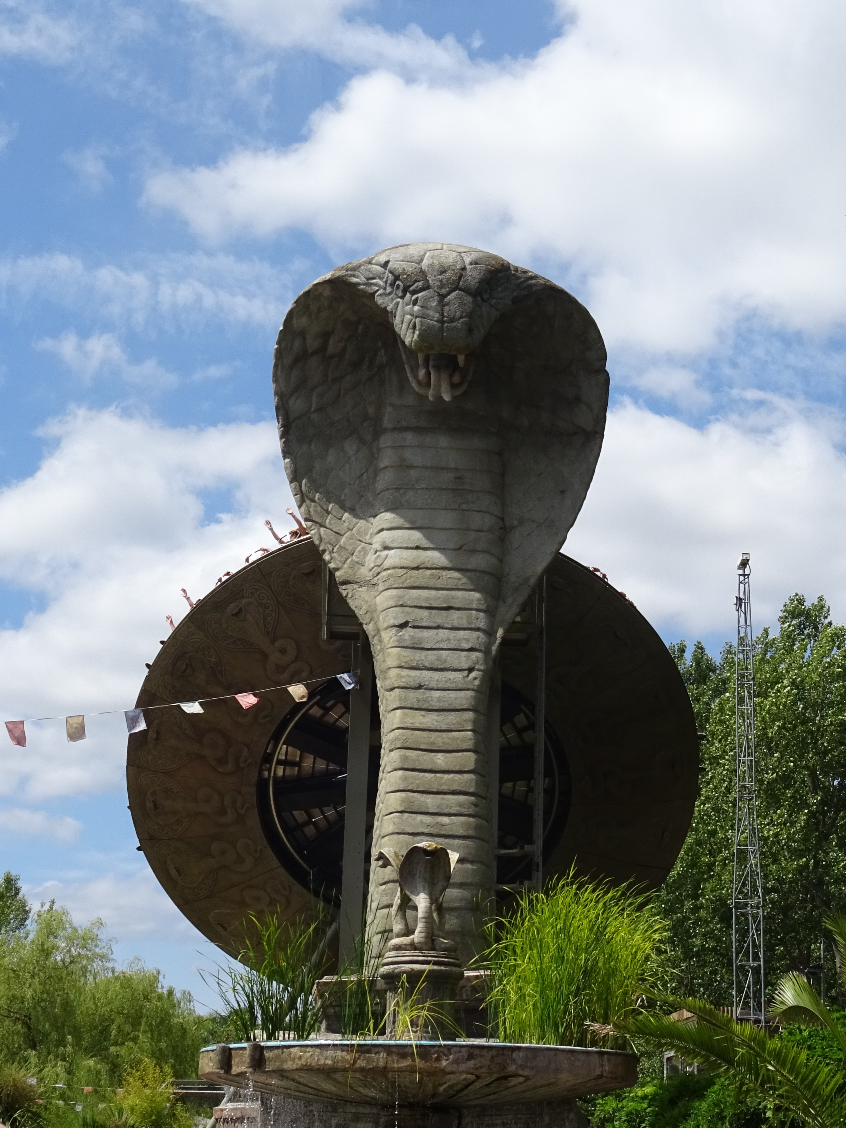
Kobra (ride)

Kobra is a Zamperla Mega Disk’O Coaster which opened in 2010 at Chessington World of Adventures Resort in southwest London, England. As of May 2021, the...

Have you been to Stoke Wood?

Leave your review of Stoke Wood below (or comments, questions and feedback).