Adecroft Furze Field

Wood, Forest in Surrey Elmbridge

England

Adecroft Furze Field

Bridle Lane Stoke D'Abernon Viewing the Leatherhead Stoke D'Abernon DAB TV transmitter mast.
Bridle Lane Stoke D'Abernon Credit: James Emmans

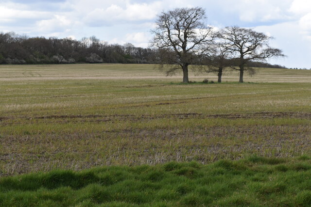
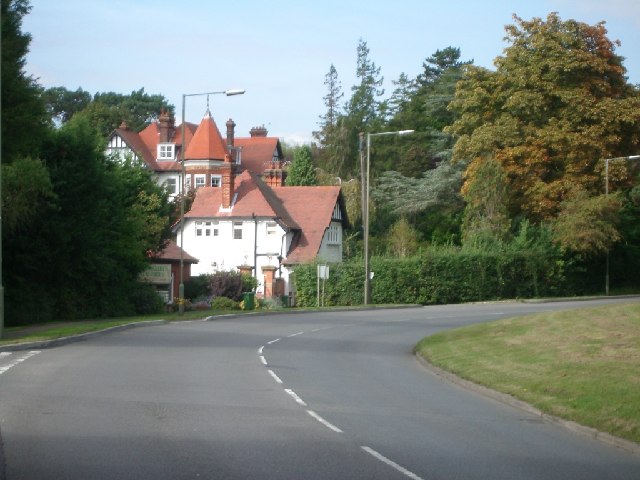
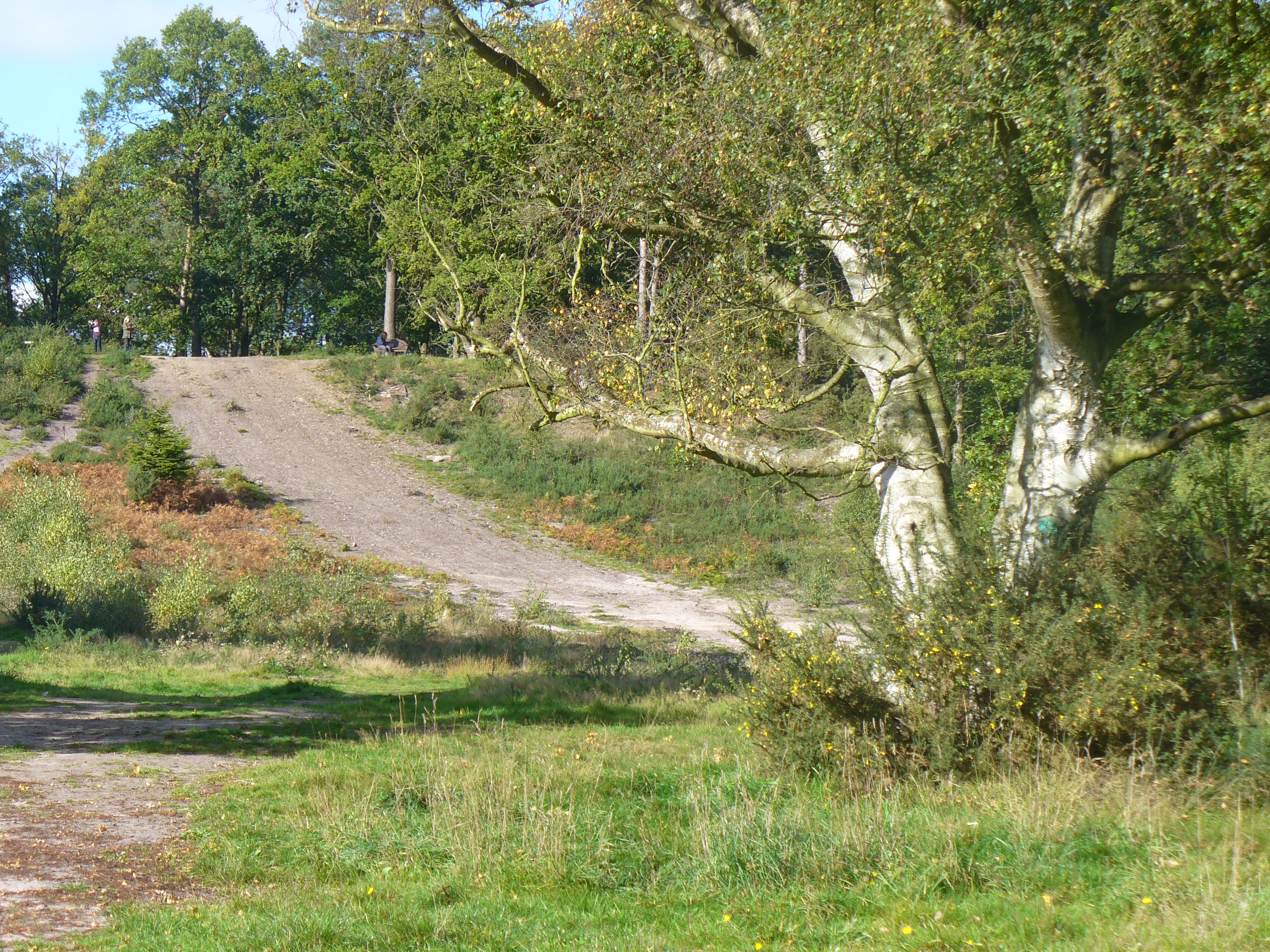
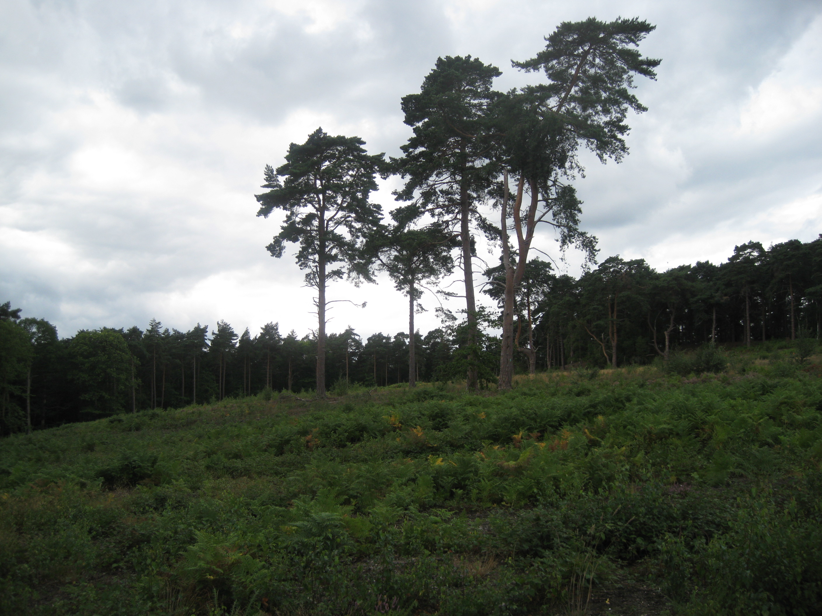
Adecroft Furze Field is a sprawling woodland area located in Surrey, England. Covering approximately 50 acres, it is a prominent feature of the local landscape and is renowned for its natural beauty and diverse wildlife.

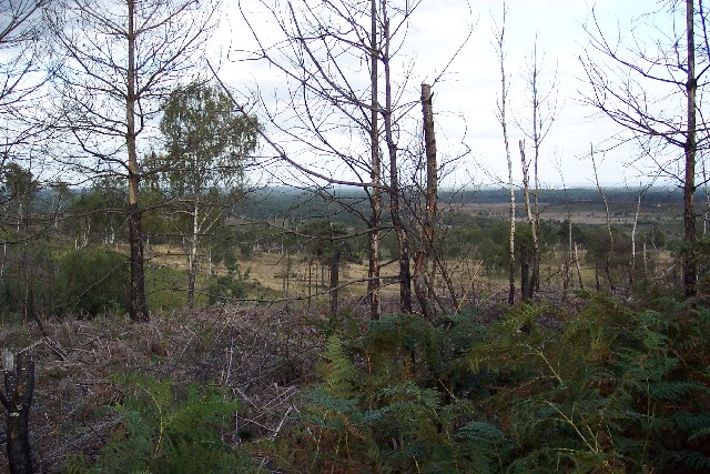
The woodland is primarily composed of deciduous and coniferous trees, creating a rich tapestry of colors throughout the changing seasons. Oak, beech, and birch trees dominate the landscape, while pine trees can also be found in certain areas. The dense canopy provides shelter and nesting grounds for a variety of bird species, including woodpeckers, owls, and finches.

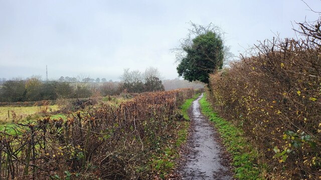
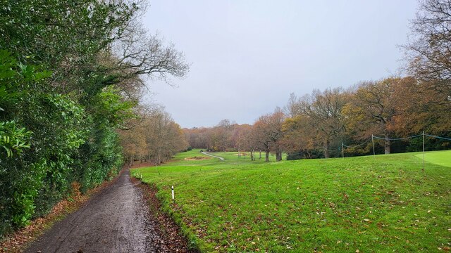
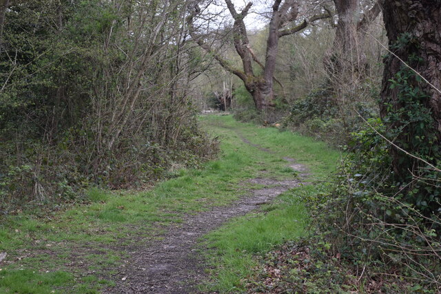
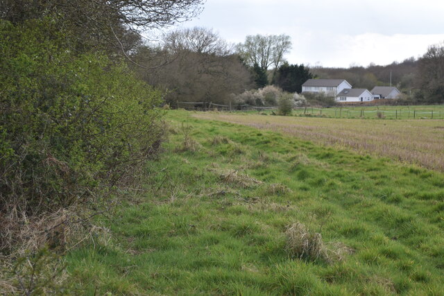
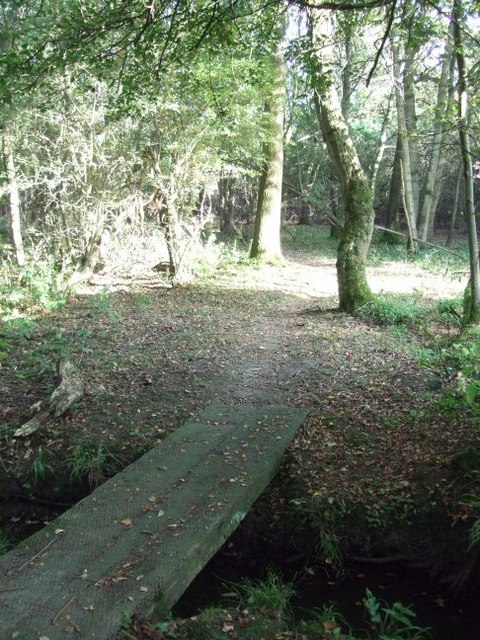
Adecroft Furze Field is crisscrossed by a network of well-maintained footpaths, offering visitors the opportunity to explore the woodlands and enjoy its tranquility. The paths wind through a mixture of open glades, dense thickets, and gentle slopes, providing a varied and picturesque walking experience.

The biodiversity of the area is particularly notable, with an abundance of wildlife inhabiting the woodlands. Deer, foxes, rabbits, and squirrels are commonly sighted, while the occasional glimpse of a badger or hedgehog is a real treat for nature enthusiasts.

The woodland also boasts a diverse array of plant life, with wildflowers such as bluebells, primroses, and foxgloves carpeting the forest floor during the spring and summer months. This creates a vibrant and fragrant atmosphere, attracting butterflies, bees, and other pollinators.

Overall, Adecroft Furze Field is a haven for nature lovers and offers a peaceful escape from the hustle and bustle of everyday life. Its stunning natural scenery, varied wildlife, and well-maintained footpaths make it a popular destination for hikers, photographers, and families alike.

If you have any feedback on the listing, please let us know in the comments section below.

Adecroft Furze Field Images

Images are sourced within 2km of 51.331653/-0.34754457 or Grid Reference TQ1560. Thanks to Geograph Open Source API. All images are credited.

Bridle Lane Stoke D'Abernon Viewing the Leatherhead Stoke D'Abernon DAB TV transmitter mast.
Bridle Lane Stoke D'Abernon
Viewing the Leatherhead Stoke D'Abernon DAB TV transmitter mast.
The Leatherhead Golf Club The golf club is on the parkland of Pachesham Manor.
The Leatherhead Golf Club
The golf club is on the parkland of Pachesham Manor.
M25 Motorway Seen from Oxshott Road, close to junction 9.
M25 Motorway
Seen from Oxshott Road, close to junction 9.
Path into woodland, on Ashtead Common
Oxshott railway station  Oxshott railway station entrance seen from the car park. The station opened in 1885 and is operated and served by South Western Railway.
Oxshott railway station
Oxshott railway station entrance seen from the car park. The station opened in 1885 and is operated and served by South Western Railway.
Farmland between Ashtead Common and the A243
View along outer edge of woodland at Ashtead Common
Eight lanes of hell The M25 where it passes under Oaklawn Road.  Imagine the noise!
Eight lanes of hell
The M25 where it passes under Oaklawn Road. Imagine the noise!
Roundabout at the junction of Oxshott Road with Oaklawn Road looking north
Roundabout at the junction of Oxshott Road with Oaklawn Road
looking north
A243 Entrance to Leatherhead Golf Club
The approach to Oxshott along Leatherhead Road looking ENE
The approach to Oxshott along Leatherhead Road
looking ENE
Permissive Footpath
Permissive Footpath
Mast at winter sunset This view is from the bridleway from Wrens Hill looking across the fields towards Stoke d'Abernon.
Mast at winter sunset
This view is from the bridleway from Wrens Hill looking across the fields towards Stoke d'Abernon.
M25: anti-clockwise, half mile to junction 9 The M25 is a 117 mile orbital motorway that encircles London. It was constructed between 1975 and 1986.
The motorway is not a continuous loop as a section to the East of London at The Dartford Crossing is an A-Road.
Wikipedia; <span class="nowrap"><a title="http://en.wikipedia.org/wiki/M25_motorway" rel="nofollow ugc noopener" href="http://en.wikipedia.org/wiki/M25_motorway">Link</a><img style="margin-left:2px;" alt="External link" title="External link - shift click to open in new window" src="https://s1.geograph.org.uk/img/external.png" width="10" height="10"/></span>
M25: anti-clockwise, half mile to junction 9
The M25 is a 117 mile orbital motorway that encircles London. It was constructed between 1975 and 1986. The motorway is not a continuous loop as a section to the East of London at The Dartford Crossing is an A-Road. Wikipedia; LinkExternal link
M25: anticlockwise, Oaklawn Bridge The M25 is a 117 mile orbital motorway that encircles London. It was constructed between 1975 and 1986.
The motorway is not a continuous loop as a section to the East of London at The Dartford Crossing is an A-Road.
Wikipedia; <span class="nowrap"><a title="http://en.wikipedia.org/wiki/M25_motorway" rel="nofollow ugc noopener" href="http://en.wikipedia.org/wiki/M25_motorway">Link</a><img style="margin-left:2px;" alt="External link" title="External link - shift click to open in new window" src="https://s1.geograph.org.uk/img/external.png" width="10" height="10"/></span>
M25: anticlockwise, Oaklawn Bridge
The M25 is a 117 mile orbital motorway that encircles London. It was constructed between 1975 and 1986. The motorway is not a continuous loop as a section to the East of London at The Dartford Crossing is an A-Road. Wikipedia; LinkExternal link
M25: anti-clockwise approaching 9 The M25 is a 117 mile orbital motorway that encircles London. It was constructed between 1975 and 1986.
The motorway is not a continuous loop as a section to the East of London at The Dartford Crossing is an A-Road.
Wikipedia; <span class="nowrap"><a title="http://en.wikipedia.org/wiki/M25_motorway" rel="nofollow ugc noopener" href="http://en.wikipedia.org/wiki/M25_motorway">Link</a><img style="margin-left:2px;" alt="External link" title="External link - shift click to open in new window" src="https://s1.geograph.org.uk/img/external.png" width="10" height="10"/></span>
M25: anti-clockwise approaching 9
The M25 is a 117 mile orbital motorway that encircles London. It was constructed between 1975 and 1986. The motorway is not a continuous loop as a section to the East of London at The Dartford Crossing is an A-Road. Wikipedia; LinkExternal link
M25: anti-clockwise junction 9 The Dorking and Leatherhead junction.
M25: anti-clockwise junction 9
The Dorking and Leatherhead junction.
The Star, Kingston Road, Malden Rushett The Star is a large pub on the A243 road, near the hamlet of Malden Rushett. It seems it is actually owned by the Shepherd Neame brewery of Kent, but the pub is operated by Barons Pubs, who also run three others, all in Surrey. It has been a pub since at least the 1860's, and at one time part of the premises were used as a school, and church lectures were also held there up to 1865.

<a href="https://www.geograph.org.uk/photo/2033952">TQ1659 : The Star (pub signs), Kingston Road, Malden Rushett</a>.
<a href="https://www.geograph.org.uk/photo/2033964">TQ1659 : The Star (pub sign close-up), Kingston Road, Malden Rushett</a>.
The Star, Kingston Road, Malden Rushett
The Star is a large pub on the A243 road, near the hamlet of Malden Rushett. It seems it is actually owned by the Shepherd Neame brewery of Kent, but the pub is operated by Barons Pubs, who also run three others, all in Surrey. It has been a pub since at least the 1860's, and at one time part of the premises were used as a school, and church lectures were also held there up to 1865. TQ1659 : The Star (pub signs), Kingston Road, Malden Rushett. TQ1659 : The Star (pub sign close-up), Kingston Road, Malden Rushett.
Show me another place!

Adecroft Furze Field is located at Grid Ref: TQ1560 (Lat: 51.331653, Lng: -0.34754457)

Administrative County: Surrey

District: Elmbridge

Police Authority: Surrey

What 3 Words

///dragon.cheat.tones. Near Leatherhead, Surrey

Related Wikis

Oxshott

Oxshott is a suburban village in the borough of Elmbridge in Surrey, England. Oxshott includes hilly acidic heath which is partly wooded (see Esher Commons...

Prince's Coverts

Prince's Coverts is an area of 864 acres (3.50 km2; 1.350 sq mi) of managed woodland in Oxshott, Surrey, England, to which there is public access. It is...

Oxshott railway station

Oxshott railway station serves the village of Oxshott, in Surrey, England. It is 16 miles 79 chains (27.3 km) down the line from London Waterloo. The station...

Colony Bog and Bagshot Heath

Colony Bog and Bagshot Heath is a 1,130.5-hectare (2,794-acre) biological Site of Special Scientific Interest between Camberley and Woking in Surrey, England...

Oxshott Heath and Woods

Oxshott Heath and Woods is an area of woods and heathland in Oxshott, Surrey, England covering approximately 200 acres (81 ha), as an area of common land...

Malden Rushett

Malden Rushett is a small village in the Royal Borough of Kingston upon Thames, London. It is located at the southernmost tip of the Royal Borough, surrounded...

Reed's School

Reed's School is an independent secondary boarding school for boys with a mixed sixth form located in Cobham, Surrey, England. There are currently around...

Ashtead Common

Ashtead Common, nearly 495 acres (c. 200 ha), is a wooded area open to the public, to the north of the village of Ashtead in Surrey, England. It is owned...

Nearby Amenities

Located within 500m of 51.331653,-0.34754457
Turning Circle
Lat/Long: 51.3291198/-0.3533086
Turning Circle
Lat/Long: 51.3313768/-0.3500004
Traffic Calming: hump
Lat/Long: 51.3353254/-0.3479
Turning Loop
Lat/Long: 51.3342999/-0.3513357
Generator Method: photovoltaic
Generator Output Electricity: yes
Generator Source: solar
Generator Type: solar_photovoltaic_panel
Location: roof
Power: generator
Lat/Long: 51.3323202/-0.3536077
Traffic Calming: hump
Lat/Long: 51.3339265/-0.3485021
Traffic Calming: hump
Lat/Long: 51.3329327/-0.3529049
The data included in this document is from www.openstreetmap.org. The data is made available under ODbL.

Have you been to Adecroft Furze Field?

Leave your review of Adecroft Furze Field below (or comments, questions and feedback).