Elford

Settlement in Staffordshire Lichfield

England

Elford

Road passing over Rail Bridge towards Harlaston
Road passing over Rail Bridge towards Harlaston Credit: Mick Malpass

Elford is a small village located in the county of Staffordshire, England. Situated on the banks of the River Tame, it is approximately 6 miles northeast of the town of Tamworth. With a population of around 800 residents, Elford is known for its picturesque countryside, historic buildings, and close-knit community.

The village is home to Elford Hall, a beautiful Grade II listed country house that dates back to the 18th century. Built in a Georgian style, this stunning mansion is surrounded by well-maintained gardens and features intricate architectural details. Elford also boasts St. Peter's Church, a medieval building that showcases a mix of architectural styles including Norman and Gothic.

Nature lovers can enjoy the tranquility of Elford Nature Reserve, a local site of special scientific interest. This reserve is home to a variety of wildlife, including rare bird species and wildflowers, making it a popular destination for birdwatchers and photographers. The nearby River Tame offers opportunities for fishing and boating.

Elford hosts an annual village fete, which attracts visitors from neighboring areas. This event showcases local crafts, produce, and traditional games, providing an opportunity for the community to come together and celebrate their heritage. The village also has a primary school, a village hall, and a pub that serves as a social hub for residents and visitors alike.

Overall, Elford offers a charming and idyllic setting for those looking to escape the hustle and bustle of city life, with its rich history and natural beauty making it an attractive destination for tourists and a peaceful place to call home.

If you have any feedback on the listing, please let us know in the comments section below.
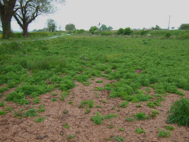
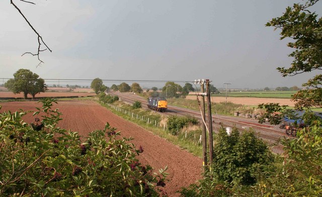
Elford Images

Images are sourced within 2km of 52.691456/-1.7228146 or Grid Reference SK1810. Thanks to Geograph Open Source API. All images are credited.

Road passing over Rail Bridge towards Harlaston
Driveway to Haselour House, Harlaston
Looking across fields in the direction of Alrewas
Farmland, Haselour
Farmland, Haselour
Haselour Lane near Model Farm
Grange Farm
Grange Farm
Fields and Haselour House This well kept hedge is part of the beautiful Staffordshire countryside. The Track leads to both the house and the hall.
Fields and Haselour House
This well kept hedge is part of the beautiful Staffordshire countryside. The Track leads to both the house and the hall.
Grange Farm triangulation pillar View north towards the Trent.

--
2018
The pillar has been removed.
Grange Farm triangulation pillar
View north towards the Trent. -- 2018 The pillar has been removed.
HST train A Virgin HST train near Harlaston on its way up to Derby from Birmingham, also visible is the footpath across to the railway and the road overbridge to Harlaston.
HST train
A Virgin HST train near Harlaston on its way up to Derby from Birmingham, also visible is the footpath across to the railway and the road overbridge to Harlaston.
Footpaths and railway Looking to the railway embankment from the footpath.
Footpaths and railway
Looking to the railway embankment from the footpath.
Waiting for rain The ground is very dry and cracking in desperate need of some rain.
Waiting for rain
The ground is very dry and cracking in desperate need of some rain.
Railway Lines A Virgin HST heading North to Derby
Railway Lines
A Virgin HST heading North to Derby
Passing Trains 56 018 heads South with a train load of steel, being passed by a Virgin HST heading for Derby.
Passing Trains
56 018 heads South with a train load of steel, being passed by a Virgin HST heading for Derby.
Elford Loop Looking towards Burton on Trent a locomotive heads away north. On the right is the loop where freight trains are often held so passenger services can pass them. This is the Derby to Birmingham main line and is busy with passenger and freight services.
Elford Loop
Looking towards Burton on Trent a locomotive heads away north. On the right is the loop where freight trains are often held so passenger services can pass them. This is the Derby to Birmingham main line and is busy with passenger and freight services.
Elford loop The loop line can be seen on the left of the picture. The two main lines to the right. This is the view towards Tamworth. A loaded coal service is passing heading towards Burton on Trent and onward to the power station at Ratcliffe.
Elford loop
The loop line can be seen on the left of the picture. The two main lines to the right. This is the view towards Tamworth. A loaded coal service is passing heading towards Burton on Trent and onward to the power station at Ratcliffe.
A513 Near Elford   (1) The above photograph shows a stretch of the A513 located in the countryside heading towards the village of Elford.
A513 Near Elford (1)
The above photograph shows a stretch of the A513 located in the countryside heading towards the village of Elford.
A513 Near Elford  (3) The above photograph shows a view across the A513 near Elford of part of a corn field and a wheat field in the distance with a road seen in the centre of the photograph turning left at the T-junction. This photograph <a href="https://www.geograph.org.uk/photo/1882450">SK1911 : A513 Near Elford  (2)</a> shows another view of this stretch of road.
A513 Near Elford (3)
The above photograph shows a view across the A513 near Elford of part of a corn field and a wheat field in the distance with a road seen in the centre of the photograph turning left at the T-junction. This photograph SK1911 : A513 Near Elford (2) shows another view of this stretch of road.
A513 Near Elford  (4) The above photograph shows a stretch of the A513 heading towards the National Memorial Arboretum. This photograph <a href="https://www.geograph.org.uk/photo/1882450">SK1911 : A513 Near Elford  (2)</a> shows another view of the A513.
A513 Near Elford (4)
The above photograph shows a stretch of the A513 heading towards the National Memorial Arboretum. This photograph SK1911 : A513 Near Elford (2) shows another view of the A513.
Show me another place!

Elford is located at Grid Ref: SK1810 (Lat: 52.691456, Lng: -1.7228146)

Administrative County: Staffordshire

District: Lichfield

Police Authority: Staffordshire

What 3 Words

///carpeted.snapping.eclipses. Near Whittington, Staffordshire

Nearby Locations

Dogkennel Wood Elford

Related Wikis

Elford

Elford is a village and civil parish in Lichfield District, Staffordshire, England. It is on the east bank of the River Tame, about 5 miles (8 km) east...

St Peter's Church, Elford

St Peter's Church, Elford is a parish church in the village of Elford, Staffordshire in the United Kingdom. The church is situated on the eastern edge...

Elford railway station

Elford railway station was a railway station serving the village of Elford and the manor of Haselour Hall in Staffordshire. == History == It was opened...

Whitemoor Haye

Whitemoor Haye (grid reference SK1813) is a mainly agricultural area in the floodplain of the River Tame, near Alrewas in Staffordshire, England. It is...

Nearby Amenities

Located within 500m of 52.691456,-1.7228146
Bus Stop
Social Club
Bus: yes
Naptan AtcoCode: 3800C401000
Naptan Bearing: NE
Naptan CommonName: Social Club
Naptan Indicator: Adj
Naptan Landmark: Social Club
Naptan Street: The Beck
Naptan Verified: no
Public Transport: platform
Source: naptan_import
Lat/Long: 52.6913147/-1.7206902
Bus Stop
Croft Close
Bus: yes
Naptan AtcoCode: 3800C401001
Naptan Bearing: NE
Naptan CommonName: Croft Close
Naptan Indicator: Adj
Naptan Landmark: Croft Close
Naptan Street: The Beck
Naptan Verified: no
Public Transport: platform
Source: naptan_import
Lat/Long: 52.6922191/-1.7191753
Bus Stop
Eddies Lane
Bus: yes
Naptan AtcoCode: 3800C430701
Naptan Bearing: N
Naptan CommonName: Eddies Lane
Naptan Indicator: Adj
Naptan Landmark: Eddies Lane
Naptan Street: Burton Road
Naptan Verified: no
Public Transport: platform
Source: naptan_import
Lat/Long: 52.6904857/-1.716109
Pub
The Crown
Wikidata: Q26475332
Lat/Long: 52.6917907/-1.722372
Defibrillator
Access: yes
Defibrillator Location: outside Elford Village Hall
Emergency: defibrillator
Indoor: no
Ref GB The Circuit: E8D5ACA0-F943-448B-B76B-4BBF8915EA17
Source: West Midlands Ambulance Service FOI request
Lat/Long: 52.6913827/-1.7218249
Post Office
Elford Post Office
Addr City: Tamworth
Addr Housename: Village Hall
Addr Postcode: B79 9DA
Addr Street: Church Road
Addr Village: Elford
Brand: Post Office
Brand Wikidata: Q1783168
Fixme: verify by survey
Opening Hours: Tu 09:00-13:00
Ref Pol Id: 167863
Source: pol_branch_list_2018-02
Website: https://www.postoffice.co.uk/branch-finder/0204714/elford
Wikidata: Q26475299
Lat/Long: 52.69142/-1.72179
Waste Basket
Waste: dog_excrement;trash
Lat/Long: 52.6900087/-1.7205087
Noexit: yes
Lat/Long: 52.6905916/-1.7204777
Cafe
Gluten Free: no
Lactose Free: no
Lat/Long: 52.6928211/-1.7295504
Bench
Backrest: yes
Material: wood
Lat/Long: 52.6935948/-1.7292833
Public Bookcase
Booth: K6
Disused Amenity: telephone
Man Made: telephone_box
Public Bookcase Type: phone_box
Lat/Long: 52.6913248/-1.7223507
Man Made: flagpole
Lat/Long: 52.6912748/-1.7216453
The data included in this document is from www.openstreetmap.org. The data is made available under ODbL.

Have you been to Elford?

Leave your review of Elford below (or comments, questions and feedback).