Dogkennel Wood

Wood, Forest in Staffordshire Lichfield

England

Dogkennel Wood

Road passing over Rail Bridge towards Harlaston
Road passing over Rail Bridge towards Harlaston Credit: Mick Malpass

Dogkennel Wood is a picturesque woodland located in the county of Staffordshire, England. Covering an area of approximately 50 acres, this enchanting forest is a popular destination for nature lovers and outdoor enthusiasts alike.

Situated on the outskirts of the charming village of Dogkennel, the wood is easily accessible and offers a peaceful retreat from the hustle and bustle of city life. It is nestled within the rolling hills of Staffordshire, providing visitors with breathtaking views of the surrounding countryside.

The wood is predominantly made up of native broadleaf trees, including oak, beech, and birch. These towering trees create a dense canopy, casting dappled sunlight onto the woodland floor below. The forest is home to a rich variety of flora and fauna, making it a haven for wildlife. Visitors may spot squirrels scampering through the branches, or hear the melodious songs of songbirds echoing through the trees.

Dogkennel Wood is crisscrossed with a network of well-maintained footpaths, allowing visitors to explore the wood at their own pace. These trails lead visitors through tranquil glades, alongside babbling streams, and towards hidden clearings where one can sit and admire the natural beauty surrounding them.

The wood also boasts several picnic areas, providing the perfect spot to enjoy a packed lunch amidst the serene surroundings. Additionally, there are designated camping areas for those seeking a more immersive experience in nature.

Overall, Dogkennel Wood offers a delightful escape for individuals and families seeking a tranquil retreat amidst the beauty of Staffordshire's natural landscape.

If you have any feedback on the listing, please let us know in the comments section below.

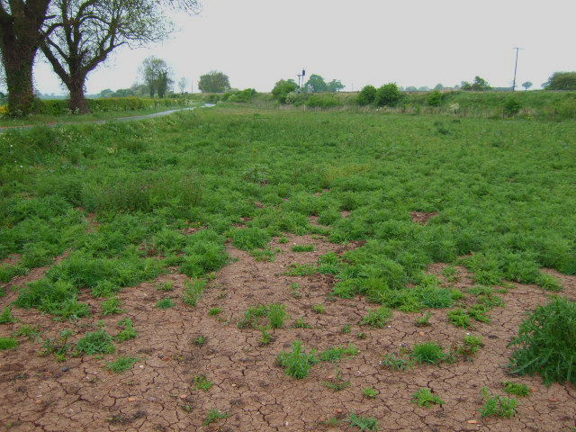
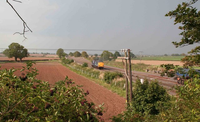
Dogkennel Wood Images

Images are sourced within 2km of 52.695873/-1.7279655 or Grid Reference SK1810. Thanks to Geograph Open Source API. All images are credited.

Road passing over Rail Bridge towards Harlaston
Looking across fields in the direction of Alrewas
Farmland, Haselour
Farmland, Haselour
Haselour Lane near Model Farm
Fields and Haselour House This well kept hedge is part of the beautiful Staffordshire countryside. The Track leads to both the house and the hall.
Fields and Haselour House
This well kept hedge is part of the beautiful Staffordshire countryside. The Track leads to both the house and the hall.
Grange Farm triangulation pillar View north towards the Trent.

--
2018
The pillar has been removed.
Grange Farm triangulation pillar
View north towards the Trent. -- 2018 The pillar has been removed.
HST train A Virgin HST train near Harlaston on its way up to Derby from Birmingham, also visible is the footpath across to the railway and the road overbridge to Harlaston.
HST train
A Virgin HST train near Harlaston on its way up to Derby from Birmingham, also visible is the footpath across to the railway and the road overbridge to Harlaston.
Footpaths and railway Looking to the railway embankment from the footpath.
Footpaths and railway
Looking to the railway embankment from the footpath.
Waiting for rain The ground is very dry and cracking in desperate need of some rain.
Waiting for rain
The ground is very dry and cracking in desperate need of some rain.
Railway Lines A Virgin HST heading North to Derby
Railway Lines
A Virgin HST heading North to Derby
Passing Trains 56 018 heads South with a train load of steel, being passed by a Virgin HST heading for Derby.
Passing Trains
56 018 heads South with a train load of steel, being passed by a Virgin HST heading for Derby.
Elford Loop Looking towards Burton on Trent a locomotive heads away north. On the right is the loop where freight trains are often held so passenger services can pass them. This is the Derby to Birmingham main line and is busy with passenger and freight services.
Elford Loop
Looking towards Burton on Trent a locomotive heads away north. On the right is the loop where freight trains are often held so passenger services can pass them. This is the Derby to Birmingham main line and is busy with passenger and freight services.
Elford loop The loop line can be seen on the left of the picture. The two main lines to the right. This is the view towards Tamworth. A loaded coal service is passing heading towards Burton on Trent and onward to the power station at Ratcliffe.
Elford loop
The loop line can be seen on the left of the picture. The two main lines to the right. This is the view towards Tamworth. A loaded coal service is passing heading towards Burton on Trent and onward to the power station at Ratcliffe.
A513 Near Elford   (1) The above photograph shows a stretch of the A513 located in the countryside heading towards the village of Elford.
A513 Near Elford (1)
The above photograph shows a stretch of the A513 located in the countryside heading towards the village of Elford.
A513 Near Elford  (3) The above photograph shows a view across the A513 near Elford of part of a corn field and a wheat field in the distance with a road seen in the centre of the photograph turning left at the T-junction. This photograph <a href="https://www.geograph.org.uk/photo/1882450">SK1911 : A513 Near Elford  (2)</a> shows another view of this stretch of road.
A513 Near Elford (3)
The above photograph shows a view across the A513 near Elford of part of a corn field and a wheat field in the distance with a road seen in the centre of the photograph turning left at the T-junction. This photograph SK1911 : A513 Near Elford (2) shows another view of this stretch of road.
A513 Near Elford  (4) The above photograph shows a stretch of the A513 heading towards the National Memorial Arboretum. This photograph <a href="https://www.geograph.org.uk/photo/1882450">SK1911 : A513 Near Elford  (2)</a> shows another view of the A513.
A513 Near Elford (4)
The above photograph shows a stretch of the A513 heading towards the National Memorial Arboretum. This photograph SK1911 : A513 Near Elford (2) shows another view of the A513.
A513 Near Elford  (5) The above photograph shows a stretch of the A513. This photograph <a href="https://www.geograph.org.uk/photo/1882420">SK2011 : A513 Near Elford   (1)</a> shows another stretch of the A513 going in the opposite direction.
A513 Near Elford (5)
The above photograph shows a stretch of the A513. This photograph SK2011 : A513 Near Elford (1) shows another stretch of the A513 going in the opposite direction.
A513 Near Elford  (7) The above photograph shows another stretch of the A513 near Elford, on the right hand side of the photograph, an entrance to a field can be seen with its gate wide open. This photograph <a href="https://www.geograph.org.uk/photo/1882663">SK1911 : A513 Near Elford  (6)</a> shows another view of a stretch of the A513.
A513 Near Elford (7)
The above photograph shows another stretch of the A513 near Elford, on the right hand side of the photograph, an entrance to a field can be seen with its gate wide open. This photograph SK1911 : A513 Near Elford (6) shows another view of a stretch of the A513.
Show me another place!

Dogkennel Wood is located at Grid Ref: SK1810 (Lat: 52.695873, Lng: -1.7279655)

Administrative County: Staffordshire

District: Lichfield

Police Authority: Staffordshire

What 3 Words

///kick.drilled.relocated. Near Whittington, Staffordshire

Nearby Locations

Elford Dogkennel Wood

Related Wikis

St Peter's Church, Elford

St Peter's Church, Elford is a parish church in the village of Elford, Staffordshire in the United Kingdom. The church is situated on the eastern edge...

Elford

Elford is a village and civil parish in Lichfield District, Staffordshire, England. It is on the east bank of the River Tame, about 5 miles (8 km) east...

Elford railway station

Elford railway station was a railway station serving the village of Elford and the manor of Haselour Hall in Staffordshire. == History == It was opened...

Whitemoor Haye

Whitemoor Haye (grid reference SK1813) is a mainly agricultural area in the floodplain of the River Tame, near Alrewas in Staffordshire, England. It is...

Nearby Amenities

Located within 500m of 52.695873,-1.7279655
Cafe
Gluten Free: no
Lactose Free: no
Lat/Long: 52.6928211/-1.7295504
Toilets
Access: yes
Lat/Long: 52.6938715/-1.7294018
Entrance: main
Lat/Long: 52.6938269/-1.7293689
Noexit: yes
Lat/Long: 52.6924015/-1.7301625
Leisure: bird_hide
Operator: Elford Hall Gardens
Lat/Long: 52.6924187/-1.7301635
Bench
Lat/Long: 52.6936883/-1.7293492
Noexit: yes
Lat/Long: 52.6936626/-1.7295861
Bench
Backrest: yes
Material: wood
Lat/Long: 52.6935948/-1.7292833
Bench
Lat/Long: 52.693669/-1.7295894
Noexit: yes
Lat/Long: 52.6934672/-1.730241
Fireplace: no
Tourism: picnic_site
Lat/Long: 52.6933123/-1.7298595
The data included in this document is from www.openstreetmap.org. The data is made available under ODbL.

Have you been to Dogkennel Wood?

Leave your review of Dogkennel Wood below (or comments, questions and feedback).