Badger Hills

Wood, Forest in Lincolnshire West Lindsey

England

Badger Hills

Cuxwold Hall: aerial 2022
Cuxwold Hall: aerial 2022 Credit: Chris

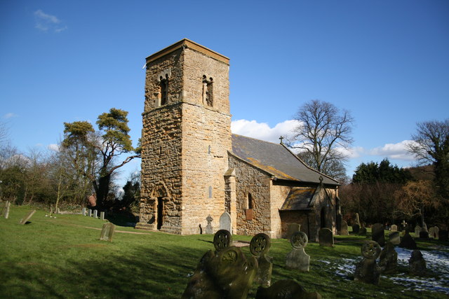
Badger Hills is a small woodland area located in Lincolnshire, England. Situated near the town of Wood, the forest covers an area of approximately 50 acres. The woodland is predominantly made up of deciduous trees, including oak, beech, and birch.

Badger Hills is known for its rich biodiversity and is home to a variety of plant and animal species. The forest floor is adorned with a carpet of bluebells during springtime, creating a picturesque sight for visitors. Other wildflowers, such as primroses and wild garlic, can also be found flourishing throughout the woodland.

The forest provides a habitat for numerous bird species, including woodpeckers, owls, and various songbirds. It is not uncommon to spot small mammals like squirrels and rabbits scurrying through the undergrowth. However, the most significant presence in Badger Hills is the badger population from which the woodland derives its name. Badgers are known to have created extensive underground burrow systems within the forest, providing them with shelter and protection.

Badger Hills is a popular destination for nature enthusiasts and hikers alike. The forest offers several walking trails, allowing visitors to explore its natural beauty while enjoying the tranquility of the surroundings. The wood is managed to maintain its ecological balance, with efforts made to preserve the habitat and protect the wildlife within it.

Overall, Badger Hills in Lincolnshire is a charming woodland area that showcases the beauty of nature in its diverse flora and fauna. It offers a serene retreat for those seeking solace in the great outdoors.

If you have any feedback on the listing, please let us know in the comments section below.

Badger Hills Images

Images are sourced within 2km of 53.496878/-0.26506159 or Grid Reference TA1501. Thanks to Geograph Open Source API. All images are credited.

Cuxwold Hall: aerial 2022
Cabourne: aerial 2022
Cutting on Caistor Road near Swallow: aerial 2022
Experimental planting near Rothwell: aerial 2022 (1)
Experimental planting near Rothwell: aerial 2022 (2)
Former field boundaries at Cabourne: aerial 2022
Valley between Cabourne and Cabourne Parva: aerial 2023
Twisty road into Rothwell Heading west.
Twisty road into Rothwell
Heading west.
Entering Rothwell Heading west on Partridge Drive.
Entering Rothwell
Heading west on Partridge Drive.
The Blacksmith's Arms, Rothwell
Painted sign on the Blacksmith's Arms, Rothwell
Communications hub, Rothwell Phone box, post box and bus shelter on Beckside.
Communications hub, Rothwell
Phone box, post box and bus shelter on Beckside.
Rothwell: aerial 2015
Ordnance Survey Flush Bracket S6515 This bracket can be found on the wall of The Village Hall in Rothwell.
For more detail see : <span class="nowrap"><a title="http://www.bench-marks.org.uk/bm13099" rel="nofollow ugc noopener" href="http://www.bench-marks.org.uk/bm13099">Link</a><img style="margin-left:2px;" alt="External link" title="External link - shift click to open in new window" src="https://s1.geograph.org.uk/img/external.png" width="10" height="10"/></span>
Ordnance Survey Flush Bracket S6515
This bracket can be found on the wall of The Village Hall in Rothwell. For more detail see : LinkExternal link
Field edge footpath on the outskirts of Rothwell Looking north-eastward.
Field edge footpath on the outskirts of Rothwell
Looking north-eastward.
Beckside, Rothwell
Beckside, Rothwell
The Blacksmith's Arms The Blacksmith's Arms in Rothwell sells excellent Bateman's beers and good food - the perfect rendezvous for walking in the wolds with refreshments afterwards.
The Blacksmith's Arms
The Blacksmith's Arms in Rothwell sells excellent Bateman's beers and good food - the perfect rendezvous for walking in the wolds with refreshments afterwards.
Cherry Valley The factory for the famous Cherry Valley brand, normally associated with duckling.  View looking north-west from the Rothwell to Cuxwold road.
Cherry Valley
The factory for the famous Cherry Valley brand, normally associated with duckling. View looking north-west from the Rothwell to Cuxwold road.
Show me another place!

Badger Hills is located at Grid Ref: TA1501 (Lat: 53.496878, Lng: -0.26506159)

Administrative County: Lincolnshire

District: West Lindsey

Police Authority: Lincolnshire

What 3 Words

///livid.positions.heartache. Near Caistor, Lincolnshire

Nearby Locations

Badger Hills

Related Wikis

Cabourne

Cabourne is a hamlet and civil parish in the West Lindsey district of Lincolnshire, England. It is situated on the A46 road, and just over 1 mile (1.6...

Rothwell, Lincolnshire

Rothwell is a small village and civil parish in the district of West Lindsey in north-east Lincolnshire, England. The population of the civil parish at...

Cuxwold

Cuxwold is a village and former civil parish, now in the parish of Swallow, in the West Lindsey district of Lincolnshire, England. It lies in the Lincolnshire...

North Riding of Lindsey

The North Riding of Lindsey was a division of the Lindsey part of Lincolnshire in England. It consisted of the north-eastern part of the county, and included...

Caistor Rural District

Caistor was a rural district in Lincolnshire, Parts of Lindsey from 1894 to 1974. It was formed by the Local Government Act 1894 from Caistor rural sanitary...

Swallow, Lincolnshire

Swallow is a small village and civil parish in the West Lindsey district of Lincolnshire, England, on the A46 road 4 miles (6.4 km) north-east from Caistor...

Caistor Yarborough Academy

Caistor Yarborough Academy is a mixed 11–16 yrs secondary school based in the Lincolnshire market town of Caistor, England. The school was founded as Caistor...
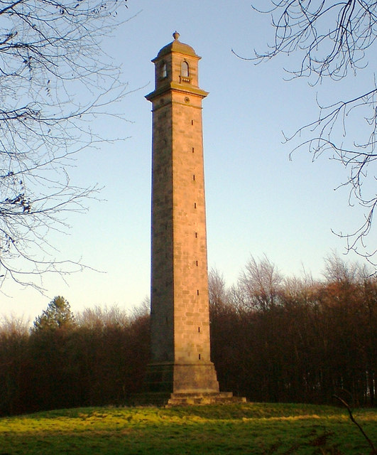
Pelham's Pillar

Pelham's Pillar is a monument dedicated to Charles Anderson-Pelham, 1st Earl of Yarborough who died in 1846. The Pillar is in Cabourne, West Lindsey on...

Nearby Amenities

Located within 500m of 53.496878,-0.26506159
Power: tower
Lat/Long: 53.4978423/-0.2586799
Power: tower
Lat/Long: 53.4997591/-0.2614219
Power: tower
Lat/Long: 53.5007556/-0.2658002
Power: pole
Source: Bing
Lat/Long: 53.4932312/-0.2622141
Power: pole
Source: Bing
Lat/Long: 53.4935159/-0.2644302
Power: pole
Source: Bing
Lat/Long: 53.4937685/-0.2664349
Power: pole
Source: Bing
Lat/Long: 53.49399/-0.2685229
Power: pole
Lat/Long: 53.4940748/-0.2592395
Power: pole
Source: Bing
Lat/Long: 53.4943767/-0.2704281
Power: pole
Lat/Long: 53.4947936/-0.258939
Power: pole
Lat/Long: 53.4955049/-0.2586734
Power: pole
Lat/Long: 53.4962368/-0.2583539
Power: pole
Lat/Long: 53.4969744/-0.2580724
Power: pole
Lat/Long: 53.4993349/-0.2595077
Power: pole
Lat/Long: 53.499437/-0.260534
Power: pole
Lat/Long: 53.4996095/-0.2623261
Power: pole
Lat/Long: 53.4997587/-0.2639168
Power: pole
Lat/Long: 53.4999256/-0.2654513
Power: pole
Lat/Long: 53.5000316/-0.2667351
Power: pole
Lat/Long: 53.5001513/-0.2679627
Power: pole
Lat/Long: 53.500264/-0.2691895
Badger Hills
Place: locality
Source: Bing
Lat/Long: 53.4968973/-0.2647036
The data included in this document is from www.openstreetmap.org. The data is made available under ODbL.

Have you been to Badger Hills?

Leave your review of Badger Hills below (or comments, questions and feedback).