Chadhurst Moor

Wood, Forest in Surrey Mole Valley

England

Chadhurst Moor

Wolvens Lane Byway between Coldharbour and Wotton.
Wolvens Lane Credit: Ian Capper

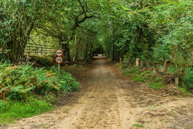
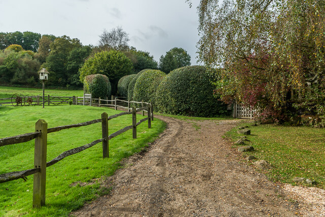
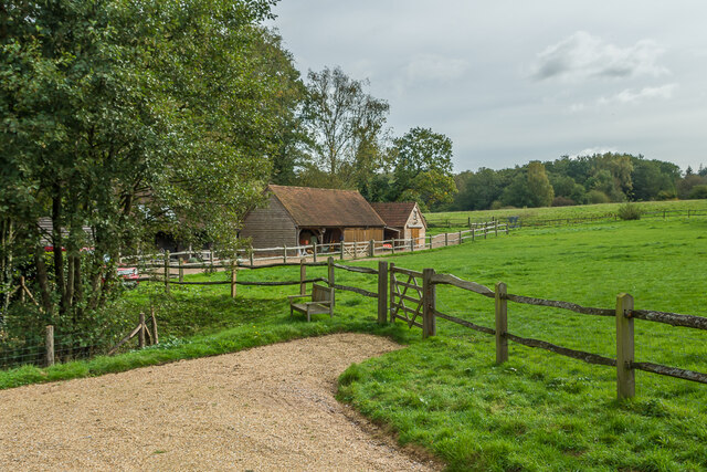
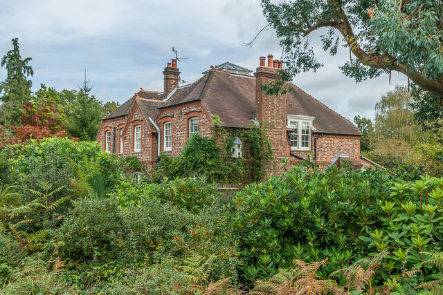
Chadhurst Moor, located in Surrey, England, is a picturesque woodland and forest area that spans over a vast expanse of approximately 100 acres. Situated near the village of Chiddingfold, this natural haven offers a tranquil escape from the hustle and bustle of everyday life.

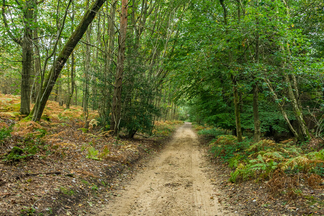
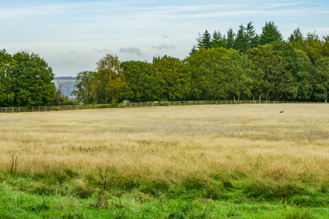
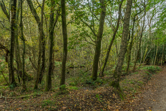
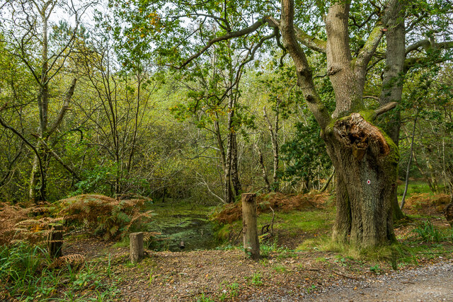
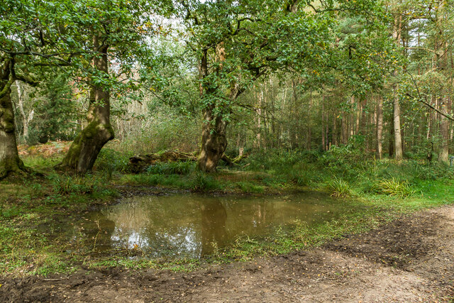
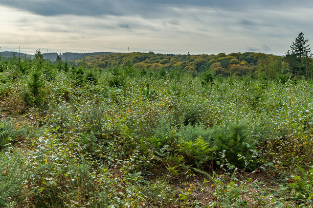
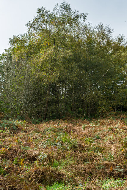
The moor is characterized by its diverse ecosystem, comprising a mixture of ancient woodland, open heathland, and wetland areas. It is home to a wide range of flora and fauna, including oak, birch, and beech trees, as well as various species of wildflowers and ferns. The forest floor is adorned with a vibrant carpet of bluebells during the spring season, creating a stunning spectacle for visitors.

The woodland is also teeming with wildlife, providing a habitat for an array of creatures. Visitors may spot resident bird species such as woodpeckers, nuthatches, and tawny owls, while lucky observers might catch a glimpse of elusive mammals like deer, foxes, and badgers.

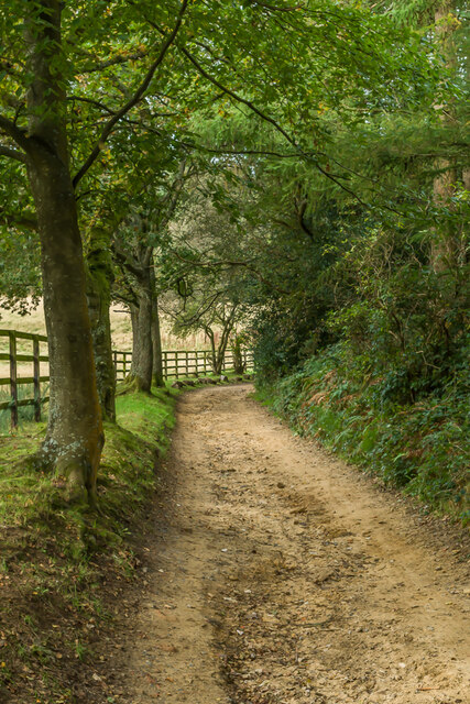
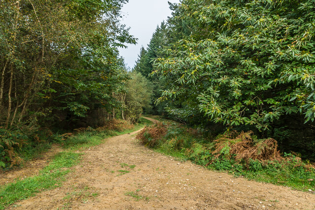
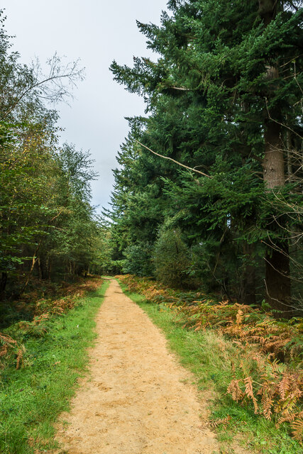
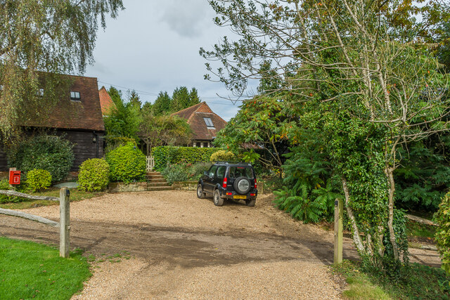
Chadhurst Moor offers a network of well-maintained paths and trails, allowing visitors to explore the area and soak in its natural beauty. The peaceful atmosphere and idyllic surroundings make it an ideal destination for nature lovers, hikers, and photographers.

Managed by local conservation groups, the moor ensures the preservation of its natural treasures and promotes environmental education. It also serves as an important site for research and scientific studies, contributing to the understanding of woodland ecosystems and their conservation.

Overall, Chadhurst Moor in Surrey stands as a testament to the untouched beauty of nature, offering a serene retreat for those seeking solace in the heart of the English countryside.

If you have any feedback on the listing, please let us know in the comments section below.

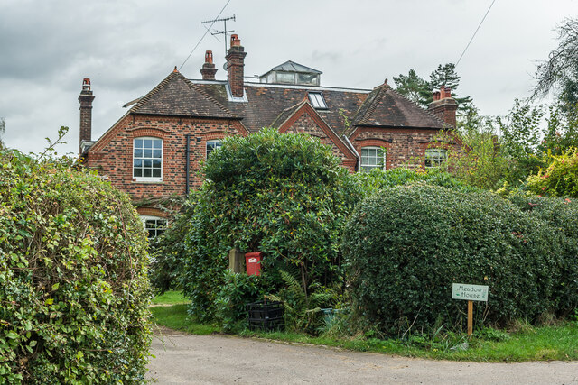
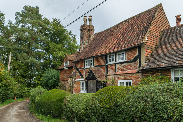
Chadhurst Moor Images

Images are sourced within 2km of 51.207929/-0.35239172 or Grid Reference TQ1546. Thanks to Geograph Open Source API. All images are credited.

Wolvens Lane Byway between Coldharbour and Wotton.
Wolvens Lane
Byway between Coldharbour and Wotton.
Field Field off Wolvens Lane, a byway between Coldharbour and Wotton.  A couple of Roe Deer can be seen towards the right of the photo.  In the far distance are the North Downs.
Field
Field off Wolvens Lane, a byway between Coldharbour and Wotton. A couple of Roe Deer can be seen towards the right of the photo. In the far distance are the North Downs.
Wolvens Lane Byway between Coldharbour and Wotton.
Wolvens Lane
Byway between Coldharbour and Wotton.
Upper Merriden Cottage Remote house on Wolvens Lane, a byway between Coldharbour and Wotton.  The current building dates from the early 2000s, replacing an earlier slightly smaller forester's cottage on the same site but nearer the lane, which had been damaged by fire.
Upper Merriden Cottage
Remote house on Wolvens Lane, a byway between Coldharbour and Wotton. The current building dates from the early 2000s, replacing an earlier slightly smaller forester's cottage on the same site but nearer the lane, which had been damaged by fire.
Wolvens Lane Byway between Coldharbour and Wotton.  Although it is a "BOAT" (Byway open to all traffic), there is currently a temporary closure to four wheel drive vehicles (and horses and carts!), to avoid damage to recent repairs, as indicated by the signs here).  A consultation is currently under way to make the closure permanent.
Wolvens Lane
Byway between Coldharbour and Wotton. Although it is a "BOAT" (Byway open to all traffic), there is currently a temporary closure to four wheel drive vehicles (and horses and carts!), to avoid damage to recent repairs, as indicated by the signs here). A consultation is currently under way to make the closure permanent.
Tankards Pond Partly overgrown pond alongside Wolvens Lane, a byway between Coldharbour and Wotton.
Tankards Pond
Partly overgrown pond alongside Wolvens Lane, a byway between Coldharbour and Wotton.
Tankards Pond Partly overgrown pond alongside Wolvens Lane, a byway between Coldharbour and Wotton.
Tankards Pond
Partly overgrown pond alongside Wolvens Lane, a byway between Coldharbour and Wotton.
Pond A small pond just north of the larger Tankards Pond, alongside Wolvens Lane, a byway between Coldharbour and Wotton.
Pond
A small pond just north of the larger Tankards Pond, alongside Wolvens Lane, a byway between Coldharbour and Wotton.
Replanted woodland Replanted woodland off Wolvens Lane, a byway between Coldharbour and Wotton.  In the left distance can be seen the tower on the summit of Leith Hill.
Replanted woodland
Replanted woodland off Wolvens Lane, a byway between Coldharbour and Wotton. In the left distance can be seen the tower on the summit of Leith Hill.
Squire's Great Wood Path through Squire's Great Wood.
Squire's Great Wood
Path through Squire's Great Wood.
Squire's Great Wood Path through Squire's Great Wood.
Squire's Great Wood
Path through Squire's Great Wood.
Bracken slope A bracken covered slope near Logmore Farm.
Bracken slope
A bracken covered slope near Logmore Farm.
Logmore Farm Track outside Logmore Farm.
Logmore Farm
Track outside Logmore Farm.
Logmore Farm Farm near Logmore Green.
Logmore Farm
Farm near Logmore Green.
Logmore Farm Paddocks at Logmore Farm near Logmore Green.
Logmore Farm
Paddocks at Logmore Farm near Logmore Green.
Meadow House and April Cottage Pair of semi-detached cottages on Logmore Lane.
Meadow House and April Cottage
Pair of semi-detached cottages on Logmore Lane.
Meadow House and April Cottage Pair of semi-detached cottages on Logmore Lane.
Meadow House and April Cottage
Pair of semi-detached cottages on Logmore Lane.
Old Cottage Cottage on Logmore Lane dating from the 17th Century with 19th and 20th Century extensions.  Grade II listed  - see <span class="nowrap"><a title="www.historicengland.org.uk/listing/the-list/list-entry/1391462" rel="nofollow ugc noopener" href="http://www.historicengland.org.uk/listing/the-list/list-entry/1391462">Link</a><img style="margin-left:2px;" alt="External link" title="External link - shift click to open in new window" src="https://s1.geograph.org.uk/img/external.png" width="10" height="10"/></span>.
Old Cottage
Cottage on Logmore Lane dating from the 17th Century with 19th and 20th Century extensions. Grade II listed - see LinkExternal link.
Show me another place!

Chadhurst Moor is located at Grid Ref: TQ1546 (Lat: 51.207929, Lng: -0.35239172)

Administrative County: Surrey

District: Mole Valley

Police Authority: Surrey

What 3 Words

///basin.making.modest. Near Westcott, Surrey

Nearby Locations

Chadhurst Moor

Related Wikis

A24 road (England)

The A24 is a major road in England that runs for 53.2 miles (85.6 km) from Clapham in south-west London to Worthing on the English Channel in West Sussex...

Westcott, Surrey

Westcott is a village in central Surrey, England, about 1.5 miles (2.5 km) west of the centre of Dorking. It is in the Mole Valley district and the Surrey...

North Holmwood

North Holmwood is a residential area on the outskirts of Dorking, in Surrey, England. The village is accessible from the A24, the village's historic heart...

South Holmwood

South Holmwood () is a semi-rural village in Surrey, England. It can be considered cognate with its wider civil parish, which stretches to the east to...

Nearby Amenities

Located within 500m of 51.207929,-0.35239172
Barrier: kissing_gate
Lat/Long: 51.2102567/-0.356826
Barrier: kissing_gate
Lat/Long: 51.2090433/-0.356811
Barrier: kissing_gate
Lat/Long: 51.2086511/-0.3574246
Power: pole
Source: gps
Lat/Long: 51.2090881/-0.35815
The data included in this document is from www.openstreetmap.org. The data is made available under ODbL.

Have you been to Chadhurst Moor?

Leave your review of Chadhurst Moor below (or comments, questions and feedback).