Bonets Wood

Wood, Forest in Surrey Mole Valley

England

Bonets Wood

Leith Hill - Rhododendron A common shrub on Leith Hill, part of the Greensand Ridge.
Leith Hill - Rhododendron Credit: Colin Smith

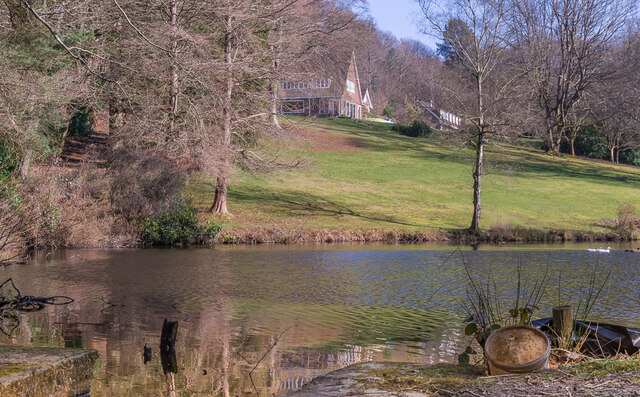
Bonets Wood is a picturesque woodland located in the county of Surrey, England. Spanning an area of approximately 100 acres, this enchanting forest is renowned for its natural beauty and diverse wildlife. The wood is situated near the village of Haslemere, just a short distance from the Surrey Hills Area of Outstanding Natural Beauty.

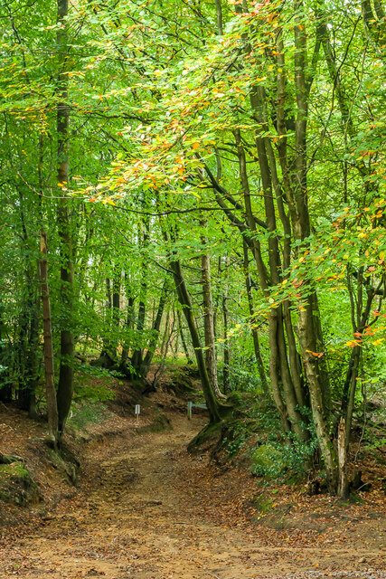
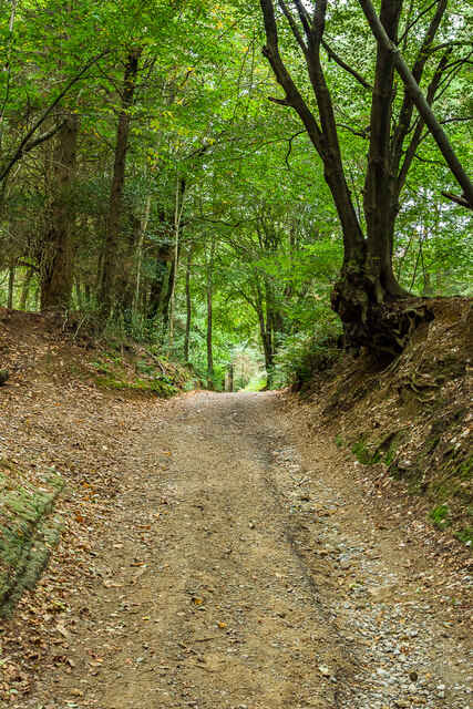
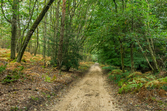
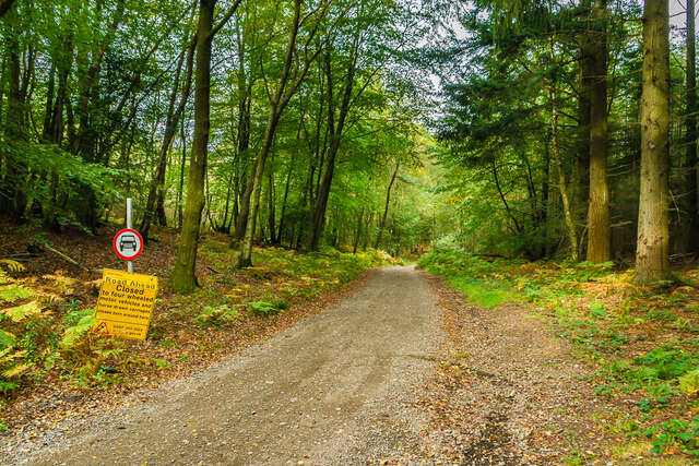
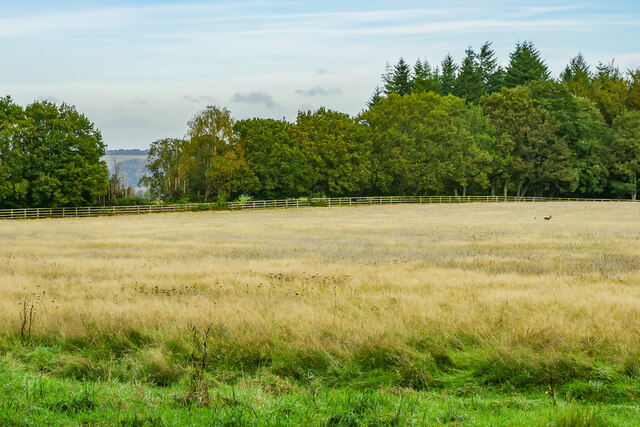
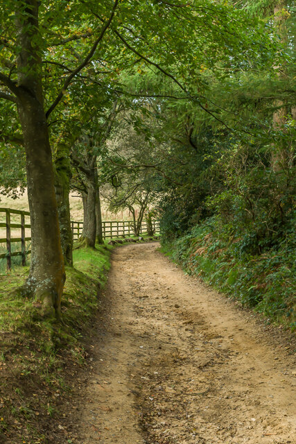
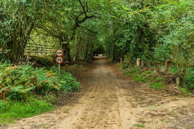
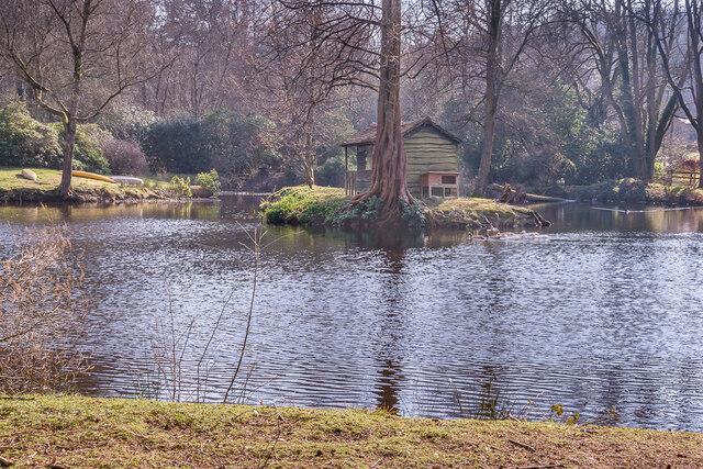
Bonets Wood is characterized by its dense canopy of trees, which primarily consists of native species such as oak, beech, and birch. The woodland floor is adorned with a carpet of bluebells during the spring months, creating a breathtaking scene. The towering trees provide a tranquil atmosphere, making it a popular destination for nature lovers and outdoor enthusiasts.

The wood is home to a rich variety of wildlife, including deer, badgers, foxes, and numerous species of birds. Birdwatchers are often delighted by the presence of woodpeckers, owls, and various songbirds. The diverse ecosystem of Bonets Wood provides a habitat for these animals, making it an important conservation area.

Visitors to Bonets Wood can enjoy a network of well-maintained footpaths that wind through the forest, allowing for peaceful walks and exploration. The woodland also features a small picnic area, providing an ideal spot for visitors to relax and enjoy the surroundings.

Bonets Wood is a cherished natural gem in Surrey, offering a tranquil escape from the hustle and bustle of everyday life. Its beauty and biodiversity make it a significant ecological site, attracting nature enthusiasts and promoting the importance of conservation.

If you have any feedback on the listing, please let us know in the comments section below.
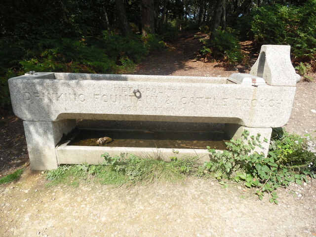
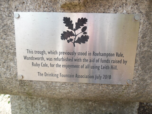
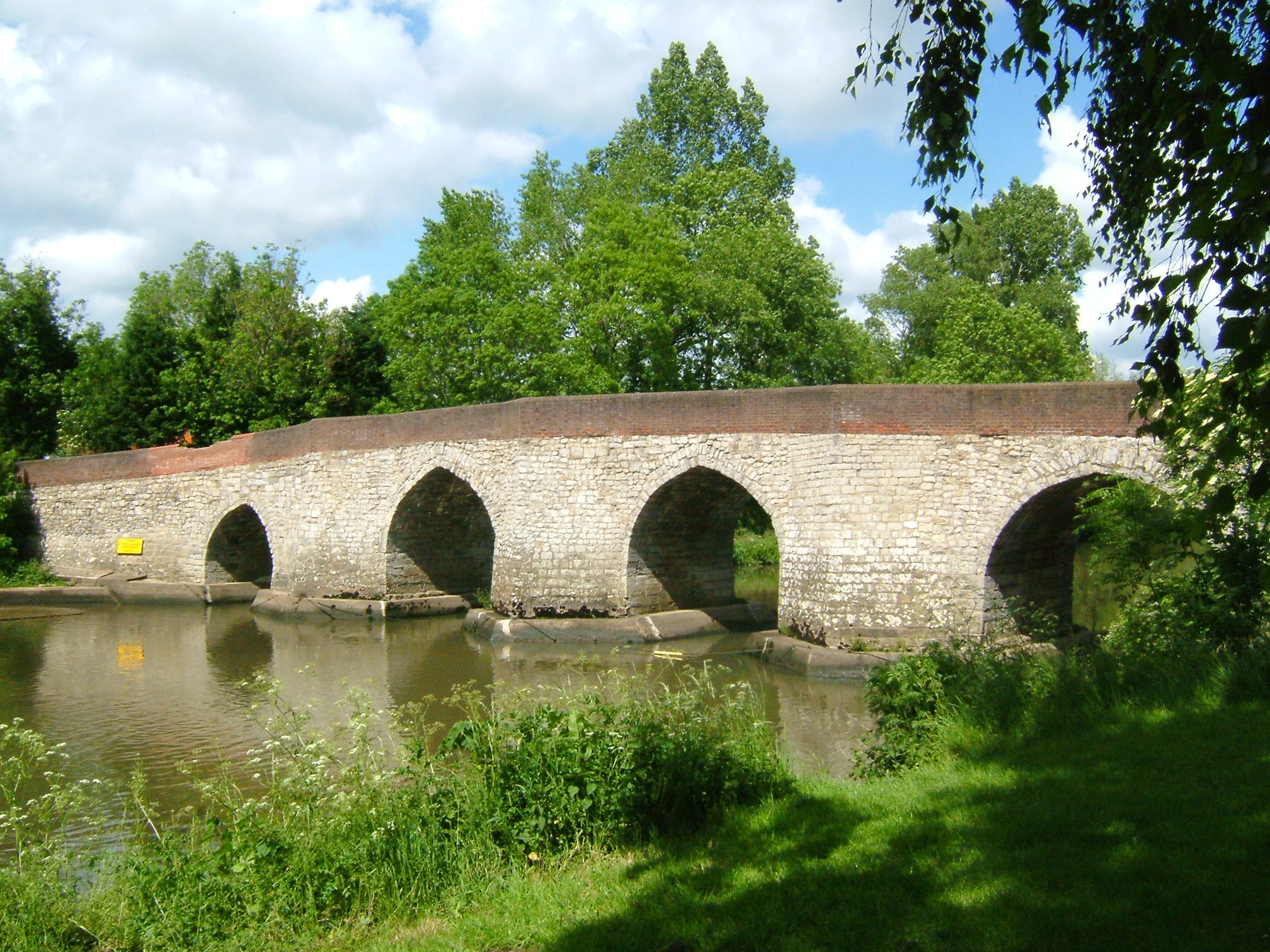
Bonets Wood Images

Images are sourced within 2km of 51.179141/-0.35351832 or Grid Reference TQ1543. Thanks to Geograph Open Source API. All images are credited.

Leith Hill - Rhododendron A common shrub on Leith Hill, part of the Greensand Ridge.
Leith Hill - Rhododendron
A common shrub on Leith Hill, part of the Greensand Ridge.
Drinking trough Drinking trough and fountain near the summit of Leith Hill.  Originally installed in Roehampton Vale, Wandsworth, by the Metropolitan Drinking Fountain and Cattle Trough Association, it was moved here in July 2018 with the support of the charity (now known as The Drinking Fountain Association).
Drinking trough
Drinking trough and fountain near the summit of Leith Hill. Originally installed in Roehampton Vale, Wandsworth, by the Metropolitan Drinking Fountain and Cattle Trough Association, it was moved here in July 2018 with the support of the charity (now known as The Drinking Fountain Association).
Leith Hill Tower Tower on the summit of Leith Hill, built in 1774-5 with the stair turret added in 1864.  Grade II listed - see <span class="nowrap"><a title="www.historicengland.org.uk/listing/the-list/list-entry/1028808" rel="nofollow ugc noopener" href="http://www.historicengland.org.uk/listing/the-list/list-entry/1028808">Link</a><img style="margin-left:2px;" alt="External link" title="External link - shift click to open in new window" src="https://s1.geograph.org.uk/img/external.png" width="10" height="10"/></span>.
Leith Hill Tower
Tower on the summit of Leith Hill, built in 1774-5 with the stair turret added in 1864. Grade II listed - see LinkExternal link.
Leith Hill summit The summit of Leith Hill, with the drinking trough installed in 2018 on the left (see <a href="https://www.geograph.org.uk/photo/6994981">TQ1343 : Drinking trough</a> and Leith Hill Tower in the background (see <a href="https://www.geograph.org.uk/photo/6994999">TQ1343 : Leith Hill Tower</a>).
Leith Hill summit
The summit of Leith Hill, with the drinking trough installed in 2018 on the left (see TQ1343 : Drinking trough and Leith Hill Tower in the background (see TQ1343 : Leith Hill Tower).
Wolvens Lane Byway between Coldharbour and Wotton.
Wolvens Lane
Byway between Coldharbour and Wotton.
Wolvens Lane Byway between Coldharbour and Wotton.
Wolvens Lane
Byway between Coldharbour and Wotton.
Wolvens Lane Byway between Coldharbour and Wotton.
Wolvens Lane
Byway between Coldharbour and Wotton.
Wolvens Lane Byway between Coldharbour and Wotton.  Although it is a "BOAT" (Byway open to all traffic), the sign refers to a temporary closure to four wheel drive vehicles, to avoid damage to recent repairs, and a consultation is currently under way to make the closure permanent.
Wolvens Lane
Byway between Coldharbour and Wotton. Although it is a "BOAT" (Byway open to all traffic), the sign refers to a temporary closure to four wheel drive vehicles, to avoid damage to recent repairs, and a consultation is currently under way to make the closure permanent.
Field Field off Wolvens Lane, a byway between Coldharbour and Wotton.  A couple of Roe Deer can be seen towards the right of the photo.  In the far distance are the North Downs.
Field
Field off Wolvens Lane, a byway between Coldharbour and Wotton. A couple of Roe Deer can be seen towards the right of the photo. In the far distance are the North Downs.
Wolvens Lane Byway between Coldharbour and Wotton.
Wolvens Lane
Byway between Coldharbour and Wotton.
Upper Merriden Cottage Remote house on Wolvens Lane, a byway between Coldharbour and Wotton.  The current building dates from the early 2000s, replacing an earlier slightly smaller forester's cottage on the same site but nearer the lane, which had been damaged by fire.
Upper Merriden Cottage
Remote house on Wolvens Lane, a byway between Coldharbour and Wotton. The current building dates from the early 2000s, replacing an earlier slightly smaller forester's cottage on the same site but nearer the lane, which had been damaged by fire.
Wolvens Lane Byway between Coldharbour and Wotton.  Although it is a "BOAT" (Byway open to all traffic), there is currently a temporary closure to four wheel drive vehicles (and horses and carts!), to avoid damage to recent repairs, as indicated by the signs here).  A consultation is currently under way to make the closure permanent.
Wolvens Lane
Byway between Coldharbour and Wotton. Although it is a "BOAT" (Byway open to all traffic), there is currently a temporary closure to four wheel drive vehicles (and horses and carts!), to avoid damage to recent repairs, as indicated by the signs here). A consultation is currently under way to make the closure permanent.
Tilling Springs House with ornamental pond near the source of the River Tillingbourne.
Tilling Springs
House with ornamental pond near the source of the River Tillingbourne.
Pond, Tilling Springs Ornamental pond below Tilling Springs (see <a href="https://www.geograph.org.uk/photo/7116861">TQ1444 : Tilling Springs</a>), near the source of the River Tillingbourne.
Pond, Tilling Springs
Ornamental pond below Tilling Springs (see TQ1444 : Tilling Springs), near the source of the River Tillingbourne.
Leith Hill Tower This tower was built in 1765 by Richard Hull of Leith Hill Place nearby, TQ1342 refers. At 965ft (294m) above sea level, it is the highest point in south-east England, and from the top of the tower at 1029ft (313m) asl, views can be obtained of thirteen counties on a clear day. It was given with five acres of surrounding land to the National Trust in 1923, and one can climb the steps to its top on Fridays-Sundays and Bank Holidays between the beginning of April and the end of September, <span class="nowrap"><a title="https://www.nationaltrust.org.uk/leith-hill" rel="nofollow ugc noopener" href="https://www.nationaltrust.org.uk/leith-hill">Link</a><img style="margin-left:2px;" alt="External link" title="External link - shift click to open in new window" src="https://s1.geograph.org.uk/img/external.png" width="10" height="10"/></span> refers.
Leith Hill Tower
This tower was built in 1765 by Richard Hull of Leith Hill Place nearby, TQ1342 refers. At 965ft (294m) above sea level, it is the highest point in south-east England, and from the top of the tower at 1029ft (313m) asl, views can be obtained of thirteen counties on a clear day. It was given with five acres of surrounding land to the National Trust in 1923, and one can climb the steps to its top on Fridays-Sundays and Bank Holidays between the beginning of April and the end of September, LinkExternal link refers.
View from Leith Hill Tower This photo shows the view from the foot of Leith Hill Tower looking south towards the South Downs in the distance.
View from Leith Hill Tower
This photo shows the view from the foot of Leith Hill Tower looking south towards the South Downs in the distance.
Drinking Trough on Leith Hill This drinking trough was originally located in Roehampton Vale in London SW15 until it was moved to Leith Hill more recently. It has the following wording inscribed on its side:

               METROPOLITAN
      DRINKING FOUNTAIN & CATTLE TROUGH
               ASSOCIATION
Drinking Trough on Leith Hill
This drinking trough was originally located in Roehampton Vale in London SW15 until it was moved to Leith Hill more recently. It has the following wording inscribed on its side: METROPOLITAN DRINKING FOUNTAIN & CATTLE TROUGH ASSOCIATION
Plaque on side of drinking trough at Leith Hill This plaque is fixed on the side of the drinking trough near Leith Hill Tower. It has the following wording:

     This trough, which previously stood in Roehampton Vale,
   Wandsworth, was refurbished with the aid of funds raised by
      Ruby Cole, for the enjoyment of all using Leith Hill.

          The Drinking Fountain Association July 2018
Plaque on side of drinking trough at Leith Hill
This plaque is fixed on the side of the drinking trough near Leith Hill Tower. It has the following wording: This trough, which previously stood in Roehampton Vale, Wandsworth, was refurbished with the aid of funds raised by Ruby Cole, for the enjoyment of all using Leith Hill. The Drinking Fountain Association July 2018
Show me another place!

Bonets Wood is located at Grid Ref: TQ1543 (Lat: 51.179141, Lng: -0.35351832)

Administrative County: Surrey

District: Mole Valley

Police Authority: Surrey

What 3 Words

///corn.exact.save. Near Holmwood, Surrey

Related Wikis

Coldharbour, Surrey

Coldharbour is a hamlet in the Mole Valley district, in the English county of Surrey. It is on a minor road from Dorking to Leith Hill Place. == Description... ==

Broome Hall

Broome Hall is a Grade II-listed country house with grounds including cottages and outhouses on the wooded, upper southern slopes of the Greensand Ridge...
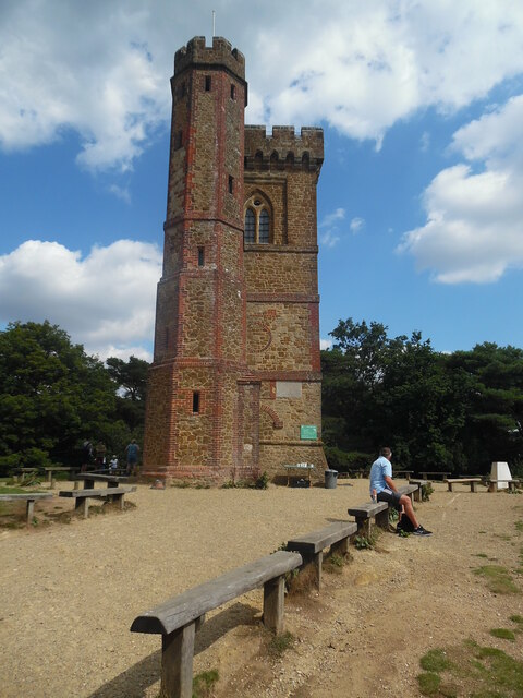
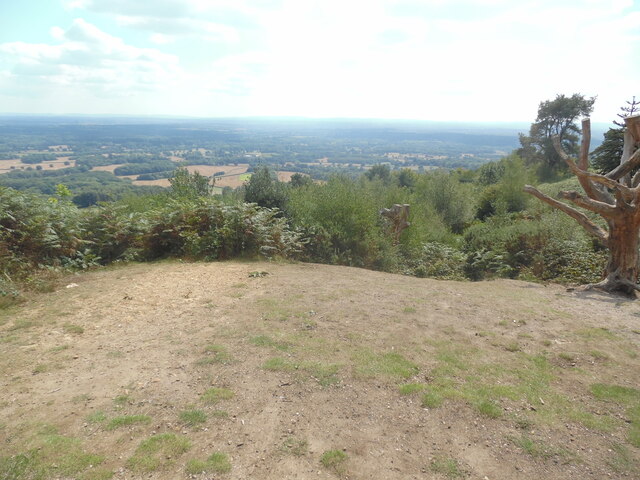
Leith Hill

Leith Hill in southern England is the highest summit of the Greensand Ridge, approximately 6.7 km (4 mi) southwest of Dorking, Surrey and 40.5 km (30 mi...

Leith Hill multiple aircraft accident

On 26 November 1944, four C-47 transport aircraft of the 442nd Operations Group departed from Advanced Landing Ground "A-4 in Pays de la Loire, northern...

Greensand Way

The Greensand Way is a long-distance path of 108 miles (174 km) in southeast England, from Haslemere in Surrey to Hamstreet in Kent. It follows the Greensand...

Greensand Ridge

The Greensand Ridge, also known as the Wealden Greensand, is an extensive, prominent, often wooded, mixed greensand/sandstone escarpment in south-east...

Leith Hill SSSI

Leith Hill SSSI is a 337.9-hectare (835-acre) biological Site of Special Scientific Interest south-east of Dorking in Surrey. The SSSI consists of four...

Holmwood railway station

Holmwood railway station serves the villages of Beare Green and South Holmwood in Surrey, England, on the Sutton and Mole Valley Lines between Dorking...

Nearby Amenities

Located within 500m of 51.179141,-0.35351832
Kitlands
Building: yes
Source: npe
Lat/Long: 51.1793459/-0.3502745
Created By: Merkaartor 0.12
Lat/Long: 51.1834359/-0.3541159
Created By: Merkaartor 0.12
Lat/Long: 51.1828941/-0.3539706
Barrier: stile
Lat/Long: 51.1784494/-0.3468184
Barrier: stile
Foot: yes
Lat/Long: 51.1752384/-0.3512845
Barrier: stile
Lat/Long: 51.1750053/-0.3525892
Barrier: stile
Lat/Long: 51.175051/-0.3526221
Barrier: stile
Lat/Long: 51.1768891/-0.3582886
Bench
Backrest: yes
Seats: 3
Lat/Long: 51.1769418/-0.3585098
Barrier: stile
Stile: stepover
Lat/Long: 51.1826303/-0.3536182
Historic: memorial
Wheelchair: no
Lat/Long: 51.1817849/-0.3573063
Weald View Cottages
Building: yes
Lat/Long: 51.1784668/-0.3585361
Bus Stop
Broomehall Road
Naptan AtcoCode: 40004408803H
Naptan NaptanCode: surdawmp
Physically Present: no
Public Transport: platform
Lat/Long: 51.1784985/-0.3564884
Bus Stop
Broomehall Road
Naptan AtcoCode: 40004408803C
Naptan NaptanCode: surdawja
Physically Present: no
Public Transport: platform
Lat/Long: 51.1785251/-0.3564056
The data included in this document is from www.openstreetmap.org. The data is made available under ODbL.

Have you been to Bonets Wood?

Leave your review of Bonets Wood below (or comments, questions and feedback).