Meares Copse

Wood, Forest in Surrey Mole Valley

England

Meares Copse

Leith Hill - Rhododendron A common shrub on Leith Hill, part of the Greensand Ridge.
Leith Hill - Rhododendron Credit: Colin Smith

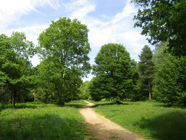
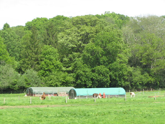
Meares Copse is a charming woodland located in the county of Surrey, England. Covering an area of approximately 50 acres, it forms part of the larger Surrey Hills Area of Outstanding Natural Beauty. The copse is nestled between the villages of Shere and Abinger Hammer, offering visitors a tranquil and picturesque setting to explore.

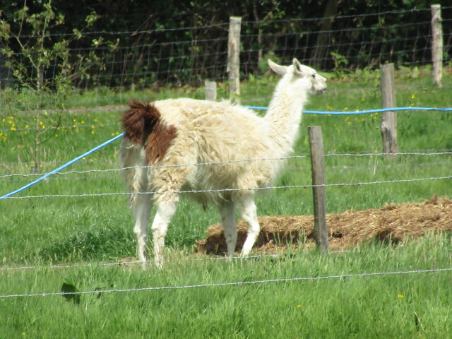
The woodland is predominantly composed of mixed deciduous trees, including oak, beech, and birch, which create a diverse and vibrant canopy throughout the seasons. This variety of tree species provides a rich habitat for an array of wildlife, including birds, mammals, and insects. Nature enthusiasts can often spot species such as woodpeckers, deer, and butterflies as they wander through the copse.

Meares Copse features several well-maintained footpaths and trails that wind through the woodland, allowing visitors to immerse themselves in its natural beauty. These paths offer opportunities for walking, jogging, and cycling, catering to a range of outdoor enthusiasts. Additionally, there are designated picnic areas where visitors can relax and enjoy the peaceful surroundings.

The copse is managed by the Surrey Wildlife Trust, ensuring its preservation and conservation. The organization actively promotes the copse's biodiversity and natural heritage through various initiatives and educational programs.

Overall, Meares Copse is a hidden gem within Surrey, offering visitors a chance to escape the hustle and bustle of daily life and immerse themselves in the beauty of nature. Whether it is a leisurely stroll, a family picnic, or wildlife observation, this woodland is a perfect destination for anyone seeking a serene and idyllic outdoor experience.

If you have any feedback on the listing, please let us know in the comments section below.

Meares Copse Images

Images are sourced within 2km of 51.163931/-0.36099661 or Grid Reference TQ1441. Thanks to Geograph Open Source API. All images are credited.

Leith Hill - Rhododendron A common shrub on Leith Hill, part of the Greensand Ridge.
Leith Hill - Rhododendron
A common shrub on Leith Hill, part of the Greensand Ridge.
Drinking trough Drinking trough and fountain near the summit of Leith Hill.  Originally installed in Roehampton Vale, Wandsworth, by the Metropolitan Drinking Fountain and Cattle Trough Association, it was moved here in July 2018 with the support of the charity (now known as The Drinking Fountain Association).
Drinking trough
Drinking trough and fountain near the summit of Leith Hill. Originally installed in Roehampton Vale, Wandsworth, by the Metropolitan Drinking Fountain and Cattle Trough Association, it was moved here in July 2018 with the support of the charity (now known as The Drinking Fountain Association).
Leith Hill Tower Tower on the summit of Leith Hill, built in 1774-5 with the stair turret added in 1864.  Grade II listed - see <span class="nowrap"><a title="www.historicengland.org.uk/listing/the-list/list-entry/1028808" rel="nofollow ugc noopener" href="http://www.historicengland.org.uk/listing/the-list/list-entry/1028808">Link</a><img style="margin-left:2px;" alt="External link" title="External link - shift click to open in new window" src="https://s1.geograph.org.uk/img/external.png" width="10" height="10"/></span>.
Leith Hill Tower
Tower on the summit of Leith Hill, built in 1774-5 with the stair turret added in 1864. Grade II listed - see LinkExternal link.
Leith Hill summit The summit of Leith Hill, with the drinking trough installed in 2018 on the left (see <a href="https://www.geograph.org.uk/photo/6994981">TQ1343 : Drinking trough</a> and Leith Hill Tower in the background (see <a href="https://www.geograph.org.uk/photo/6994999">TQ1343 : Leith Hill Tower</a>).
Leith Hill summit
The summit of Leith Hill, with the drinking trough installed in 2018 on the left (see TQ1343 : Drinking trough and Leith Hill Tower in the background (see TQ1343 : Leith Hill Tower).
Leith Hill Place This property is now administered by the National Trust and previously has been home to Wedgwood, Darwin and Vaughan Williams families.
Leith Hill Place
This property is now administered by the National Trust and previously has been home to Wedgwood, Darwin and Vaughan Williams families.
Leith Hill Place - Graffiti Colourful graffiti in the cellar created probably in the 1960s when this house was a school.
Leith Hill Place - Graffiti
Colourful graffiti in the cellar created probably in the 1960s when this house was a school.
Leith Hill Place - Mural Schoolboy artwork, probably 1960s, in the cellar in this former school.
Leith Hill Place - Mural
Schoolboy artwork, probably 1960s, in the cellar in this former school.
Leith Hill Place - "The Lark Ascending" Detail from the Ralph Vaughan Williams timeline displayed in his former home - now a National Trust property.
Leith Hill Place - "The Lark Ascending"
Detail from the Ralph Vaughan Williams timeline displayed in his former home - now a National Trust property.
Leith Hill Place - Wedgwood Fireplace Wedgwood design on the fireplace with Darwinian exhibits above.
Leith Hill Place was home to Wedgwood, Darwin and Vaughan Williams families and is now administered by the National Trust.
Leith Hill Place - Wedgwood Fireplace
Wedgwood design on the fireplace with Darwinian exhibits above. Leith Hill Place was home to Wedgwood, Darwin and Vaughan Williams families and is now administered by the National Trust.
Leith Hill Place - Vaughan Williams Tryptych Three faces of Ralph Vaughan Williams, celebrated composer, in his former home near Dorking.
Leith Hill Place - Vaughan Williams Tryptych
Three faces of Ralph Vaughan Williams, celebrated composer, in his former home near Dorking.
Leith Hill Place This Palladian style house near Dorking has an Elizabethan kernel and has had a varied history - it has been home to Wedgwood, Darwin and Vaughan Williams families.
Leith Hill Place
This Palladian style house near Dorking has an Elizabethan kernel and has had a varied history - it has been home to Wedgwood, Darwin and Vaughan Williams families.
Leith Hill Place - Earthenware Exhibits in the kitchen - note the "stone pig" which was used as a bed warmer - it carries a maker's name, Pierson & Co of Dorking.
The house is now administered by the National Trust.
Leith Hill Place - Earthenware
Exhibits in the kitchen - note the "stone pig" which was used as a bed warmer - it carries a maker's name, Pierson & Co of Dorking. The house is now administered by the National Trust.
Leith Hill Place - Ralph Vaughan Williams Violin and bust of the celebrated composer in his former home SW of Dorking. This is now a National Trust property.
Leith Hill Place - Ralph Vaughan Williams
Violin and bust of the celebrated composer in his former home SW of Dorking. This is now a National Trust property.
Leith Hill Place - Ralph Vaughan Williams' Piano Exhibit within his former home which is now a National Trust property.
Leith Hill Place - Ralph Vaughan Williams' Piano
Exhibit within his former home which is now a National Trust property.
Leith Hill Place - Lodge Attractive lodgehouse and flowering rhododendron at the entrance to this National Trust property.
Leith Hill Place - Lodge
Attractive lodgehouse and flowering rhododendron at the entrance to this National Trust property.
Leith Hill Place - Estate Walk On the Etherley Farm Loop, a firm path passing through Dingwall Wood.
Leith Hill Place - Estate Walk
On the Etherley Farm Loop, a firm path passing through Dingwall Wood.
Forest Green - Etherley Farm Llamas and barns in a paddock beside the Etherley Farm Loop Walk which passes through the Leith Hill Place estate.
Forest Green - Etherley Farm
Llamas and barns in a paddock beside the Etherley Farm Loop Walk which passes through the Leith Hill Place estate.
Etherley Farm - Llama Exotic beast at Etherley Farm, seen on the loop walk from Leith Hill Place.
Etherley Farm - Llama
Exotic beast at Etherley Farm, seen on the loop walk from Leith Hill Place.
Show me another place!

Meares Copse is located at Grid Ref: TQ1441 (Lat: 51.163931, Lng: -0.36099661)

Administrative County: Surrey

District: Mole Valley

Police Authority: Surrey

What 3 Words

///mushroom.twitches.consoles. Near Capel, Surrey

Related Wikis

Greensand Ridge

The Greensand Ridge, also known as the Wealden Greensand, is an extensive, prominent, often wooded, mixed greensand/sandstone escarpment in south-east...

Broome Hall

Broome Hall is a Grade II-listed country house with grounds including cottages and outhouses on the wooded, upper southern slopes of the Greensand Ridge...

Leith Hill

Leith Hill in southern England is the highest summit of the Greensand Ridge, approximately 6.7 km (4 mi) southwest of Dorking, Surrey and 40.5 km (30 mi...

Leith Hill multiple aircraft accident

On 26 November 1944, four C-47 transport aircraft of the 442nd Operations Group departed from Advanced Landing Ground "A-4 in Pays de la Loire, northern...

Ockley

Ockley is a rural village in Surrey. It lies astride the A29, the modern road using the alignment of Stane Street (Chichester). The A29 diverges from the...

Greensand Way

The Greensand Way is a long-distance path of 108 miles (174 km) in southeast England, from Haslemere in Surrey to Hamstreet in Kent. It follows the Greensand...

Ockley railway station

Ockley railway station serves the villages of Ockley and Capel in Surrey, England and is 1.4 miles (2.3 km) from Ockley village and 0.5 miles (0.80 km...

Coldharbour, Surrey

Coldharbour is a hamlet in the Mole Valley district, in the English county of Surrey. It is on a minor road from Dorking to Leith Hill Place. == Description... ==

Related Videos

Leith Hill | Gomshall to Dorking Walk | 4K | Day Hike Saturday | 🇬🇧 Hiking UK | England

This walk starts at Leigh station and heads west through parkland to the attractive village of Penshurst. After crossing the River ...

Experience the Ultimate Beginner's Hiking Trail in England

A quiet corner of Surrey - woods, gentle hills and a lovely lunchtime pub Length 16.5km (10.3 miles), 5 hours. For the whole outing ...

[GB] 🇬🇧 Weekend Hiking - Exploring into the Nature - Tillingbourne waterfall

Leith Hill is 40KMs from Central London. It's in Southern England. It reaches 294m above sea level, which is second height point ...

LEITH HILL TOWER | Drone 4k | National Trust Walk | Day Hike Saturday | 🇬🇧 Hiking UK | England

Holmwood to Gomshall walk Next event: http://www.senderismoenlondres.co.uk/events.html A very pretty forest walk, quite close ...

Nearby Amenities

Located within 500m of 51.163931,-0.36099661
Power: pole
Lat/Long: 51.1599703/-0.3575982
Power: pole
Lat/Long: 51.1601063/-0.3596447
Power: pole
Lat/Long: 51.1600316/-0.3628297
Power: pole
Lat/Long: 51.1600249/-0.3643345
Woodyers
Place: isolated_dwelling
Lat/Long: 51.165413/-0.3579425
Barrier: stile
Lat/Long: 51.1650424/-0.360065
Barrier: stile
Lat/Long: 51.1656664/-0.3576402
Power: pole
Lat/Long: 51.1600647/-0.3627983
Power: pole
Lat/Long: 51.160142/-0.3596225
Power: pole
Lat/Long: 51.1600142/-0.3575975
Power: pole
Source: gps;Bing
Lat/Long: 51.1667737/-0.3613083
Power: pole
Source: gps;Bing
Lat/Long: 51.1627913/-0.3622431
Power: pole
Source: gps;Bing
Lat/Long: 51.1641905/-0.3619896
Power: pole
Source: gps;Bing
Lat/Long: 51.1650725/-0.3620214
Barrier: stile
Lat/Long: 51.1649957/-0.3607451
Power: pole
Source: gps
Lat/Long: 51.1655021/-0.3546212
Power: pole
Lat/Long: 51.1671821/-0.3645881
Power: pole
Lat/Long: 51.1663187/-0.3578088
Power: pole
Lat/Long: 51.1658926/-0.3562419
The data included in this document is from www.openstreetmap.org. The data is made available under ODbL.

Have you been to Meares Copse?

Leave your review of Meares Copse below (or comments, questions and feedback).