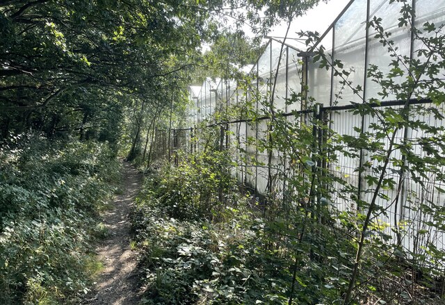
Firtree Plantation

Wood, Forest in Sussex Horsham

England

Firtree Plantation

Modern Waymarker The Modern Waymarker is located  on the road.  Parish of Ashington (Horsham District). Carved stone plaque laid inside brick semicircle, erected in the 20th Century. 

Inscription reads:-  
ASHINGTON / LONDON / () MILES / WORTHING / 10 MILES

Milestone Society National ID: SX_XASH
Modern Waymarker Credit: Janet Dowding

Firtree Plantation is a picturesque woodland located in Sussex, England. Covering an extensive area, it is renowned for its dense population of fir trees, which give the plantation its name. The forest serves as a haven for nature enthusiasts, offering a tranquil escape from the bustle of urban life.

The plantation is characterized by its tall, evergreen trees that provide a lush green canopy throughout the year. These fir trees, predominantly of the Scots pine species, create a unique atmosphere with their distinct aroma and the soothing sound of rustling needles in the breeze.

The woodland is home to a diverse range of flora and fauna. Bluebells, primroses, and wild garlic carpet the forest floor during spring, transforming it into a vibrant haven for wildflowers. Among the towering trees, visitors may spot various bird species, including woodpeckers and owls, as well as small mammals such as squirrels and rabbits.

Firtree Plantation offers a variety of recreational activities for visitors to enjoy. Well-maintained walking trails wind their way through the forest, providing opportunities for leisurely strolls and hikes. Cyclists can explore the network of bike paths that crisscross the plantation, while horse riders can take advantage of designated bridleways.

The plantation also has several picnic areas, allowing visitors to relax and enjoy the natural surroundings. It is a popular destination for families, providing a safe and scenic environment for children to play and explore.

In summary, Firtree Plantation is a captivating woodland in Sussex, offering a serene retreat amidst nature's beauty. With its dense fir trees, diverse wildlife, and range of recreational activities, it is an ideal destination for individuals seeking solace in the great outdoors.

If you have any feedback on the listing, please let us know in the comments section below.

Firtree Plantation Images

Images are sourced within 2km of 50.933498/-0.37199902 or Grid Reference TQ1416. Thanks to Geograph Open Source API. All images are credited.

Modern Waymarker The Modern Waymarker is located  on the road.  Parish of Ashington (Horsham District). Carved stone plaque laid inside brick semicircle, erected in the 20th Century. 

Inscription reads:-  
ASHINGTON / LONDON / () MILES / WORTHING / 10 MILES

Milestone Society National ID: SX_XASH
Modern Waymarker
The Modern Waymarker is located on the road.  Parish of Ashington (Horsham District). Carved stone plaque laid inside brick semicircle, erected in the 20th Century.  Inscription reads:- ASHINGTON / LONDON / () MILES / WORTHING / 10 MILES Milestone Society National ID: SX_XASH
London Road London Road in Ashington near Church Lane looking northwards.
London Road
London Road in Ashington near Church Lane looking northwards.
London Road roundabout The roundabout at the north end of Ashington where London Road meets Billingshurst Road and Ivy Lane.
London Road roundabout
The roundabout at the north end of Ashington where London Road meets Billingshurst Road and Ivy Lane.
Oast Cottage Viewed from the Billingshurst Road the cottage is a Grade II listed building. See <span class="nowrap"><a title="https://historicengland.org.uk/listing/the-list/list-entry/1182086" rel="nofollow ugc noopener" href="https://historicengland.org.uk/listing/the-list/list-entry/1182086">Link</a><img style="margin-left:2px;" alt="External link" title="External link - shift click to open in new window" src="https://s1.geograph.org.uk/img/external.png" width="10" height="10"/></span>
Oast Cottage
Viewed from the Billingshurst Road the cottage is a Grade II listed building. See LinkExternal link
Spear Hill The junction of Spear Hill with Billingshurst Road.
Spear Hill
The junction of Spear Hill with Billingshurst Road.
Footpath beside Nursery On footpath number 2607 as it passes the greenhouses of a Nursery on the outskirts of Ashington.
Footpath beside Nursery
On footpath number 2607 as it passes the greenhouses of a Nursery on the outskirts of Ashington.
The Parish Church of St Peter and St Paul The church is a Grade II* (star) listed building. See <span class="nowrap"><a title="https://historicengland.org.uk/listing/the-list/list-entry/1027442" rel="nofollow ugc noopener" href="https://historicengland.org.uk/listing/the-list/list-entry/1027442">Link</a><img style="margin-left:2px;" alt="External link" title="External link - shift click to open in new window" src="https://s1.geograph.org.uk/img/external.png" width="10" height="10"/></span>
The Parish Church of St Peter and St Paul
The church is a Grade II* (star) listed building. See LinkExternal link
St Peter and St Paul's Church, Ashington Extended in 1871. One of the bells (the stocks for which were renewed for the millennium) dates back to 1350.
St Peter and St Paul's Church, Ashington
Extended in 1871. One of the bells (the stocks for which were renewed for the millennium) dates back to 1350.
The Old School, Ashington Looking north. Built in 1872.
The Old School, Ashington
Looking north. Built in 1872.
The Old Mill Once a family owned water mill this is now a hotel.
The Old Mill
Once a family owned water mill this is now a hotel.
London Road, Ashington Looking north from the southern end of the village. Once, as its name suggests, this was the main A24 London to Worthing road. Now the traffic has been diverted away onto a bypass and the main street has been traffic-calmed. In recent years the village has developed from being a straggle along the main road into a substantial dormitory village. Surprisingly, the church is on the outskirts of the village. This may be because a Roman building, possibly a villa, existed at Church Farm and maybe the original church was associated with it.
London Road, Ashington
Looking north from the southern end of the village. Once, as its name suggests, this was the main A24 London to Worthing road. Now the traffic has been diverted away onto a bypass and the main street has been traffic-calmed. In recent years the village has developed from being a straggle along the main road into a substantial dormitory village. Surprisingly, the church is on the outskirts of the village. This may be because a Roman building, possibly a villa, existed at Church Farm and maybe the original church was associated with it.
Ashington The A24 underpass at the south end of London Road looking south. The bypass skirts the eastern side of the village and joins up with the original main road just south of this point. The road under the underpass is the road to Hole Street and Wiston and also links up with the southbound carriageway.
Ashington
The A24 underpass at the south end of London Road looking south. The bypass skirts the eastern side of the village and joins up with the original main road just south of this point. The road under the underpass is the road to Hole Street and Wiston and also links up with the southbound carriageway.
Fields of Hole Street Farm A view across this entirely agricultural square: the fields of Hole Street Farm, looking towards Upper Chancton, with the trees of Birth Copse in the middle distance. The hedge line in the foreground is probably ancient; it marks the parish boundary.
Fields of Hole Street Farm
A view across this entirely agricultural square: the fields of Hole Street Farm, looking towards Upper Chancton, with the trees of Birth Copse in the middle distance. The hedge line in the foreground is probably ancient; it marks the parish boundary.
Rosewood Cottage Ivy Close, Ashington, W. Sussex.
Rosewood Cottage
Ivy Close, Ashington, W. Sussex.
Footpath to Kensett's Corner Taken from North Lane bridleway.
Footpath to Kensett's Corner
Taken from North Lane bridleway.
Coppicing, Brickyard Copse Taken from North Lane bridleway.
Coppicing, Brickyard Copse
Taken from North Lane bridleway.
Basing Wood A lone oak stands guard over an army of firs. Taken from North Lane bridleway just north of Coombelands.
Basing Wood
A lone oak stands guard over an army of firs. Taken from North Lane bridleway just north of Coombelands.
Capite Wood Taken from the footpath that links Woodman's Farm with Buckells Farm. The dense cover of the firs gives it a spooky feel.
Capite Wood
Taken from the footpath that links Woodman's Farm with Buckells Farm. The dense cover of the firs gives it a spooky feel.
Show me another place!

Firtree Plantation is located at Grid Ref: TQ1416 (Lat: 50.933498, Lng: -0.37199902)

Administrative County: West Sussex

District: Horsham

Police Authority: Sussex

What 3 Words

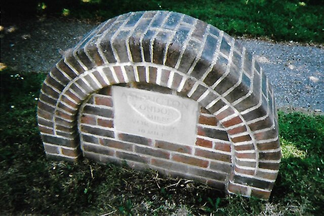
///variation.wrong.risking. Near Ashington, West Sussex

Related Wikis

Ashington, West Sussex

Ashington is a village and civil parish in the Horsham District of West Sussex, England. It lies on the A24 road 3 miles (4.8 km) north-east of Storrington...

Wiston, West Sussex

Wiston is a scattered village and civil parish in the Horsham District of West Sussex, England. It lies on the A283 road 2.8 miles (4.5 km) northwest of...

Buncton

Buncton () is a small village in the Horsham District of West Sussex, England, part of the civil parish of Wiston 0.5 miles (0.80 km) north. It lies to...

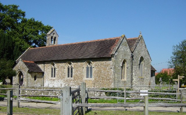
All Saints Church, Buncton

All Saints Church is an Anglican church in the hamlet of Buncton in the district of Horsham, one of seven local government districts in the English county...

South Downs National Park

The South Downs National Park is England's newest national park, designated on 31 March 2010. The park, covering an area of 1,627 square kilometres (628...

Church of the Holy Sepulchre, Warminghurst

The Church of the Holy Sepulchre is a former Anglican church in the hamlet of Warminghurst in the district of Horsham, one of seven local government districts...

Warminghurst

Warminghurst is a village and former civil parish, now in the parish of Thakeham, in the Horsham district of West Sussex, England. It lies on the Ashington...

Rock Mill, Washington

Rock Mill is a Grade II listed smock mill at Washington, West Sussex, England, which has been converted to residential use. == History == Rock Mill was...

Nearby Amenities

Located within 500m of 50.933498,-0.37199902
The data included in this document is from www.openstreetmap.org. The data is made available under ODbL.

Have you been to Firtree Plantation?

Leave your review of Firtree Plantation below (or comments, questions and feedback).