Mill Plantation

Wood, Forest in Sussex Worthing

England

Mill Plantation

The Cricketers public house Shopping street with Pastel blue lamp posts for the coastal theme.
The Cricketers public house Credit: James Emmans

Mill Plantation is a picturesque woodland located in Sussex, England. Spanning over several acres, it is a prime example of a thriving forest ecosystem. The plantation gets its name from the historic mill that once operated in the area, serving as a vital hub for the local community.

The woodland is characterized by a diverse range of tree species, including oak, beech, and birch. These towering trees create a dense canopy, providing shade and shelter for an abundance of flora and fauna. The forest floor is adorned with a rich carpet of ferns, mosses, and wildflowers, adding to the enchanting atmosphere of the plantation.

A network of well-maintained trails winds through the woodland, allowing visitors to explore its natural beauty at their own pace. The paths lead to a charming stream that meanders through the heart of the plantation, providing a serene backdrop for leisurely walks or picnics.

Mill Plantation is not only a sanctuary for nature enthusiasts but also a haven for wildlife. Birdwatchers can spot a variety of species, such as woodpeckers, owls, and thrushes, while small mammals like badgers and foxes can occasionally be seen darting through the undergrowth.

The plantation is open to the public year-round, with an onsite visitor center providing information and resources for visitors. It is also a popular destination for educational school trips, offering a unique opportunity for students to learn about the importance of forests and conservation.

In conclusion, Mill Plantation in Sussex is a captivating woodland that showcases the beauty and biodiversity of the region. Its lush vegetation, tranquil streams, and abundant wildlife make it a must-visit destination for nature lovers and those seeking a peaceful retreat amidst nature.

If you have any feedback on the listing, please let us know in the comments section below.

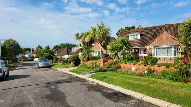
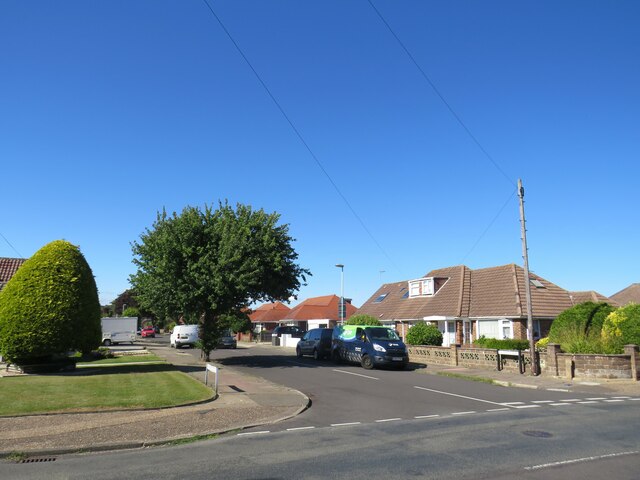
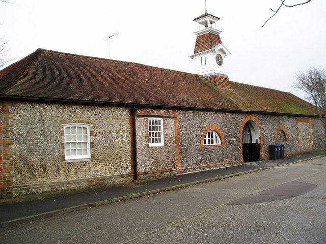
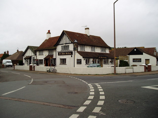
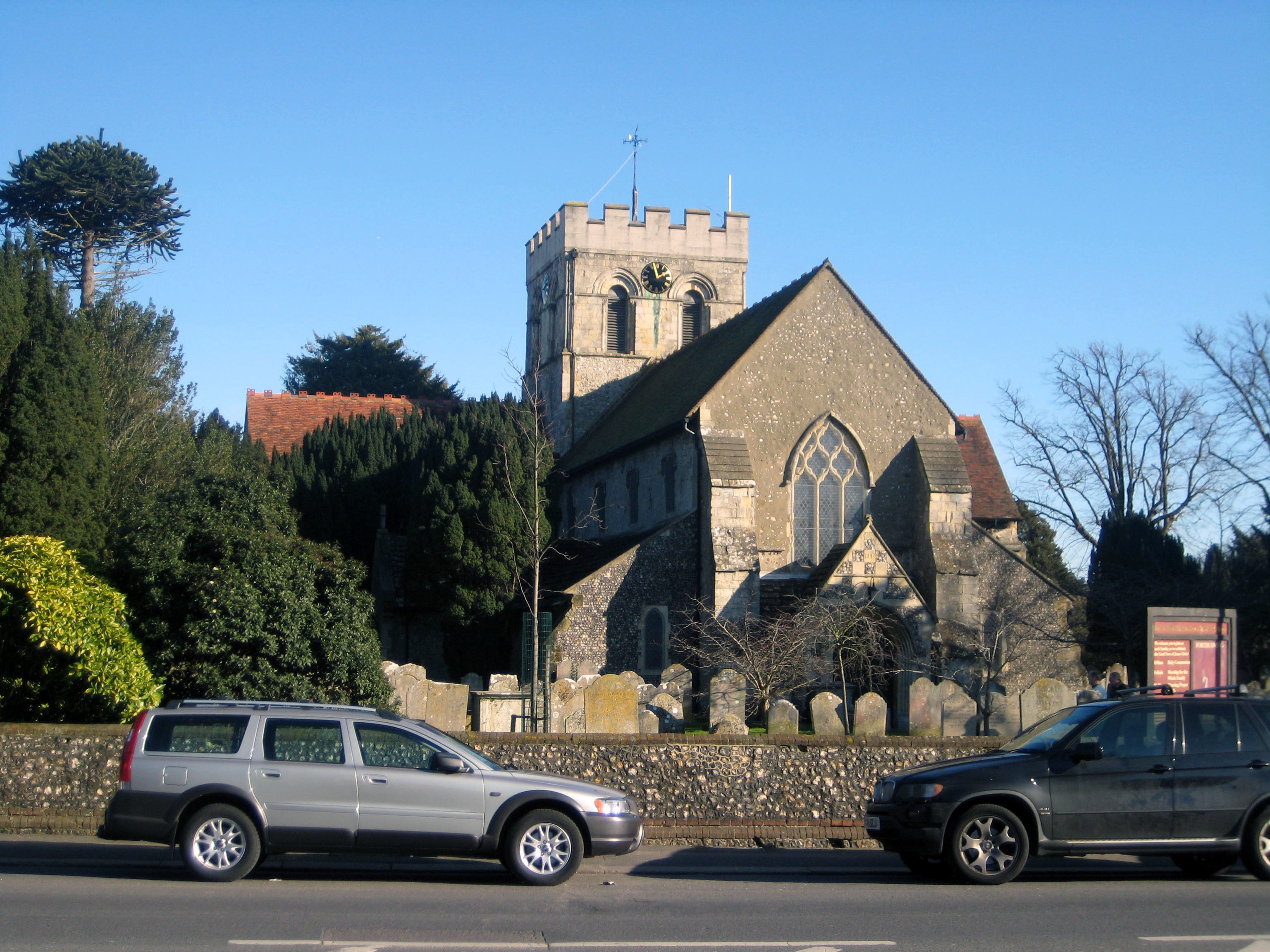
Mill Plantation Images

Images are sourced within 2km of 50.840363/-0.38485775 or Grid Reference TQ1305. Thanks to Geograph Open Source API. All images are credited.

The Cricketers public house Shopping street with Pastel blue lamp posts for the coastal theme.
The Cricketers public house
Shopping street with Pastel blue lamp posts for the coastal theme.
Border of the Southdown National Park Footpath next to a Hill Barn Golf Club.

Park info : <span class="nowrap"><a title="https://en.wikipedia.org/wiki/South_Downs_National_Park" rel="nofollow ugc noopener" href="https://en.wikipedia.org/wiki/South_Downs_National_Park">Link</a><img style="margin-left:2px;" alt="External link" title="External link - shift click to open in new window" src="https://s1.geograph.org.uk/img/external.png" width="10" height="10"/></span>
Border of the Southdown National Park
Footpath next to a Hill Barn Golf Club. Park info : LinkExternal link
Bungalows in Hillside Avenue Housing on the edge of Worthing.
Bungalows in Hillside Avenue
Housing on the edge of Worthing.
Lavington Road Detached 1930's houses, with new attic rooms.
Lavington Road
Detached 1930's houses, with new attic rooms.
St Lawrence Avenue 1920's detached housing in an area called West Tarring.
St Lawrence Avenue
1920's detached housing in an area called West Tarring.
Church Road, West Worthing Church Road is a residential road in West Worthing.
Church Road, West Worthing
Church Road is a residential road in West Worthing.
Bellview Road, West Worthing Bellview Road is a residential road in West Worthing.
Bellview Road, West Worthing
Bellview Road is a residential road in West Worthing.
Pelham Road, West Worthing Pelham Road is a residential road in West Worthing.
Pelham Road, West Worthing
Pelham Road is a residential road in West Worthing.
Terringes Avenue, West Worthing Terringes Avenue is a residential road in West Worthing.
Terringes Avenue, West Worthing
Terringes Avenue is a residential road in West Worthing.
High Street, Tarring, near Worthing High Street in Tarring, in the suburbs of Worthing.
High Street, Tarring, near Worthing
High Street in Tarring, in the suburbs of Worthing.
Old School House, Tarring, near Worthing The name "Old School House" indicates that this building was originally a school.
Old School House, Tarring, near Worthing
The name "Old School House" indicates that this building was originally a school.
Lavington Road, Worthing Lavington Road is a residential road in Worthing.
Lavington Road, Worthing
Lavington Road is a residential road in Worthing.
Broomfield Avenue, Worthing Broomfield Avenue is a residential road in the suburbs of Worthing.
Broomfield Avenue, Worthing
Broomfield Avenue is a residential road in the suburbs of Worthing.
Loxwood Avenue, Worthing Loxwood Avenue is a residential road in Worthing.
Loxwood Avenue, Worthing
Loxwood Avenue is a residential road in Worthing.
Loxwood Avenue, Worthing Loxwood Avenue is a minor residential road in Worthing.  This image shows the mini-roundabout at the junction with another minor road, Wiston Avenue.
Loxwood Avenue, Worthing
Loxwood Avenue is a minor residential road in Worthing. This image shows the mini-roundabout at the junction with another minor road, Wiston Avenue.
Wiston Avenue, Worthing Wiston Avenue is a residential road in Worthing.
Wiston Avenue, Worthing
Wiston Avenue is a residential road in Worthing.
Alfriston Road, Worthing Alfriston Road is a residential road in Worthing.
Alfriston Road, Worthing
Alfriston Road is a residential road in Worthing.
Cranleigh Road, Worthing Cranleigh Road is a residential road in Worthing.
Cranleigh Road, Worthing
Cranleigh Road is a residential road in Worthing.
Show me another place!

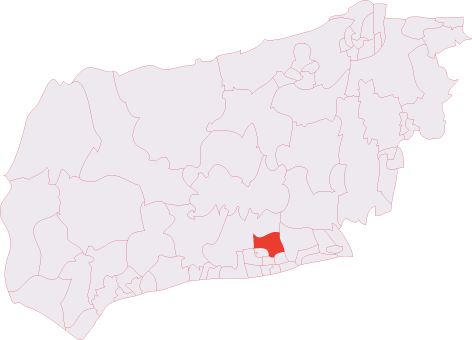
Mill Plantation is located at Grid Ref: TQ1305 (Lat: 50.840363, Lng: -0.38485775)

Administrative County: West Sussex

District: Worthing

Police Authority: Sussex

What 3 Words

///sides.releasing.rejoined. Near Broadwater, West Sussex

Nearby Locations

Salvington Mill Plantation

Related Wikis

Worthing Golf Club

Worthing Golf Club is a golf club on the South Downs at Worthing, England. Located close to the Iron Age hill fort of Cissbury Ring in the new South Downs...

Bohunt School Worthing

Bohunt School Worthing (BSW) is an 11–16 mixed secondary school with academy status in Worthing, West Sussex, England. It was established in September...

Offington

Offington is a neighbourhood of Worthing, in the borough of Worthing in West Sussex, England. It lies on the A2031 road 1.6 miles (2.5 km) northwest of...

Cissbury (electoral division)

Cissbury is an electoral division of West Sussex in the United Kingdom, and returns one member to sit on West Sussex County Council. == Extent == The division...

Salvington

Salvington is a neighbourhood of Worthing, in the borough of Worthing in West Sussex, England. It lies south of the A27 road two miles (3 km) north-west...

Worthing United F.C.

Worthing United Football Club is a football club based in Worthing, England. Established in 1988 by a merger of Wigmore Athletic and Southdown, they are...

Broadwater, West Sussex

Broadwater is a neighbourhood of Worthing, in the borough of Worthing in West Sussex, England. Situated between the South Downs and the English Channel...

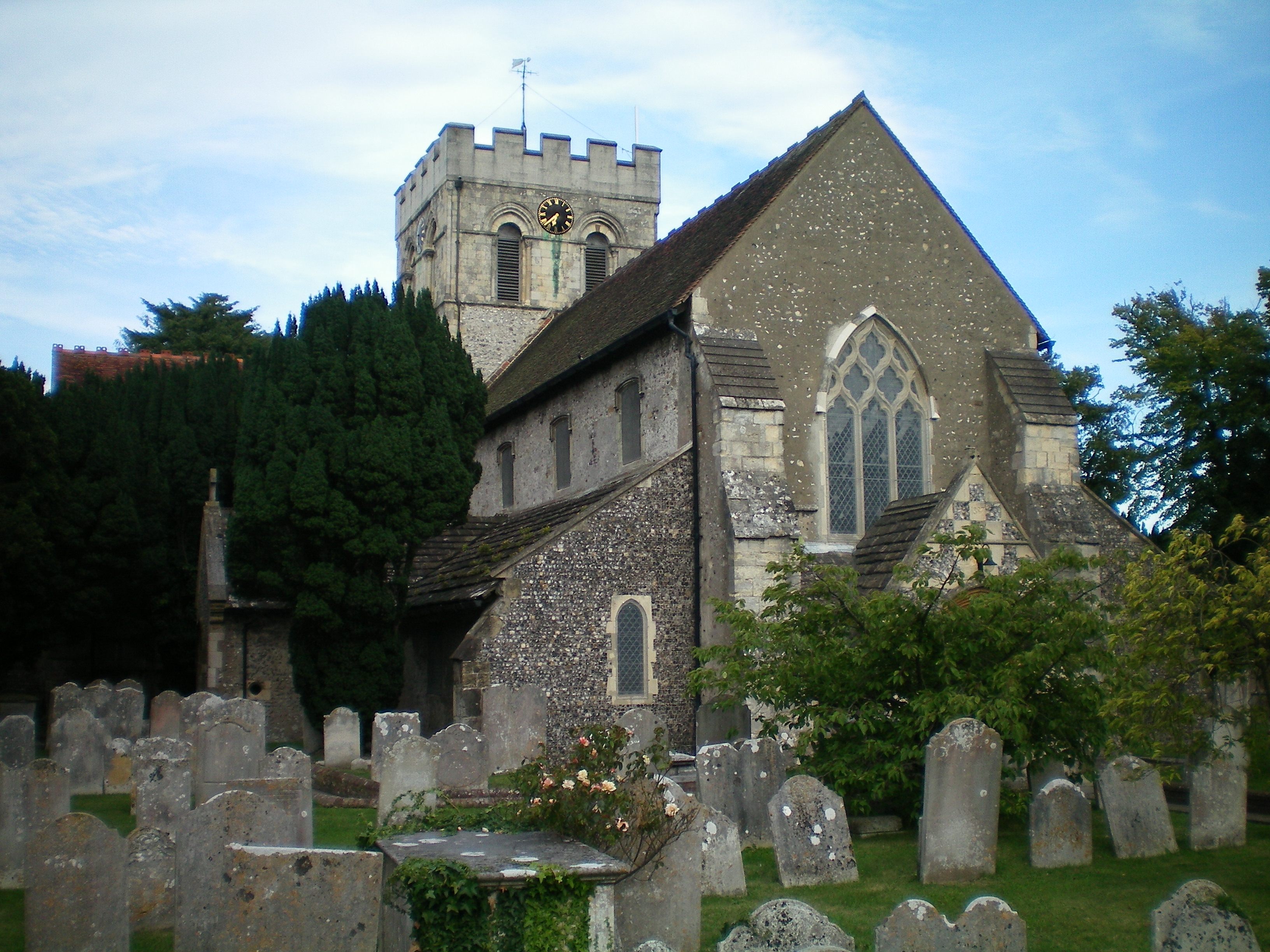
St Mary's Church, Broadwater

St. Mary's Church, Broadwater, is a Church of England parish church in the Worthing Deanery of the Diocese of Chichester. It serves the ecclesiastical...

Nearby Amenities

Located within 500m of 50.840363,-0.38485775
Turning Circle
Source: bing
Lat/Long: 50.8373727/-0.3856597
Traffic Calming: hump
Lat/Long: 50.8411701/-0.3895327
Traffic Calming: hump
Lat/Long: 50.8415169/-0.3888858
Bus Stop
Hillside Avenue
Bench: yes
Naptan AtcoCode: 4400WO0128
Naptan Bearing: SE
Naptan CommonName: Hillside Avenue
Naptan Indicator: adj
Naptan Landmark: Hillside Avenue
Naptan NaptanCode: wsxdmtjg
Naptan ShortCommonName: Hillside Avenue
Naptan Street: Warren Road
Naptan Verified: no
Public Transport: platform
Shelter: no
Source: naptan_import
Lat/Long: 50.8363407/-0.385557
Bus Stop
Hillside Avenue
Naptan AtcoCode: 4400WO0129
Naptan Bearing: NW
Naptan CommonName: Hillside Avenue
Naptan Indicator: opp
Naptan Landmark: Hillside Avenue
Naptan NaptanCode: wsxdmtjm
Naptan ShortCommonName: Hillside Avenue
Naptan Street: Warren Road
Naptan Verified: no
Public Transport: platform
Source: naptan_import
Lat/Long: 50.8366965/-0.3865787
Bus Stop
Offington Drive
Naptan AtcoCode: 4400WO0130
Naptan Bearing: E
Naptan CommonName: Offington Drive
Naptan Indicator: o/s 116
Naptan Landmark: Worthing Golf Club
Naptan NaptanCode: wsxdmtjp
Naptan Street: Warren Road
Naptan Verified: no
Public Transport: platform
Source: naptan_import
Lat/Long: 50.8380065/-0.3885304
Bus Stop
Offington Drive
Naptan AtcoCode: 4400WO0131
Naptan Bearing: W
Naptan CommonName: Offington Drive
Naptan Indicator: o/s 105
Naptan Landmark: Offington Drive
Naptan NaptanCode: wsxdmtjt
Naptan Street: Warren Road
Naptan Verified: no
Public Transport: platform
Source: naptan_import
Lat/Long: 50.8381201/-0.3891808
Barrier: bollard
Lat/Long: 50.8374631/-0.3803847
Traffic Calming: hump
Lat/Long: 50.8420228/-0.3874484
Generator Method: photovoltaic
Generator Output Electricity: yes
Generator Source: solar
Generator Type: solar_photovoltaic_panel
Location: roof
Power: generator
Lat/Long: 50.8379483/-0.3827409
Generator Method: photovoltaic
Generator Output Electricity: yes
Generator Source: solar
Generator Type: solar_photovoltaic_panel
Location: roof
Power: generator
Lat/Long: 50.8379167/-0.3829906
Generator Method: photovoltaic
Generator Output Electricity: yes
Generator Source: solar
Generator Type: solar_photovoltaic_panel
Location: roof
Power: generator
Lat/Long: 50.8376364/-0.3869342
Post Box
Collection Plate: CP1D
Collection Times: Mo-Fr 09:00; Sa 07:00
Last Checked: 2020-12-04
Note: This postbox is set back from the road near the bushes.
Operator: Royal Mail
Operator Wikidata: Q638098
Post Box Mounting: brick_pillar
Post Box Type: wall
Ref: BN14 1776D
Royal Cypher: GR
Royal Cypher Wikidata: Q33102273
Source: survey
Lat/Long: 50.8365009/-0.3856428
Golf: pin
Lat/Long: 50.8420362/-0.3893161
Golf: pin
Lat/Long: 50.843694/-0.3890937
Golf: pin
Lat/Long: 50.8432748/-0.3859524
Golf: pin
Lat/Long: 50.8445446/-0.3839542
Golf: pin
Lat/Long: 50.8433248/-0.3834418
Golf: pin
Lat/Long: 50.8393676/-0.3864966
Golf: pin
Lat/Long: 50.8422501/-0.3866045
Golf: pin
Lat/Long: 50.8410832/-0.3890852
Golf: pin
Lat/Long: 50.8388925/-0.3878028
The data included in this document is from www.openstreetmap.org. The data is made available under ODbL.

Have you been to Mill Plantation?

Leave your review of Mill Plantation below (or comments, questions and feedback).