Woodhams Shaw

Wood, Forest in Surrey Mole Valley

England

Woodhams Shaw

The Sussex Border Path at the junction with the A29 The path uses the drive to Denne Farm.
This is in West Sussex.
The Sussex Border Path at the junction with the A29 Credit: Shazz

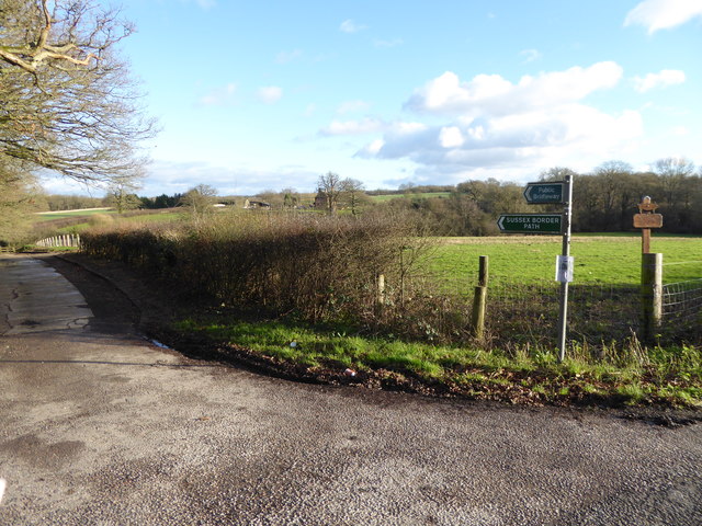
Woodhams Shaw is a small forested area located in Surrey, England. Covering an area of approximately 20 acres, it is known for its dense woodland and picturesque scenery. The forest is located near the town of Woking and is easily accessible by car or foot.

Woodhams Shaw is predominantly made up of deciduous trees, including species such as oak, birch, and beech. The forest floor is covered in a rich carpet of moss, ferns, and wildflowers, creating a diverse and vibrant ecosystem. The trees provide a habitat for a wide range of wildlife, including birds, squirrels, and various insect species.

The forest is a popular destination for nature lovers and outdoor enthusiasts. It offers numerous walking trails and paths, allowing visitors to explore the area and enjoy the tranquility of the surroundings. There is also a designated picnic area, where visitors can relax and enjoy a meal amidst the natural beauty of the forest.

Woodhams Shaw is well-maintained, with regular tree maintenance and conservation efforts taking place. The local authorities work to preserve the natural habitat and protect the wildlife that calls the forest home.

Overall, Woodhams Shaw in Surrey is a charming woodland area that provides a peaceful escape from the hustle and bustle of everyday life. Its natural beauty and diverse ecosystem make it an ideal location for nature enthusiasts and those seeking a serene outdoor experience.

If you have any feedback on the listing, please let us know in the comments section below.

Woodhams Shaw Images

Images are sourced within 2km of 51.125201/-0.39026278 or Grid Reference TQ1237. Thanks to Geograph Open Source API. All images are credited.

The Sussex Border Path at the junction with the A29 The path uses the drive to Denne Farm.
This is in West Sussex.
The Sussex Border Path at the junction with the A29
The path uses the drive to Denne Farm. This is in West Sussex.
Monks Lane going south The buildings at Monks Farm are in the background.
This is in West Sussex.
Monks Lane going south
The buildings at Monks Farm are in the background. This is in West Sussex.
Monks Lane going north This is in West Sussex.
Monks Lane going north
This is in West Sussex.
Stane Street north of Monks Farm This is in West Sussex.
Stane Street north of Monks Farm
This is in West Sussex.
Stane Street passes barn north of Monks Farm See <a title="https://www.geograph.org.uk/photo/2724380" href="https://www.geograph.org.uk/photo/2724380">Link</a> for a view the other way.
This is in West Sussex.
Stane Street passes barn north of Monks Farm
See Link for a view the other way. This is in West Sussex.
Standon Lane, Ockley Going over the brook
Standon Lane, Ockley
Going over the brook
Brook by Standon Lane, Ockley
Cottage on Standon Lane, Leith Vale
Standon Lane at the junction of Church Lane
Standon Lane, Walliswood
Woods by Standon Lane, Walliswood
The entrance to Standon Stables, Leith Vale
Standon Lane, Ockley
Pisley Lane, Ockley
Pisley Lane, Ockley
Houses on Standon Lane, Ockley
Standon Lane, Ockley
The Black and White Cottage, Ockley Situated in the Hannah Peschar Sculpture Garden, this 15th century Grade II listed cottage is set in 10 acres of garden designed by Anthony Paul. The garden is open to the public during the summer months with admission charges.
The Black and White Cottage, Ockley
Situated in the Hannah Peschar Sculpture Garden, this 15th century Grade II listed cottage is set in 10 acres of garden designed by Anthony Paul. The garden is open to the public during the summer months with admission charges.
Sculpture in the Hannah Peschar Sculpture Garden, Ockley By a path between the reception area and the Black and White Cottage in the 10 acres of garden designed by Anthony Paul. The garden is open to the public during the summer months with admission charges.
Sculpture in the Hannah Peschar Sculpture Garden, Ockley
By a path between the reception area and the Black and White Cottage in the 10 acres of garden designed by Anthony Paul. The garden is open to the public during the summer months with admission charges.
Show me another place!

Woodhams Shaw is located at Grid Ref: TQ1237 (Lat: 51.125201, Lng: -0.39026278)

Administrative County: Surrey

District: Mole Valley

Police Authority: Surrey

What 3 Words

///lizards.tall.hazelnuts. Near Ewhurst, Surrey

Related Wikis

Stane Street (Chichester)

Stane Street is the modern name of the 91 km-long (57 mi) Roman road in southern England that linked Londinium (London) to Noviomagus Reginorum (Chichester...

Wallis Wood

Wallis Wood is a 14-hectare (35-acre) nature reserve south-east of Ewhurst in Surrey. It is managed by the Surrey Wildlife Trust.A stream runs through...

Smokejack Clay Pit

Smokejack Clay Pit is a 56-hectare (140-acre) geological Site of Special Scientific Interest east of Cranleigh in Surrey. It is a Geological Conservation...

High Weald AONB

The High Weald Area of Outstanding Natural Beauty is in south-east England. Covering an area of 1,450 square kilometres (560 sq mi), it takes up parts...

Vann Lake and Ockley Woods

Vann Lake and Ockley Woods is a 57.8-hectare (143-acre) biological Site of Special Scientific Interest south of Ockley in Surrey. Vann Lake is part of...

Ockley

Ockley is a rural village in Surrey. It lies astride the A29, the modern road using the alignment of Stane Street (Chichester). The A29 diverges from the...

Baynards Park

Baynards Park is a 2,000 acres (810 ha) estate and site of a demolished country house with extant outbuildings, privately owned, in the south of the parishes...

Auclaye

Auclaye is a 0.6-hectare (1.5-acre) geological Site of Special Scientific Interest south of Capel in Surrey. It is a Geological Conservation Review site...

Nearby Amenities

Located within 500m of 51.125201,-0.39026278
Okewood Hill
Place: village
Lat/Long: 51.1245729/-0.3836729
Rose Hill Farm
Place: farm
Lat/Long: 51.1261924/-0.3962777
Chapel House Farm
Place: farm
Lat/Long: 51.1283291/-0.3932021
Okewood Hill House
Place: isolated_dwelling
Lat/Long: 51.1261924/-0.3888533
Woodhams Farm
Place: farm
Lat/Long: 51.1230186/-0.3857777
Lower Sent
Place: isolated_dwelling
Lat/Long: 51.1265252/-0.3842828
Fountain
Lat/Long: 51.1258262/-0.3871913
Upper Sent
Place: isolated_dwelling
Lat/Long: 51.1256966/-0.3874117
Bus Stop
Okewood Hill
Naptan AtcoCode: 40004408815D
Naptan NaptanCode: surdgdtd
Physically Present: no
Public Transport: platform
Lat/Long: 51.1266377/-0.3897665
Bus Stop
Okewood Hill
Naptan AtcoCode: 40004408815C
Naptan NaptanCode: surdgdta
Physically Present: no
Public Transport: platform
Lat/Long: 51.1267084/-0.3897384
The data included in this document is from www.openstreetmap.org. The data is made available under ODbL.

Have you been to Woodhams Shaw?

Leave your review of Woodhams Shaw below (or comments, questions and feedback).