Askham
Settlement in Nottinghamshire Bassetlaw
England
Askham

Askham is a small village located in Nottinghamshire, England. Situated approximately 10 miles northwest of Newark-on-Trent, it is nestled within the scenic Vale of Trent. The village is part of the civil parish of Sutton-on-Trent and lies near the River Trent.
The population of Askham is relatively small, with around 200 residents as of the latest census. It is a close-knit community with a friendly and welcoming atmosphere. The village is predominantly residential, consisting of a mix of traditional cottages and newer houses.
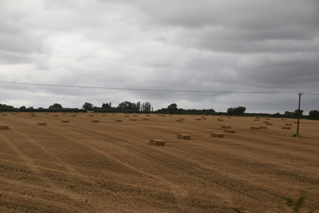
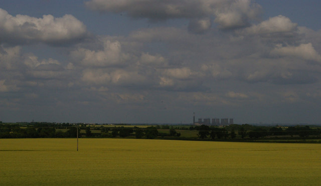
Askham is known for its picturesque surroundings and rural charm. Lush green fields, rolling hills, and meandering streams characterize the landscape, making it an ideal place for nature enthusiasts and walkers. The village benefits from its proximity to the River Trent, offering opportunities for boating and fishing.
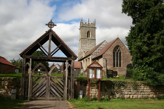
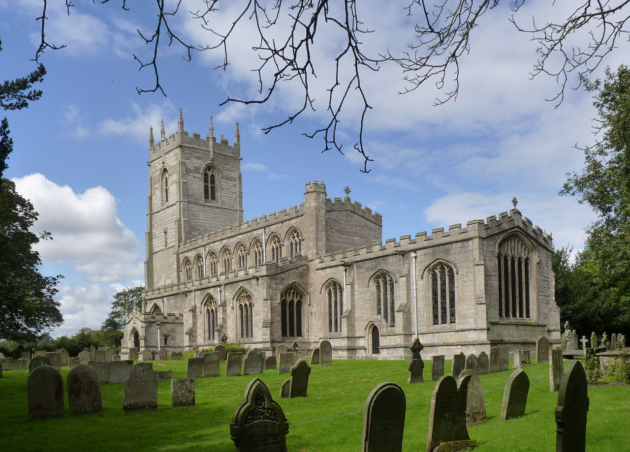
A notable feature of Askham is the St. Nicholas Church, a Grade II listed building. Dating back to the 13th century, the church showcases beautiful architecture and historical significance, attracting visitors interested in heritage and culture.
While not possessing extensive amenities, Askham is conveniently located near the larger town of Newark-on-Trent, which provides a range of services including shops, supermarkets, schools, and healthcare facilities. This proximity allows residents of Askham to enjoy a peaceful village lifestyle while having access to essential amenities just a short distance away.
Overall, Askham offers a tranquil and idyllic setting for those seeking a rural retreat, with its natural beauty, historical landmarks, and tight-knit community spirit.
If you have any feedback on the listing, please let us know in the comments section below.
Askham Images
Images are sourced within 2km of 53.266958/-0.89158 or Grid Reference SK7475. Thanks to Geograph Open Source API. All images are credited.


Askham is located at Grid Ref: SK7475 (Lat: 53.266958, Lng: -0.89158)
Administrative County: Nottinghamshire
District: Bassetlaw
Police Authority: Nottinghamshire
What 3 Words
///affair.dozens.finders. Near East Markham, Nottinghamshire
Related Wikis
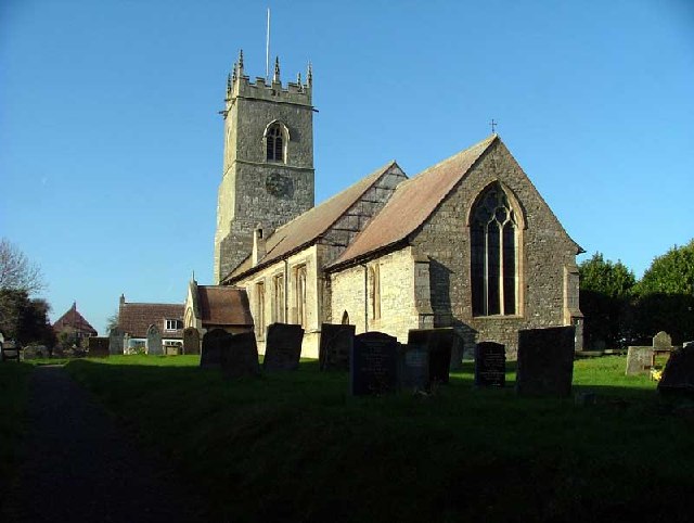
St Nicholas' Church, Askham
St Nicholas' Church, Askham is a parish church in the Church of England in Askham, Nottinghamshire. The church is Grade II* listed by the Department for...
Askham, Nottinghamshire
Askham is a village and civil parish in the Bassetlaw district of Nottinghamshire, England, about six miles south-east of East Retford. According to the...

Upton, Bassetlaw
Upton is a small village in the English county of Nottinghamshire. It is located north of Askham and south of Headon; with the latter it forms the civil...
East Markham
East Markham, historically also known as Great Markham, is a small village and civil parish near Tuxford, Nottinghamshire. The population of the civil...
Nearby Amenities
Located within 500m of 53.266958,-0.89158Have you been to Askham?
Leave your review of Askham below (or comments, questions and feedback).