Askham

Settlement in Westmorland Eden

England

Askham

Cattle, Riddingleys Top
Cattle, Riddingleys Top Credit: Ian Taylor

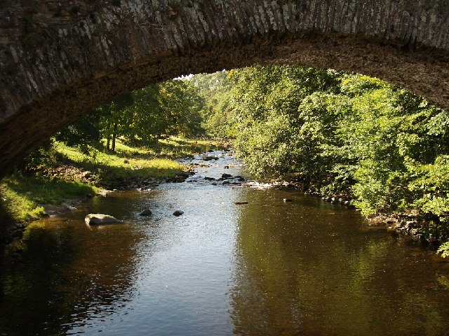
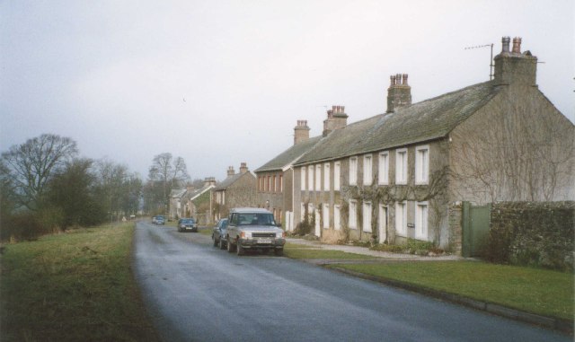
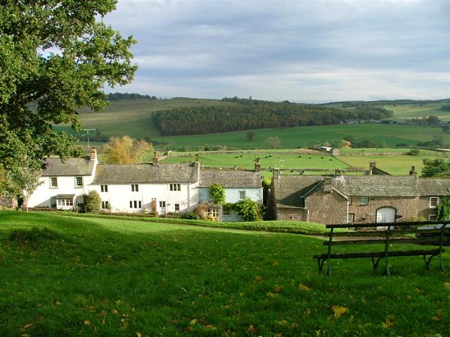
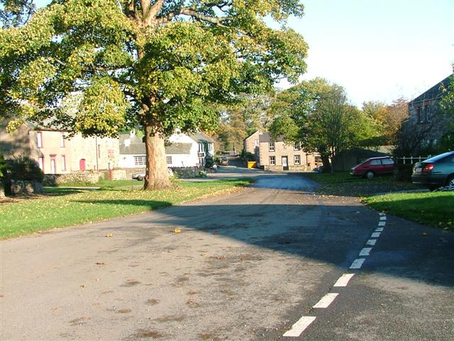
Askham is a small village located in Westmorland, a historic county in the North West of England. Nestled within the picturesque valley of the River Lowther, Askham is situated approximately 5 miles east of Penrith, a popular tourist destination in the region. The village is part of the Eden district in the county of Cumbria.

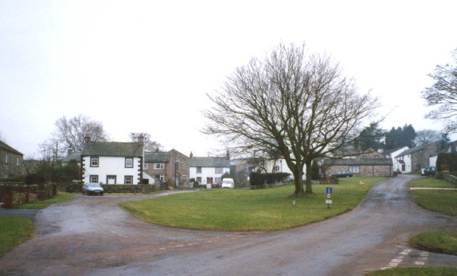
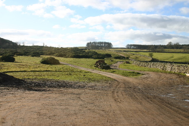
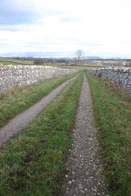
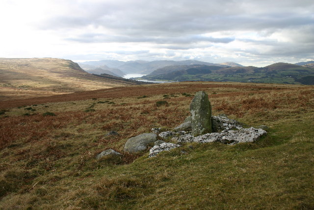
With a population of around 300 residents, Askham exudes a charming and tranquil atmosphere. It is renowned for its scenic beauty and is a popular destination for nature enthusiasts and hikers. The village is surrounded by rolling hills, lush meadows, and dense woodlands, making it an ideal base for exploring the stunning countryside.

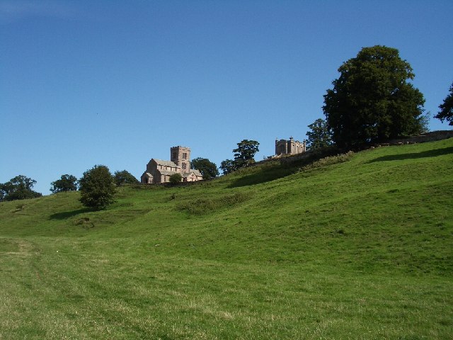
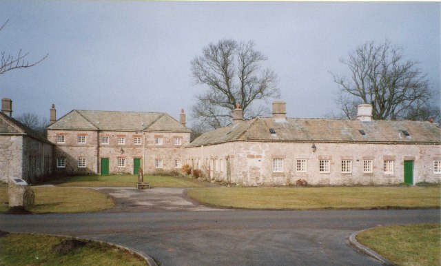
Askham is notable for its historic architecture, particularly Askham Hall, a Grade I listed country house situated in the heart of the village. Dating back to the 14th century, the hall boasts impressive Tudor and medieval features and is now a luxury hotel, renowned for its fine dining and beautiful gardens.

The village also features St. Peter's Church, a Norman building that dates back to the 12th century. This ancient place of worship is adorned with intricate stained glass windows and houses several historical artifacts.

In addition to its natural and architectural attractions, Askham offers a range of amenities including a village shop, a pub, and a tea room, providing visitors and residents with essential services and a taste of local cuisine.

Overall, Askham is a hidden gem in the heart of Westmorland, offering a peaceful retreat for those seeking to immerse themselves in the beauty of the English countryside.

If you have any feedback on the listing, please let us know in the comments section below.

Askham Images

Images are sourced within 2km of 54.607085/-2.756669 or Grid Reference NY5123. Thanks to Geograph Open Source API. All images are credited.

Cattle, Riddingleys Top
Finger post, Riddingleys Top
Fell ponies, Riddingleys Top
Lowther Park Shot when taking a lovely walk along the side of the river Lowther
Lowther Park
Shot when taking a lovely walk along the side of the river Lowther
River Lowther under Low Gardens Bridge
Upper Green, Askham Askham is noted for its large expanse of greens.  They are divided by the road from Penrith to Bampton, and the upper green is smaller and probably less well-known than the lower green, which is by the road leading to the church and Lowther.
Upper Green, Askham
Askham is noted for its large expanse of greens. They are divided by the road from Penrith to Bampton, and the upper green is smaller and probably less well-known than the lower green, which is by the road leading to the church and Lowther.
Newtown, Lowther These estate houses were built next to the Home Farm to replace the old village that was demolished in 1685.  However the 17C houses had hipped roofs, so the terraces in this picture are probably later (19C?).
Newtown, Lowther
These estate houses were built next to the Home Farm to replace the old village that was demolished in 1685. However the 17C houses had hipped roofs, so the terraces in this picture are probably later (19C?).
Helton Village Green
Askham View East From Upper Green
Lowther Castle, Cumbria The most significant feature in this grid square has been the family seat of the Earls of Lonsdale from time immemorial. After the death of the fifth Earl the Castle was abandoned, the interior was dismantled and only the walls left standing as a memorial to past glories.
<span class="nowrap"><a title="http://www.visitcumbria.com/pen/lowthcas.htm" rel="nofollow ugc noopener" href="http://www.visitcumbria.com/pen/lowthcas.htm">Link</a><img style="margin-left:2px;" alt="External link" title="External link - shift click to open in new window" src="https://s1.geograph.org.uk/img/external.png" width="10" height="10"/></span>
Lowther Castle, Cumbria
The most significant feature in this grid square has been the family seat of the Earls of Lonsdale from time immemorial. After the death of the fifth Earl the Castle was abandoned, the interior was dismantled and only the walls left standing as a memorial to past glories. LinkExternal link
Mini Reservoir Not on the scale of Kielder Water, this one measures about 10m across and still holds water, even though long disused.
Mini Reservoir
Not on the scale of Kielder Water, this one measures about 10m across and still holds water, even though long disused.
Stubble Field The Ullswater Fells are in the far distance.
Stubble Field
The Ullswater Fells are in the far distance.
Path Meeting above Askham The bridleway to the right leads onto Askham Fell.
Path Meeting above Askham
The bridleway to the right leads onto Askham Fell.
Mini Reservoir Shown as just a small square on the OS map, this is clearly constructed and has an outflow but none in - being on limestone it is probably a modified rising.
Mini Reservoir
Shown as just a small square on the OS map, this is clearly constructed and has an outflow but none in - being on limestone it is probably a modified rising.
Farmland Between Plantations Grazed by sheep. There are gamebird rearing pens in the woods to the right.
Farmland Between Plantations
Grazed by sheep. There are gamebird rearing pens in the woods to the right.
Mirebank Plantation On the open, wild fells above Askham, this straight-sided plantation looks very out-of-place.
Mirebank Plantation
On the open, wild fells above Askham, this straight-sided plantation looks very out-of-place.
Bridleway Looking over the Eden Valley towards the Pennines and Cross Fell
Bridleway
Looking over the Eden Valley towards the Pennines and Cross Fell
Ponies on Rough Land The grazing here is too poor to support ponies and horses, hence the hay feed. The area is criss-crossed with bridleways, and riding is a popular pastime and industry here.
Ponies on Rough Land
The grazing here is too poor to support ponies and horses, hence the hay feed. The area is criss-crossed with bridleways, and riding is a popular pastime and industry here.
Show me another place!

Askham is located at Grid Ref: NY5123 (Lat: 54.607085, Lng: -2.756669)

Administrative County: Cumbria

District: Eden

Police Authority: Cumbria

What 3 Words

///suspends.strutting.marriage. Near Penrith, Cumbria

Related Wikis

Askham Hall

Askham Hall is a country house near Askham in Cumbria. It is a Grade I listed building. == History == A peel tower was built on the site during the 14th...

Lowther Castle Stead

Lowther Castle Stead is a medieval site in Cumbria, possibly a ringwork castle. Lancaster University Archaeology Unit carried out a survey of the earthworks...

Askham, Cumbria

Askham is a village and civil parish in the Eden district of Cumbria, England. It is in the historic county of Westmorland. According to the 2001 census...
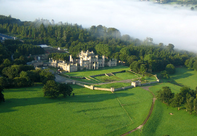
Lowther Castle

Lowther Castle is a country house in the historic county of Westmorland, which now under the current unitary authority of Westmorland and Furness, in the...

Helton, Cumbria

Helton is a village in the Eden district, in the English county of Cumbria. It is about a mile south of the village of Askham. Circa 1870, it had a population...

Lowther, Cumbria

Lowther is a civil parish in Westmorland and Furness, Cumbria. Within the parish are the settlements of Lowther Village, Newtown or Lowther Newtown, Hackthorpe...

Sockbridge and Tirril

Sockbridge and Tirril is a small civil parish in Eden District, Cumbria. It had a population of 397 in 2001, increasing to 415 at the 2011 Census. It comprises...

Heughscar Hill

Heughscar Hill is a hill in the east of the English Lake District, east of Ullswater and north of High Street, Cumbria. It is the subject of a chapter...

Nearby Amenities

Located within 500m of 54.607085,-2.756669
Askham
Is In County: Cumbria
Is In Historic County: Westmorland
Place: village
Source: npe
Lat/Long: 54.6059111/-2.7560341
Post Box
Collection Times: Mo-Fr 16:15; Sa 11:30
Post Box Type: lamp
Ref: CA10 66
Royal Cypher: EIIR
Royal Cypher Wikidata: Q33102113
Lat/Long: 54.6057809/-2.7554067
Defibrillator
Emergency: defibrillator
Indoor: no
Location: outside Askham Stores nest to post box
Ref: AK15
Lat/Long: 54.6057671/-2.7553831
Askham Stores
Addr City: Askham
Addr Postcode: CA10 2PG
Fhrs Id: 306918
Image: https://www.geograph.org.uk/photo/4024251
Shop: convenience
Lat/Long: 54.6058126/-2.7552953
Barrier: stile
Material: stone
Source: survey;gps
Stile: stepover
Lat/Long: 54.6049732/-2.7582804
Entrance: main
Lat/Long: 54.6063841/-2.7551601
Entrance: secondary
Lat/Long: 54.6061654/-2.7551747
Give Way
Direction: backward
Lat/Long: 54.6058664/-2.7556241
Give Way
Direction: backward
Lat/Long: 54.6057153/-2.7552572
Give Way
Direction: backward
Lat/Long: 54.6058422/-2.7557369
Give Way
Direction: forward
Lat/Long: 54.6058226/-2.7561056
Give Way
Direction: backward
Lat/Long: 54.6057215/-2.7573676
Give Way
Direction: forward
Lat/Long: 54.6057073/-2.7571142
Give Way
Direction: backward
Lat/Long: 54.6056579/-2.7571399
Give Way
Direction: backward
Lat/Long: 54.6055344/-2.7550121
Board Type: notice
Information: board
Tourism: information
Lat/Long: 54.6057284/-2.7556633
Tourism: information
Lat/Long: 54.605733/-2.7557233
Direction: S
Generator Method: photovoltaic
Generator Output Electricity: yes
Generator Source: solar
Generator Type: solar_photovoltaic_panel
Location: roof
Power: generator
Lat/Long: 54.6057709/-2.7588073
Direction: SSE
Generator Method: photovoltaic
Generator Output Electricity: yes
Generator Source: solar
Generator Type: solar_photovoltaic_panel
Location: roof
Power: generator
Lat/Long: 54.6070101/-2.7557509
Direction: SSE
Generator Method: photovoltaic
Generator Output Electricity: yes
Generator Source: solar
Generator Type: solar_photovoltaic_panel
Location: roof
Power: generator
Lat/Long: 54.6057/-2.75353
The Health Barn
Addr City: Askham
Addr Housename: Holly House Barn
Addr Postcode: CA10 2PG
Healthcare: therapist
Shop: massage
Lat/Long: 54.6060226/-2.7560723
Telephone
Booth: K6
Covered: booth
Image: https://www.geograph.org.uk/photo/5021712
Listed Status: Grade II
Wikidata: Q26438413
Lat/Long: 54.6057327/-2.7555942
Grit Bin
Lat/Long: 54.605642/-2.7551423
Bench
Lat/Long: 54.6068382/-2.7523273
Leisure: outdoor_seating
Lat/Long: 54.6070914/-2.7505866
Power: pole
Lat/Long: 54.6048395/-2.7609028
Power: pole
Lat/Long: 54.6049975/-2.7587022
Power: pole
Lat/Long: 54.6050649/-2.7563629
Power: pole
Lat/Long: 54.6052553/-2.7552201
Power: pole
Lat/Long: 54.604811/-2.7565217
Power: pole
Lat/Long: 54.6044405/-2.7568304
Power: pole
Lat/Long: 54.6035117/-2.7575125
Power: pole
Lat/Long: 54.6027526/-2.7581163
The data included in this document is from www.openstreetmap.org. The data is made available under ODbL.

Have you been to Askham?

Leave your review of Askham below (or comments, questions and feedback).