Askett

Settlement in Buckinghamshire

England

Askett

A landfill waste train approaching Little Kimble Station Class 66 No. 66148 approaches Little Kimble with a train of landfill wagons headed for the disposal site at Calvert, north of Aylesbury.  These trains run every day, bringing spoil from the London area to fill the old claypits.
A landfill waste train approaching Little Kimble Station Credit: Bob Walters

Askett is a small village located in the county of Buckinghamshire, England. Situated about 3 miles west of Princes Risborough, it falls within the Wycombe district. The village is surrounded by picturesque countryside and has a population of approximately 300 residents.

Historically, Askett was an agricultural community, and evidence of its rural past can still be seen in the surrounding landscape. The village is known for its charming cottages and traditional buildings, which add to its quaint and peaceful atmosphere. The local economy has shifted from agriculture to a mix of residential and small-scale businesses.

Despite its small size, Askett benefits from its proximity to larger towns and cities. Princes Risborough, with its amenities and train station, is easily accessible, providing residents with convenient transport links to London and other major cities.

Residents and visitors can enjoy the tranquility of the surrounding countryside, which offers opportunities for walking, cycling, and exploring nature. The nearby Chiltern Hills provide stunning views and picturesque trails.

Askett is also home to a community center, which hosts various events and activities throughout the year. The village has a primary school, ensuring educational facilities for local children.

In summary, Askett is a charming and peaceful village in Buckinghamshire, offering a rural lifestyle with easy access to larger towns and cities. Its picturesque setting and community spirit make it an attractive place to live or visit.

If you have any feedback on the listing, please let us know in the comments section below.
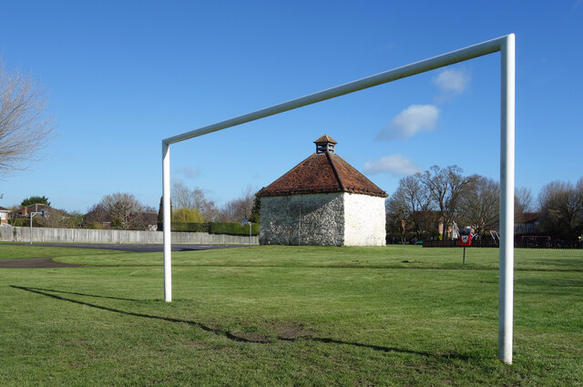
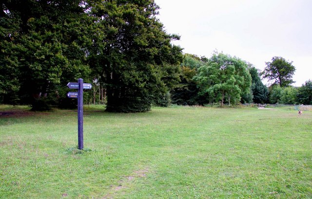
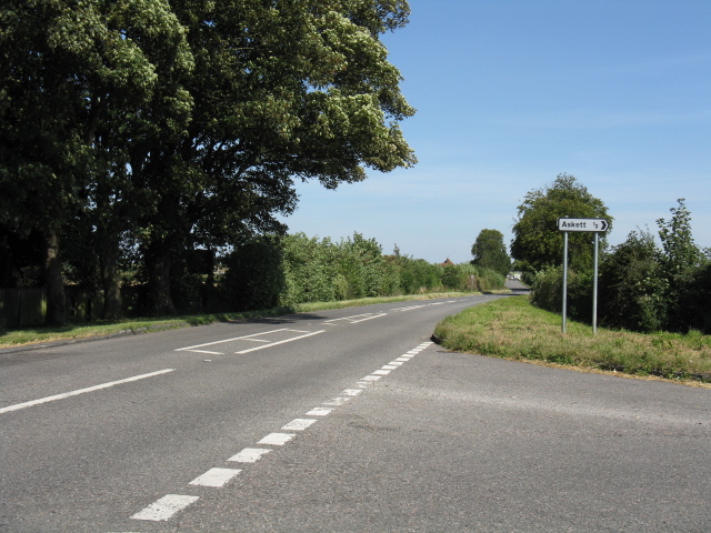
Askett Images

Images are sourced within 2km of 51.738291/-0.82183 or Grid Reference SP8105. Thanks to Geograph Open Source API. All images are credited.

A landfill waste train approaching Little Kimble Station Class 66 No. 66148 approaches Little Kimble with a train of landfill wagons headed for the disposal site at Calvert, north of Aylesbury.  These trains run every day, bringing spoil from the London area to fill the old claypits.
A landfill waste train approaching Little Kimble Station
Class 66 No. 66148 approaches Little Kimble with a train of landfill wagons headed for the disposal site at Calvert, north of Aylesbury. These trains run every day, bringing spoil from the London area to fill the old claypits.
Railway line towards Princes Risborough A view towards Princes Risborough from the railway bridge at Askett.
Railway line towards Princes Risborough
A view towards Princes Risborough from the railway bridge at Askett.
Decorated Pillar Box, Princes Risborough Situated in High Street HP27 0AX, this pillar box is decorated on top with knitted woolly items relating to Christmas. These include a Christmas Tree with a star on top, father Christmas and a Snowman. They will probably be removed after Christmas.
Decorated Pillar Box, Princes Risborough
Situated in High Street HP27 0AX, this pillar box is decorated on top with knitted woolly items relating to Christmas. These include a Christmas Tree with a star on top, father Christmas and a Snowman. They will probably be removed after Christmas.
North End of Whiteleaf Hill The tree ahead, like a lot round here, has thick ivy covering it's lower trunk.
Whiteleaf Hill Local Nature Reserve is one of 12 sites managed in the Chilterns by the Chiltern Society charity. Brush Hill Local Nature Reserve, another one of theirs, is situated adjacent to this one, on the other side of Peters Lane, the road leading up here from Monks Risborough.
The Chilterns are chalk hills situated NorthWest of London, covering an area of about 700 square miles, that run from NorthEast to Southwest. They drop steeply on the North side, and more gradually on the South towards the River Thames. The steep slopes to the North give rise to the range sometimes getting called the Chiltern Scarp or Escarpment. About half their area is designated as an Area of Outstanding Beauty.
North End of Whiteleaf Hill
The tree ahead, like a lot round here, has thick ivy covering it's lower trunk. Whiteleaf Hill Local Nature Reserve is one of 12 sites managed in the Chilterns by the Chiltern Society charity. Brush Hill Local Nature Reserve, another one of theirs, is situated adjacent to this one, on the other side of Peters Lane, the road leading up here from Monks Risborough. The Chilterns are chalk hills situated NorthWest of London, covering an area of about 700 square miles, that run from NorthEast to Southwest. They drop steeply on the North side, and more gradually on the South towards the River Thames. The steep slopes to the North give rise to the range sometimes getting called the Chiltern Scarp or Escarpment. About half their area is designated as an Area of Outstanding Beauty.
Farmland, Great Kimble A pleasingly shaped oak in a boundary between arable fields as viewed from the bridleway to the north of Hollytree Farm.
Farmland, Great Kimble
A pleasingly shaped oak in a boundary between arable fields as viewed from the bridleway to the north of Hollytree Farm.
Duke Street, Princes Risborough
Market Square, Princes Risborough I think this may have been inspired by Trumpton, or vice versa.
Market Square, Princes Risborough
I think this may have been inspired by Trumpton, or vice versa.
Market Square, Princes Risborough
St Mary's Church, Princes Risborough
Court Close, Princes Risborough
Longwick Road, Princes Risborough At the end of Alscot Lane.
Longwick Road, Princes Risborough
At the end of Alscot Lane.
Tree on Longwick Road, Princes Risborough
Dovecote in the Park An ancient dovecote thought to date from the 16th century is all that remains of Place Farm, demolished in the 1970s.
Now it stands isolated in St Dunstan's Recreation Ground.
Listing details on <span class="nowrap"><a title="https://historicengland.org.uk/listing/the-list/list-entry/1125788?section=official-list-entry" rel="nofollow ugc noopener" href="https://historicengland.org.uk/listing/the-list/list-entry/1125788?section=official-list-entry">Link</a><img style="margin-left:2px;" alt="External link" title="External link - shift click to open in new window" src="https://s1.geograph.org.uk/img/external.png" width="10" height="10"/></span>
Dovecote in the Park
An ancient dovecote thought to date from the 16th century is all that remains of Place Farm, demolished in the 1970s. Now it stands isolated in St Dunstan's Recreation Ground. Listing details on LinkExternal link
Basketball Court, St Dunstan's Park Part of a recreation ground in Monk's Risborough.
Basketball Court, St Dunstan's Park
Part of a recreation ground in Monk's Risborough.
Outdoor Gym, St Dunstan's Park
Princes Risborough : toposcope, Brush Hill Local Nature Reserve
The lane from Meadle to Ford A minor road north of Princes Risborough.
The lane from Meadle to Ford
A minor road north of Princes Risborough.
St Mary's Church, Princes Risborough
Show me another place!

Askett is located at Grid Ref: SP8105 (Lat: 51.738291, Lng: -0.82183)

Unitary Authority: Buckinghamshire

Police Authority: Thames Valley

What 3 Words

///flick.enchanted.seaside. Near Princes Risborough, Buckinghamshire

Nearby Locations

Askett

Related Wikis

Monks Risborough railway station

Monks Risborough railway station is a small, single platform railway station of the village of Monks Risborough in Buckinghamshire, England. The station...

Monks Risborough

Monks Risborough is a village and ecclesiastical parish in Buckinghamshire, England, lying between Princes Risborough and Great Kimble. The village lies...

Whiteleaf, Buckinghamshire

Whiteleaf is a hamlet in the civil parish of Princes Risborough and the ecclesiastical parish of Monks Risborough in Buckinghamshire, England. It is...

Askett

Askett is a picturesque hamlet in the civil parish of Princes Risborough, Buckinghamshire, England. It is situated where the steep escarpment of the Chiltern...

Nearby Amenities

Located within 500m of 51.738291,-0.82183
Monks Risborough
Place: village
Source: NPE
Wikidata: Q6900949
Wikipedia: en:Monks Risborough
Lat/Long: 51.7342875/-0.8228185
Pub
The Three Crowns
Addr City: Askett
Addr Postcode: HP27 9LT
Fhrs Id: 576429
Phone: +44 1844 347166
Website: https://www.thethreecrownsaskett.co.uk/
Lat/Long: 51.7396658/-0.8194218
Askett
Created By: Potlatch 0.10f
Place: village
Wikidata: Q4807182
Lat/Long: 51.7400112/-0.8206664
Post Box
Brand: Royal Mail
Brand Wikidata: Q638098
Brand Wikipedia: en:Royal Mail
Collection Times: Mo-Fr 16:15; Sa 10:30
Operator: Royal Mail
Operator Wikidata: Q638098
Post Box Type: lamp
Ref: HP27 110
Royal Cypher: EIIR
Royal Cypher Wikidata: Q33102113
Source: survey
Survey Date: 2015-10-22
Lat/Long: 51.7390755/-0.8178948
Railway: crossing
Lat/Long: 51.7383436/-0.8270744
Barrier: kissing_gate
Lat/Long: 51.7371753/-0.8209705
Traffic Calming: island
Lat/Long: 51.7386528/-0.8159636
Post Box
Brand: Royal Mail
Brand Wikidata: Q638098
Brand Wikipedia: en:Royal Mail
Collection Times: Mo-Fr 09:00; Sa 07:00
Operator: Royal Mail
Operator Wikidata: Q638098
Post Box Type: lamp
Ref: HP27 111D
Royal Cypher: EIIR
Royal Cypher Wikidata: Q33102113
Source: survey
Survey Date: 2015-10-22
Lat/Long: 51.7393744/-0.8219082
Barrier: kissing_gate
Lat/Long: 51.7383163/-0.8270121
Barrier: kissing_gate
Railway: level_crossing
Lat/Long: 51.738403/-0.8272118
Bus Stop
Bus: yes
Public Transport: platform
Shelter: yes
Lat/Long: 51.7393257/-0.8149678
Graham's Garage Services
Service: repair
Shop: car_repair
Website: https://www.grahamsgarageservices.co.uk/
Lat/Long: 51.7373832/-0.8183728
Direction: 210
Generator Method: photovoltaic
Generator Output Electricity: yes
Generator Solar Modules: 6
Generator Source: solar
Generator Type: solar_photovoltaic_panel
Location: roof
Power: generator
Lat/Long: 51.7345119/-0.8241792
Direction: 210
Generator Method: photovoltaic
Generator Output Electricity: yes
Generator Solar Modules: 6
Generator Source: solar
Generator Type: solar_photovoltaic_panel
Location: roof
Power: generator
Lat/Long: 51.7345316/-0.824232
Direction: 210
Generator Method: photovoltaic
Generator Output Electricity: yes
Generator Solar Modules: 6
Generator Source: solar
Generator Type: solar_photovoltaic_panel
Location: roof
Power: generator
Lat/Long: 51.7345491/-0.8242715
Direction: 210
Generator Method: photovoltaic
Generator Output Electricity: yes
Generator Solar Modules: 6
Generator Source: solar
Generator Type: solar_photovoltaic_panel
Location: roof
Power: generator
Lat/Long: 51.7345674/-0.824322
Direction: 210
Generator Method: photovoltaic
Generator Output Electricity: yes
Generator Solar Modules: 6
Generator Source: solar
Generator Type: solar_photovoltaic_panel
Location: roof
Power: generator
Lat/Long: 51.7345848/-0.8243726
Direction: 210
Generator Method: photovoltaic
Generator Output Electricity: yes
Generator Solar Modules: 5
Generator Source: solar
Generator Type: solar_photovoltaic_panel
Location: roof
Power: generator
Lat/Long: 51.734427/-0.8245609
Direction: 210
Generator Method: photovoltaic
Generator Output Electricity: yes
Generator Solar Modules: 5
Generator Source: solar
Generator Type: solar_photovoltaic_panel
Location: roof
Power: generator
Lat/Long: 51.7343866/-0.8244497
Direction: 210
Generator Method: photovoltaic
Generator Output Electricity: yes
Generator Solar Modules: 5
Generator Source: solar
Generator Type: solar_photovoltaic_panel
Location: roof
Power: generator
Lat/Long: 51.734359/-0.824375
Direction: 210
Generator Method: photovoltaic
Generator Output Electricity: yes
Generator Solar Modules: 5
Generator Source: solar
Generator Type: solar_photovoltaic_panel
Location: roof
Power: generator
Lat/Long: 51.7343418/-0.8243327
Direction: 210
Generator Method: photovoltaic
Generator Output Electricity: yes
Generator Solar Modules: 32
Generator Source: solar
Generator Type: solar_photovoltaic_panel
Location: roof
Power: generator
Lat/Long: 51.7393949/-0.8204018
The data included in this document is from www.openstreetmap.org. The data is made available under ODbL.

Have you been to Askett?

Leave your review of Askett below (or comments, questions and feedback).