Evedon Wood
Wood, Forest in Lincolnshire North Kesteven
England
Evedon Wood

Evedon Wood is a beautiful woodland located in Lincolnshire, England. Covering an area of approximately 50 acres, this enchanting forest is known for its serene and tranquil atmosphere. It is situated near the village of Evedon, just a few miles away from the market town of Sleaford.
The wood is predominantly made up of native broadleaf trees such as oak, ash, and beech, creating a diverse and vibrant ecosystem. The dense foliage provides a haven for a variety of wildlife, including birds, squirrels, and deer. Walking through the wood, visitors can enjoy the melodious songs of birds and the rustling of leaves underfoot.
Evedon Wood offers a network of well-maintained footpaths and trails, allowing visitors to explore its natural beauty at their own pace. These pathways wind through the forest, leading to hidden clearings and peaceful spots perfect for picnics or quiet contemplation. The wood also features a small stream that adds to its charm, meandering through the trees and providing a source of water for the local wildlife.
The wood is a popular destination for nature lovers, hikers, and photographers. Its stunning scenery and unspoiled environment make it an ideal place for capturing the beauty of nature through the lens. Evedon Wood is also a designated Site of Special Scientific Interest (SSSI), highlighting its ecological significance and the need for its preservation.
Overall, Evedon Wood is a hidden gem in Lincolnshire that offers a peaceful retreat from the hustle and bustle of everyday life. It is a place where nature thrives, and visitors can immerse themselves in the tranquility of the forest.
If you have any feedback on the listing, please let us know in the comments section below.
Evedon Wood Images
Images are sourced within 2km of 53.021042/-0.34656455 or Grid Reference TF1148. Thanks to Geograph Open Source API. All images are credited.


![Bridge carrying Park Lane over the River Slea [Sleaford Navigation] Built in 1893, after this section of the river navigation had closed, and Grade 2 listed.](https://s3.geograph.org.uk/geophotos/06/58/09/6580931_05e50d25.jpg)

![River Slea [Sleaford Navigation] above Haverholme Lock The iron fittings for the top gates of the lock are in the foreground. The Sleaford Navigation is a canalised section of the River Slea. It opened in May 1794. There were seven locks, each 60 ft long and 15 ft wide [18.3 x 4.6m]. Coal came into Sleaford from all over the East Midlands, and grain went out, mainly to Nottinghamshire. Boats stopped using this section in 1881, but the Sleaford Navigation Trust is now seeking to restore the navigation.](https://s1.geograph.org.uk/geophotos/06/58/09/6580937_cd338dcc.jpg)
![Haverholme Lock, Sleaford Navigation The Sleaford Navigation is a canalised section of the River Slea. It opened in May 1794. There were seven locks, each 60 ft long and 15 ft wide [18.3 x 4.6m]. Coal came into Sleaford from all over the East Midlands, and grain went out, mainly to Nottinghamshire. Boats stopped using this section in 1881, but the Sleaford Navigation Trust is now seeking to restore the navigation.](https://s0.geograph.org.uk/geophotos/06/58/09/6580996_1c3001df.jpg)
Evedon Wood is located at Grid Ref: TF1148 (Lat: 53.021042, Lng: -0.34656455)
Administrative County: Lincolnshire
District: North Kesteven
Police Authority: Lincolnshire
What 3 Words
///training.immediate.mission. Near Ruskington, Lincolnshire
Nearby Locations
Related Wikis

Sleaford Rural District
Sleaford was a rural district in Lincolnshire, Parts of Kesteven, England, from 1894 to 1931. It was created by the Local Government Act 1894 based on...

Haverholme
Haverholme is a hamlet and site of Haverholme Priory in the North Kesteven district of Lincolnshire, England. It is situated about 4 miles (6 km) north...
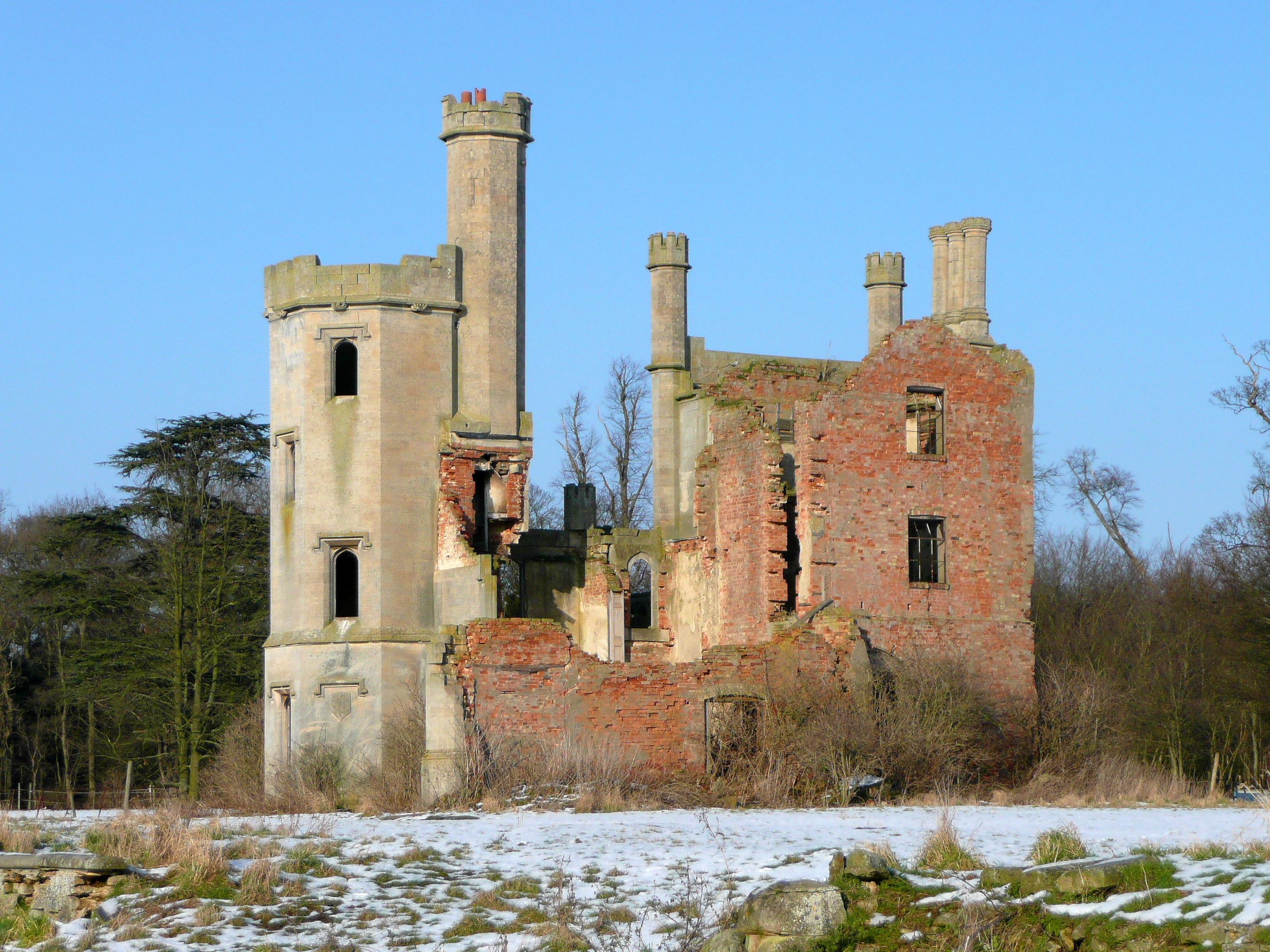
Haverholme Priory
Haverholme Priory was a monastery in Lincolnshire, England. Its remains are situated 4 miles (6 km) north-east of the town of Sleaford and less than 1...
Ewerby and Evedon
Ewerby and Evedon is a civil Parish in North Kesteven, Lincolnshire, England. It includes the villages of Ewerby and Evedon, the hamlet of Haverholme,...

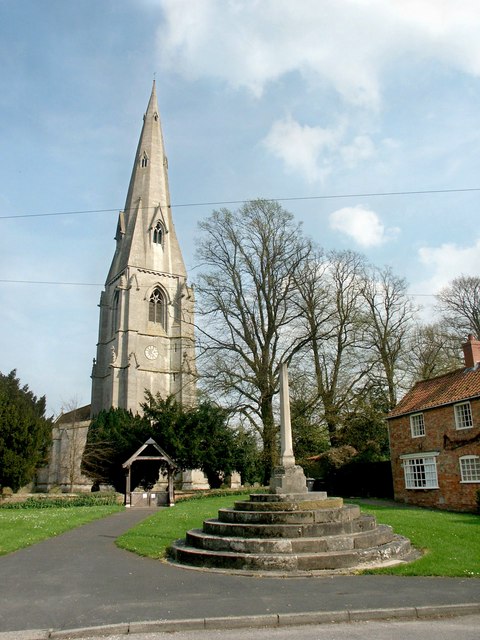
Evedon
Evedon is a village in the North Kesteven district of Lincolnshire, England. It is situated 2 miles (3.2 km) north-east from the town of Sleaford. In 1885...
Ewerby
Ewerby is a village in the North Kesteven district of Lincolnshire, England. It lies 3 miles (4.8 km) north-east from Sleaford and 2 miles (3.2 km) south...

Anwick
Anwick is a small village and civil parish in the North Kesteven district of Lincolnshire, England. The population of the civil parish at the 2011 census...
East Kesteven Rural District
East Kesteven was a rural district in Lincolnshire, Parts of Kesteven from 1931 to 1974. It was formed under a County Review Order, by the merger of most...
Have you been to Evedon Wood?
Leave your review of Evedon Wood below (or comments, questions and feedback).