Wellfield Spring

Wood, Forest in Hertfordshire St. Albans

England

Wellfield Spring

Toms Lane, Bedmond Toms Lane approaching the centre of Bedmond, a village in west Hertfordshire.
Toms Lane, Bedmond Credit: Malc McDonald

Wellfield Spring is a picturesque woodland located in Hertfordshire, England. Covering an area of approximately 100 hectares, it offers a tranquil retreat for nature lovers and outdoor enthusiasts alike. The woodland is situated in the southeast of the county, near the town of Welwyn Garden City.

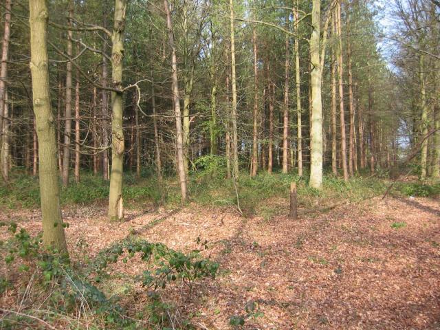
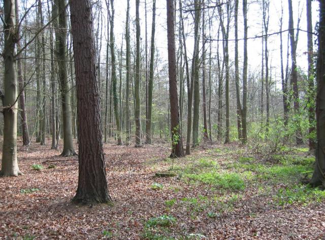
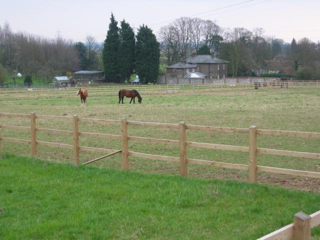
Wellfield Spring is known for its diverse range of flora and fauna, making it a haven for wildlife. The woodland is characterized by a dense canopy of trees, predominantly consisting of oak, beech, and birch. These towering trees provide ample shade and create a serene atmosphere throughout the year.

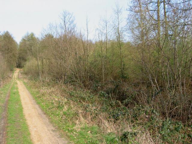
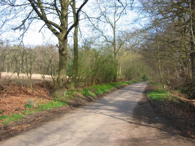
Visitors to Wellfield Spring can explore a network of well-maintained walking trails that wind through the woodland. These trails offer the opportunity to observe a variety of bird species, including woodpeckers, jays, and tawny owls. The woodland is also home to numerous mammals, such as deer, foxes, and squirrels.

In addition to its natural beauty, Wellfield Spring boasts several amenities for visitors. There are picnic areas with benches scattered throughout the woodland, providing the perfect spot for a leisurely lunch or a peaceful break. The site also has ample parking facilities and well-maintained restroom facilities.

Wellfield Spring is a popular destination for both locals and tourists, offering a peaceful escape from the hustle and bustle of daily life. Whether it's a leisurely stroll, birdwatching, or simply enjoying the beauty of nature, this woodland provides a wonderful setting for outdoor recreation and relaxation.

If you have any feedback on the listing, please let us know in the comments section below.

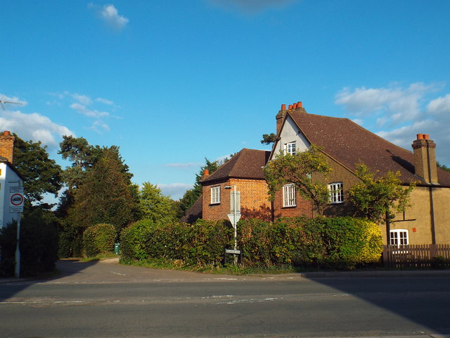
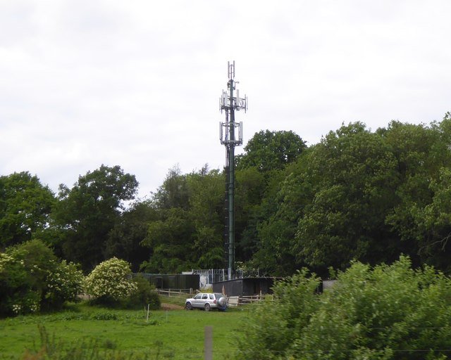
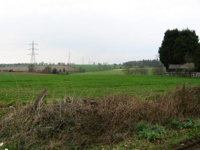
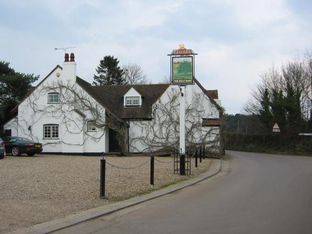
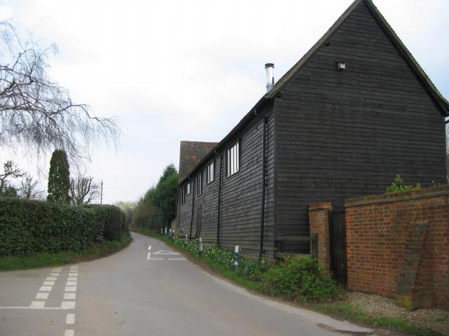
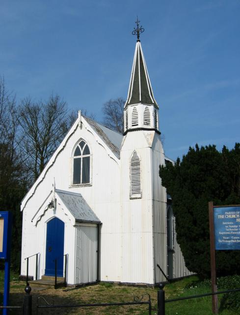
Wellfield Spring Images

Images are sourced within 2km of 51.728177/-0.39569296 or Grid Reference TL1004. Thanks to Geograph Open Source API. All images are credited.

Toms Lane, Bedmond Toms Lane approaching the centre of Bedmond, a village in west Hertfordshire.
Toms Lane, Bedmond
Toms Lane approaching the centre of Bedmond, a village in west Hertfordshire.
Millhouse Lane, Bedmond
Church of the Ascension, Bedmond The Church of the Ascension in Bedmond is a prefabricated building.  According to the BBC website <span class="nowrap"><a title="http://www.bbc.co.uk/news/uk-england-beds-bucks-herts-12580526" rel="nofollow ugc noopener" href="http://www.bbc.co.uk/news/uk-england-beds-bucks-herts-12580526">Link</a><img style="margin-left:2px;" alt="External link" title="External link - shift click to open in new window" src="https://s1.geograph.org.uk/img/external.png" width="10" height="10"/></span> it is one of only two such churches in the country.

The church is situated on the corner of Church Hill and Sergehill Lane.
Church of the Ascension, Bedmond
The Church of the Ascension in Bedmond is a prefabricated building. According to the BBC website LinkExternal link it is one of only two such churches in the country. The church is situated on the corner of Church Hill and Sergehill Lane.
Church Hill, Bedmond Church Hill entering the Hertfordshire village of Bedmond.
Church Hill, Bedmond
Church Hill entering the Hertfordshire village of Bedmond.
Sergehill Lane, Bedmond This image was taken late on a September afternoon, as shadows were lengthening.
Sergehill Lane, Bedmond
This image was taken late on a September afternoon, as shadows were lengthening.
Mobile phone mast near Bedmond, seen from M25
M1/M25 Junction It's noisy, hostile and bleak but the motorway junction occupies about half the entire grid square so is the dominating feature. Photo taken looking South down the M1 from the bridge at TL115038.
M1/M25 Junction
It's noisy, hostile and bleak but the motorway junction occupies about half the entire grid square so is the dominating feature. Photo taken looking South down the M1 from the bridge at TL115038.
Pylon and copse Looking North from TL117043, we see the power lines jump over a little copse. That's pretty much the most significant landmark in the grid square.
Pylon and copse
Looking North from TL117043, we see the power lines jump over a little copse. That's pretty much the most significant landmark in the grid square.
Farmland, farmland... Looking NW from the track at TL107064 by Hill End Farm (buildings at right).
Farmland, farmland...
Looking NW from the track at TL107064 by Hill End Farm (buildings at right).
The 'Holly Bush' at Potters Crouch The 'Holly Bush' pub at Potters Crouch: a village of about 4 houses.
And yes, Potters Crouch is its real name - I'm not making it up.
The 'Holly Bush' at Potters Crouch
The 'Holly Bush' pub at Potters Crouch: a village of about 4 houses. And yes, Potters Crouch is its real name - I'm not making it up.
Barn-like house, Potters Crouch Looking East into Potters Crouch on the road from Bedmond (at TL114052).
Barn-like house, Potters Crouch
Looking East into Potters Crouch on the road from Bedmond (at TL114052).
Corrugated tin church, Bedmond The Church Of The Ascension at Bedmond, in the NE corner of the grid square, is very small and seems to be built almost entirely from sheets of corrugated metal.
Corrugated tin church, Bedmond
The Church Of The Ascension at Bedmond, in the NE corner of the grid square, is very small and seems to be built almost entirely from sheets of corrugated metal.
Tin church, Bedmond Another photo of the little sheet-metal church in Bedmond.
Tin church, Bedmond
Another photo of the little sheet-metal church in Bedmond.
Potterscrouch Plantations Looking East from the forestry track in Potterscrouch Plantations at TL104047.
Potterscrouch Plantations
Looking East from the forestry track in Potterscrouch Plantations at TL104047.
Plantation Looking SW from the track through the woods at TL104047.
Plantation
Looking SW from the track through the woods at TL104047.
New growth in plantation Looking E along the track in the woods at about TL105053. Not the classiest woods, mind you - they seem to be a popular venue for fly-tipping and burning cars, to judge by patches of wreckage.
New growth in plantation
Looking E along the track in the woods at about TL105053. Not the classiest woods, mind you - they seem to be a popular venue for fly-tipping and burning cars, to judge by patches of wreckage.
Daneswick farm buildings Looking SE from TL122046
Daneswick farm buildings
Looking SE from TL122046
Road from Potters Crouch to Chiswell Green Looking East from TL123052 with copse on the right, open field and then woods on the left.
Road from Potters Crouch to Chiswell Green
Looking East from TL123052 with copse on the right, open field and then woods on the left.
Show me another place!

Wellfield Spring is located at Grid Ref: TL1004 (Lat: 51.728177, Lng: -0.39569296)

Administrative County: Hertfordshire

District: St. Albans

Police Authority: Hertfordshire

What 3 Words

///tone.admiral.proven. Near Abbots Langley, Hertfordshire

Related Wikis

Potters Crouch

Potters Crouch is a small hamlet in Hertfordshire, England, south-west of St Albans near Chiswell Green. It is in the civil parish of St Michael. ��2...
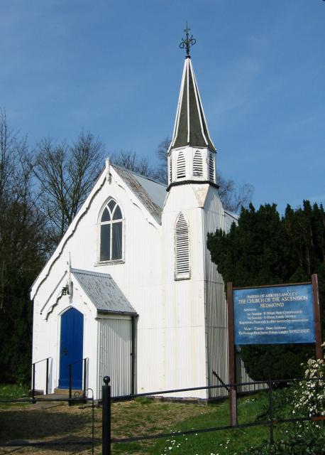
Bedmond

Bedmond is a village in the civil parish of Abbots Langley, in the Three Rivers district of Hertfordshire, England. It is located around one mile (1.6...

International Crown

The Hanwha LifePlus International Crown is a biennial women's professional team golf tournament on the LPGA Tour. Eight national teams of four players...

Centurion Club

The Centurion Club is a golf club in Hemel Hempstead in Hertfordshire. The club opened in 2013. It has hosted the GolfSixes series in 2017 and 2018 and...

Nearby Amenities

Located within 500m of 51.728177,-0.39569296
Power: tower
Lat/Long: 51.7262666/-0.390853
Power: tower
Lat/Long: 51.7278703/-0.3916283
Power: tower
Lat/Long: 51.7307434/-0.3929918
Serge Hill
Place: hamlet
Lat/Long: 51.7255282/-0.398456
Street Lamp
Lamp Model: CU Phosco P860
Lamp Type: LED
Source: Survey of 2019-02-22
Lat/Long: 51.7317842/-0.3914248
Street Lamp
Lamp Model: CU Phosco P860
Lamp Type: LED
Source: Survey of 2019-02-22
Lat/Long: 51.7313773/-0.3912962
Speed Camera
Maxspeed: 70 mph
Maxspeed Type: GB:motorway
Lat/Long: 51.7316411/-0.3915713
Street Lamp
Lamp Model: CU Phosco P860
Lamp Type: LED
Source: Survey of 2019-02-22
Lat/Long: 51.730994/-0.3911641
Street Lamp
Lamp Model: CU Phosco P860
Lamp Type: LED
Source: Survey of 2019-02-22
Lat/Long: 51.7306258/-0.3910285
Street Lamp
Lamp Model: CU Phosco P860
Lamp Type: LED
Source: Survey of 2019-02-22
Lat/Long: 51.7302554/-0.3908929
Street Lamp
Lamp Model: CU Phosco P860
Lamp Type: LED
Source: Survey of 2019-02-22
Lat/Long: 51.7299131/-0.3907573
Street Lamp
Lamp Model: CU Phosco P860
Lamp Type: LED
Source: Survey of 2019-02-22
Lat/Long: 51.7295556/-0.3906182
Street Lamp
Lamp Model: CU Phosco P860
Lamp Type: LED
Source: Survey of 2019-02-22
Lat/Long: 51.7291852/-0.3904688
Street Lamp
Lamp Model: CU Phosco P860
Lamp Type: LED
Source: Survey of 2019-02-22
Lat/Long: 51.728789/-0.3903297
Street Lamp
Lamp Model: CU Phosco P860
Lamp Type: LED
Source: Survey of 2019-02-22
Lat/Long: 51.7283842/-0.3901767
Street Lamp
Lamp Model: CU Phosco P860
Lamp Type: LED
Source: Survey of 2019-02-22
Lat/Long: 51.7279815/-0.3900203
Street Lamp
Lamp Model: CU Phosco P860
Lamp Type: LED
Source: Survey of 2019-02-22
Lat/Long: 51.7275855/-0.3898507
Street Lamp
Lamp Model: CU Phosco P860
Lamp Type: LED
Source: Survey of 2019-02-22
Lat/Long: 51.7271567/-0.3896518
Street Lamp
Lamp Model: CU Phosco P860
Lamp Type: LED
Source: Survey of 2019-02-22
Lat/Long: 51.7267497/-0.3894779
Street Lamp
Lamp Model: CU Phosco P860
Lamp Type: LED
Source: Survey of 2019-02-22
Lat/Long: 51.7263492/-0.389311
Power: pole
Lat/Long: 51.7274512/-0.4027189
Street Lamp
Lamp Model: CU Phosco P862
Lamp Mount: bent_mast
Lamp Type: LED
Ref: D67
Source: Bing Aerial Imagery (2022-04-21)
Lat/Long: 51.7299968/-0.3911379
Street Lamp
Lamp Model: CU Phosco P862
Lamp Mount: bent_mast
Lamp Type: LED
Ref: D66
Source: Bing Aerial Imagery (2022-04-21)
Lat/Long: 51.729637/-0.3910139
Street Lamp
Lamp Model: CU Phosco P862
Lamp Mount: bent_mast
Lamp Type: LED
Ref: D65
Source: Bing Aerial Imagery (2022-04-21)
Lat/Long: 51.7292644/-0.3908839
Street Lamp
Lamp Model: CU Phosco P862
Lamp Mount: bent_mast
Lamp Type: LED
Ref: D64
Source: Bing Aerial Imagery (2022-04-21)
Lat/Long: 51.728895/-0.3907494
Street Lamp
Lamp Model: CU Phosco P862
Lamp Mount: bent_mast
Lamp Type: LED
Ref: D63
Source: Bing Aerial Imagery (2022-04-21)
Lat/Long: 51.7285141/-0.3906149
Street Lamp
Lamp Model: CU Phosco P862
Lamp Mount: bent_mast
Lamp Type: LED
Ref: D62
Source: Bing Aerial Imagery (2022-04-21)
Lat/Long: 51.7281453/-0.390491
Street Lamp
Lamp Model: CU Phosco P862
Lamp Mount: bent_mast
Lamp Type: LED
Ref: D61
Source: Bing Aerial Imagery (2022-04-21)
Lat/Long: 51.7277671/-0.3903477
Street Lamp
Lamp Model: CU Phosco P862
Lamp Mount: bent_mast
Lamp Type: LED
Ref: D60
Source: Bing Aerial Imagery (2022-04-21)
Lat/Long: 51.7273945/-0.3902123
Street Lamp
Lamp Model: CU Phosco P862
Lamp Mount: bent_mast
Lamp Type: LED
Ref: D59
Source: Bing Aerial Imagery (2022-04-21)
Lat/Long: 51.7270569/-0.3900822
Street Lamp
Lamp Model: CU Phosco P862
Lamp Mount: bent_mast
Lamp Type: LED
Ref: D58
Source: Bing Aerial Imagery (2022-04-21)
Lat/Long: 51.726711/-0.3899451
Street Lamp
Lamp Model: CU Phosco P862
Lamp Mount: bent_mast
Lamp Type: LED
Ref: D57
Source: Bing Aerial Imagery (2022-04-21)
Lat/Long: 51.7263712/-0.3898141
Street Lamp
Lamp Model: CU Phosco P862
Lamp Mount: bent_mast
Lamp Type: LED
Ref: D56
Source: Bing Aerial Imagery (2022-04-21)
Lat/Long: 51.7260342/-0.3896779
Street Lamp
Lamp Model: CU Phosco P862
Lamp Mount: bent_mast
Lamp Type: LED
Ref: D68
Source: Bing Aerial Imagery (2022-04-21)
Lat/Long: 51.7303849/-0.391278
Speed Camera
Maxspeed: 70 mph
Lat/Long: 51.7266003/-0.3897776
Speed Camera
Maxspeed: 70 mph
Maxspeed Type: GB:motorway
Lat/Long: 51.7266204/-0.3896302
Street Lamp
Lat/Long: 51.7275529/-0.3893937
Street Lamp
Lat/Long: 51.7286894/-0.3898366
Street Lamp
Lat/Long: 51.7265712/-0.388944
Street Lamp
Lat/Long: 51.730158/-0.3904109
Street Lamp
Lat/Long: 51.7268951/-0.3890936
Street Lamp
Lat/Long: 51.7279193/-0.3895259
Street Lamp
Lat/Long: 51.7297914/-0.390267
Street Lamp
Lat/Long: 51.7290427/-0.3899754
Street Lamp
Lat/Long: 51.7294131/-0.3901172
Street Lamp
Lat/Long: 51.7272368/-0.3892377
Street Lamp
Lat/Long: 51.7283051/-0.3896887
The data included in this document is from www.openstreetmap.org. The data is made available under ODbL.

Have you been to Wellfield Spring?

Leave your review of Wellfield Spring below (or comments, questions and feedback).