Farm Copse

Wood, Forest in Sussex Horsham

England

Farm Copse

Downs Link, near Slinfold A view of the Downs Link path as it approaches Slinfold in West Sussex.  The path follows a dismantled railway line.  It also forms part of route 223 of the National Cycle Network.

Here, a public footpath crosses the Downs Link path.
Downs Link, near Slinfold Credit: Malc McDonald

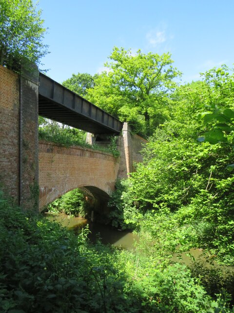
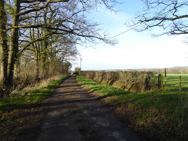
Farm Copse is a picturesque woodland located in Sussex, England. Covering an area of approximately 100 acres, this enchanting forest is a haven of tranquility and natural beauty. The copse is predominantly composed of deciduous trees, including oak, beech, and birch, which create a dense canopy that provides shade and shelter for a diverse range of flora and fauna.

The forest floor of Farm Copse is adorned with a vibrant carpet of wildflowers, including bluebells, primroses, and wood anemones, which bloom in the spring, adding a burst of color to the landscape. The copse is also home to a variety of ferns and mosses that thrive in the damp and shaded environment.

This woodland is not only aesthetically pleasing but also serves as an important habitat for many woodland creatures. Visitors to Farm Copse may catch sight of roe deer gracefully bounding through the trees or hear the melodic songs of various bird species, such as blackbirds, thrushes, and woodpeckers. The copse is also a sanctuary for smaller mammals like foxes, badgers, and squirrels.

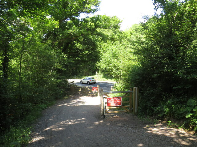
A network of well-maintained footpaths and trails wind their way through Farm Copse, allowing visitors to explore its natural wonders at their own pace. The copse is a popular destination for nature enthusiasts, hikers, and photographers, who are drawn to its serene ambiance and photogenic landscapes.

Farm Copse is a true gem in the Sussex countryside, offering a peaceful retreat from the hustle and bustle of everyday life and providing a glimpse into the captivating beauty of nature.

If you have any feedback on the listing, please let us know in the comments section below.

Farm Copse Images

Images are sourced within 2km of 51.077246/-0.42548949 or Grid Reference TQ1032. Thanks to Geograph Open Source API. All images are credited.

Downs Link, near Slinfold A view of the Downs Link path as it approaches Slinfold in West Sussex.  The path follows a dismantled railway line.  It also forms part of route 223 of the National Cycle Network.

Here, a public footpath crosses the Downs Link path.
Downs Link, near Slinfold
A view of the Downs Link path as it approaches Slinfold in West Sussex. The path follows a dismantled railway line. It also forms part of route 223 of the National Cycle Network. Here, a public footpath crosses the Downs Link path.
Double bridge near Rudgwick, West Sussex The double bridge which crosses the River Arun near Rudgwick is unique in Britain, in having both a brick arch and an iron girder.

The brick arch was built to carry a railway line across the river.  However, on the far side of the river, the railway would then climb a steep gradient into Rudgwick station.  Inspectors from the government's Board of Trade refused permission for the railway to open, as they felt the gradient up to Rudgwick station was too steep.  The railway compamny therefore had to rebuild this section of the route with higher embankments, so that the gradient into Rudgwick was less steep.  As the railway had been raised to a higher level at this location, the iron girder bridge was installed to carry it across the river.  The brick arch has never been used for its intended purpose.

The railway opened in 1865 but closed a century later.  The railway route now forms part of the Downs Link long distance path, which itself forms part of route 223 of the National Cycle Network.
Double bridge near Rudgwick, West Sussex
The double bridge which crosses the River Arun near Rudgwick is unique in Britain, in having both a brick arch and an iron girder. The brick arch was built to carry a railway line across the river. However, on the far side of the river, the railway would then climb a steep gradient into Rudgwick station. Inspectors from the government's Board of Trade refused permission for the railway to open, as they felt the gradient up to Rudgwick station was too steep. The railway compamny therefore had to rebuild this section of the route with higher embankments, so that the gradient into Rudgwick was less steep. As the railway had been raised to a higher level at this location, the iron girder bridge was installed to carry it across the river. The brick arch has never been used for its intended purpose. The railway opened in 1865 but closed a century later. The railway route now forms part of the Downs Link long distance path, which itself forms part of route 223 of the National Cycle Network.
Downs Link, near Rudgwick The Downs Link path follows a dismantled railway line for almost all of its length.  It also forms part of route 223 of the National Cycle Network.

Here, there used to be a bridge carrying the railway across the A281 road.  The bridge was demolished after the railway closed, and the Downs Link path therefore descends to road level to cross the road.  There has been a long-running campaign to reinstate a bridge here.  Sadly, a 20-year-old cyclist was killed in 2020 whilst crossing the road at this point.
Downs Link, near Rudgwick
The Downs Link path follows a dismantled railway line for almost all of its length. It also forms part of route 223 of the National Cycle Network. Here, there used to be a bridge carrying the railway across the A281 road. The bridge was demolished after the railway closed, and the Downs Link path therefore descends to road level to cross the road. There has been a long-running campaign to reinstate a bridge here. Sadly, a 20-year-old cyclist was killed in 2020 whilst crossing the road at this point.
Houses on Haven Road, Rudgwick
Haven Road at Colin's Cross
Haven Road, Colin's Cross
Electricity poles on Haven Road
Field by Haven Road
Field by Haven Road
Haven Road, The Haven
Weathercock on Naldretts Lane
Looking along Naldretts Lane which is a public bridleway
Entrance to Naldrett House
Looking west on Pensfold Lane
Pensfold Lane looking west past Morelands The property Morelands is hidden by trees in the picture.
Pensfold Lane looking west past Morelands
The property Morelands is hidden by trees in the picture.
Gateway and buildings at Pensfold Farm
Dwellings at Pensfold Farm See also <a title="https://www.geograph.org.uk/photo/1984971" href="https://www.geograph.org.uk/photo/1984971">Link</a> from 2010.
Dwellings at Pensfold Farm
See also Link from 2010.
The drive at Park Farm
Show me another place!

Farm Copse is located at Grid Ref: TQ1032 (Lat: 51.077246, Lng: -0.42548949)

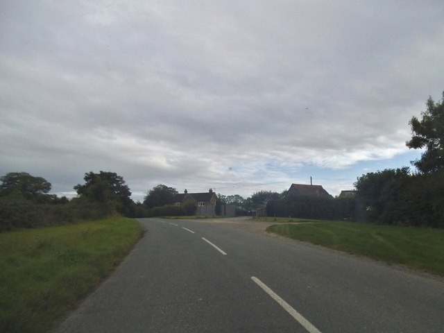
Administrative County: West Sussex

District: Horsham

Police Authority: Sussex

What 3 Words

///craft.orbit.cheetahs. Near Slinfold, West Sussex

Nearby Locations

Whales Copse Farm Copse

Related Wikis

Slinfold railway station

Slinfold railway station was on the Cranleigh Line and served the village of Slinfold in West Sussex. == History == The line had a single track and opened...

Slinfold

Slinfold is a village and civil parish in the Horsham District of West Sussex, England. == Geography == The village is almost 4 miles (6.4 km) west of...

Slinfold Stream and Quarry

Slinfold Stream and Quarry is a 2.3-hectare (5.7-acre) geological Site of Special Scientific Interest west of Horsham in West Sussex. It is a Geological...

Rudgwick railway station

Rudgwick railway station was on the Cranleigh Line. It served the village of Rudgwick in West Sussex until June, 1965. == History == Rudgwick station opened...

Rudgwick

Rudgwick is a village and civil parish in the Horsham District of West Sussex, England. The village is 6 miles (10 km) west from Horsham on the north...

Holy Trinity Church, Rudgwick

Holy Trinity Church is the Anglican parish church of Rudgwick, a village in the Horsham district of West Sussex, England. The oldest part of the church...

Tisman's Common

Tisman's Common is a hamlet in the Horsham District of West Sussex, England. It stands in the parish of Rudgwick, on the Rudgwick to Loxwood road, 6.4...

The Haven, West Sussex

The Haven is a rural hamlet in West Sussex, south east England located about 7 miles to the west of Horsham.The Haven is primarily an agricultural area...

Nearby Amenities

Located within 500m of 51.077246,-0.42548949
Barrier: kissing_gate
Foot: yes
Lat/Long: 51.0757636/-0.4285183
Huntingrove Farm
Place: farm
Lat/Long: 51.0740234/-0.4282887
The data included in this document is from www.openstreetmap.org. The data is made available under ODbL.

Have you been to Farm Copse?

Leave your review of Farm Copse below (or comments, questions and feedback).