Broomy Downs

Wood, Forest in Surrey Mole Valley

England

Broomy Downs

Railway bridge at Gomshall An arch bridge carries the North Downs Line over a narrow lane in Gomshall.  The sign indicates the maximum height for vehicles passing beneath the bridge is 10 feet 3 inches.

Route 22 of the National Cycle Network passes through the arch.
Railway bridge at Gomshall Credit: Malc McDonald

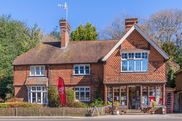
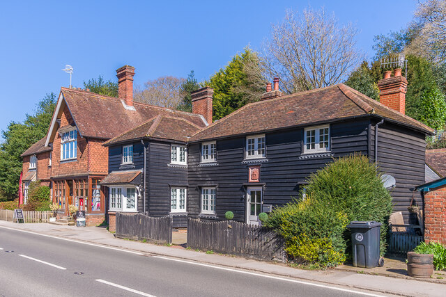
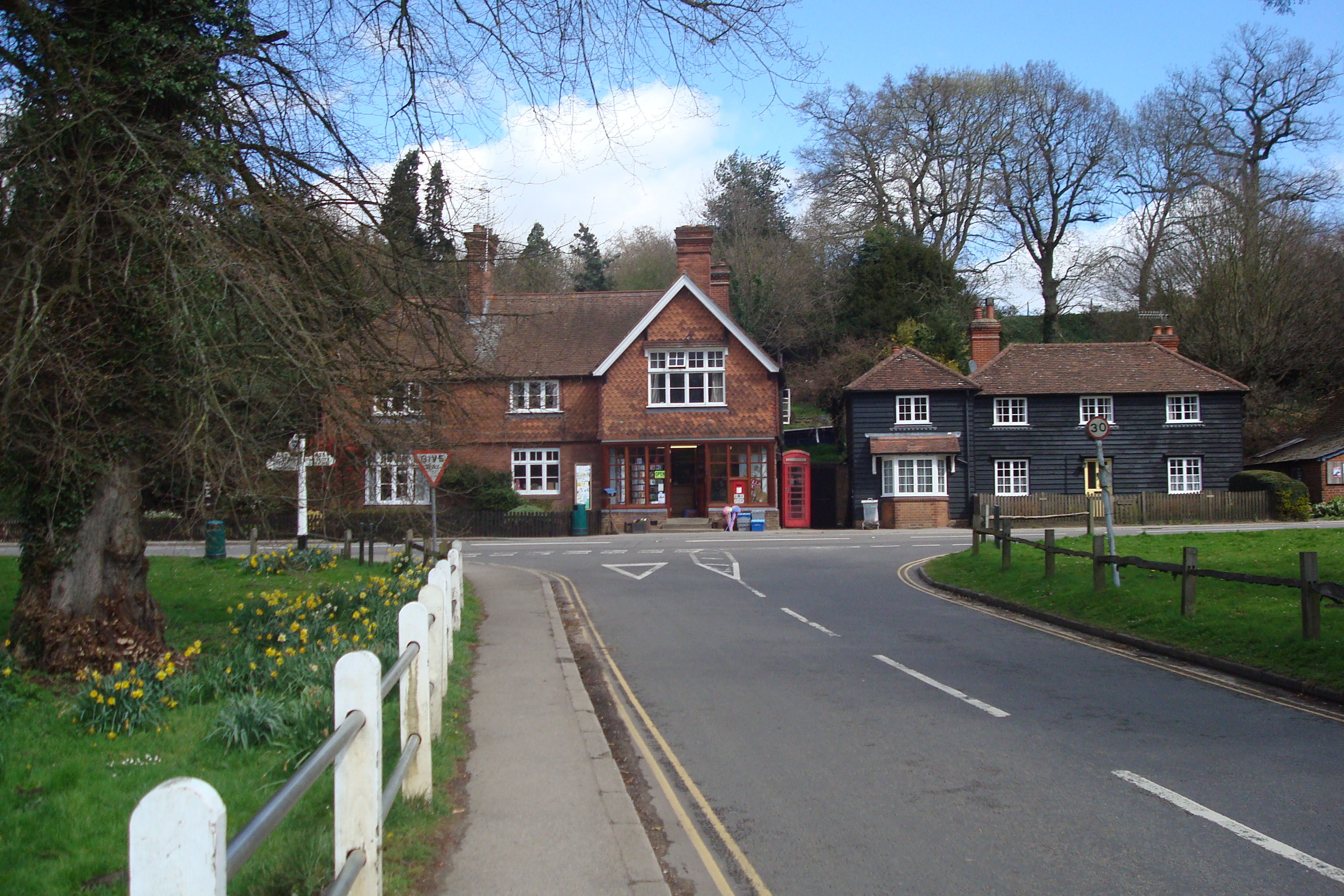
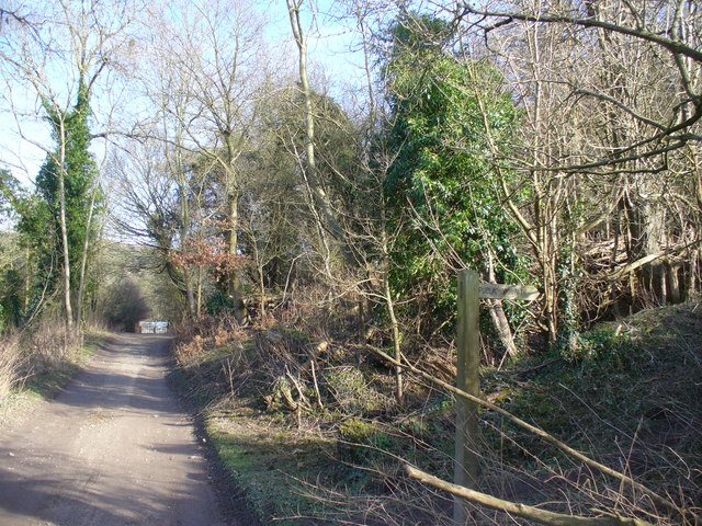
Broomy Downs is a picturesque woodland area located in Surrey, England. Situated just outside the village of Wood, this forested region offers a tranquil escape from the bustling city life. Spanning over 100 acres, Broomy Downs is a haven for nature enthusiasts and outdoor lovers.

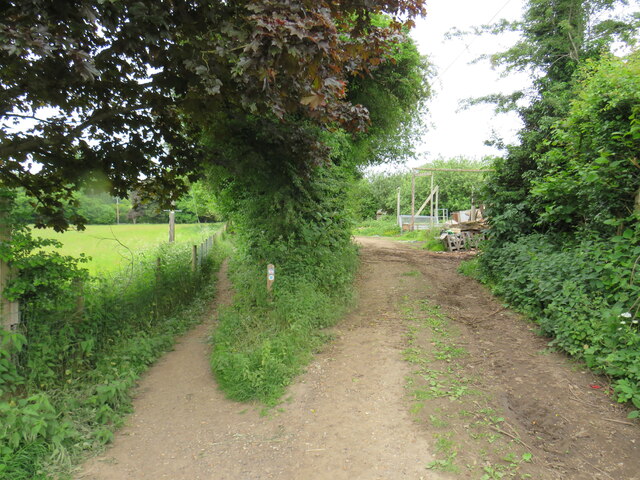
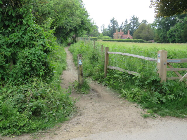
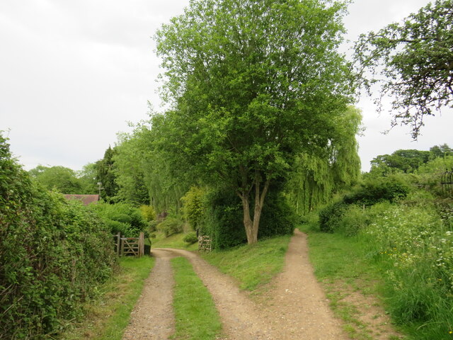
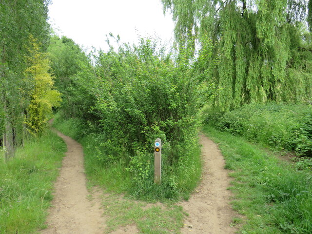
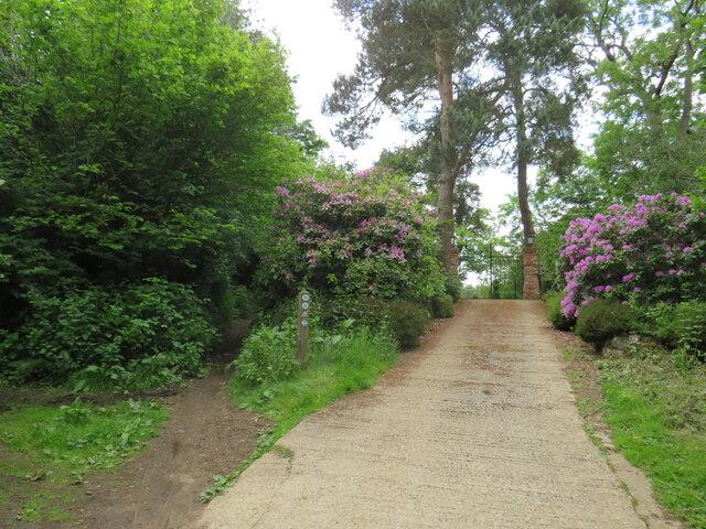
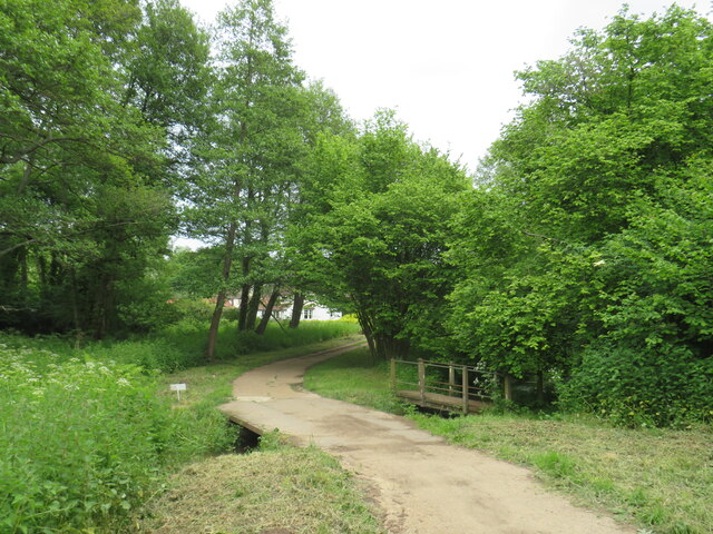
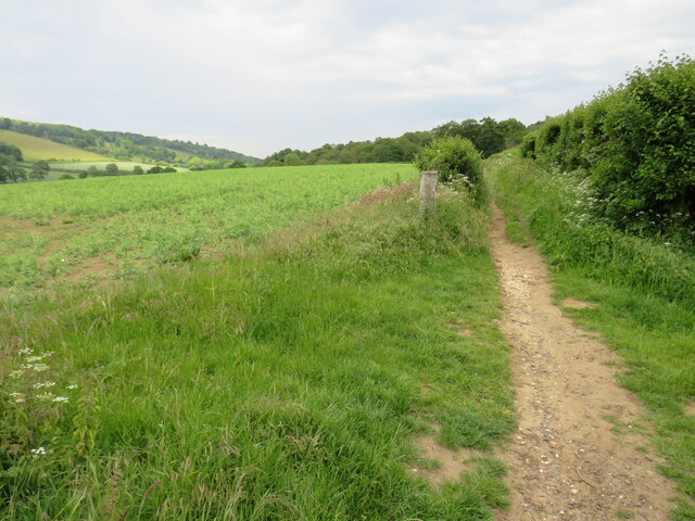
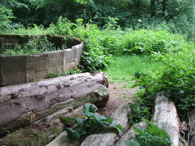
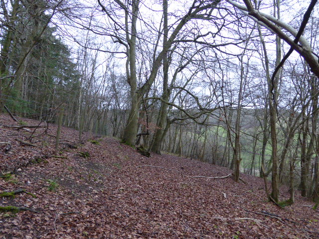
The landscape of Broomy Downs is characterized by dense woodland, with towering trees and a diverse array of flora and fauna. The forest floor is carpeted with vibrant wildflowers during the spring and summer months, creating a colorful and enchanting atmosphere. Walking through the woods, visitors can expect to encounter a variety of wildlife, including squirrels, deer, and a wide range of bird species.

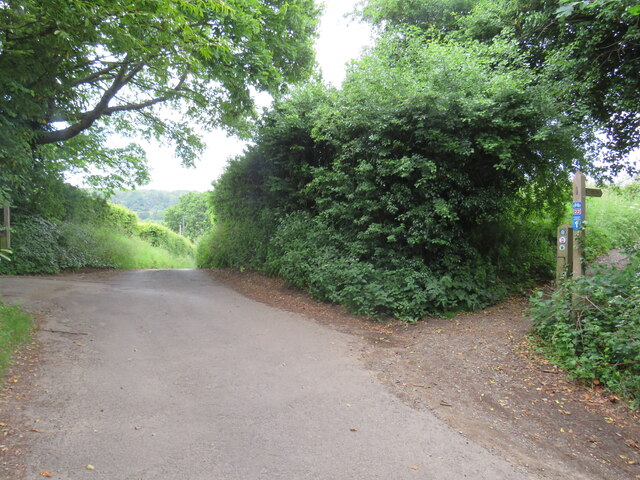
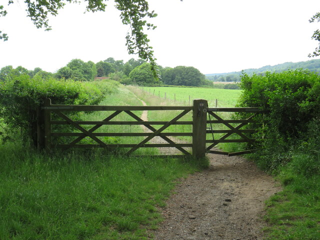
The trails winding through Broomy Downs offer a perfect opportunity for hiking and exploring the natural beauty of the area. The paths are well-maintained and clearly marked, ensuring a pleasant and safe experience for visitors of all ages. With its peaceful ambiance and stunning scenery, Broomy Downs is also a popular spot for photography and painting enthusiasts.

In addition to its natural attractions, Broomy Downs offers a range of recreational activities. There are designated picnic areas where visitors can enjoy a leisurely meal surrounded by the beauty of nature. The forest also has a number of wooden benches strategically placed, allowing visitors to rest and take in the serenity of the surroundings.

Overall, Broomy Downs in Surrey is a true gem for those seeking a peaceful retreat in nature. With its lush woodland, diverse wildlife, and well-maintained trails, it provides the perfect setting for a relaxing day out or a rejuvenating hike.

If you have any feedback on the listing, please let us know in the comments section below.

Broomy Downs Images

Images are sourced within 2km of 51.219375/-0.42342367 or Grid Reference TQ1047. Thanks to Geograph Open Source API. All images are credited.

Railway bridge at Gomshall An arch bridge carries the North Downs Line over a narrow lane in Gomshall.  The sign indicates the maximum height for vehicles passing beneath the bridge is 10 feet 3 inches.

Route 22 of the National Cycle Network passes through the arch.
Railway bridge at Gomshall
An arch bridge carries the North Downs Line over a narrow lane in Gomshall. The sign indicates the maximum height for vehicles passing beneath the bridge is 10 feet 3 inches. Route 22 of the National Cycle Network passes through the arch.
Railway bridge at Gomshall An arch bridge carries the North Downs Line over a narrow lane in Gomshall.

Route 22 of the National Cycle Network passes through the arch.
Railway bridge at Gomshall
An arch bridge carries the North Downs Line over a narrow lane in Gomshall. Route 22 of the National Cycle Network passes through the arch.
Towerhill Farm, Gomshall The track passing through the farm is a public right of way as a bridleway.  It forms part of route 22 of the National Cycle Network.
Towerhill Farm, Gomshall
The track passing through the farm is a public right of way as a bridleway. It forms part of route 22 of the National Cycle Network.
Bridleway and farm track at Gomshall The path to the left is a public bridleway which is on route 22 of the National Cycle Network.  To the right is a farm track.
Bridleway and farm track at Gomshall
The path to the left is a public bridleway which is on route 22 of the National Cycle Network. To the right is a farm track.
Public bridleway, Gomshall A public bridleway at Gomshall in Surrey.  The bridleway is on route 22 of the National Cycle Network.
Public bridleway, Gomshall
A public bridleway at Gomshall in Surrey. The bridleway is on route 22 of the National Cycle Network.
Private driveway and public bridleway, Gomshall A private driveway leading to a house on the left, and a public bridleway to the right.  The bridleway is on route 22 of the National Cycle Network.
Private driveway and public bridleway, Gomshall
A private driveway leading to a house on the left, and a public bridleway to the right. The bridleway is on route 22 of the National Cycle Network.
Paths fork near Gomshall A fork in the path near Gomshall.  The path to the right is a public footpath, while the path to the left is a public bridleway which can be used by horse riders and cyclists as well as walkers.

The bridleway is on route 22 of the National Cycle Network.
Paths fork near Gomshall
A fork in the path near Gomshall. The path to the right is a public footpath, while the path to the left is a public bridleway which can be used by horse riders and cyclists as well as walkers. The bridleway is on route 22 of the National Cycle Network.
Driveway and bridle path near Abinger Hammer A private driveway leading to a house near the village of Abinger Hammer in Surrey.  This image was taken in early June, as the rhododendrons were in bloom.

To the left of the driveway is a public bridleway.  This path forms part of route 22 of the National Cycle Network.
Driveway and bridle path near Abinger Hammer
A private driveway leading to a house near the village of Abinger Hammer in Surrey. This image was taken in early June, as the rhododendrons were in bloom. To the left of the driveway is a public bridleway. This path forms part of route 22 of the National Cycle Network.
Bridge over Tilling Bourne near Abinger Hammer A bridge carries a driveway across Tilling Bourne near the village of Abinger Hammer in Surrey.  The driveway is a public right of way as a bridleway, and forms part of route 22 of the National Cycle Network.
Bridge over Tilling Bourne near Abinger Hammer
A bridge carries a driveway across Tilling Bourne near the village of Abinger Hammer in Surrey. The driveway is a public right of way as a bridleway, and forms part of route 22 of the National Cycle Network.
Rad Lane, Abinger Hammer Rad Lane is a driveway leading to a few houses in the Surrey village of Abinger Hammer.  The lane is a public right of way as a bridleway, and is on route 22 of the National Cycle Network.
Rad Lane, Abinger Hammer
Rad Lane is a driveway leading to a few houses in the Surrey village of Abinger Hammer. The lane is a public right of way as a bridleway, and is on route 22 of the National Cycle Network.
Abinger Hammer The A25 road passing through the Surrey village of Abinger Hammer.

The blue signs towards the right of the image indicate the route taken by route 22 of the National Cycle Network.
Abinger Hammer
The A25 road passing through the Surrey village of Abinger Hammer. The blue signs towards the right of the image indicate the route taken by route 22 of the National Cycle Network.
Hackhurst Lane, Abinger Hammer Hackhurst Lane is a minor road climbing a hillside out of the village of Abinger Hammer.  It is on the route of National Cycle Network route 22 which then turns along the public bridleway to the right.  The blue and red sign attached to the wooden signpost indicates the cycle route.
Hackhurst Lane, Abinger Hammer
Hackhurst Lane is a minor road climbing a hillside out of the village of Abinger Hammer. It is on the route of National Cycle Network route 22 which then turns along the public bridleway to the right. The blue and red sign attached to the wooden signpost indicates the cycle route.
Public bridleway near Abinger Hammer This public bridleway in the North Downs forms part of route 22 of the National Cycle Network.
Public bridleway near Abinger Hammer
This public bridleway in the North Downs forms part of route 22 of the National Cycle Network.
Gate on National Cycle Network route 22 near Abinger Hammer A gate on a public bridleway in the North Downs.  The bridleway forms part of the route of National Cycle Network route 22.
Gate on National Cycle Network route 22 near Abinger Hammer
A gate on a public bridleway in the North Downs. The bridleway forms part of the route of National Cycle Network route 22.
Netley Heath - Old Reservoir Derelict round reservoir and discarded felled timber beside the North Downs Way at Gravelhill Gate.
Netley Heath - Old Reservoir
Derelict round reservoir and discarded felled timber beside the North Downs Way at Gravelhill Gate.
Grasmere Black weatherboarded house on Guildford Road.  Above the front door is a Wotton estate plaque, depicting a griffin - see <a href="https://www.geograph.org.uk/photo/7159118">TQ1248 : Gable on barn, Park Farm</a> for a close up of another example.
Grasmere
Black weatherboarded house on Guildford Road. Above the front door is a Wotton estate plaque, depicting a griffin - see TQ1248 : Gable on barn, Park Farm for a close up of another example.
Abinger Hammer village shop Village shop and tea room (and former post office, which closed in 2004) on Guildford Road.
Abinger Hammer village shop
Village shop and tea room (and former post office, which closed in 2004) on Guildford Road.
Grasmere and Abinger Hammer village shop Buildings on Guildford Road.  See <a href="https://www.geograph.org.uk/photo/7453102">TQ0947 : Grasmere</a> for a close up of Grasmere and <a href="https://www.geograph.org.uk/photo/7453127">TQ0947 : Abinger Hammer village shop</a> for one of the village shop.
Grasmere and Abinger Hammer village shop
Buildings on Guildford Road. See TQ0947 : Grasmere for a close up of Grasmere and TQ0947 : Abinger Hammer village shop for one of the village shop.
Show me another place!

Broomy Downs is located at Grid Ref: TQ1047 (Lat: 51.219375, Lng: -0.42342367)

Administrative County: Surrey

District: Mole Valley

Police Authority: Surrey

What 3 Words

///puppy.bunch.limit. Near Peaslake, Surrey

Related Wikis

Abinger Hammer

Abinger Hammer is a village in the Vale of Holmesdale, located on the A25 in Surrey, England. The village is located within the Surrey Hills AONB, approximately...

Piney Copse

Piney Copse is 1.7 hectares (4.2 acres) of woodland located approximately 450 metres (1,480 ft) east of Gomshall railway station and north of the Surrey...
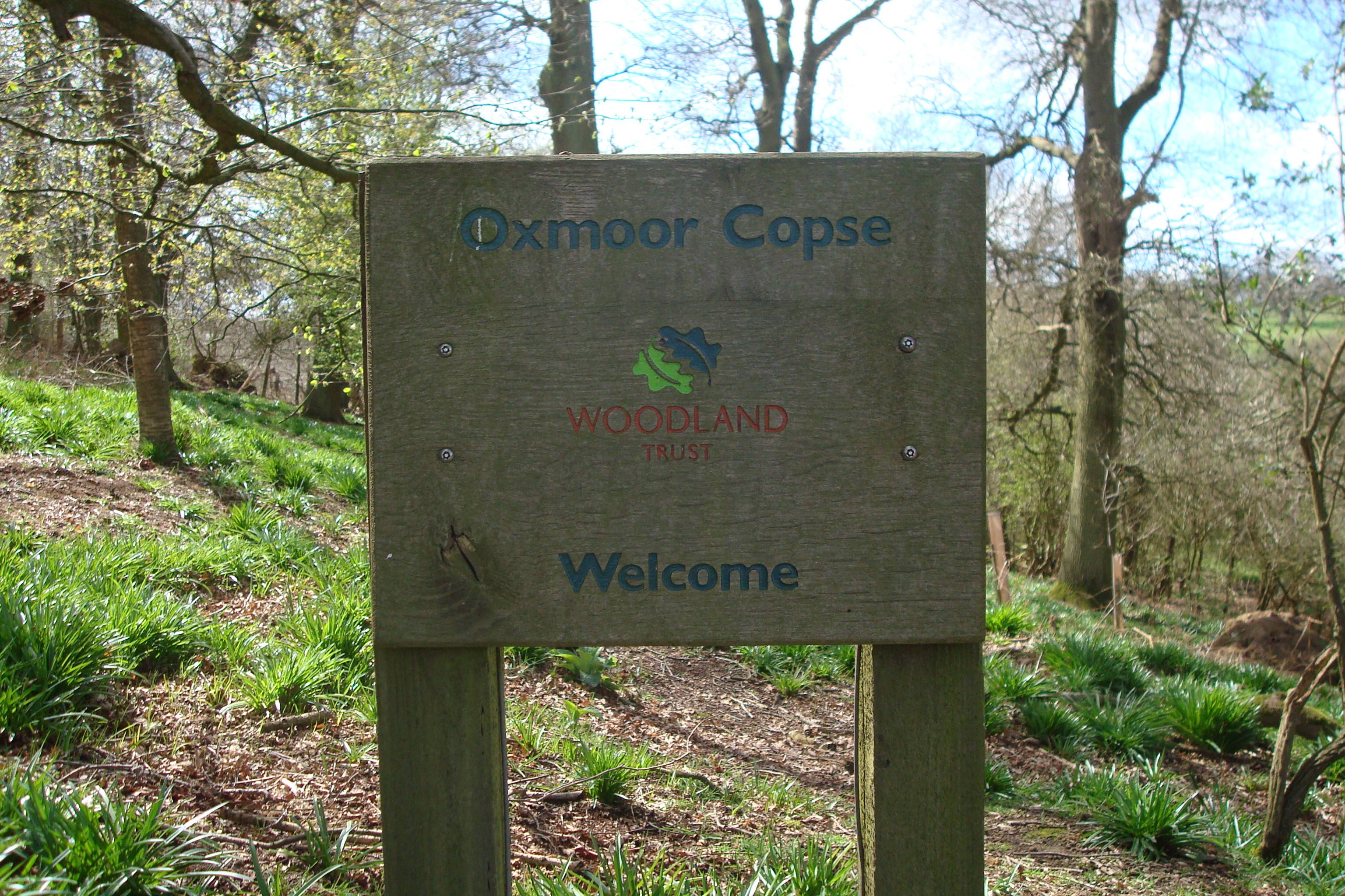
Oxmoor Copse

Oxmoor Copse is just south of the village of Abinger Hammer and to the west of the village of Abinger Common, in Surrey. It is 1.23 hectares (3.0 acres...

Gomshall railway station

Gomshall railway station serves the village of Gomshall in Surrey, England. The station, and all trains serving it, are operated by Great Western Railway...

Gomshall

Gomshall is a village in the borough of Guildford in Surrey, England.It is on the A25, roughly halfway between Guildford and Dorking, and in Shere civil...

Hackhurst and White Downs

Hackhurst and White Downs is a 185.1-hectare (457-acre) biological Site of Special Scientific Interest west of Dorking in Surrey. White Downs is a Nature...

Colekitchen Down

Colekitchen Down is a 3-hectare (7.4-acre) nature reserve north of Gomshall in Surrey. It is managed by the Surrey Wildlife Trust.This sloping area of...

Netley Heath

Netley Heath is an area of woods and heathland in the parish of Shere close to Gomshall in Surrey, England. It is part of a larger geological stratum across...

Nearby Amenities

Located within 500m of 51.219375,-0.42342367
Abinger Hall
Building: yes
Source: npe
Lat/Long: 51.2169444/-0.4202901
Barrier: stile
Lat/Long: 51.2179829/-0.4187054
Abinger Roughs
Natural: wood
Lat/Long: 51.2202849/-0.4215032
Bench
Lat/Long: 51.2194838/-0.4225523
Bench
Backrest: yes
Check Date: 2022-02-06
Lat/Long: 51.2187857/-0.4227776
Bench
Backrest: no
Lat/Long: 51.2190088/-0.4283195
Bench
Lat/Long: 51.2207922/-0.4193203
Bench
Lat/Long: 51.2205605/-0.4189069
Bench
Lat/Long: 51.2197966/-0.42474
The data included in this document is from www.openstreetmap.org. The data is made available under ODbL.

Have you been to Broomy Downs?

Leave your review of Broomy Downs below (or comments, questions and feedback).