Birchetts Coppice

Wood, Forest in Surrey Guildford

England

Birchetts Coppice

Access to Hermitage Plantation
Access to Hermitage Plantation Credit: James Emmans

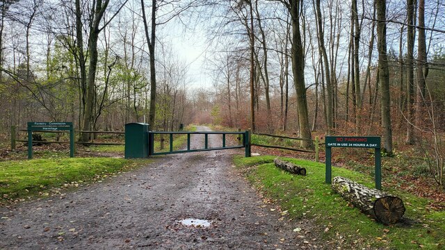
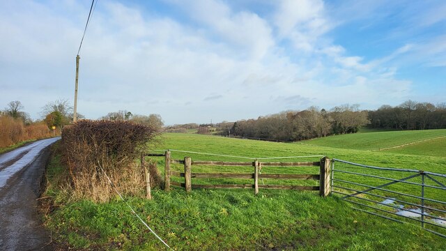
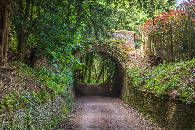
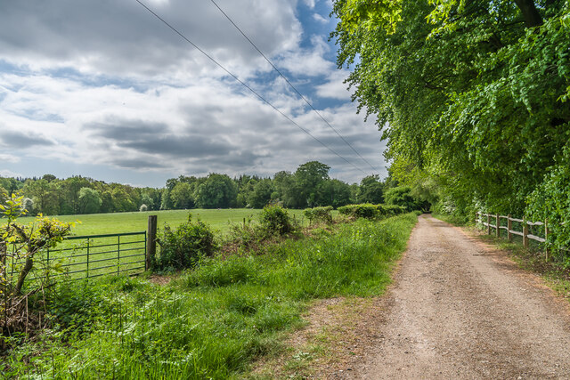
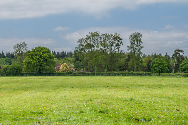
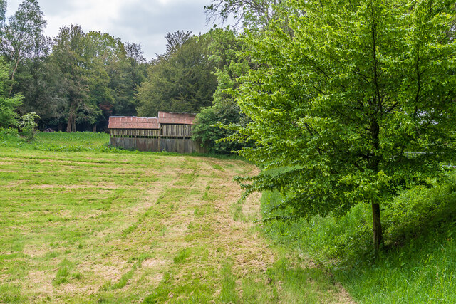
Birchetts Coppice is a picturesque woodland located in the county of Surrey, England. Covering an area of approximately 100 acres, it is nestled in the heart of the Surrey Hills Area of Outstanding Natural Beauty. The coppice is known for its abundant birch trees, which lend their name to the site.

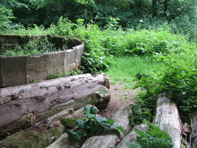
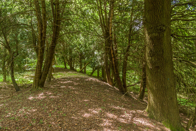
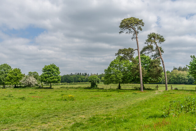
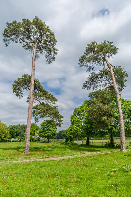
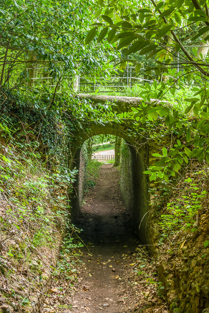
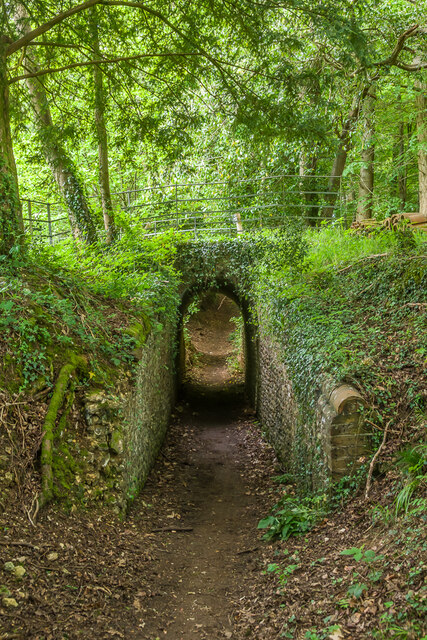
The woodland is a diverse habitat, home to a wide range of flora and fauna. The forest floor is carpeted with bluebells in the spring, creating a stunning display of color. Other native plants that thrive in the coppice include primroses, wood anemones, and wild garlic. The birch trees themselves provide a habitat for various bird species, including woodpeckers and owls.

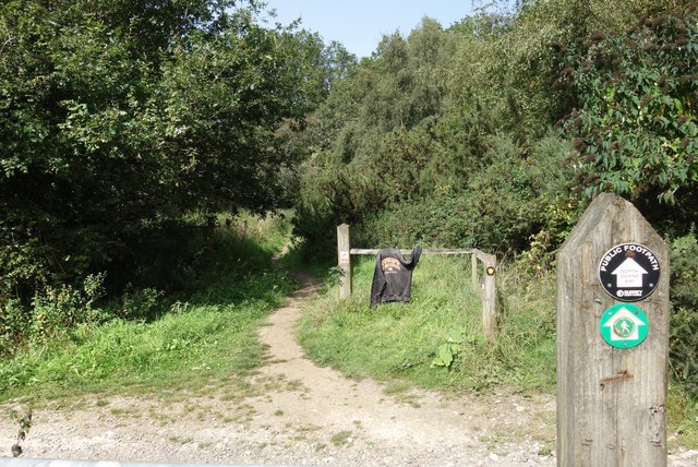
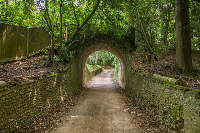
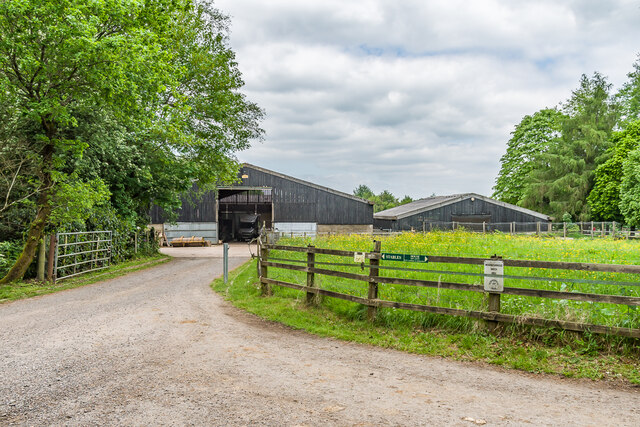
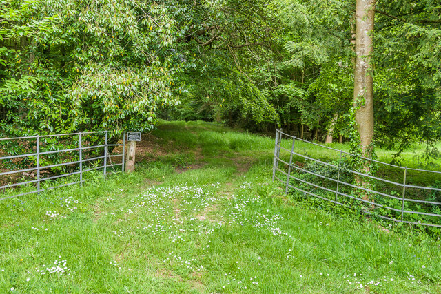
Birchetts Coppice is a popular destination for nature lovers and outdoor enthusiasts. It offers a network of well-maintained trails, allowing visitors to explore the woodland on foot or by bike. The peaceful atmosphere and tranquil surroundings make it an ideal spot for activities such as picnicking, birdwatching, and photography.

The management of the coppice is carefully undertaken to preserve its natural beauty and biodiversity. Traditional woodland management techniques, such as coppicing, are employed to encourage the growth of new trees, maintain a healthy woodland ecosystem, and provide a sustainable source of timber.

Overall, Birchetts Coppice is a haven of natural beauty within Surrey. Its lush woodland, vibrant wildflowers, and diverse wildlife make it a must-visit destination for those seeking a peaceful retreat in the heart of nature.

If you have any feedback on the listing, please let us know in the comments section below.

Birchetts Coppice Images

Images are sourced within 2km of 51.244203/-0.42409362 or Grid Reference TQ1050. Thanks to Geograph Open Source API. All images are credited.

Access to Hermitage Plantation
Field near Dogkennel Green Access road for St Teresa's School. Website - <span class="nowrap"><a title="https://st-teresas.com/" rel="nofollow ugc noopener" href="https://st-teresas.com/">Link</a><img style="margin-left:2px;" alt="External link" title="External link - shift click to open in new window" src="https://s1.geograph.org.uk/img/external.png" width="10" height="10"/></span>
Field near Dogkennel Green
Access road for St Teresa's School. Website - LinkExternal link
Going up White Hill Beech Avenue is a narrow rural lane leading to Critten Lane.
Going up White Hill
Beech Avenue is a narrow rural lane leading to Critten Lane.
Netley Heath - Old Reservoir Derelict round reservoir and discarded felled timber beside the North Downs Way at Gravelhill Gate.
Netley Heath - Old Reservoir
Derelict round reservoir and discarded felled timber beside the North Downs Way at Gravelhill Gate.
Fleece on a Fence On Hackhurst Down. The North Downs Way ldp crosses Beggars Lane, a steep green lane heading downhill to Gomshall.
Someone has lost a nice warm fleece.
Fleece on a Fence
On Hackhurst Down. The North Downs Way ldp crosses Beggars Lane, a steep green lane heading downhill to Gomshall. Someone has lost a nice warm fleece.
Hermitage Bridge Bridge over Sheepwalk Lane, one of the Lovelace Bridges (see below).  Grade II listed - see <span class="nowrap"><a title="https://historicengland.org.uk/listing/the-list/list-entry/1377858?section=official-list-entry" rel="nofollow ugc noopener" href="https://historicengland.org.uk/listing/the-list/list-entry/1377858?section=official-list-entry">Link</a><img style="margin-left:2px;" alt="External link" title="External link - shift click to open in new window" src="https://s1.geograph.org.uk/img/external.png" width="10" height="10"/></span>.
Hermitage Bridge
Bridge over Sheepwalk Lane, one of the Lovelace Bridges (see below). Grade II listed - see LinkExternal link.
Hermitage Bridge Looking across Hermitage Bridge, a bridge over Sheepwalk Lane, one of the Lovelace Bridges (see below), with this being the route of one of the forestry tracks.  Grade II listed - see <span class="nowrap"><a title="https://historicengland.org.uk/listing/the-list/list-entry/1377858?section=official-list-entry" rel="nofollow ugc noopener" href="https://historicengland.org.uk/listing/the-list/list-entry/1377858?section=official-list-entry">Link</a><img style="margin-left:2px;" alt="External link" title="External link - shift click to open in new window" src="https://s1.geograph.org.uk/img/external.png" width="10" height="10"/></span>.  See <a href="https://www.geograph.org.uk/photo/7646909">TQ1050 : Hermitage Bridge</a> and <a href="https://www.geograph.org.uk/photo/7646910">TQ1050 : Hermitage Bridge</a> for photos of the bridge from below.  The house in the background is The Hermitage, built by Lovelace at around the same time, possibly for a gamekeeper or forester.
Hermitage Bridge
Looking across Hermitage Bridge, a bridge over Sheepwalk Lane, one of the Lovelace Bridges (see below), with this being the route of one of the forestry tracks. Grade II listed - see LinkExternal link. See TQ1050 : Hermitage Bridge and TQ1050 : Hermitage Bridge for photos of the bridge from below. The house in the background is The Hermitage, built by Lovelace at around the same time, possibly for a gamekeeper or forester.
Embankment, Hermitage Bridge Embankment south of Hermitage Bridge, a bridge over Sheepwalk Lane, one of the Lovelace Bridges (see below), with this being the route of one of the forestry tracks.
Embankment, Hermitage Bridge
Embankment south of Hermitage Bridge, a bridge over Sheepwalk Lane, one of the Lovelace Bridges (see below), with this being the route of one of the forestry tracks.
Track Track off Crocknorth Road, leading to Sheepwalk Lane.
Track
Track off Crocknorth Road, leading to Sheepwalk Lane.
Crocknorth Farm Barns at Crocknorth Farm, off Crocknorth Lane.
Crocknorth Farm
Barns at Crocknorth Farm, off Crocknorth Lane.
Near Crocknorth Farm A field edge near Crocknorth Farm, off Crocknorth Lane.
Near Crocknorth Farm
A field edge near Crocknorth Farm, off Crocknorth Lane.
Near Crocknorth Farm Two Scots Pines by a field edge near Crocknorth Farm, off Crocknorth Lane.
Near Crocknorth Farm
Two Scots Pines by a field edge near Crocknorth Farm, off Crocknorth Lane.
Towards Crocknorth House Looking across a field to the partly hidden Crocknorth House.
Towards Crocknorth House
Looking across a field to the partly hidden Crocknorth House.
Meadow Plat Bridge Bridge over a bridleway near Meadow Plat, one of the Lovelace Bridges (see below).  This is the narrowest of all the bridges, with a span of only 6'.  It is also the only one of the extant which is not grade II listed.
Meadow Plat Bridge
Bridge over a bridleway near Meadow Plat, one of the Lovelace Bridges (see below). This is the narrowest of all the bridges, with a span of only 6'. It is also the only one of the extant which is not grade II listed.
Meadow Plat Bridge Looking across Meadow Plat Bridge, a bridge over a bridleway near Meadow Plat, one of the Lovelace Bridges (see below), with this being the route of one of the forestry tracks.  See <a href="https://www.geograph.org.uk/photo/7647792">TQ1050 : Meadow Plat Bridge</a> and <a href="https://www.geograph.org.uk/photo/7647793">TQ1050 : Meadow Plat Bridge</a> for photos of the bridge from the bridleway underneath.
Meadow Plat Bridge
Looking across Meadow Plat Bridge, a bridge over a bridleway near Meadow Plat, one of the Lovelace Bridges (see below), with this being the route of one of the forestry tracks. See TQ1050 : Meadow Plat Bridge and TQ1050 : Meadow Plat Bridge for photos of the bridge from the bridleway underneath.
Barn A barn near Meadow Plat.
Barn
A barn near Meadow Plat.
Show me another place!

Birchetts Coppice is located at Grid Ref: TQ1050 (Lat: 51.244203, Lng: -0.42409362)

Administrative County: Surrey

District: Guildford

Police Authority: Surrey

What 3 Words

///bunks.risky.lots. Near West Horsley, Surrey

Related Wikis

Stockbroker Belt

The Stockbroker Belt is a loosely defined region overlapping the borders of the London metropolitan area and the commuter region surrounding Greater London...

List of local nature reserves in Surrey

Local nature reserves are designated by local authorities under the National Parks and Access to the Countryside Act 1949. The local authority must have...

Surrey Wildlife Trust

Surrey Wildlife Trust (SWT) was founded in 1959 as Surrey Naturalists' Trust and it is one of forty-six wildlife trusts covering Great Britain, Northern...

Sheepleas

Sheepleas is a 99.9-hectare (247-acre) biological and geological Site of Special Scientific Interest east of Guildford in Surrey. It is a Geological Conservation...

Netley Heath

Netley Heath is an area of woods and heathland in the parish of Shere close to Gomshall in Surrey, England. It is part of a larger geological stratum across...

St Teresa's School Effingham

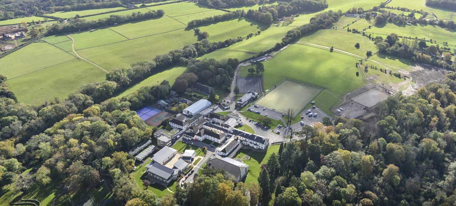
St Teresa's Effingham is a selective, independent boarding and day school for girls aged 2–18 in Effingham, Surrey, England, established in 1928. It is...

Surrey

Surrey () is a ceremonial county in South East England and one of the home counties. It is bordered by Greater London to the northeast, Kent to the east...

Upper Common Pits

Upper Common Pits is a 3-hectare (7.4-acre) geological Site of Special Scientific Interest in the north of Gomshall in Surrey. It is a Geological Conservation...

Nearby Amenities

Located within 500m of 51.244203,-0.42409362
Crocknorth Farm
Landuse: farm
Note Retag: CS #48756035
Source: npe
Lat/Long: 51.2473076/-0.4204829
Parking
Addr Street: Crocknorth Hill
Capacity: 1
Wheelchair: limited
Wheelchair Description: Gravel surface, gravel track into woodlands.
Lat/Long: 51.247044/-0.4247866
Dick Focks Common
Place: locality
Lat/Long: 51.2436949/-0.4289084
The data included in this document is from www.openstreetmap.org. The data is made available under ODbL.

Have you been to Birchetts Coppice?

Leave your review of Birchetts Coppice below (or comments, questions and feedback).