Gatewick Copse

Wood, Forest in Sussex Horsham

England

Gatewick Copse

Gateway with a view Looking westwards from the West Sussex Literary Trail.
Gateway with a view Credit: Chris Thomas-Atkin

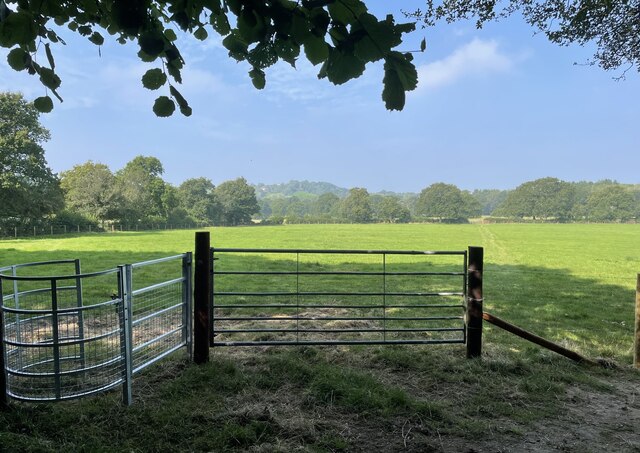
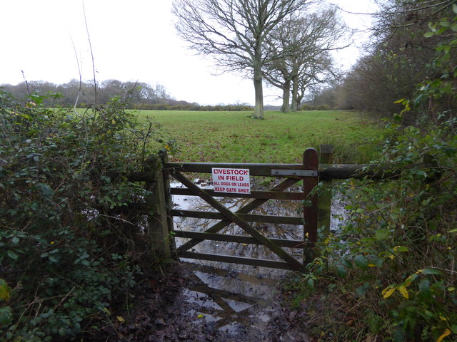
Gatewick Copse is a picturesque woodland located in Sussex, England. Covering an area of approximately 120 acres, it is known for its diverse range of flora and fauna, making it a popular destination for nature enthusiasts and wildlife lovers.

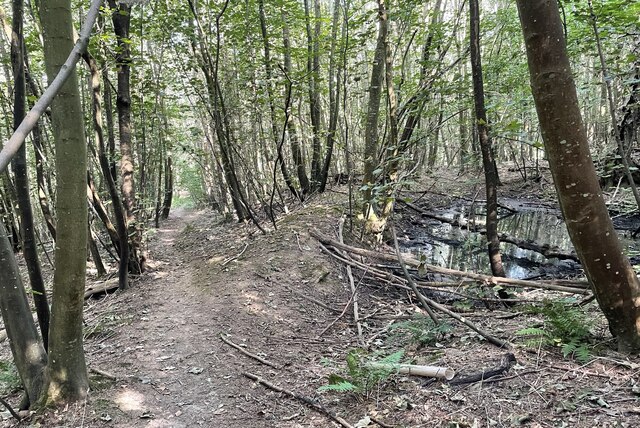
The copse is primarily composed of native broadleaf trees such as oak, ash, and beech, which create a dense canopy overhead. These towering trees provide a habitat for a wide variety of bird species, including woodpeckers, tits, and finches, which can be observed and heard throughout the year.

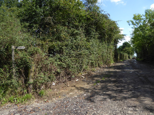
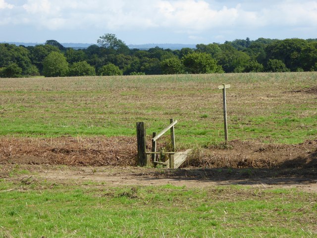
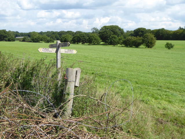
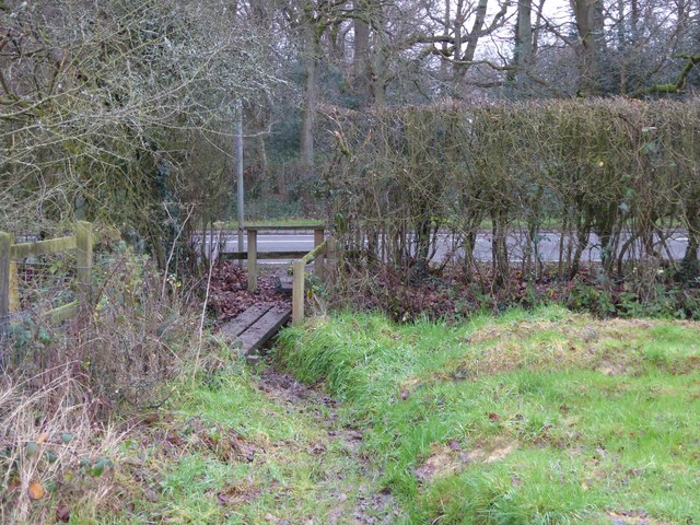
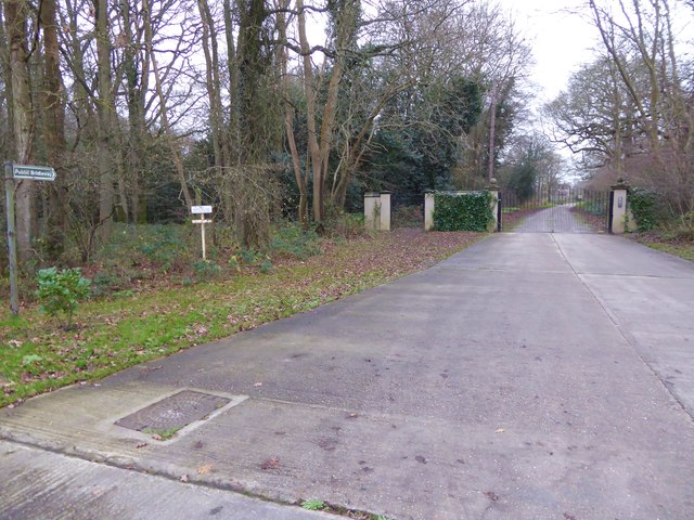
A network of well-marked trails and footpaths crisscrosses the copse, allowing visitors to explore its enchanting beauty at their own pace. These paths take visitors through different parts of the woodland, offering a chance to discover hidden meadows, babbling streams, and secluded ponds. The copse is also home to a diverse range of plant species, including bluebells, wild garlic, and wood anemones, which create a vibrant carpet of color during the springtime.

Gatewick Copse is a haven for wildlife, with an abundance of mammals such as deer, foxes, and badgers inhabiting the woodland. The copse's tranquil atmosphere and natural surroundings make it an ideal spot for birdwatching, photography, or simply enjoying a peaceful walk in nature.

Managed by a local conservation organization, Gatewick Copse is dedicated to preserving the natural beauty and biodiversity of the area. Regular conservation projects and habitat management ensure the copse remains a thriving ecosystem for the benefit and enjoyment of both present and future generations.

If you have any feedback on the listing, please let us know in the comments section below.

Gatewick Copse Images

Images are sourced within 2km of 50.982017/-0.4481449 or Grid Reference TQ0921. Thanks to Geograph Open Source API. All images are credited.

Gateway with a view Looking westwards from the West Sussex Literary Trail.
Gateway with a view
Looking westwards from the West Sussex Literary Trail.
West Sussex Literary Trail Passing through unnamed woodland near Woods Hill.
West Sussex Literary Trail
Passing through unnamed woodland near Woods Hill.
Nyetimber Vines Vines beside the West Sussex Literary Trail at Nyetimber Vineyard.
Nyetimber Vines
Vines beside the West Sussex Literary Trail at Nyetimber Vineyard.
Track heading east from Broadford Bridge Road This is signed as a public footpath but is not mapped as a public right of way.
Track heading east from Broadford Bridge Road
This is signed as a public footpath but is not mapped as a public right of way.
Footpath bridge over ditch by High Copse Farm
Crossing of footpaths east of Broadford Bridge Road
Footpath arrives at Adversane Lane A view the other way is at <a title="https://www.geograph.org.uk/photo/4375146" href="https://www.geograph.org.uk/photo/4375146">Link</a>.
Footpath arrives at Adversane Lane
A view the other way is at Link.
The bridleway known as Steepwood Lane goes south from Adversane Lane See an earlier picture at <a title="https://www.geograph.org.uk/photo/1194219" href="https://www.geograph.org.uk/photo/1194219">Link</a>.
The bridleway known as Steepwood Lane goes south from Adversane Lane
See an earlier picture at Link.
Footpath goes east from Gay Street Lane
Dog at crossing paths The animal was very muddy but friendly and we hit it off.
For a view the other way see <a title="https://www.geograph.org.uk/photo/4377803" href="https://www.geograph.org.uk/photo/4377803">Link</a>.
Dog at crossing paths
The animal was very muddy but friendly and we hit it off. For a view the other way see Link.
A bit of a mess at footpath junction The canine guardian of the crossing paths (see <a href="https://www.geograph.org.uk/photo/4771062">TQ0721 : Dog at crossing paths</a>) can be seen on the extreme left beyond the pile of rubble.
A bit of a mess at footpath junction
The canine guardian of the crossing paths (see TQ0721 : Dog at crossing paths) can be seen on the extreme left beyond the pile of rubble.
Footpath crosses stream on plank bridge See also <a title="https://www.geograph.org.uk/photo/4377984" href="https://www.geograph.org.uk/photo/4377984">Link</a> for a picture earlier in the year.
Footpath crosses stream on plank bridge
See also Link for a picture earlier in the year.
Footpath arrives at muddy corner of field and junction with bridleway See also <a title="https://www.geograph.org.uk/photo/4374766" href="https://www.geograph.org.uk/photo/4374766">Link</a>.
Footpath arrives at muddy corner of field and junction with bridleway
See also Link.
Bridleway enters field going north
Bridleway junction with Gay Street The bridleway is called Steepwood Lane.
Bridleway junction with Gay Street
The bridleway is called Steepwood Lane.
Field entrance on Gay Street
Barn at Hayes Farm on Gay Street
Tree at Hayes Farm
Tree at Hayes Farm
Show me another place!

Gatewick Copse is located at Grid Ref: TQ0921 (Lat: 50.982017, Lng: -0.4481449)

Administrative County: West Sussex

District: Horsham

Police Authority: Sussex

What 3 Words

///shepherds.nights.sunbeam. Near Billingshurst, West Sussex

Related Wikis

Gay Street, West Sussex

Gay Street is a hamlet in the Horsham District of West Sussex, England. It lies on the North Heath to West Chiltington road 1.9 miles (3.1 km) northeast...

North Heath

North Heath is a hamlet in the Horsham District of West Sussex, England. It lies just off the A29 road 1.9 miles (3 km) north of Pulborough. The Brinsbury...

Adversane

Adversane is a large hamlet in the Horsham District of West Sussex, England, located 1.5 miles south of Billingshurst (where, at the 2011 Census, the population...

Pulborough (electoral division)

Pulborough is an electoral division of West Sussex in the United Kingdom and returns one member to sit on West Sussex County Council. The current County...
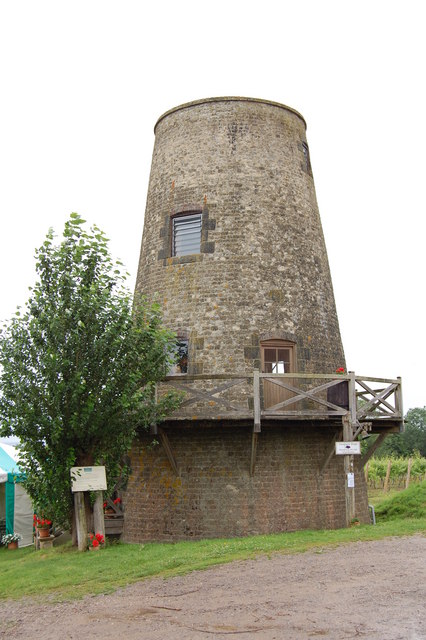
Nutbourne Windmill

Nutbourne Windmill is a tower mill at Nutbourne, Sussex, England which has been converted to retail use. == History == Nutbourne Windmill was built in...

Coneyhurst

Coneyhurst is a hamlet in the Horsham District of West Sussex, England. It lies on the A272 road 1.6 miles (2.5 km) southeast of Billingshurst (where the...

West Chiltington

West Chiltington is a village and civil parish in the Horsham district of West Sussex, England. It lies on the Storrington to Broadford Bridge road, 2...

A29 road

The A29 is a main road in England in Surrey and chiefly in West Sussex that runs for 34.4 miles (55.4 km). == Route == The road starts at the Beare Green...

Nearby Amenities

Located within 500m of 50.982017,-0.4481449
Barrier: stile
Lat/Long: 50.9828725/-0.4444977
Man Made: utility_pole
Lat/Long: 50.9820618/-0.4417597
Man Made: utility_pole
Lat/Long: 50.981836/-0.4432316
Man Made: utility_pole
Lat/Long: 50.9816362/-0.444546
Man Made: utility_pole
Lat/Long: 50.9814223/-0.4459341
Man Made: utility_pole
Lat/Long: 50.981499/-0.4501407
Granary Farm
Place: farm
Lat/Long: 50.9829511/-0.4419768
Homefield Farm
Place: farm
Lat/Long: 50.9837352/-0.4431522
Man Made: petroleum_well
Lat/Long: 50.9848096/-0.4481394
Gatewick Farm
Place: farm
Lat/Long: 50.9805231/-0.4478481
The data included in this document is from www.openstreetmap.org. The data is made available under ODbL.

Have you been to Gatewick Copse?

Leave your review of Gatewick Copse below (or comments, questions and feedback).