Ockham Village Green
Wood, Forest in Surrey Guildford
England
Ockham Village Green

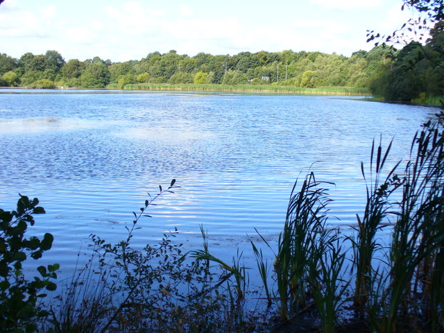
Ockham Village Green, located in the county of Surrey, England, is a picturesque area known for its scenic woodlands and lush forests. Nestled within the tranquil countryside, this green space is a popular destination for nature enthusiasts and locals seeking a peaceful retreat.
Covering an extensive area, Ockham Village Green is characterized by its dense and diverse woodland, comprising a variety of tree species such as oak, beech, and birch. The dense canopy provides a rich habitat for wildlife, including various bird species, small mammals, and insects.
The green's well-maintained paths and trails offer visitors the opportunity to explore the natural beauty at their own pace. Hikers and walkers can enjoy leisurely strolls through the forest, taking in the sights and sounds of nature. The green also features designated picnic areas, allowing visitors to relax and enjoy a meal amidst the serene surroundings.
Ockham Village Green is not only a haven for nature lovers but also holds historical significance. It is believed to have been a gathering place for local villagers for centuries, providing a space for community events and celebrations. Today, this tradition is continued, with occasional events and fairs organized on the green, bringing the community together.
Overall, Ockham Village Green offers a peaceful and idyllic setting for those seeking respite from the hustle and bustle of everyday life. Its verdant woodlands, diverse wildlife, and historical charm make it a must-visit destination for anyone looking to connect with nature and immerse themselves in the beauty of Surrey's countryside.
If you have any feedback on the listing, please let us know in the comments section below.
Ockham Village Green Images
Images are sourced within 2km of 51.311808/-0.46050476 or Grid Reference TQ0758. Thanks to Geograph Open Source API. All images are credited.


Ockham Village Green is located at Grid Ref: TQ0758 (Lat: 51.311808, Lng: -0.46050476)
Administrative County: Surrey
District: Guildford
Police Authority: Surrey
What 3 Words
///snake.loft.thin. Near Ripley, Surrey
Nearby Locations
Related Wikis

Wisley Airfield
Wisley Airfield is a former wartime airfield located in the Parish of Ockham near Wisley in Surrey, England. Originally a grass airstrip, the runway was...
Ockham and Wisley Commons
Ockham and Wisley Commons is a 266-hectare (660-acre) biological Site of Special Scientific Interest east of Woking in Surrey. It is also a Local Nature...

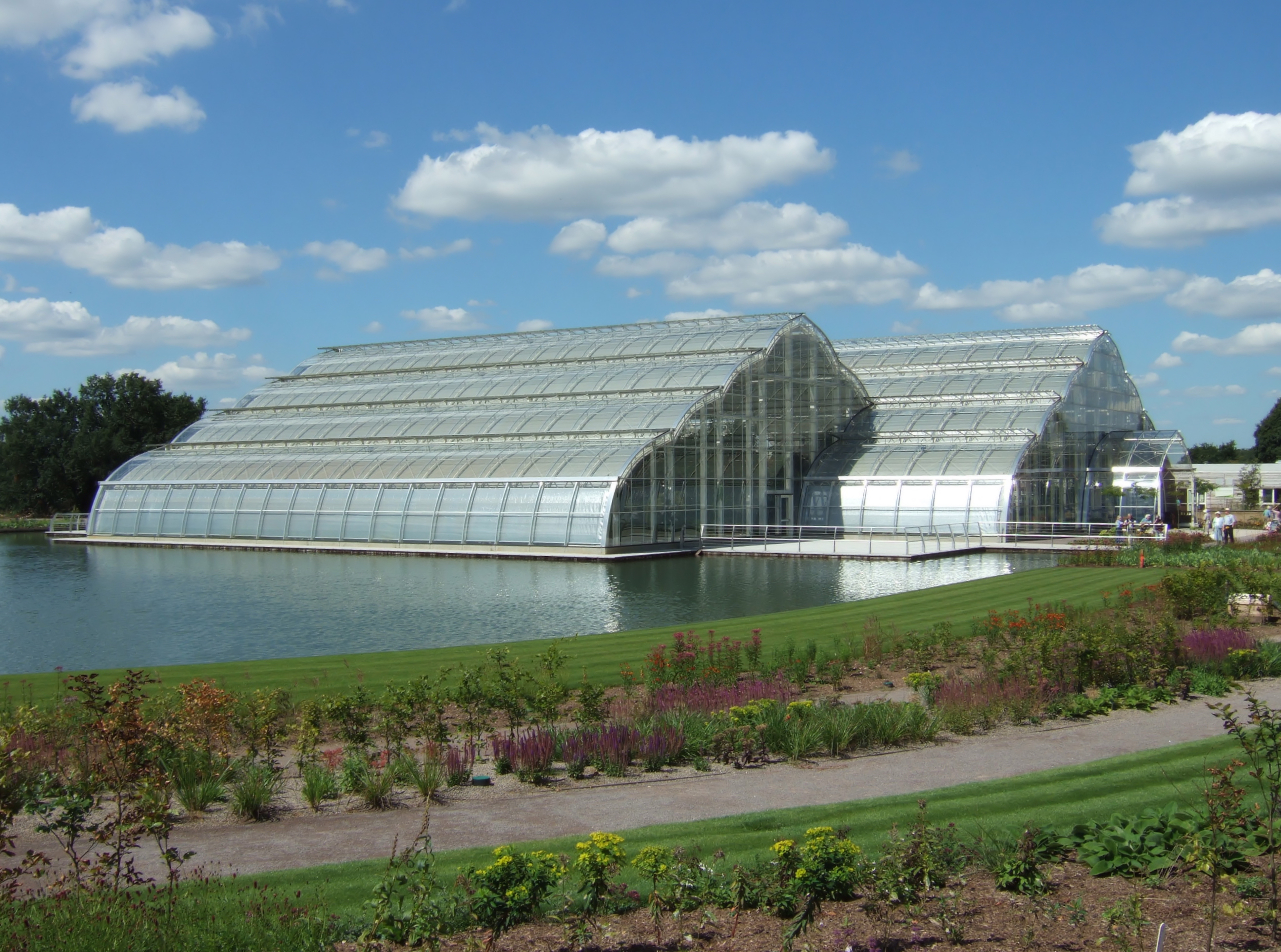
RHS Garden Wisley
RHS Garden Wisley is a garden run by the Royal Horticultural Society in Wisley, Surrey, south of London. It is one of five gardens run by the society,...

Ockham, Surrey
Ockham ( OK-əm) is a rural and semi-rural village in the borough of Guildford in Surrey, England. The village starts immediately east of the A3 but the...
Chatley Heath
Chatley Heath is part of 336 hectare reserve including Wisley Common, Ockham and parts of Hatchford. It is an area with a mixed habitats including heathland...
Wisley
Wisley is a village and civil parish in Surrey, England between Cobham and Woking, in the Borough of Guildford. It is the home of the Royal Horticultural...

Wisley Golf Club
The Wisley Golf Club is a golf club in Wisley in Surrey, England. The club is only open to members and their guests.The club has 700 members, each of whom...
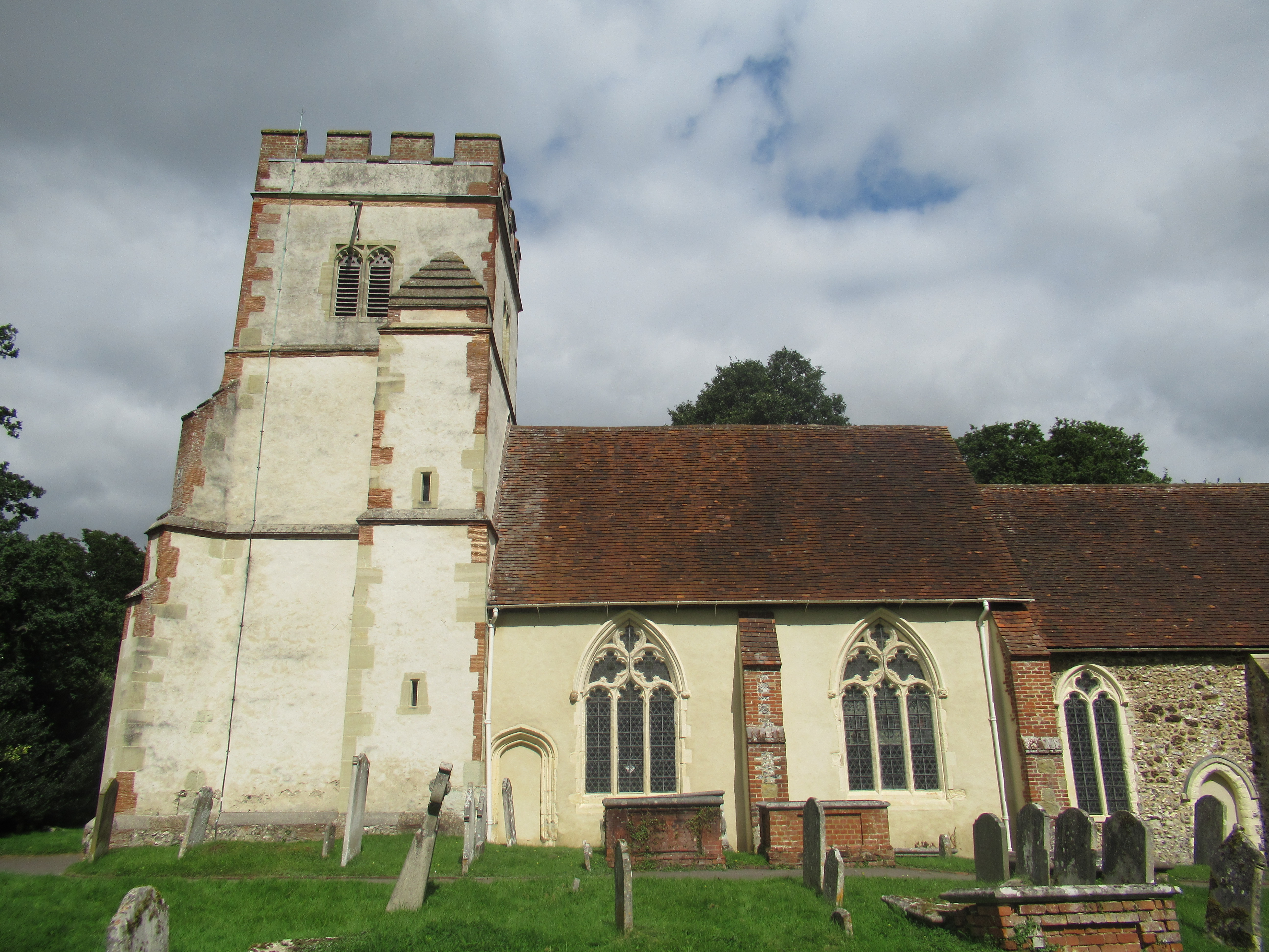
All Saints' Church, Ockham
The Church of All Saints, usually known as All Saints' Church, is an Anglican church in Ockham, England. It is the parish church of Ockham with Hatchford...
Nearby Amenities
Located within 500m of 51.311808,-0.46050476Have you been to Ockham Village Green?
Leave your review of Ockham Village Green below (or comments, questions and feedback).