Hut Hill

Hill, Mountain in Surrey Guildford

England

Hut Hill

Byfleet Manor Byfleet Manor was originally a royal hunting lodge which was given by Edward II to Piers Gaveston, his reputed lover. It was rebuilt in 1619 by Anne of Denmark, wife of King James I at the house's last royal owner, but she died before it was finished. The massive front walls and gate piers date from that time. It was then rebuilt again in 1685 because it was reported to be in ruinous condition! This resulted in a much smaller building. It was restored in 1905 when it was again enlarged by adding asymmetrical wings.
Byfleet Manor Credit: Ron Strutt

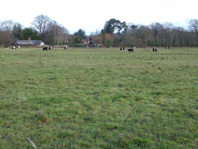
Hut Hill is a small hill located in the Surrey Hills Area of Outstanding Natural Beauty in Surrey, England. With an elevation of approximately 150 meters (492 feet), it is classified as a hill rather than a mountain. The hill is situated near the village of Abinger Hammer and is a popular destination for outdoor enthusiasts and nature lovers.

Hut Hill is known for its stunning panoramic views of the surrounding countryside, including the North Downs and the Weald. On a clear day, visitors can enjoy breathtaking vistas stretching for miles. The hill is covered with lush green grass and is dotted with trees, providing a picturesque setting for picnics and leisurely walks.

One of the notable features of Hut Hill is the presence of Iron Age hillfort earthworks. These ancient fortifications are believed to have been constructed between 500 and 100 BC and are a testament to the rich history of the area. Archaeological surveys have revealed evidence of human activity in the vicinity of Hut Hill dating back thousands of years.

The hill is easily accessible via footpaths and bridleways, making it a popular spot for hikers, cyclists, and horse riders. It also offers a variety of wildlife, including birds, butterflies, and small mammals, making it a haven for nature enthusiasts.

Overall, Hut Hill is a beautiful and historically significant natural landmark in Surrey, offering visitors a chance to immerse themselves in the tranquil beauty of the Surrey Hills landscape.

If you have any feedback on the listing, please let us know in the comments section below.

Hut Hill Images

Images are sourced within 2km of 51.317073/-0.45813298 or Grid Reference TQ0758. Thanks to Geograph Open Source API. All images are credited.

Byfleet Manor Byfleet Manor was originally a royal hunting lodge which was given by Edward II to Piers Gaveston, his reputed lover. It was rebuilt in 1619 by Anne of Denmark, wife of King James I at the house's last royal owner, but she died before it was finished. The massive front walls and gate piers date from that time. It was then rebuilt again in 1685 because it was reported to be in ruinous condition! This resulted in a much smaller building. It was restored in 1905 when it was again enlarged by adding asymmetrical wings.
Byfleet Manor
Byfleet Manor was originally a royal hunting lodge which was given by Edward II to Piers Gaveston, his reputed lover. It was rebuilt in 1619 by Anne of Denmark, wife of King James I at the house's last royal owner, but she died before it was finished. The massive front walls and gate piers date from that time. It was then rebuilt again in 1685 because it was reported to be in ruinous condition! This resulted in a much smaller building. It was restored in 1905 when it was again enlarged by adding asymmetrical wings.
The Wey near Byfleet A quiet stretch of the River Wey at Park Barn Farm, south of the former Byfleet Mill.
The Wey near Byfleet
A quiet stretch of the River Wey at Park Barn Farm, south of the former Byfleet Mill.
Approaching Park Barn Farm Narrow footpath with a good clay surface for walkers. The farm is hidden on the right behind a high fence. Beyond, the path goes along the bank of the River Wey for a short stretch.
Approaching Park Barn Farm
Narrow footpath with a good clay surface for walkers. The farm is hidden on the right behind a high fence. Beyond, the path goes along the bank of the River Wey for a short stretch.
1950s Vauxhall Cresta on Redhill Road
Byfleet Mill Lade Sylvan scene around the old lade at the end of Mill Lane, Byfleet. The mill is now residential and the lade is still fed by the River Wey.
<span class="nowrap"><a title="www.weyriver.co.uk" rel="nofollow ugc noopener" href="http://www.weyriver.co.uk">Link</a><img style="margin-left:2px;" alt="External link" title="External link - shift click to open in new window" src="https://s1.geograph.org.uk/img/external.png" width="10" height="10"/></span>
Byfleet Mill Lade
Sylvan scene around the old lade at the end of Mill Lane, Byfleet. The mill is now residential and the lade is still fed by the River Wey. LinkExternal link
Drainage Ditch by Byfleet Manor The ditch has a straight watercourse and helps drain the fields in the Wey flood plain at Byfleet.
<span class="nowrap"><a title="www.weyriver.co.uk" rel="nofollow ugc noopener" href="http://www.weyriver.co.uk">Link</a><img style="margin-left:2px;" alt="External link" title="External link - shift click to open in new window" src="https://s1.geograph.org.uk/img/external.png" width="10" height="10"/></span>
Drainage Ditch by Byfleet Manor
The ditch has a straight watercourse and helps drain the fields in the Wey flood plain at Byfleet. LinkExternal link
Not Fleeced Yet Shaggy sheep, perhaps a rare breed, by Byfleet Manor in the Wey Valley.
<span class="nowrap"><a title="www.weyriver.co.uk" rel="nofollow ugc noopener" href="http://www.weyriver.co.uk">Link</a><img style="margin-left:2px;" alt="External link" title="External link - shift click to open in new window" src="https://s1.geograph.org.uk/img/external.png" width="10" height="10"/></span>
Not Fleeced Yet
Shaggy sheep, perhaps a rare breed, by Byfleet Manor in the Wey Valley. LinkExternal link
Byfleet Manor House Historic house on the River Wey at Byfleet. The gate posts pre-date the present mansion. Byfleet Manor has been visited by royalty, including the Black Prince and, reportedly, Henry VIII.
<span class="nowrap"><a title="www.weyriver.co.uk" rel="nofollow ugc noopener" href="http://www.weyriver.co.uk">Link</a><img style="margin-left:2px;" alt="External link" title="External link - shift click to open in new window" src="https://s1.geograph.org.uk/img/external.png" width="10" height="10"/></span>     <span class="nowrap"><a title="http://en.wikipedia.org/wiki/Byfleet_Manor" rel="nofollow ugc noopener" href="http://en.wikipedia.org/wiki/Byfleet_Manor">Link</a><img style="margin-left:2px;" alt="External link" title="External link - shift click to open in new window" src="https://s1.geograph.org.uk/img/external.png" width="10" height="10"/></span>     <span class="nowrap"><a title="www.byfleetmanor.com" rel="nofollow ugc noopener" href="http://www.byfleetmanor.com">Link</a><img style="margin-left:2px;" alt="External link" title="External link - shift click to open in new window" src="https://s1.geograph.org.uk/img/external.png" width="10" height="10"/></span>
Byfleet Manor House
Historic house on the River Wey at Byfleet. The gate posts pre-date the present mansion. Byfleet Manor has been visited by royalty, including the Black Prince and, reportedly, Henry VIII. LinkExternal link LinkExternal link LinkExternal link
Belties in Byfleet Belted Galloway cattle grazing on the Manor Farm Estate at Byfleet.
The breed seems to be more common in southern England nowadays.
Belties in Byfleet
Belted Galloway cattle grazing on the Manor Farm Estate at Byfleet. The breed seems to be more common in southern England nowadays.
Byfleet Belties Belted Galloway cattle grazing at Manor Farm Estate, Byfleet. The trees in the background are beside the River Wey.
<span class="nowrap"><a title="www.weyriver.co.uk" rel="nofollow ugc noopener" href="http://www.weyriver.co.uk">Link</a><img style="margin-left:2px;" alt="External link" title="External link - shift click to open in new window" src="https://s1.geograph.org.uk/img/external.png" width="10" height="10"/></span>
Byfleet Belties
Belted Galloway cattle grazing at Manor Farm Estate, Byfleet. The trees in the background are beside the River Wey. LinkExternal link
Residential Byfleet Modern housing estate on the southern edge of Byfleet, between parish church and M25 motorway.
Residential Byfleet
Modern housing estate on the southern edge of Byfleet, between parish church and M25 motorway.
The glasshouse at RHS Wisley The main glasshouse and pathways at the RHS (Royal Horticultural Society) Wisley gardens, Surrey. There is a large pool in front of the glasshouse.
The glasshouse at RHS Wisley
The main glasshouse and pathways at the RHS (Royal Horticultural Society) Wisley gardens, Surrey. There is a large pool in front of the glasshouse.
Ockham Road North, Ripley
Chittenden Cottages, Wisley
Ockham Road North, Ripley
House on Wisley Lane
Tozer Seeds greenhouses, Ripley
Show me another place!

Hut Hill is located at Grid Ref: TQ0758 (Lat: 51.317073, Lng: -0.45813298)

Administrative County: Surrey

District: Guildford

Police Authority: Surrey

What 3 Words

///heap.mile.sticky. Near Ripley, Surrey

Related Wikis

Ockham and Wisley Commons

Ockham and Wisley Commons is a 266-hectare (660-acre) biological Site of Special Scientific Interest east of Woking in Surrey. It is also a Local Nature...

Wisley Airfield

Wisley Airfield is a former wartime airfield located in the Parish of Ockham near Wisley in Surrey, England. Originally a grass airstrip, the runway was...
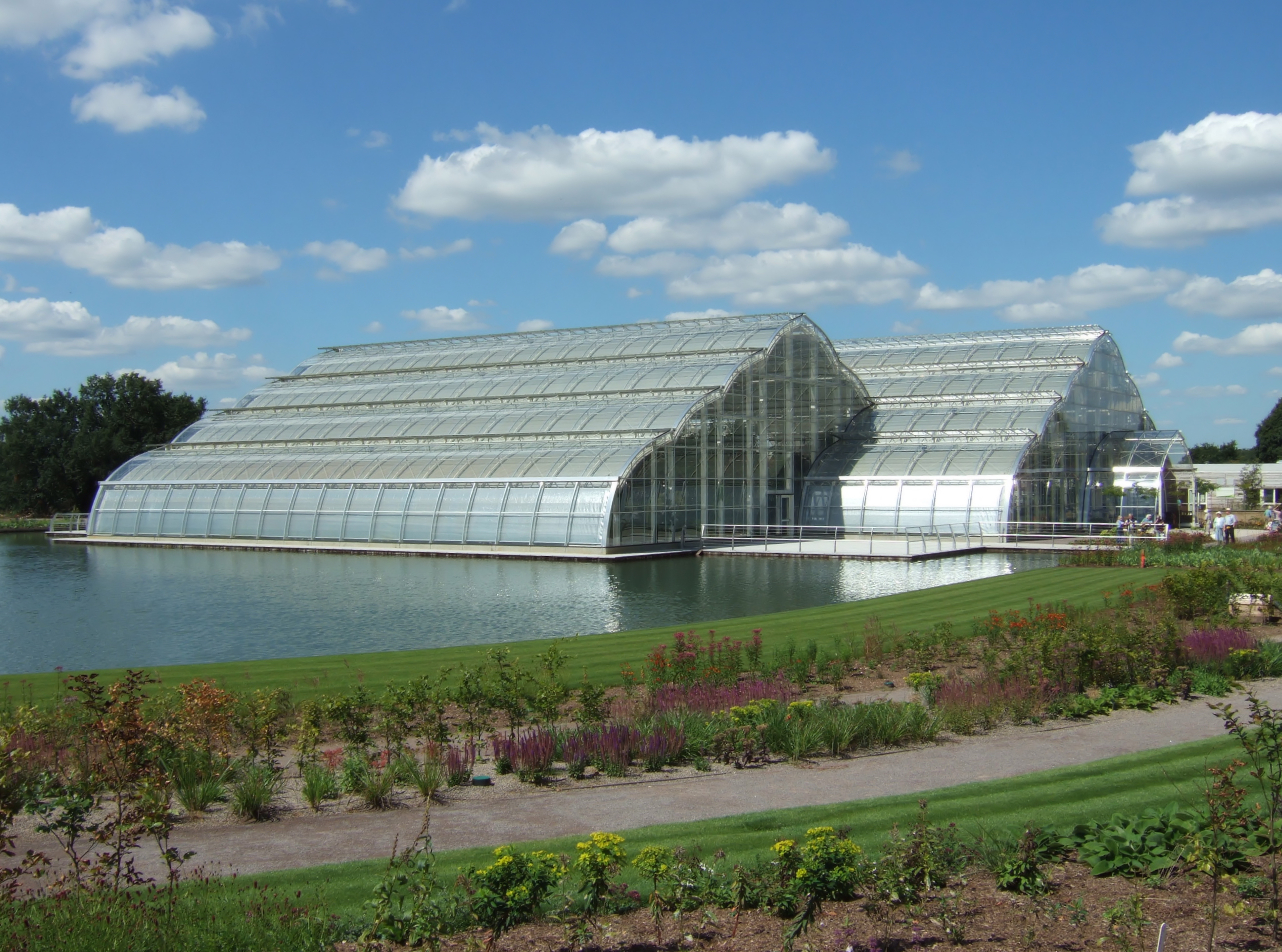
RHS Garden Wisley

RHS Garden Wisley is a garden run by the Royal Horticultural Society in Wisley, Surrey, south of London. It is one of five gardens run by the society,...
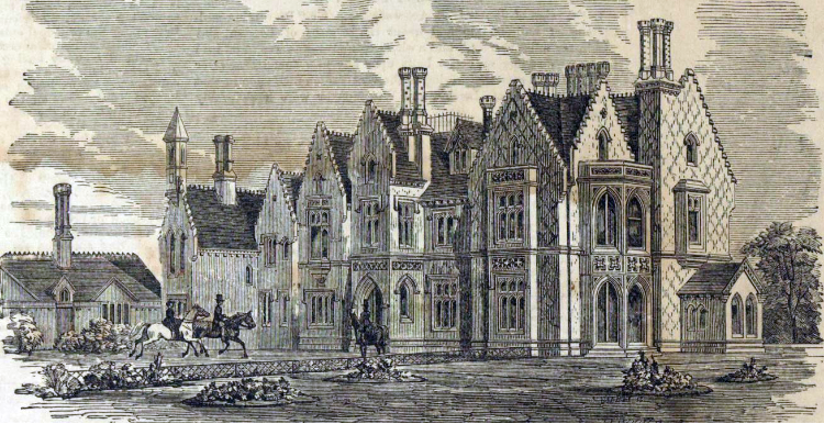
Foxwarren Park

Foxwarren Park, at Wisley in Surrey, is a Victorian country house and estate. On sandstone Ockham and Wisley Commons, it was designed in 1860 by the railway...

Chatley Heath

Chatley Heath is part of 336 hectare reserve including Wisley Common, Ockham and parts of Hatchford. It is an area with a mixed habitats including heathland...

Wisley

Wisley is a village and civil parish in Surrey, England between Cobham and Woking, in the Borough of Guildford. It is the home of the Royal Horticultural...

Manor Farm, Surrey

Manor Farm is a 25-hectare (62-acre) nature reserve in Byfleet, Surrey. It is owned and managed by the Surrey Wildlife Trust.In the seventeenth century...

Byfleet Manor

Byfleet Manor is a Grade II* listed house in Byfleet, Surrey, England. Byfleet Manor has been used as a filming location in three television series, most...

Nearby Amenities

Located within 500m of 51.317073,-0.45813298
Created By: Merkaartor 0.13
Lat/Long: 51.3187725/-0.4547756
Cafe
Ockham Bites
Addr City: Cobham
Addr Country: GB
Addr Postcode: KT11 1NA
Addr Street: Old Lane
Fhrs Authority: Guildford
Fhrs Id: 649783
Fhrs Local Authority Id: 4328
Website: http://www.ockhambites.com
Wheelchair: yes
Wheelchair Description: Closed when visited, but appears step-free. RADAR key toilet padlocked shut. Parking largely smooth.
Lat/Long: 51.3171494/-0.4538573
Toilets
Ockham Bites
Addr Street: Old Lane
Fee: no
Toilets Wheelchair: no
Wheelchair: no
Wheelchair Description: Padlocked SHUT when cafe is closed. Therefore rated RED until I am able to check internally. RADAR Key.
Lat/Long: 51.3171136/-0.4536992
Motorway Junction
Wisley
Lat/Long: 51.3191255/-0.4531684
Crossing
Bicycle: yes
Crossing: unmarked
Kerb: lowered
Sloped Curb: yes
Tactile Paving: no
Lat/Long: 51.3169247/-0.4546759
Wisley & Ockham Commons
Information: map
Tourism: information
Lat/Long: 51.3188245/-0.4549167
Barrier: cattle_grid
Lat/Long: 51.3208794/-0.4592997
Discover Surrey
Information: map
Tourism: information
Lat/Long: 51.316822/-0.4535331
Wisley & Ockham Commons
Check Date: 2022-07-24
Information: map
Tourism: information
Lat/Long: 51.3168449/-0.4531251
Covered: no
Leisure: picnic_table
Lat/Long: 51.3165717/-0.4536568
Covered: no
Leisure: picnic_table
Lat/Long: 51.3170594/-0.453815
Covered: no
Leisure: picnic_table
Lat/Long: 51.3170594/-0.4538559
Covered: no
Leisure: picnic_table
Lat/Long: 51.3170606/-0.4537788
Covered: no
Leisure: picnic_table
Lat/Long: 51.3170874/-0.4538345
Covered: no
Leisure: picnic_table
Lat/Long: 51.3171059/-0.4537761
Covered: no
Leisure: picnic_table
Lat/Long: 51.3171059/-0.4538479
Covered: no
Leisure: picnic_table
Lat/Long: 51.3171071/-0.4538137
Waste Basket
Lat/Long: 51.3171125/-0.4538512
Crossing
Bicycle: yes
Crossing: unmarked
Kerb: lowered
Sloped Curb: yes
Tactile Paving: no
Lat/Long: 51.317025/-0.4545336
Barrier: kerb
Kerb: lowered
Tactile Paving: no
Lat/Long: 51.3170633/-0.4544637
Give Way
Lat/Long: 51.3169253/-0.45475
Entrance: yes
Lat/Long: 51.3171198/-0.4538532
Entrance: yes
Lat/Long: 51.3171194/-0.4537691
Entrance: yes
Lat/Long: 51.3171089/-0.4537233
The data included in this document is from www.openstreetmap.org. The data is made available under ODbL.

Have you been to Hut Hill?

Leave your review of Hut Hill below (or comments, questions and feedback).