Auster Wood

Wood, Forest in Lincolnshire South Kesteven

England

Auster Wood

Catching the bus Catching the bus to Stamford, a Delaine 201 service, on fleet number 167. It had been raining fitfully all morning and came on heavy just as the bus approached.
Catching the bus Credit: Bob Harvey

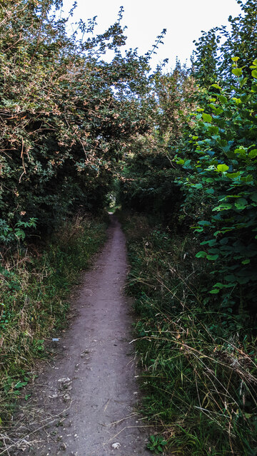
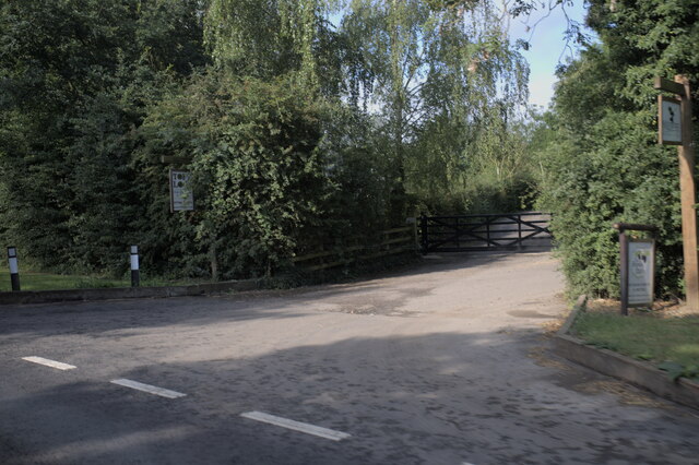
Auster Wood is a picturesque woodland located in Lincolnshire, England. Situated near the village of Austerby, this woodland is known for its natural beauty and peaceful atmosphere. Covering an area of approximately 50 acres, Auster Wood is a haven for nature enthusiasts and those seeking a tranquil escape from the hustle and bustle of everyday life.

The woodland is predominantly composed of deciduous trees, including oak, beech, and birch, which provide a stunning display of colors throughout the changing seasons. The forest floor is rich in flora, with wildflowers such as bluebells and primroses carpeting the ground during springtime.

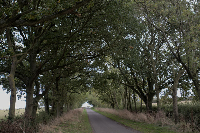
Auster Wood offers a variety of recreational activities for visitors. There are well-maintained walking trails that wind through the woodland, allowing visitors to explore its natural wonders at their own pace. Birdwatchers will delight in the diverse array of avian species that call this woodland home, including woodpeckers, owls, and various songbirds.

Moreover, Auster Wood is a designated Site of Special Scientific Interest (SSSI), reflecting its importance in terms of biodiversity and conservation. Rare species of plants and animals can be found within its boundaries, making it a significant ecological site.

The wood has a rich history, with evidence of human habitation dating back to the Neolithic period. Archaeological finds, such as flint tools and pottery fragments, have been discovered in the area, providing insight into the lives of ancient inhabitants.

Overall, Auster Wood is a captivating natural gem that offers visitors a chance to connect with nature, explore its trails, and immerse themselves in its serene ambiance.

If you have any feedback on the listing, please let us know in the comments section below.

Auster Wood Images

Images are sourced within 2km of 52.765435/-0.41223102 or Grid Reference TF0719. Thanks to Geograph Open Source API. All images are credited.

Catching the bus Catching the bus to Stamford, a Delaine 201 service, on fleet number 167. It had been raining fitfully all morning and came on heavy just as the bus approached.
Catching the bus
Catching the bus to Stamford, a Delaine 201 service, on fleet number 167. It had been raining fitfully all morning and came on heavy just as the bus approached.
Arched over The path to West Road. The trees and hedges provide a living tunnel.
Arched over
The path to West Road. The trees and hedges provide a living tunnel.
A tree by the road At the side of West Road
A tree by the road
At the side of West Road
A tree number A number tag on the tree in <a href="https://www.geograph.org.uk/photo/6941403">TF0819 : A tree by the road</a>. LCC would be the Lincolnshire County Council.
A tree number
A number tag on the tree in TF0819 : A tree by the road. LCC would be the Lincolnshire County Council.
Toft lodge entrance
Toft lodge entrance
Roundabout sponsorship Advertising space is offered on all our roundabouts now.
Roundabout sponsorship
Advertising space is offered on all our roundabouts now.
Arched with trees
Arched with trees
Lorry in West Road
Lorry in West Road
Service 201 AD21 DBL, Delaine bus fleet number 168, returning to Bourne with the Peterborough-Stamford-Bourne day time service.  This route is normally served by single deckers during the day.  

This bus was new in March 2021, and is a  E200 MMC from Alexander Dennis
Service 201
AD21 DBL, Delaine bus fleet number 168, returning to Bourne with the Peterborough-Stamford-Bourne day time service. This route is normally served by single deckers during the day. This bus was new in March 2021, and is a E200 MMC from Alexander Dennis
Service 201 The Bourne to Peterborough service via Stamford, approaching on the outbound leg.  This is AD70 DBL, Delaine fleet number 167, an Alexander Dennis E200 MMC delivered new in September 2020.
Service 201
The Bourne to Peterborough service via Stamford, approaching on the outbound leg. This is AD70 DBL, Delaine fleet number 167, an Alexander Dennis E200 MMC delivered new in September 2020.
Musselburgh Way One of the tightly packed streets on Elsea Park.  Some of the houses are three storey
Musselburgh Way
One of the tightly packed streets on Elsea Park. Some of the houses are three storey
Adult playground All is not what it seems here.  This is not exactly a children's playground.  Take a look at <a href="https://www.geograph.org.uk/photo/7051540">TF0819 : Exercise instructions</a>
Adult playground
All is not what it seems here. This is not exactly a children's playground. Take a look at TF0819 : Exercise instructions
Exercise instructions Notice for the equipment at <a href="https://www.geograph.org.uk/photo/7051535">TF0819 : Adult playground</a>.

Note that it says "for youth and adults or having an overall height greater than 1.4m only".
Exercise instructions
Notice for the equipment at TF0819 : Adult playground. Note that it says "for youth and adults or having an overall height greater than 1.4m only".
Housing to come The slabs laid out for another tranche of the Elsea Park development, that is more than doubling the number of homes in the town.
Housing to come
The slabs laid out for another tranche of the Elsea Park development, that is more than doubling the number of homes in the town.
A gap in the housing It looks a bit like this strip of land will not be built on.  Or, at least, not yet.
A gap in the housing
It looks a bit like this strip of land will not be built on. Or, at least, not yet.
A break in the housing A possible gap in the spread of housing in Elsea Park.
A break in the housing
A possible gap in the spread of housing in Elsea Park.
Corner of Carlisle Terrace Two houses at the corner of one of the estate roads too small to be named on any map.
Corner of Carlisle Terrace
Two houses at the corner of one of the estate roads too small to be named on any map.
Playground Playground at the corner of Uttoxeter Close and Haydock Park Drive.

Several of the houses on this estate feature the spotted brickwork, and while it obviously provides visual variety, I am not sure I actually understand it.
Playground
Playground at the corner of Uttoxeter Close and Haydock Park Drive. Several of the houses on this estate feature the spotted brickwork, and while it obviously provides visual variety, I am not sure I actually understand it.
Show me another place!

Auster Wood is located at Grid Ref: TF0719 (Lat: 52.765435, Lng: -0.41223102)

Administrative County: Lincolnshire

District: South Kesteven

Police Authority: Lincolnshire

What 3 Words

///informer.rates.clubbing. Near Bourne, Lincolnshire

Nearby Locations

Auster Wood

Related Wikis

Bourne Woods

Bourne Woods are situated near Bourne, Lincolnshire, England, and includes Bourne Wood and Fox Wood. Bourne Wood (National Grid reference TF0821; Co...

Lound, Lincolnshire

Lound is a village in the South Kesteven district of Lincolnshire, England. It is situated about 2 miles (3 km) south-west from the town of Bourne. Originally...

Scottlethorpe

Scottlethorpe is a village in the South Kesteven district of Lincolnshire, England. It is situated approximately 3 miles (4.8 km) north-west from Bourne...

Bourne Eau

Bourne Eau is a short river which rises from an artesian spring in the town of Bourne in Lincolnshire, England, and flows in an easterly direction to join...

Bourne Festival

Bourne Festival is an annual music event held in Wellhead Park in the market town of Bourne, Lincolnshire, England. The festival is a charity event organised...

Bourne Castle

Bourne Castle was a castle in the market town of Bourne in southern Lincolnshire (grid reference TF095199). A Norman castle was built by Baldwin FitzGilbert...

Edenham

Edenham ( EDD-ən-əm) is a village and civil parish in the South Kesteven district of Lincolnshire, England. It is approximately 3 miles (5 km) north-west...

Bourne railway station

Bourne was a railway station serving the town of Bourne in Lincolnshire, which opened in 1860 and closed to passengers in 1959. == History == The station...

Nearby Amenities

Located within 500m of 52.765435,-0.41223102
Barrier: stile
Bicycle: no
Foot: yes
Horse: no
Motor Vehicle: no
Lat/Long: 52.7644716/-0.4070285
Power: tower
Lat/Long: 52.7621/-0.4081462
Power: tower
Lat/Long: 52.7625804/-0.4090903
Power: tower
Lat/Long: 52.762215/-0.4134249
Power: tower
Lat/Long: 52.7636516/-0.4186819
Power: tower
Lat/Long: 52.7617882/-0.4129473
Power: pole
Lat/Long: 52.7667003/-0.4051405
Power: pole
Lat/Long: 52.7680527/-0.4077398
Power: pole
Lat/Long: 52.7686366/-0.4088935
Power: pole
Lat/Long: 52.7692154/-0.4099736
Power: pole
Lat/Long: 52.7693938/-0.4091497
Power: pole
Lat/Long: 52.7697903/-0.4110244
Power: pole
Lat/Long: 52.767336/-0.4067766
The data included in this document is from www.openstreetmap.org. The data is made available under ODbL.

Have you been to Auster Wood?

Leave your review of Auster Wood below (or comments, questions and feedback).