Cartpath Wood

Wood, Forest in Hertfordshire Three Rivers

England

Cartpath Wood

Croxley Green: Lone tree near Dell Wood Viewed looking south across rolling arable farmland from the public footpath from Rousebarn Lane, with the houses in Croxley Green just visible on the horizon. This point is about 28 kilometres, or about 17 miles, as the crow flies, from Charing Cross railway station in central London!
Croxley Green: Lone tree near Dell Wood Credit: Nigel Cox

Cartpath Wood is a charming woodland located in Hertfordshire, England. Covering an area of approximately 20 acres, it is nestled in the heart of the county, providing a peaceful and serene environment for visitors to enjoy.

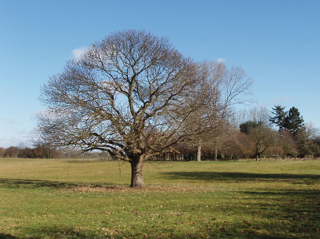
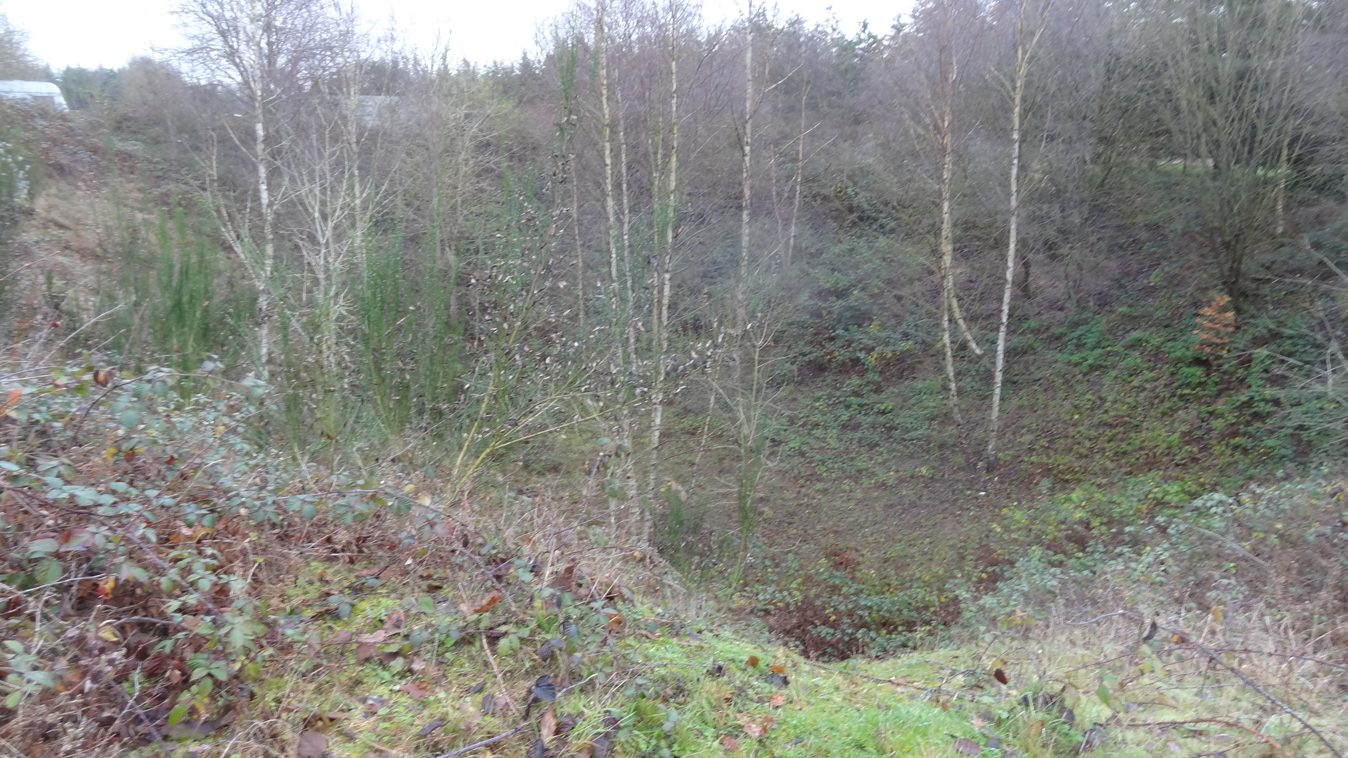
The wood is predominantly composed of broadleaf trees, including oak, beech, and birch, which create a rich and diverse ecosystem. The dense canopy of foliage provides shade and shelter for a variety of plant and animal species, making it a haven for wildlife enthusiasts and nature lovers.

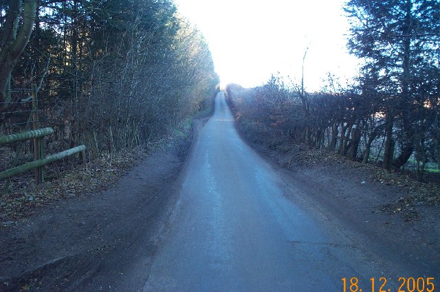
Traversing through Cartpath Wood is a network of well-maintained footpaths, allowing visitors to explore its enchanting beauty. The paths wind their way around the woodland, meandering through patches of wildflowers and offering glimpses of small clearings where sunlight filters through the trees.

The wood is also home to a small stream, which adds to the tranquility and charm of the area. The babbling sound of water flowing over rocks creates a soothing ambiance and provides a refreshing spot for visitors to relax and unwind.

Cartpath Wood is a popular destination for walkers, joggers, and families seeking a peaceful escape from the hustle and bustle of everyday life. It offers a serene setting for picnics, photography, and birdwatching, with a variety of bird species, including woodpeckers, robins, and blue tits, frequently spotted among the trees.

Overall, Cartpath Wood is a hidden gem in Hertfordshire, offering a tranquil retreat where visitors can immerse themselves in the beauty of nature and experience the calming effect of a woodland environment.

If you have any feedback on the listing, please let us know in the comments section below.

Cartpath Wood Images

Images are sourced within 2km of 51.675827/-0.45066655 or Grid Reference TQ0798. Thanks to Geograph Open Source API. All images are credited.

Croxley Green: Lone tree near Dell Wood Viewed looking south across rolling arable farmland from the public footpath from Rousebarn Lane, with the houses in Croxley Green just visible on the horizon. This point is about 28 kilometres, or about 17 miles, as the crow flies, from Charing Cross railway station in central London!
Croxley Green: Lone tree near Dell Wood
Viewed looking south across rolling arable farmland from the public footpath from Rousebarn Lane, with the houses in Croxley Green just visible on the horizon. This point is about 28 kilometres, or about 17 miles, as the crow flies, from Charing Cross railway station in central London!
Watford: Whippendell Wood Possibly the most boring photograph ever to be uploaded onto the site! Footpath, field, trees, sky. Whippendell Wood viewed looking eastwards, Rousebarn Lane runs behind the hedge at the bottom of the field.
Watford: Whippendell Wood
Possibly the most boring photograph ever to be uploaded onto the site! Footpath, field, trees, sky. Whippendell Wood viewed looking eastwards, Rousebarn Lane runs behind the hedge at the bottom of the field.
Grand Union Canal: near Grove Mill Lane bridge, Watford Viewed looking northwards from the Grove Mill Lane bridge, the canal makes a right angled turn here, hence the need for a wide channel to enable long narrow boats to make the turn.
Grand Union Canal: near Grove Mill Lane bridge, Watford
Viewed looking northwards from the Grove Mill Lane bridge, the canal makes a right angled turn here, hence the need for a wide channel to enable long narrow boats to make the turn.
Watford: The Grove Mill The former mill building in Grove Mill Lane now converted into residential use.
Watford: The Grove Mill
The former mill building in Grove Mill Lane now converted into residential use.
Sarratt: Buckshill Bottom valley A dry valley viewed looking eastwards from a footpath to Newhall Farm near Sarratt.
Sarratt: Buckshill Bottom valley
A dry valley viewed looking eastwards from a footpath to Newhall Farm near Sarratt.
Sarratt: Great Wood, Micklefield Green Sylvan tranquility in this mixed deciduous and coniferous woodland. The only problem is that it is less than 300 metres away from the M25 Motorway...
Sarratt: Great Wood, Micklefield Green
Sylvan tranquility in this mixed deciduous and coniferous woodland. The only problem is that it is less than 300 metres away from the M25 Motorway...
Chandler's Cross: Fir Tree Hill Fir Tree Hill is the name of the road, viewed looking westwards towards Chandler's Cross.
Chandler's Cross: Fir Tree Hill
Fir Tree Hill is the name of the road, viewed looking westwards towards Chandler's Cross.
M25 Motorway Link Road, Chandler's Cross This is the spur road leading to Junction 19 of the M25 Motorway from the Hunton Bridge roundabout, viewed looking westwards from the Langleybury Lane overbridge. Traffic is usually stationary westbound on this stretch during the weekday morning rush hour, but the road is virtually deserted on a Sunday morning. This particular road existed as the A405 trunk road, by-passing Watford, for many years prior to the M25 being built, and the route of the A405 was also incorporated into the motorway from Junction 19 to Junction 17 at Maple Cross. The distant dark triangular shaped structure is the gantry holding a conveyor belt crossing the road, associated with the numerous gravel pit workings in the vicinity.
M25 Motorway Link Road, Chandler's Cross
This is the spur road leading to Junction 19 of the M25 Motorway from the Hunton Bridge roundabout, viewed looking westwards from the Langleybury Lane overbridge. Traffic is usually stationary westbound on this stretch during the weekday morning rush hour, but the road is virtually deserted on a Sunday morning. This particular road existed as the A405 trunk road, by-passing Watford, for many years prior to the M25 being built, and the route of the A405 was also incorporated into the motorway from Junction 19 to Junction 17 at Maple Cross. The distant dark triangular shaped structure is the gantry holding a conveyor belt crossing the road, associated with the numerous gravel pit workings in the vicinity.
Chandler's Cross: Oldhouse Lane Viewed looking westwards up Juniper Hill from Beechen Bottom.
Chandler's Cross: Oldhouse Lane
Viewed looking westwards up Juniper Hill from Beechen Bottom.
M25 Motorway, Chandler's Cross Viewed looking south westwards from the Chandler's Lane overbridge.
M25 Motorway, Chandler's Cross
Viewed looking south westwards from the Chandler's Lane overbridge.
Loudwater: Welling Grove wood Viewed looking westwards from Sarratt Road.
Loudwater: Welling Grove wood
Viewed looking westwards from Sarratt Road.
Redhall farm, Chandler's Cross View north-east near the junction of Sarrat Road and Redhall Lane
Redhall farm, Chandler's Cross
View north-east near the junction of Sarrat Road and Redhall Lane
Grand Union Canal, near Watford Looking north from Lady Capel's Lock. The M25 bridge is just beyond this stretch.
Grand Union Canal, near Watford
Looking north from Lady Capel's Lock. The M25 bridge is just beyond this stretch.
The Grove Bridge, Grand Union Canal The Earl of Clarendon insisted on an elegant bridge when the canal was routed across his land. The bridge was restored in 1987 by the Railway Heritage Trust, British Waterways Board, and British Rail Property Board.
The Grove Bridge, Grand Union Canal
The Earl of Clarendon insisted on an elegant bridge when the canal was routed across his land. The bridge was restored in 1987 by the Railway Heritage Trust, British Waterways Board, and British Rail Property Board.
The Grove and golf course, Watford The Grove is now a hotel and golf course. It was bought in 1753 by Thomas Villiers, who became 1st Earl of Clarendon. It has been a school, and a training centre for British Rail.
The Grove and golf course, Watford
The Grove is now a hotel and golf course. It was bought in 1753 by Thomas Villiers, who became 1st Earl of Clarendon. It has been a school, and a training centre for British Rail.
Clarendon Park Farm, Watford View west from the Grand Union Canal across The Grove golf course.
Clarendon Park Farm, Watford
View west from the Grand Union Canal across The Grove golf course.
Filling station, by Hunton Bridge Interchange, Watford On the A41 just north of the interchange to a branch of the M25. View from the south.
Filling station, by Hunton Bridge Interchange, Watford
On the A41 just north of the interchange to a branch of the M25. View from the south.
Entering Watford - town sign and speed limit On Hempstead Road, just south of Hunton Bridge Interchange to the M25 and A41. View east to Russell Lane. The sign with coat of arms of Watford is just inside the boundary of Watford, which runs across the roundabout of the interchange.
Entering Watford - town sign and speed limit
On Hempstead Road, just south of Hunton Bridge Interchange to the M25 and A41. View east to Russell Lane. The sign with coat of arms of Watford is just inside the boundary of Watford, which runs across the roundabout of the interchange.
Show me another place!

Cartpath Wood is located at Grid Ref: TQ0798 (Lat: 51.675827, Lng: -0.45066655)

Administrative County: Hertfordshire

District: Three Rivers

Police Authority: Hertfordshire

What 3 Words

///comb.idea.fever. Near Abbots Langley, Hertfordshire

Nearby Locations

Cartpath Wood Lees Wood

Related Wikis

Westwood Quarry

Westwood Quarry is a 0.07 hectares (0.17 acres) geological site of Special Scientific Interest west of Watford in Hertfordshire. It was notified in 1987...

Whippendell Wood

Whippendell Wood (or Whippendell Woods) is an ancient woodland on the edges of Watford, England, covering an area of 165.3 acres (66.9 ha). It is owned...

The Grove, Watford

The Grove is a large hotel in Hertfordshire, England, with a 300–acre (1.2 km2) private park next to the River Gade and the Grand Union Canal. It touches...

Langleybury

Langleybury is a country house and estate in Abbots Langley, Hertfordshire, England, about 3 miles (5 km) northwest of the centre of the town of Watford...

Sun Sports Watford F.C.

Sun Sports Watford Football Club are a football club based in Watford, Hertfordshire, England. They were established in 1901 and joined the Herts Senior...

Hunton Bridge

Hunton Bridge is a small settlement near Abbots Langley, Hertfordshire, England, with a historic royal connection. Its population in the 1991 census was...

Watford Miniature Railway

The Watford Miniature Railway is a 10+1⁄4 in (260 mm) gauge railway in Cassiobury Park, Watford, Hertfordshire. == History == The railway was opened at...

Cassiobury House

Cassiobury House was a country house in Cassiobury Park, Watford, England. It was the ancestral seat of the Earls of Essex. Originally a Tudor building...

Nearby Amenities

Located within 500m of 51.675827,-0.45066655
Phone
Emergency: phone
Operator: National Highways
Operator Wikidata: Q5760006
Lat/Long: 51.6795351/-0.4547667
Lees Wood Scout & Guide Activity Centre
Addr City: Rickmansworth
Addr Postcode: WD3 4LY
Addr Street: Fir Tree Hill
Addr Suburb: Chandler's Cross
Internet Access: no
Scout: yes
Tourism: camp_site
Website: http://leeswood.org.uk/
Wheelchair: limited
Lat/Long: 51.67238/-0.4475097
Direction: 170
Fixme: survey for panel count
Generator Method: photovoltaic
Generator Output Electricity: yes
Generator Solar Modules: 13
Generator Source: solar
Generator Type: solar_photovoltaic_panel
Location: roof
Power: generator
Lat/Long: 51.6754507/-0.4573015
Direction: 170
Generator Method: photovoltaic
Generator Output Electricity: yes
Generator Solar Modules: 17
Generator Source: solar
Generator Type: solar_photovoltaic_panel
Location: roof
Power: generator
Lat/Long: 51.675611/-0.4561805
Traffic Sign: variable_message
Variable Message Model: AMI
Lat/Long: 51.678228/-0.4567429
Traffic Sign: variable_message
Variable Message Model: AMI
Lat/Long: 51.6782495/-0.4567734
Traffic Sign: variable_message
Variable Message Model: AMI
Lat/Long: 51.6799367/-0.4534565
Traffic Sign: variable_message
Variable Message Model: AMI
Lat/Long: 51.6799116/-0.4534212
Traffic Sign: variable_message
Variable Message Model: AMI
Lat/Long: 51.6798868/-0.4533863
Traffic Sign: variable_message
Variable Message Model: AMI
Lat/Long: 51.6798626/-0.4533522
Traffic Sign: variable_message
Variable Message Model: MS2
Lat/Long: 51.6798285/-0.4533043
Traffic Sign: variable_message
Variable Message Model: AMI
Lat/Long: 51.6797859/-0.4532444
Street Lamp
Lat/Long: 51.6776083/-0.4572044
Street Lamp
Lat/Long: 51.6778744/-0.4567069
Street Lamp
Lat/Long: 51.6784048/-0.455721
Street Lamp
Lat/Long: 51.6786623/-0.4552288
Street Lamp
Lat/Long: 51.6790234/-0.4557371
Street Lamp
Lat/Long: 51.6789222/-0.4547666
Street Lamp
Lat/Long: 51.6792775/-0.4552565
Street Lamp
Lat/Long: 51.6791724/-0.4542274
Street Lamp
Lat/Long: 51.6794428/-0.4537329
Street Lamp
Lat/Long: 51.6799177/-0.4527498
Street Lamp
Lat/Long: 51.6800815/-0.452331
Street Lamp
Lat/Long: 51.6802101/-0.4519021
The data included in this document is from www.openstreetmap.org. The data is made available under ODbL.

Have you been to Cartpath Wood?

Leave your review of Cartpath Wood below (or comments, questions and feedback).