Edgeworth

Settlement in Gloucestershire Cotswold

England

Edgeworth

Dark Ride The drive to Pinbury Park. There is a public bridleway to the left of this drive, though it wasn't well marked on the ground.
Dark Ride Credit: David Purchase

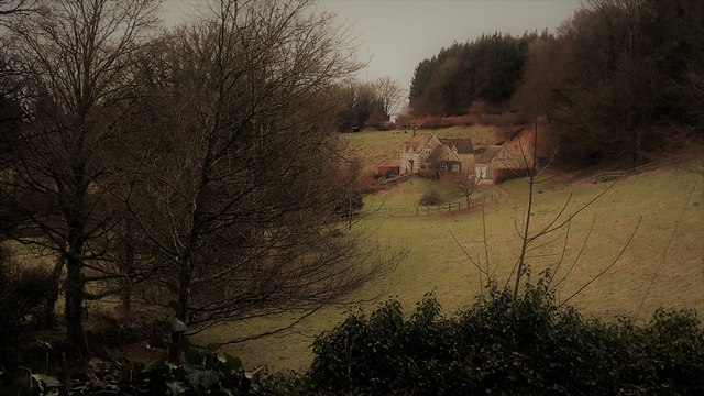
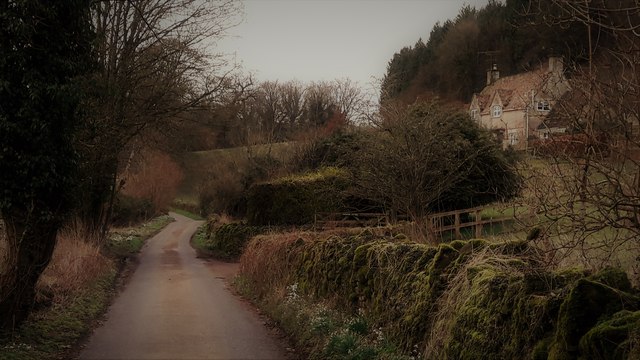
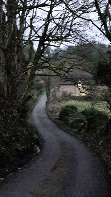
Edgeworth is a small village located in the county of Gloucestershire, England. Situated amidst picturesque countryside, it is nestled within the Cotswolds Area of Outstanding Natural Beauty, renowned for its rolling hills, charming villages, and ancient stone-built houses.

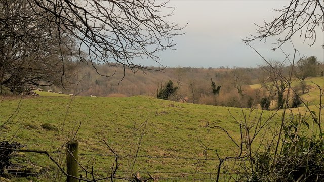
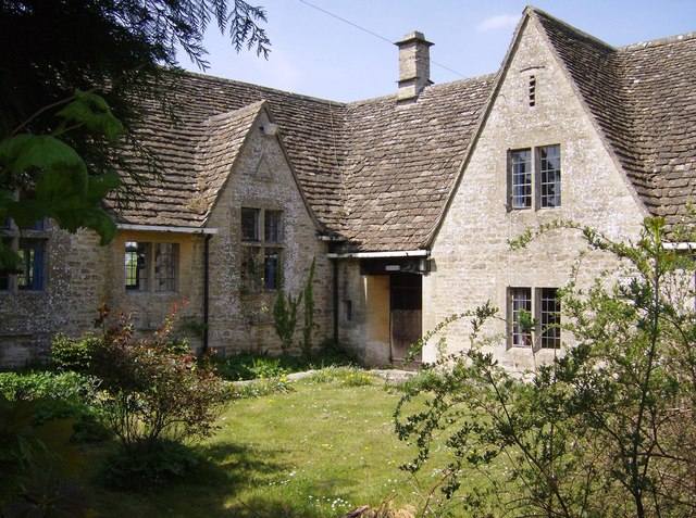
The village of Edgeworth is characterized by its idyllic rural setting, with meandering lanes lined by hedgerows and fields dotted with grazing livestock. Its population is approximately 200 residents, creating a close-knit community atmosphere. The village is composed mainly of traditional Cotswold stone cottages, which add to its timeless charm.

Historically, Edgeworth has agricultural roots, and this heritage is still evident today. The village boasts a number of working farms that contribute to the local economy and maintain the region's agricultural traditions.

Edgeworth is renowned for its natural beauty, making it a haven for outdoor enthusiasts. The surrounding countryside offers a plethora of walking and cycling routes, allowing residents and visitors to explore the stunning landscapes and enjoy the fresh air. Nearby attractions include the Cotswold Way, a long-distance footpath that passes through the village.

Although Edgeworth is a small village, it benefits from a strong sense of community spirit. The village hall serves as a hub for various social activities and events, providing opportunities for locals to come together and engage with one another.

In summary, Edgeworth is a quintessential Cotswold village that offers a peaceful and picturesque getaway. With its stunning natural surroundings and strong community spirit, it remains a cherished destination for both residents and visitors seeking a tranquil and authentic English countryside experience.

If you have any feedback on the listing, please let us know in the comments section below.
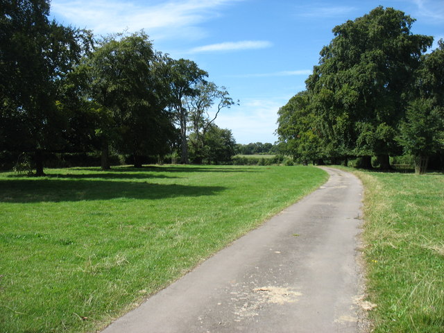
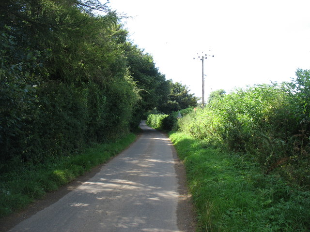
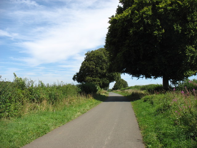
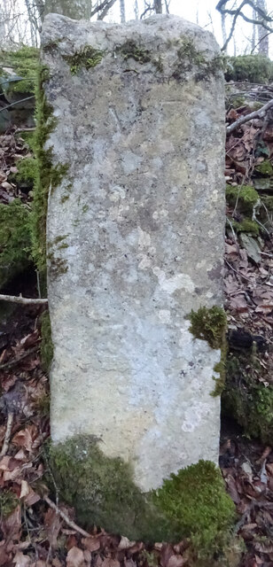
Edgeworth Images

Images are sourced within 2km of 51.755442/-2.0812698 or Grid Reference SO9406. Thanks to Geograph Open Source API. All images are credited.

Dark Ride The drive to Pinbury Park. There is a public bridleway to the left of this drive, though it wasn't well marked on the ground.
Dark Ride
The drive to Pinbury Park. There is a public bridleway to the left of this drive, though it wasn't well marked on the ground.
The lane to Edgeworth
Crabtree Lane Heading for the Duntisbournes.
Crabtree Lane
Heading for the Duntisbournes.
Edgeworth, the valley from the top of School Lane School Lane connects the two clusters of Edgeworth through a steep combe.
Edgeworth, the valley from the top of School Lane
School Lane connects the two clusters of Edgeworth through a steep combe.
Pastures at Edgeworth Looking from School Lane to the far hillside of the upper Frome valley.
Pastures at Edgeworth
Looking from School Lane to the far hillside of the upper Frome valley.
School Lane, Edgeworth
School Lane, Edgeworth Looking north from close to the church and manor house end of the lane.
School Lane, Edgeworth
Looking north from close to the church and manor house end of the lane.
Edgeworth Manor The west front, facing the church, dates from the end of the nineteenth century.
Edgeworth Manor
The west front, facing the church, dates from the end of the nineteenth century.
St Mary's church, Edgeworth
St Mary, Edgeworth St Mary's has a Saxon and Norman nave and was drastically restored in 1869-72 with a rood screen added in 1885.
St Mary, Edgeworth
St Mary's has a Saxon and Norman nave and was drastically restored in 1869-72 with a rood screen added in 1885.
Rood screen and loft in St Mary's, Edgeworth Dating from 1885, the deeply cusped tracery echoes the stone chancel rere-arches of 1872.
Rood screen and loft in St Mary's, Edgeworth
Dating from 1885, the deeply cusped tracery echoes the stone chancel rere-arches of 1872.
Chancel at St Mary, Edgeworth The Victorian east window sits above a tiny Norman slit window with 1957 stained glass by the local artist Edward Payne.  All the chancel windows have rere-arches, as do the sedilia, piscina on the right.  A formidable Victorian performance, but what a pity that it extended to scraping the walls.
Chancel at St Mary, Edgeworth
The Victorian east window sits above a tiny Norman slit window with 1957 stained glass by the local artist Edward Payne. All the chancel windows have rere-arches, as do the sedilia, piscina on the right. A formidable Victorian performance, but what a pity that it extended to scraping the walls.
Cusping in St Mary's Two windows, an altar rail and a rood screen all decorated the same way.
Cusping in St Mary's
Two windows, an altar rail and a rood screen all decorated the same way.
Mediaeval stained glass in the chancel of St Mary's Edgeworth
Nave bench ends in St Mary's, Edgeworth From the restoration of 1869-72.  They are labelled with names of estate properties, allocating where the estate staff were to sit.  The elongated poppy heads are an individual touch.
Nave bench ends in St Mary's, Edgeworth
From the restoration of 1869-72. They are labelled with names of estate properties, allocating where the estate staff were to sit. The elongated poppy heads are an individual touch.
Pews in St Mary's, Edgeworth
Old Milestone west of Tunley Farm Carved stone post by the UC road, in parish of BISLEY WITH LYPIATT (STROUD District), Tunley, 250m West of entrance to Tunley Farm on verge against barbed wire fence, on North side of road. Erected by the Cirencester to Stroud turnpike trust in the 18th century. 

Inscription reads:-
VII
Miles t(o)
(Ci)ren(..)te(r) 
Carved benchmark and rivet on top.

Gloucestershire CC.
Monument Number: 6457 <span class="nowrap"><a title="https://www.heritagegateway.org.uk/Gateway/Results_Single.aspx?uid=6457&resourceID=108" rel="nofollow ugc noopener" href="https://www.heritagegateway.org.uk/Gateway/Results_Single.aspx?uid=6457&resourceID=108">Link</a><img style="margin-left:2px;" alt="External link" title="External link - shift click to open in new window" src="https://s1.geograph.org.uk/img/external.png" width="10" height="10"/></span>

Milestone Society National ID: GL_CIBI07.
Old Milestone west of Tunley Farm
Carved stone post by the UC road, in parish of BISLEY WITH LYPIATT (STROUD District), Tunley, 250m West of entrance to Tunley Farm on verge against barbed wire fence, on North side of road. Erected by the Cirencester to Stroud turnpike trust in the 18th century. Inscription reads:- VII Miles t(o) (Ci)ren(..)te(r) Carved benchmark and rivet on top. Gloucestershire CC. Monument Number: 6457 LinkExternal link Milestone Society National ID: GL_CIBI07.
"Stone", bridleway,  near Pinbury Park Sometimes referred to the "Bisley Path", the ancient bridleway runs between the junction of Watery Lane, Dane Lane and Miserden Rd as far as the junction of Jackbarrow Rd and Overly Rd. There is a carved "V" on the path-facing face. And it is 5 miles from Cirencester along routes used in 1811/2. Old maps label it as "stone". The bridleway is, for some of its way, the boundary between Bisley with Lypiatt (Stroud) and Edgeworth (Cotswolds).

Milestone Society National ID: GL_CIBI06
"Stone", bridleway, near Pinbury Park
Sometimes referred to the "Bisley Path", the ancient bridleway runs between the junction of Watery Lane, Dane Lane and Miserden Rd as far as the junction of Jackbarrow Rd and Overly Rd. There is a carved "V" on the path-facing face. And it is 5 miles from Cirencester along routes used in 1811/2. Old maps label it as "stone". The bridleway is, for some of its way, the boundary between Bisley with Lypiatt (Stroud) and Edgeworth (Cotswolds). Milestone Society National ID: GL_CIBI06
Show me another place!

Edgeworth is located at Grid Ref: SO9406 (Lat: 51.755442, Lng: -2.0812698)

Administrative County: Gloucestershire

District: Cotswold

Police Authority: Gloucestershire

What 3 Words

///couple.directors.reveal. Near Chalford, Gloucestershire

Related Wikis

Edgeworth, Gloucestershire

Edgeworth is a small village and civil parish in the English county of Gloucestershire. It is located east of Stroud, west of Cirencester and south of...

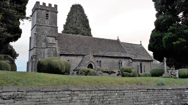
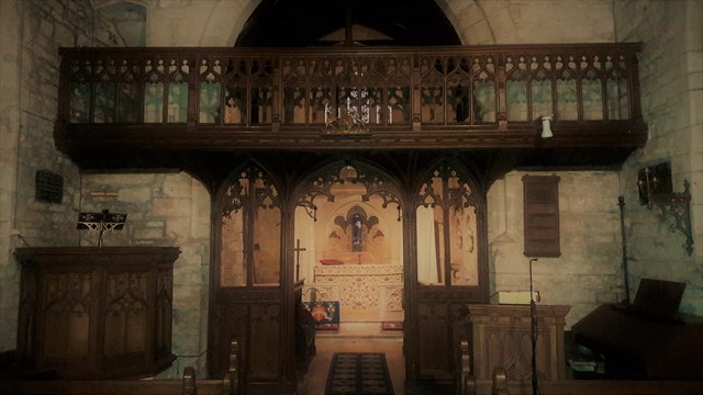
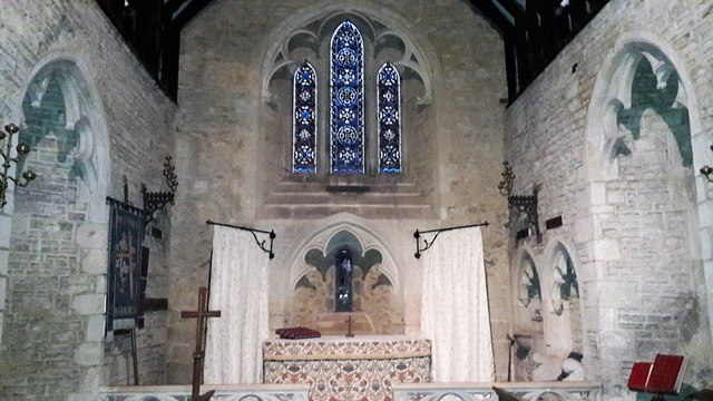
Church of St Mary, Edgeworth

The Anglican Church of St Mary at Edgeworth in the Cotswold District of Gloucestershire, England was built in 11th century. It is a grade I listed building...
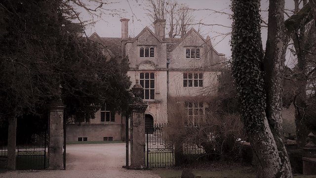
Edgeworth Manor

Edgeworth Manor is a Grade II* listed country house in Edgeworth, Gloucestershire, England. It was mentioned in the Domesday Book, when it was held by...

Juniper Hill, Edgeworth

Juniper Hill, Edgeworth (SO928058 and SO928064) is an 11.25-hectare (27.8-acre) biological Site of Special Scientific Interest in Gloucestershire, notified...

Battlescombe

Battlescombe is an area in the village of Bisley in Gloucestershire, England. == References ==

Daneway House

Daneway House is a grade I listed house in the parish of Bisley-with-Lypiatt but close to Sapperton in Gloucestershire, England.The house was built in...

Miserden War Memorial

Miserden War Memorial is a First World War memorial in the village of Miserden, near Stroud, in Gloucestershire, south-western England. The memorial, designed...

Sapperton, Gloucestershire

Sapperton is a village and civil parish in the Cotswold District of Gloucestershire in England, about 4.5 miles (7.2 km) west of Cirencester. It is most...

Nearby Amenities

Located within 500m of 51.755442,-2.0812698
Edgeworth
Is In: Gloucestershire, England, UK
Place: village
Source: NPE
Lat/Long: 51.7561019/-2.0785179
Bus Stop
Edgeworth
Naptan AtcoCode: 1600GL1806
Naptan Bearing: E
Naptan CommonName: Edgeworth
Naptan NaptanCode: glodtgap
Naptan Street: School Ln
Naptan Verified: no
Source: naptan_import
Lat/Long: 51.7520911/-2.0766632
Post Box
Collection Times: Mo-Fr 15:30; Sa 09:15
Drive Through: no
Operator: Royal Mail
Post Box Type: wall
Ref: GL6 74
Royal Cypher: GR
Royal Cypher Wikidata: Q33102273
Source: survey
Lat/Long: 51.7554827/-2.0803684
Telephone
Booth: K6
Covered: booth
Fee: yes
Listed Status: Grade II
Operator: BT
Payment Cards: yes
Phone: +44 1285 821431
Source: survey
Lat/Long: 51.7554379/-2.0803335
The data included in this document is from www.openstreetmap.org. The data is made available under ODbL.

Have you been to Edgeworth?

Leave your review of Edgeworth below (or comments, questions and feedback).