Round Copse
Wood, Forest in Middlesex Spelthorne
England
Round Copse
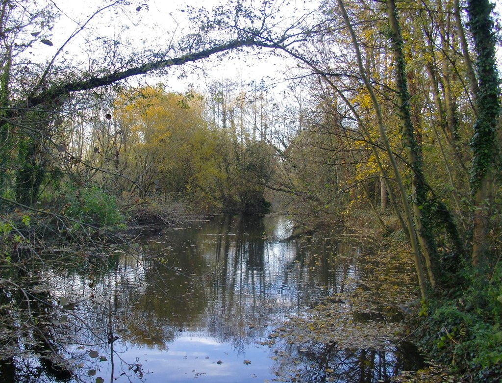
Round Copse is a charming woodland area located in Middlesex, England. Situated in the southeastern part of the county, it covers an area of approximately 20 acres. This woodland is a designated Site of Special Scientific Interest (SSSI) due to its ecological importance and rich biodiversity.
The copse features a diverse range of tree species, including oak, beech, and ash, which create a dense canopy overhead, providing shelter and habitat for various wildlife species. The forest floor is covered in a thick carpet of leaf litter, supporting a myriad of plant life, such as bluebells, ferns, and wild garlic.
The wood is crisscrossed by several well-maintained footpaths, allowing visitors to explore and appreciate its natural beauty. These paths lead to picturesque spots, including a tranquil pond, where visitors can enjoy the serene surroundings and observe the local wildlife, such as frogs, newts, and a variety of bird species.
Round Copse is not only a haven for nature enthusiasts but also a popular destination for recreational activities such as walking, jogging, and birdwatching. The peaceful ambiance and the abundance of wildlife sightings make it an ideal spot for those seeking a tranquil escape from the hustle and bustle of urban life.
Managed by the local council, Round Copse is regularly maintained to preserve its ecological integrity and ensure the safety and enjoyment of its visitors. It serves as an important green space, contributing to the overall well-being of the community and providing a valuable habitat for many species of plants and animals.
If you have any feedback on the listing, please let us know in the comments section below.
Round Copse Images
Images are sourced within 2km of 51.413403/-0.47557313 or Grid Reference TQ0669. Thanks to Geograph Open Source API. All images are credited.


Round Copse is located at Grid Ref: TQ0669 (Lat: 51.413403, Lng: -0.47557313)
Administrative County: Surrey
District: Spelthorne
Police Authority: Surrey
What 3 Words
///point.curvy.tennis. Near Ashford, Surrey
Nearby Locations
Related Wikis
River Ash, Surrey
The River Ash is a small, shallow river in Surrey, England. Its course of 10 kilometres (6.2 mi) is just outside Greater London. Work has been carried...

Staines & Lammas (Middlesex) F.C.
Staines & Lammas (Middlesex) Football Club is a football club based in the town of Staines-upon-Thames. The club is affiliated to the Middlesex County...

Shepperton Studios
Shepperton Studios is a film studio located in Shepperton, Surrey, England, with a history dating back to 1931. It is now part of the Pinewood Studios...

Laleham
Laleham is a village on the River Thames, in the Borough of Spelthorne, about 17 mi (27 km) west of central London, England. Historically part of the...
Nearby Amenities
Located within 500m of 51.413403,-0.47557313Have you been to Round Copse?
Leave your review of Round Copse below (or comments, questions and feedback).