Gerrard's Rough

Wood, Forest in Sussex Horsham

England

Gerrard's Rough

Track junction and stile near Pallingham Lock Cottage Footpath 1979 goes across the stile, bridleway 3422 goes right, the gated track goes to Pallingham Lock Cottage.
Track junction and stile near Pallingham Lock Cottage Credit: Robin Webster

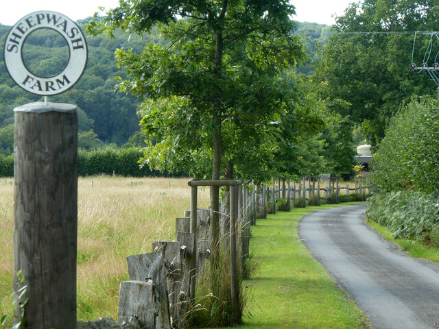
Gerrard's Rough is a picturesque woodland located in the county of Sussex, England. Situated within the larger area known as Sussex Wood, this forest is a haven for nature enthusiasts and those seeking a peaceful retreat from the hustle and bustle of everyday life.

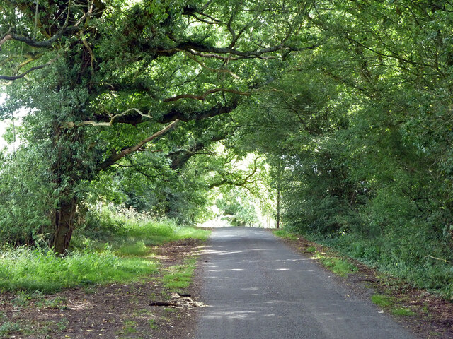
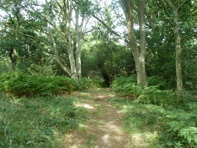
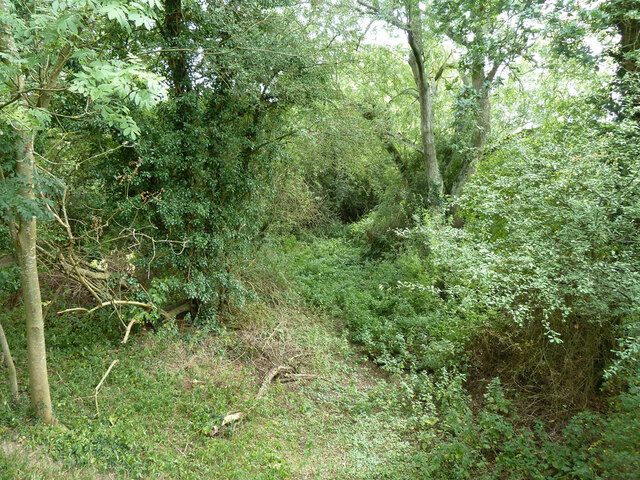
Covering an expansive area of roughly 500 acres, Gerrard's Rough boasts a diverse range of trees, including oak, beech, and ash, which create a dense and enchanting canopy overhead. The forest floor is adorned with a multitude of wildflowers, ferns, and mosses, adding to its natural beauty.

The woodland is crisscrossed by a network of footpaths and trails, making it an ideal location for leisurely walks, hikes, and nature exploration. Visitors can immerse themselves in the tranquil surroundings, listening to the gentle rustling of leaves and the melodious chirping of birds.

Gerrard's Rough is also home to a variety of wildlife. Birdwatchers can spot an array of species, including woodpeckers, owls, and various songbirds. Small mammals such as squirrels, rabbits, and deer can also be observed, further enhancing the forest's allure.

For those interested in the history of the area, Gerrard's Rough holds significance as a remnant of the ancient Sussex Weald. Its untouched beauty and unspoiled landscape provide a glimpse into the region's rich natural heritage.

Overall, Gerrard's Rough in Sussex is a captivating woodland retreat that offers a serene escape into nature. Its lush vegetation, abundant wildlife, and peaceful ambiance make it a must-visit destination for outdoor enthusiasts and nature lovers alike.

If you have any feedback on the listing, please let us know in the comments section below.

Gerrard's Rough Images

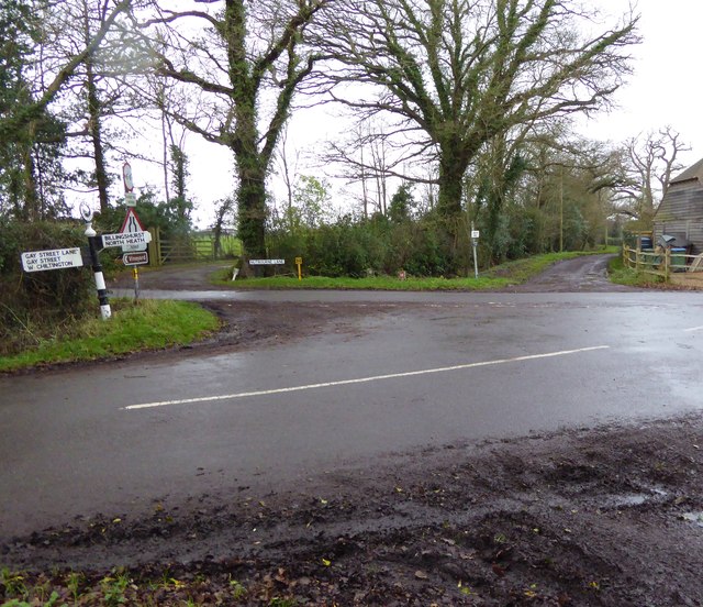
Images are sourced within 2km of 50.976108/-0.49762782 or Grid Reference TQ0520. Thanks to Geograph Open Source API. All images are credited.

Track junction and stile near Pallingham Lock Cottage Footpath 1979 goes across the stile, bridleway 3422 goes right, the gated track goes to Pallingham Lock Cottage.
Track junction and stile near Pallingham Lock Cottage
Footpath 1979 goes across the stile, bridleway 3422 goes right, the gated track goes to Pallingham Lock Cottage.
Entrance to Sheepwash Farm For a closer look at the sign, see <a href="https://www.geograph.org.uk/photo/2565099">TQ0321 : Sheepwash Farm sign - detail</a>.
Entrance to Sheepwash Farm
For a closer look at the sign, see TQ0321 : Sheepwash Farm sign - detail.
Drive towards Sheepwash Farm Also public bridleway 3422.
Drive towards Sheepwash Farm
Also public bridleway 3422.
Sheep in field by drive to Sheepwash Farm
Coombelands Lane Looking south.
Coombelands Lane
Looking south.
Start of bridleway 3422 at Pickhurst Farm It is also a drive to Sheepwash Farm.
Start of bridleway 3422 at Pickhurst Farm
It is also a drive to Sheepwash Farm.
Field with sheep East of Toat Lane.
Field with sheep
East of Toat Lane.
Toat Lane Heading south.
Toat Lane
Heading south.
Private track, Thorn Common Despite the sign, the common, which the track crosses, is registered common land, and so has public access on foot.
Private track, Thorn Common
Despite the sign, the common, which the track crosses, is registered common land, and so has public access on foot.
Bridleway 3421, Thorn Common Towards Toat Lane.
Bridleway 3421, Thorn Common
Towards Toat Lane.
Bridleway 3421 towards Toat Lane
Ruin at Townland
Ruin at Townland
Arun Navigation south of Pallingham Bridge The cut from the tidal Arun at Pallingham lock to Newbridge was abandoned in 1896.
Arun Navigation south of Pallingham Bridge
The cut from the tidal Arun at Pallingham lock to Newbridge was abandoned in 1896.
Junction of Nutbourne and Gay Street Lanes with crossing footpath For a view the other way see <a title="https://www.geograph.org.uk/photo/298829" href="https://www.geograph.org.uk/photo/298829">Link</a>.
Junction of Nutbourne and Gay Street Lanes with crossing footpath
For a view the other way see Link.
Footpath goes west from Nutbourne Lane
Footpath goes east from Gay Street Lane
Dog at crossing paths The animal was very muddy but friendly and we hit it off.
For a view the other way see <a title="https://www.geograph.org.uk/photo/4377803" href="https://www.geograph.org.uk/photo/4377803">Link</a>.
Dog at crossing paths
The animal was very muddy but friendly and we hit it off. For a view the other way see Link.
Show me another place!

Gerrard's Rough is located at Grid Ref: TQ0520 (Lat: 50.976108, Lng: -0.49762782)

Administrative County: West Sussex

District: Horsham

Police Authority: Sussex

What 3 Words

///sofa.soap.cherished. Near Pulborough, West Sussex

Related Wikis

Codmore Hill

Codmore Hill is a hamlet in the Horsham District of West Sussex, England. It lies on the A29 road 1 mile (1.6 km) north of Pulborough. It is in the civil...

North Heath

North Heath is a hamlet in the Horsham District of West Sussex, England. It lies just off the A29 road 1.9 miles (3 km) north of Pulborough. The Brinsbury...

Upper Arun

Upper Arun is a 17.6-hectare (43-acre) biological Site of Special Scientific Interest between Billingshurst and Pulborough in West Sussex.This 13-kilometre...

Pulborough

Pulborough is a large village and civil parish in the Horsham district of West Sussex, England, with some 5,000 inhabitants. It is located almost centrally...

Nearby Amenities

Located within 500m of 50.976108,-0.49762782
Bus Stop
Rose & Crown PH
Bus: yes
Naptan AtcoCode: 4400HR0070
Naptan Bearing: NE
Naptan CommonName: Rose & Crown PH
Naptan Indicator: opp. Cray Lane
Naptan Landmark: Cray Lane
Naptan NaptanCode: wsxatjag
Naptan Street: Stane Street
Naptan Verified: no
Public Transport: platform
Source: naptan_import
Lat/Long: 50.9723519/-0.4956784
A29
Naptan AtcoCode: 4400HR0667
Naptan Bearing: NE
Naptan BusStopType: CUS
Naptan CommonName: A29
Naptan Indicator: HAR
Naptan Landmark: Hail & Ride
Naptan NaptanCode: wsxdwajd
Naptan Street: A29
Naptan Verified: no
Source: naptan_import
Lat/Long: 50.9766466/-0.4911806
A29
Naptan AtcoCode: 4400HR0668
Naptan Bearing: SW
Naptan BusStopType: CUS
Naptan CommonName: A29
Naptan Indicator: HAR
Naptan Landmark: Hail & Ride
Naptan NaptanCode: wsxdwajg
Naptan Street: A29
Naptan Verified: no
Source: naptan_import
Lat/Long: 50.9766362/-0.4909757
Blackgate Nursery
Phone: +44 1798872923
Shop: garden_centre
Lat/Long: 50.97758/-0.494425
Auriel Grange
Place: isolated_dwelling
Lat/Long: 50.9755176/-0.4941417
Stane Farm
Place: isolated_dwelling
Lat/Long: 50.9741214/-0.4949369
Fountain
Lat/Long: 50.9741389/-0.495262
The data included in this document is from www.openstreetmap.org. The data is made available under ODbL.

Have you been to Gerrard's Rough?

Leave your review of Gerrard's Rough below (or comments, questions and feedback).