Cow Pastures Wood
Wood, Forest in Lincolnshire South Kesteven
England
Cow Pastures Wood

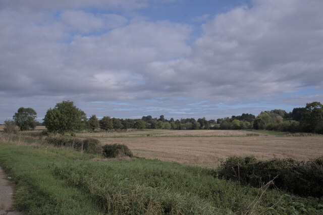
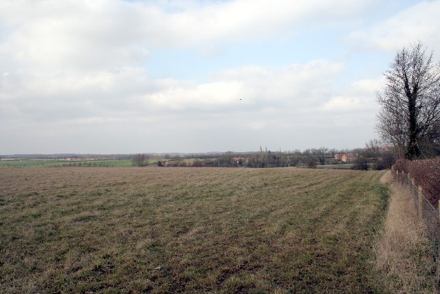
Cow Pastures Wood is a picturesque woodland located in the county of Lincolnshire, England. Spanning across a vast area of approximately 300 acres, this woodland is a popular destination for nature enthusiasts and those seeking a peaceful retreat. The wood is situated near the village of Cow Pastures and is easily accessible by road.
The wood is characterized by its diverse range of tree species, including oak, beech, ash, and birch, which create a rich and vibrant ecosystem. The dense canopy provides shelter for a variety of wildlife such as birds, small mammals, and insects. Walking through the wood, visitors may also come across beautiful wildflowers, adding to the enchanting atmosphere.
Cow Pastures Wood offers several walking trails that meander through the forest, allowing visitors to immerse themselves in the natural beauty of the surroundings. These paths are well-maintained and suitable for all levels of fitness. Along the way, there are designated picnic spots where visitors can relax and enjoy a meal amidst the tranquil surroundings.
The wood is managed by the local forestry commission, ensuring the preservation of its natural habitat and the conservation of its biodiversity. This management also includes regular maintenance of the trails and facilities, providing a safe and enjoyable experience for visitors.
In summary, Cow Pastures Wood is a captivating woodland in Lincolnshire, offering a haven of tranquility and natural beauty. Whether it's for a leisurely stroll, birdwatching, or simply a peaceful escape from the hustle and bustle of everyday life, this wood provides a perfect retreat for nature lovers.
If you have any feedback on the listing, please let us know in the comments section below.
Cow Pastures Wood Images
Images are sourced within 2km of 52.746168/-0.44405811 or Grid Reference TF0517. Thanks to Geograph Open Source API. All images are credited.


Cow Pastures Wood is located at Grid Ref: TF0517 (Lat: 52.746168, Lng: -0.44405811)
Administrative County: Lincolnshire
District: South Kesteven
Police Authority: Lincolnshire
What 3 Words
///pizzeria.aimless.snaps. Near Thurlby, Lincolnshire
Nearby Locations
Related Wikis

Bourne Rural District
Bourne was a rural district in Lincolnshire, Parts of Kesteven from 1894 to 1931. It was created by the Local Government Act 1894 based on the Bourne rural...
Witham Hall
Witham Hall is an independent boarding and day school situated in Witham on the Hill, Lincolnshire, England. == The hall == The house is described by Sir...
Witham on the Hill
Witham on the Hill is a village and civil parish in the South Kesteven district of Lincolnshire, England. The population of the civil parish was 260 at...

Lound, Lincolnshire
Lound is a village in the South Kesteven district of Lincolnshire, England. It is situated about 2 miles (3 km) south-west from the town of Bourne. Originally...

Toft, Lincolnshire
Toft is a small village in the South Kesteven district of Lincolnshire, England. It is situated approximately 2 miles (3 km) south-west from Bourne on...

Manthorpe, Bourne
Manthorpe is a small village in the South Kesteven district of Lincolnshire, England. It lies 0.5 miles (0.8 km) east from the A6121, 3 miles (5 km) south...

Bowthorpe Oak
Bowthorpe Oak in Manthorpe near Bourne, Lincolnshire, is a gigantic and ancient pedunculate oak in England. The tree has a circumference of about 44 feet...

Careby
Careby is the principal village in the a civil parish of Careby Aunby and Holywell [in which the population is included] in the South Kesteven district...
Nearby Amenities
Located within 500m of 52.746168,-0.44405811Have you been to Cow Pastures Wood?
Leave your review of Cow Pastures Wood below (or comments, questions and feedback).