Fountains Hill

Hill, Mountain in Lincolnshire South Kesteven

England

Fountains Hill

A load of Hay
A load of Hay Credit: Bob Harvey

Fountains Hill, located in Lincolnshire, England, is a picturesque hill that offers breathtaking views of the surrounding countryside. Standing at an approximate height of 130 meters above sea level, it is often referred to as a hill rather than a mountain due to its modest elevation. Situated near the village of Caistor, Fountains Hill is a popular destination for hikers, nature enthusiasts, and those seeking a tranquil escape.

The hill derives its name from the nearby Fountains Abbey, a historical site renowned for its medieval architecture and serene surroundings. Fountains Hill offers visitors a chance to experience the beauty of the Lincolnshire Wolds, an Area of Outstanding Natural Beauty. The hill's gentle slopes and well-maintained footpaths make it accessible to people of all ages and fitness levels.

Reaching the summit of Fountains Hill rewards visitors with panoramic views of the rolling hills, farmland, and distant villages. On clear days, the view stretches as far as the Lincoln Cathedral, adding to the allure of the landscape. The hill is home to a variety of flora and fauna, with wildflowers, grasses, and native trees dotting its slopes.

Fountains Hill is a perfect spot for a leisurely picnic or to simply sit and admire the natural surroundings. With its peaceful atmosphere and stunning vistas, it offers a welcome respite from the hustle and bustle of everyday life. Whether it's a leisurely stroll or a more challenging hike, Fountains Hill is a must-visit destination for anyone exploring the beauty of Lincolnshire.

If you have any feedback on the listing, please let us know in the comments section below.

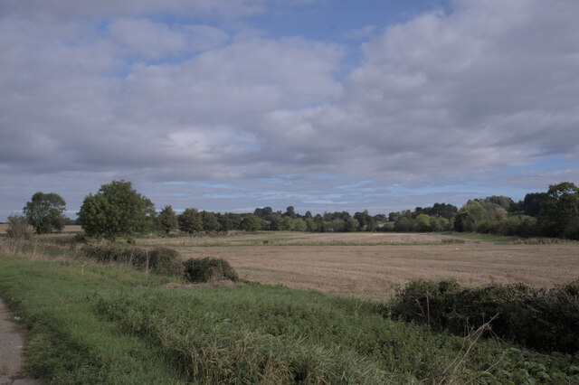
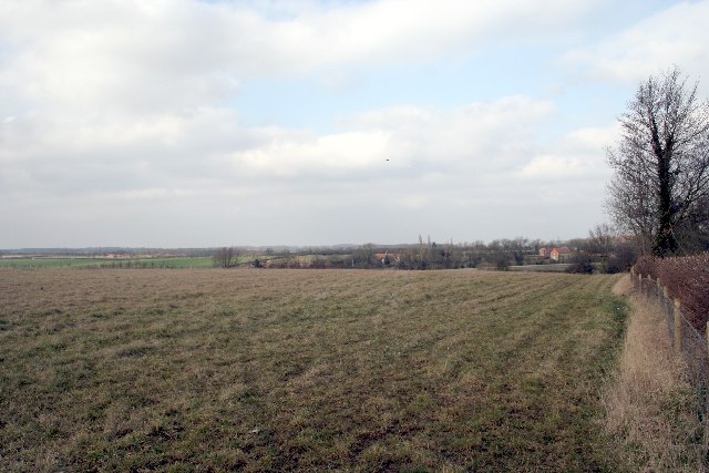
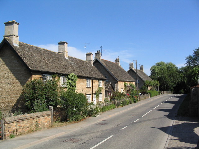
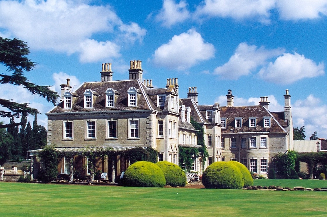
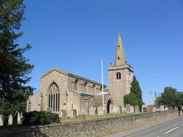
Fountains Hill Images

Images are sourced within 2km of 52.742369/-0.44028256 or Grid Reference TF0517. Thanks to Geograph Open Source API. All images are credited.

A load of Hay
A load of Hay
A trailer full of Hay Tractor-hauled, at that.  A New Holland T5.120
A trailer full of Hay
Tractor-hauled, at that. A New Holland T5.120
Grazing sheep at Manthorpe
Toward Toft
Toward Toft
Metal telegraph pole I have come across these before, but I am surprised to see one here, connected to nearby wooden ones.
Metal telegraph pole
I have come across these before, but I am surprised to see one here, connected to nearby wooden ones.
Do not climb Faded prohibition against the use of ladders on <a href="https://www.geograph.org.uk/photo/7004485">TF0616 : Metal telegraph pole</a>.
Do not climb
Faded prohibition against the use of ladders on TF0616 : Metal telegraph pole.
Stanton's Pit
Stanton's Pit
Bridge, Toft An early C19th limestone bridge consisting of a single segmental arch. Grade II listed.
It now carries the A6121 over the East Glen River.
Bridge, Toft
An early C19th limestone bridge consisting of a single segmental arch. Grade II listed. It now carries the A6121 over the East Glen River.
Stamford Road near Manthorpe The A6121 heading south towards Stamford.
The turning on the right leads to Witham on the Hill.
Stamford Road near Manthorpe
The A6121 heading south towards Stamford. The turning on the right leads to Witham on the Hill.
River Glen The East Glen River was swollen by meltwater after a couple of days snow, but after 24 hours it has dropped somewhat, and is looking like a winter river should.
River Glen
The East Glen River was swollen by meltwater after a couple of days snow, but after 24 hours it has dropped somewhat, and is looking like a winter river should.
Toft Golf Course
Toft Golf Course
A hill in Lincolnshire
Church of St Andrew, Witham on the Hill Earliest portions are mid 12th C. In 1736 the original tower and spire collapsed; the lives of the bell ringers being saved because they were taking a mid-session break at the local tavern.
Church of St Andrew, Witham on the Hill
Earliest portions are mid 12th C. In 1736 the original tower and spire collapsed; the lives of the bell ringers being saved because they were taking a mid-session break at the local tavern.
Cottages, Witham on the Hill At the entrance to this attractive village, on the road from Little Bytham
Cottages, Witham on the Hill
At the entrance to this attractive village, on the road from Little Bytham
Witham Hall, Witham on the Hill Dating from the 18th C. Now a preparatory school
Witham Hall, Witham on the Hill
Dating from the 18th C. Now a preparatory school
Show me another place!

Fountains Hill is located at Grid Ref: TF0517 (Lat: 52.742369, Lng: -0.44028256)

Administrative County: Lincolnshire

District: South Kesteven

Police Authority: Lincolnshire

What 3 Words

///product.carpets.shielding. Near Thurlby, Lincolnshire

Related Wikis

Witham Hall

Witham Hall is an independent boarding and day school situated in Witham on the Hill, Lincolnshire, England. == The hall == The house is described by Sir...

Witham on the Hill

Witham on the Hill is a village and civil parish in the South Kesteven district of Lincolnshire, England. The population of the civil parish was 260 at...

Bourne Rural District

Bourne was a rural district in Lincolnshire, Parts of Kesteven from 1894 to 1931. It was created by the Local Government Act 1894 based on the Bourne rural...

Toft, Lincolnshire

Toft is a small village in the South Kesteven district of Lincolnshire, England. It is situated approximately 2 miles (3 km) south-west from Bourne on...

Nearby Amenities

Located within 500m of 52.742369,-0.44028256
Ele: 29.0000000
Lat/Long: 52.7388603/-0.4414787
Ele: 41.0000000
Lat/Long: 52.7426225/-0.4407556
Ele: 36.0000000
Lat/Long: 52.7395748/-0.441114
Ele: 33.0000000
Lat/Long: 52.7388343/-0.4413822
Ele: 40.0000000
Lat/Long: 52.7422249/-0.4407706
Ele: 38.0000000
Lat/Long: 52.7402114/-0.441071
Ele: 40.0000000
Lat/Long: 52.7439267/-0.4408136
Ele: 40.0000000
Lat/Long: 52.7442546/-0.4404059
Ele: 40.0000000
Lat/Long: 52.7443586/-0.4403951
Ele: 28.0000000
Lat/Long: 52.7447905/-0.4349985
Ele: 40.0000000
Lat/Long: 52.7443781/-0.4404649
Ele: 34.0000000
Lat/Long: 52.7445881/-0.4365655
Ele: 29.0000000
Lat/Long: 52.7446855/-0.4355719
Ele: 27.0000000
Lat/Long: 52.7447834/-0.4349535
Ele: 26.0000000
Lat/Long: 52.7450781/-0.4346035
Ele: 26.0000000
Lat/Long: 52.7451423/-0.4344972
Barrier: stile
Steps: 1
Stile: stepover
Lat/Long: 52.7383147/-0.4420792
Woodyard Farm
Place: farm
Source: Bing
Lat/Long: 52.7400119/-0.4435547
The data included in this document is from www.openstreetmap.org. The data is made available under ODbL.

Have you been to Fountains Hill?

Leave your review of Fountains Hill below (or comments, questions and feedback).