Parnell's Wood

Wood, Forest in Yorkshire Scarborough

England

Parnell's Wood

A  tree  lined  Stepney  Drive Junction with Stepney Grove on the right
A tree lined Stepney Drive Credit: Martin Dawes

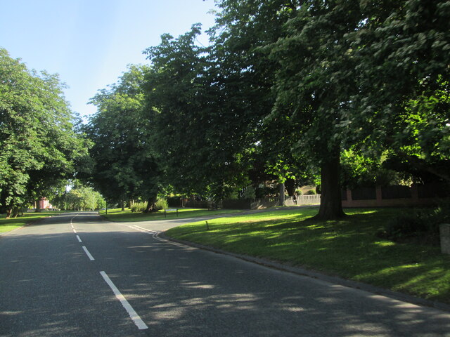
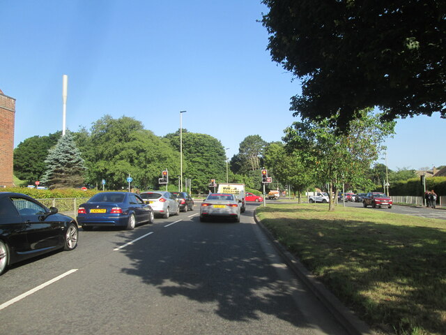
Parnell's Wood is a picturesque woodland located in the county of Yorkshire, England. Stretching across an area of approximately 100 acres, this enchanting forest is nestled within the charming countryside, making it a popular destination for nature lovers and outdoor enthusiasts.

The woodland is known for its diverse range of indigenous trees, including oak, beech, and birch, which provide a beautiful canopy of foliage throughout the year. The forest floor is covered in a rich carpet of moss and wildflowers, creating a vibrant burst of colors during the spring and summer months.

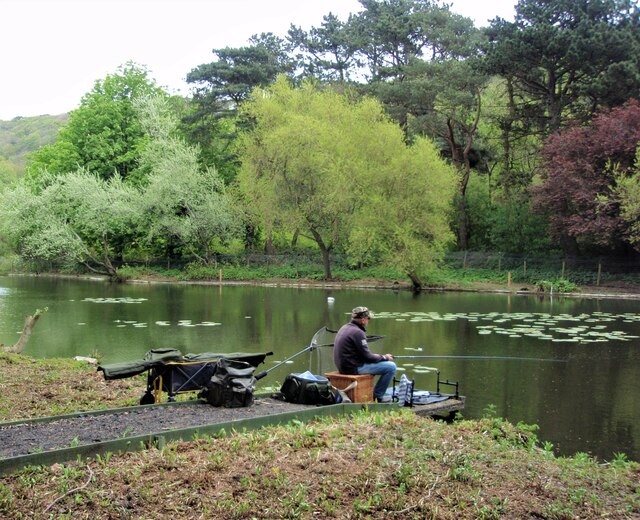
Parnell's Wood is home to an array of wildlife, making it an ideal spot for nature enthusiasts and birdwatchers. Visitors may catch a glimpse of various bird species, such as woodpeckers, owls, and songbirds, as well as small mammals like squirrels and rabbits.

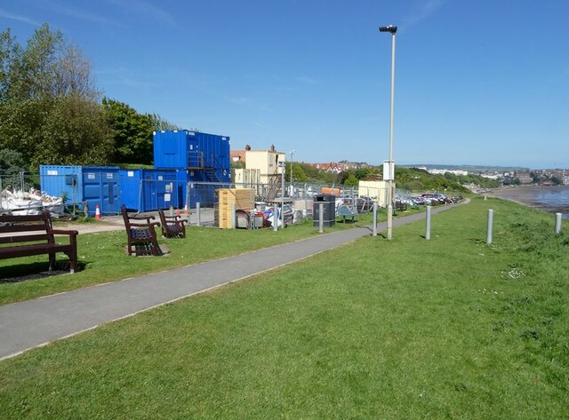
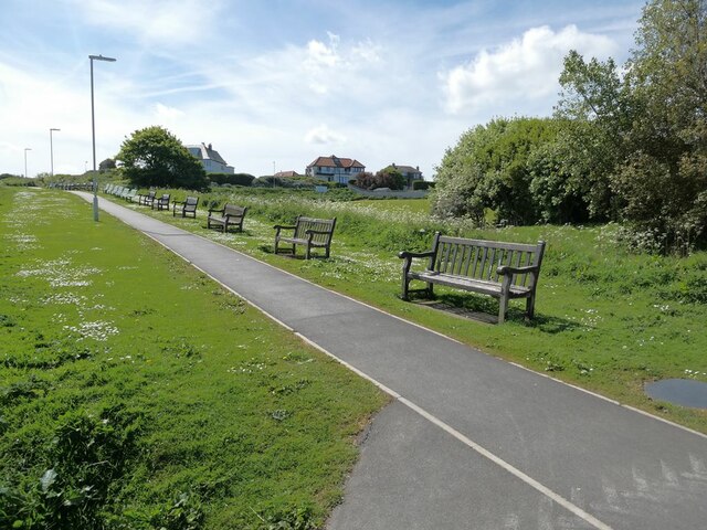
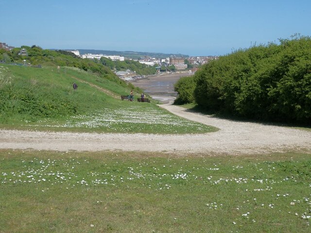
The forest offers a network of well-maintained footpaths and trails, allowing visitors to explore its natural beauty at their own pace. These paths wind through the woodland, offering stunning views of the surrounding countryside and providing opportunities for peaceful walks or invigorating hikes.

With its tranquil atmosphere and natural beauty, Parnell's Wood is not only a haven for wildlife but also a perfect escape for those seeking solace in nature. Whether it's a leisurely stroll, a birdwatching adventure, or simply a moment of quiet reflection, this enchanting woodland offers a slice of tranquility in the heart of Yorkshire.

If you have any feedback on the listing, please let us know in the comments section below.

Parnell's Wood Images

Images are sourced within 2km of 54.268727/-0.41128969 or Grid Reference TA0387. Thanks to Geograph Open Source API. All images are credited.

A  tree  lined  Stepney  Drive Junction with Stepney Grove on the right
A tree lined Stepney Drive
Junction with Stepney Grove on the right
Traffic  lights  on  A171  Scalby  Road  Scarborough Approaching Scarborough Hospital, behind trees on left
Traffic lights on A171 Scalby Road Scarborough
Approaching Scarborough Hospital, behind trees on left
Sea-front shelter Proving its value in a not-so-rare Scarborough downpour.
Sea-front shelter
Proving its value in a not-so-rare Scarborough downpour.
Fishing, The Mere, Scarborough Day 121: Olympus MJU 780 digital camera. 1/200 sec. f/3.3, 6.4 mm. ISO 80.
Fishing, The Mere, Scarborough
Day 121: Olympus MJU 780 digital camera. 1/200 sec. f/3.3, 6.4 mm. ISO 80.
The start of the Scarborough - Whitby railway Looking north towards Scalby.
The start of the Scarborough - Whitby railway
Looking north towards Scalby.
Scarborough Railway Station clock tower Grade 2 listed built in 1845.
Scarborough Railway Station clock tower
Grade 2 listed built in 1845.
Scarborough Railway Station forecourt Grade 2 listed built in 1845.
Scarborough Railway Station forecourt
Grade 2 listed built in 1845.
Westborough Pedestrianised shopping street in central Scarborough.
Westborough
Pedestrianised shopping street in central Scarborough.
Scarborough Market Hall In St Helen's Square. Built 1853.
Scarborough Market Hall
In St Helen's Square. Built 1853.
Eastborough Street leading down from the town centre to the Harbour.
Eastborough
Street leading down from the town centre to the Harbour.
Major works at Sea Cliff Road car park Not sure what is going on here.
Major works at Sea Cliff Road car park
Not sure what is going on here.
Row of benches at Sea Cliff Road Each with its own commemorative plaque.
Row of benches at Sea Cliff Road
Each with its own commemorative plaque.
Climb on the Cleveland Way Where the National Trail climbs up from South Bay to Wheatcroft Cliff.
Climb on the Cleveland Way
Where the National Trail climbs up from South Bay to Wheatcroft Cliff.
South Sands Scarborough Spa - multi-faceted entertainment and conference centre above the sea wall. On the cliff top, the elegant houses on the Esplanade.
South Sands
Scarborough Spa - multi-faceted entertainment and conference centre above the sea wall. On the cliff top, the elegant houses on the Esplanade.
South Sands The southern extension of Scarborough Spa - multi-faceted entertainment and conference centre - above the sea wall. The cliff lift just beyond and on the cliff top, the elegant houses on the Esplanade.
South Sands
The southern extension of Scarborough Spa - multi-faceted entertainment and conference centre - above the sea wall. The cliff lift just beyond and on the cliff top, the elegant houses on the Esplanade.
The Cliff Lift From South Sands up to the Esplanade.
The Cliff Lift
From South Sands up to the Esplanade.
Rock pools at South Bay
School party at South Bay Examining the contents of the rock pools.
School party at South Bay
Examining the contents of the rock pools.
Show me another place!

Parnell's Wood is located at Grid Ref: TA0387 (Lat: 54.268727, Lng: -0.41128969)

Division: North Riding

Administrative County: North Yorkshire

District: Scarborough

Police Authority: North Yorkshire

What 3 Words

///glitz.stick.pepper. Near Scarborough, North Yorkshire

Nearby Locations

Valley Park Parnell's Wood

Related Wikis

Scarborough Athletic F.C.

Scarborough Athletic Football Club is an association football club based in Scarborough, North Yorkshire, England. The club currently play in the National...

Flamingo Land Stadium

Flamingo Land Stadium in Scarborough, North Yorkshire, England, is the home ground of Scarborough Athletic F.C.Construction of the stadium started in 2016...

Scarborough War Memorial

Scarborough War Memorial is a war memorial at the north end of Oliver's Mount in the town of Scarborough in North Yorkshire. It is listed Grade II on the...

Scarborough power station

Scarborough power station supplied electricity to the town of Scarborough and the surrounding area from 1893 to 1958. It was owned and operated by the...

Scarborough University Technical College

Scarborough University Technical College is a mixed University Technical College located in Scarborough, North Yorkshire, England. It opened in 2016 and...

Athletic Ground (Scarborough)

The Athletic Ground, latterly known as the McCain Stadium, was a football stadium located on Seamer Road in Scarborough, North Yorkshire, England. It was...

St James with Holy Trinity Church, Scarborough

St James with Holy Trinity Church is in Seamer Road, Scarborough, North Yorkshire, England. It is an active Anglican parish church in the deanery of Scarborough...

Scarborough Londesborough Road railway station

Scarborough Londesborough Road railway station, originally called Washbeck Excursion Station, was built as an excursion station to ease operating pressure...

Nearby Amenities

Located within 500m of 54.268727,-0.41128969
Railway: switch
Lat/Long: 54.2717023/-0.4144386
Historic: memorial
Is In: Scarborough
Memorial: war_memorial
Wheelchair: yes
Wikidata: Q60760511
Lat/Long: 54.2681159/-0.4052636
Currys
Brand: currys
Brand Wikidata: Q3246464
Contact Website: https://www.currys.co.uk/store-finder/scarborough-2301.html
Operator: CURRYS
Shop: electronics
Wheelchair: yes
Lat/Long: 54.2656411/-0.4160722
Carpetright
Brand: Carpetright
Brand Wikidata: Q5045782
Operator: CARPETRIGHT
Shop: carpet
Lat/Long: 54.2656415/-0.4157621
Oliver's Mount
Tourism: viewpoint
Lat/Long: 54.268214/-0.4052356
Scarborough Turntable
Railway: turntable
Lat/Long: 54.2708945/-0.4149157
Railway: switch
Lat/Long: 54.2704392/-0.414763
Railway: buffer_stop
Lat/Long: 54.2705227/-0.4151576
Railway: switch
Lat/Long: 54.2716332/-0.4145108
Railway: switch
Lat/Long: 54.2721068/-0.4143733
Railway: buffer_stop
Lat/Long: 54.2665111/-0.4157356
Post Box
Post Box Mounting: lamp_post
Post Box Type: lamp
Ref: YO11 50
Lat/Long: 54.2716803/-0.4102038
Post Box
Post Box Type: wall
Ref: YO12 3
Royal Cypher: VR
Royal Cypher Wikidata: Q33102356
Lat/Long: 54.2701708/-0.4159625
Bus Stop
Naptan AtcoCode: 3200YNA01249
Naptan NaptanCode: 32001249
Lat/Long: 54.2703761/-0.4157614
Bensons for Beds
Brand: Bensons for Beds
Brand Wikidata: Q4890299
Shop: bed
Lat/Long: 54.2656399/-0.415637
Oliver's Mount transmitter
Height: 41
Man Made: tower
Tower Construction: lattice
Tower Type: communication
Lat/Long: 54.2673917/-0.4044685
Entrance: yes
Lat/Long: 54.270929/-0.4134295
Bicycle Parking
Bicycle Parking: stands
Capacity: 66
Covered: no
Lat/Long: 54.2721528/-0.4132943
Entrance: yes
Lat/Long: 54.2720057/-0.4131802
Bicycle Parking
Bicycle Parking: stands
Capacity: 32
Covered: no
Lat/Long: 54.2709821/-0.4132644
Bicycle Parking
Bicycle Parking: stands
Capacity: 40
Covered: no
Lat/Long: 54.2710135/-0.4135352
Olivers Mount
Natural: peak
Wikidata: Q7087358
Lat/Long: 54.2675245/-0.4052279
Charging Station
Capacity: 2
Contact Website: https://pod-point.com/
Operator: Lidl
Operator Wikidata: Q151954
Wheelchair: yes
Lat/Long: 54.2660498/-0.4172224
Crossing
Lat/Long: 54.2695547/-0.4042404
Power: transformer
Lat/Long: 54.2650817/-0.4147393
Power: transformer
Lat/Long: 54.265068/-0.4142962
Barrier: bollard
Lat/Long: 54.2680291/-0.4148048
Crossing
Crossing: uncontrolled
Crossing Markings: yes
Lat/Long: 54.2660269/-0.4167497
Crossing
Lat/Long: 54.2696649/-0.4050873
The data included in this document is from www.openstreetmap.org. The data is made available under ODbL.

Have you been to Parnell's Wood?

Leave your review of Parnell's Wood below (or comments, questions and feedback).