Woodfield Copse

Wood, Forest in Sussex Chichester

England

Woodfield Copse

Churchyard gates, Wisborough Green
Churchyard gates, Wisborough Green Credit: Robin Webster

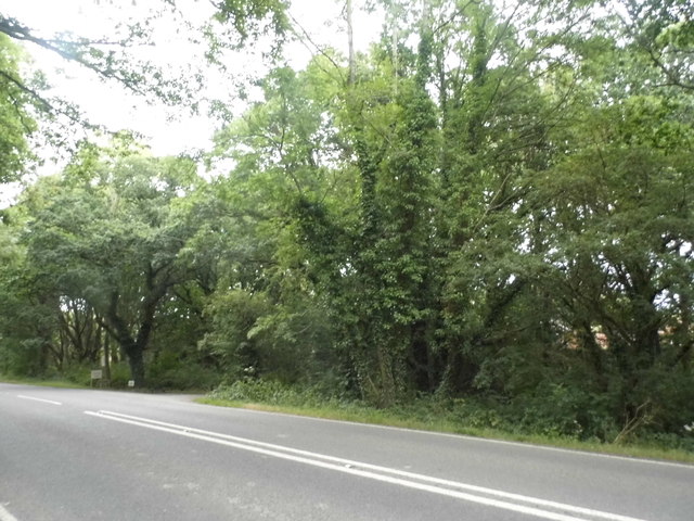
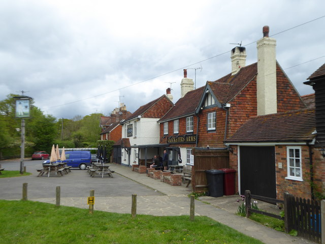
Woodfield Copse is a picturesque woodland located in Sussex, England. Spread across a vast area, it is known for its dense forest cover and rich biodiversity. The copse is situated in close proximity to several residential areas, making it easily accessible to nature enthusiasts and locals alike.

The woodland is predominantly composed of a variety of tree species, including oak, beech, and birch, which create a stunning canopy of greenery. This lush vegetation provides a habitat for numerous wildlife species, such as deer, foxes, and a wide range of bird species, attracting wildlife enthusiasts and birdwatchers.

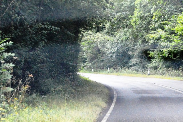
Woodfield Copse offers a network of well-maintained footpaths, allowing visitors to explore the area and enjoy peaceful walks amidst the natural beauty. The trails wind through the forest, revealing hidden clearings and tranquil spots, perfect for picnics or simply soaking in the serene atmosphere.

The copse is also home to a small stream that meanders through the woodland, adding to its charm and providing a refreshing sight and sound for visitors. This stream creates small pools and waterfalls, adding an element of tranquility to the surroundings.

Woodfield Copse is not just a haven for nature lovers; it also serves as an important ecological site, being part of a larger network of protected areas in Sussex. Efforts are made to preserve the copse's natural integrity through conservation projects and responsible management.

Overall, Woodfield Copse in Sussex offers a unique opportunity to experience the beauty of a diverse woodland ecosystem, providing a serene escape from the bustle of everyday life.

If you have any feedback on the listing, please let us know in the comments section below.

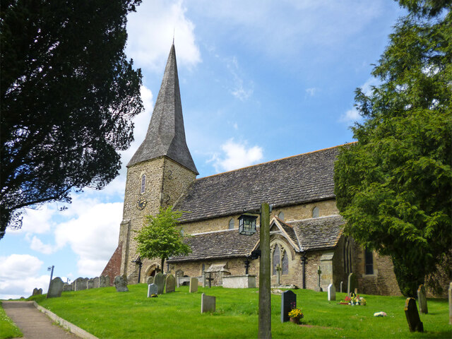
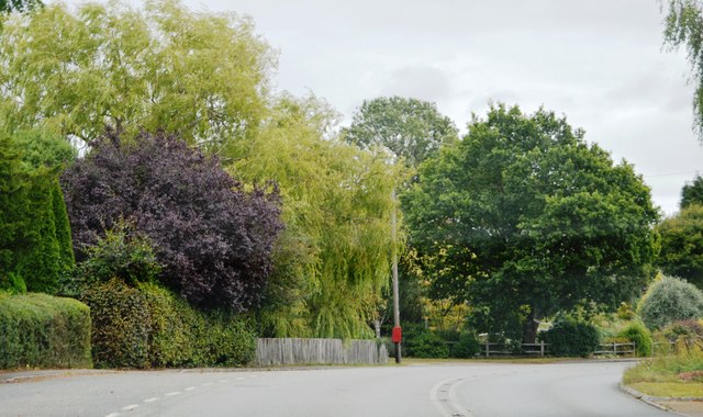
Woodfield Copse Images

Images are sourced within 2km of 51.025545/-0.52464935 or Grid Reference TQ0326. Thanks to Geograph Open Source API. All images are credited.

Churchyard gates, Wisborough Green
Wisborough Green church The Church of St Peter ad Vincula is a grade I listed building, late 11th century onwards.
Wisborough Green church
The Church of St Peter ad Vincula is a grade I listed building, late 11th century onwards.
Woodland by the A272, Strood Green
Petworth Road, Wisborough Green
House on Petworth Road, Wisborough Green
Petworth Road, Wisborough Green
A272, eastbound The A272 is a very rural A road, which follows an east to west route from near Heathfield to Winchester, passing through the Sussex countryside. It runs 86 miles from Sutton Scotney to Five Ashes <a href="https://www.geograph.org.uk/photo/6669405">TQ5523 : A267, A272 junction</a>.
<span class="nowrap"><a title="http://www.sabre-roads.org.uk/wiki/index.php?title=A272" rel="nofollow ugc noopener" href="http://www.sabre-roads.org.uk/wiki/index.php?title=A272">Link</a><img style="margin-left:2px;" alt="External link" title="External link - shift click to open in new window" src="https://s1.geograph.org.uk/img/external.png" width="10" height="10"/></span> 
Wikipedia: <span class="nowrap"><a title="http://en.wikipedia.org/wiki/A272_road" rel="nofollow ugc noopener" href="http://en.wikipedia.org/wiki/A272_road">Link</a><img style="margin-left:2px;" alt="External link" title="External link - shift click to open in new window" src="https://s1.geograph.org.uk/img/external.png" width="10" height="10"/></span>
A272, eastbound
The A272 is a very rural A road, which follows an east to west route from near Heathfield to Winchester, passing through the Sussex countryside. It runs 86 miles from Sutton Scotney to Five Ashes TQ5523 : A267, A272 junction. LinkExternal link Wikipedia: LinkExternal link
Bend, A272 The A272 is a very rural A road, which follows an east to west route from near Heathfield to Winchester, passing through the Sussex countryside. It runs 86 miles from Sutton Scotney to Five Ashes <a href="https://www.geograph.org.uk/photo/6669405">TQ5523 : A267, A272 junction</a>.
<span class="nowrap"><a title="http://www.sabre-roads.org.uk/wiki/index.php?title=A272" rel="nofollow ugc noopener" href="http://www.sabre-roads.org.uk/wiki/index.php?title=A272">Link</a><img style="margin-left:2px;" alt="External link" title="External link - shift click to open in new window" src="https://s1.geograph.org.uk/img/external.png" width="10" height="10"/></span> 
Wikipedia: <span class="nowrap"><a title="http://en.wikipedia.org/wiki/A272_road" rel="nofollow ugc noopener" href="http://en.wikipedia.org/wiki/A272_road">Link</a><img style="margin-left:2px;" alt="External link" title="External link - shift click to open in new window" src="https://s1.geograph.org.uk/img/external.png" width="10" height="10"/></span>
Bend, A272
The A272 is a very rural A road, which follows an east to west route from near Heathfield to Winchester, passing through the Sussex countryside. It runs 86 miles from Sutton Scotney to Five Ashes TQ5523 : A267, A272 junction. LinkExternal link Wikipedia: LinkExternal link
Entering Wisborough Green, A272 The A272 is a very rural A road, which follows an east to west route from near Heathfield to Winchester, passing through the Sussex countryside. It runs 86 miles from Sutton Scotney to Five Ashes <a href="https://www.geograph.org.uk/photo/6669405">TQ5523 : A267, A272 junction</a>.
<span class="nowrap"><a title="http://www.sabre-roads.org.uk/wiki/index.php?title=A272" rel="nofollow ugc noopener" href="http://www.sabre-roads.org.uk/wiki/index.php?title=A272">Link</a><img style="margin-left:2px;" alt="External link" title="External link - shift click to open in new window" src="https://s1.geograph.org.uk/img/external.png" width="10" height="10"/></span> 
Wikipedia: <span class="nowrap"><a title="http://en.wikipedia.org/wiki/A272_road" rel="nofollow ugc noopener" href="http://en.wikipedia.org/wiki/A272_road">Link</a><img style="margin-left:2px;" alt="External link" title="External link - shift click to open in new window" src="https://s1.geograph.org.uk/img/external.png" width="10" height="10"/></span>
Entering Wisborough Green, A272
The A272 is a very rural A road, which follows an east to west route from near Heathfield to Winchester, passing through the Sussex countryside. It runs 86 miles from Sutton Scotney to Five Ashes TQ5523 : A267, A272 junction. LinkExternal link Wikipedia: LinkExternal link
A272 The A272 is a very rural A road, which follows an east to west route from near Heathfield to Winchester, passing through the Sussex countryside. It runs 86 miles from Sutton Scotney to Five Ashes <a href="https://www.geograph.org.uk/photo/6669405">TQ5523 : A267, A272 junction</a>.
<span class="nowrap"><a title="http://www.sabre-roads.org.uk/wiki/index.php?title=A272" rel="nofollow ugc noopener" href="http://www.sabre-roads.org.uk/wiki/index.php?title=A272">Link</a><img style="margin-left:2px;" alt="External link" title="External link - shift click to open in new window" src="https://s1.geograph.org.uk/img/external.png" width="10" height="10"/></span> 
Wikipedia: <span class="nowrap"><a title="http://en.wikipedia.org/wiki/A272_road" rel="nofollow ugc noopener" href="http://en.wikipedia.org/wiki/A272_road">Link</a><img style="margin-left:2px;" alt="External link" title="External link - shift click to open in new window" src="https://s1.geograph.org.uk/img/external.png" width="10" height="10"/></span>
A272
The A272 is a very rural A road, which follows an east to west route from near Heathfield to Winchester, passing through the Sussex countryside. It runs 86 miles from Sutton Scotney to Five Ashes TQ5523 : A267, A272 junction. LinkExternal link Wikipedia: LinkExternal link
A272, Wisborough Green The A272 is a very rural A road, which follows an east to west route from near Heathfield to Winchester, passing through the Sussex countryside. It runs 86 miles from Sutton Scotney to Five Ashes <a href="https://www.geograph.org.uk/photo/6669405">TQ5523 : A267, A272 junction</a>.
<span class="nowrap"><a title="http://www.sabre-roads.org.uk/wiki/index.php?title=A272" rel="nofollow ugc noopener" href="http://www.sabre-roads.org.uk/wiki/index.php?title=A272">Link</a><img style="margin-left:2px;" alt="External link" title="External link - shift click to open in new window" src="https://s1.geograph.org.uk/img/external.png" width="10" height="10"/></span> 
Wikipedia: <span class="nowrap"><a title="http://en.wikipedia.org/wiki/A272_road" rel="nofollow ugc noopener" href="http://en.wikipedia.org/wiki/A272_road">Link</a><img style="margin-left:2px;" alt="External link" title="External link - shift click to open in new window" src="https://s1.geograph.org.uk/img/external.png" width="10" height="10"/></span>
A272, Wisborough Green
The A272 is a very rural A road, which follows an east to west route from near Heathfield to Winchester, passing through the Sussex countryside. It runs 86 miles from Sutton Scotney to Five Ashes TQ5523 : A267, A272 junction. LinkExternal link Wikipedia: LinkExternal link
Wisborough Green War Memorial
Cottages overlooking the village green at Wisborough Green
Horse chestnut tree on the village green
Millennium Sundial on the Little Green at Wisborough Green This was commissioned and donated to the Parish by the Wisborough Green Horticultural Society to commemorate the millennium celebrations.
Millennium Sundial on the Little Green at Wisborough Green
This was commissioned and donated to the Parish by the Wisborough Green Horticultural Society to commemorate the millennium celebrations.
Finger post at Wisborough Green
The Cricketers' Arms at Wisborough Green
Show me another place!

Woodfield Copse is located at Grid Ref: TQ0326 (Lat: 51.025545, Lng: -0.52464935)

Administrative County: West Sussex

District: Chichester

Police Authority: Sussex

What 3 Words

///envisage.among.blanket. Near Billingshurst, West Sussex

Related Wikis

Wisborough Green

Wisborough Green is a village and civil parish in the north of the Chichester district of West Sussex, England, 2 miles (3.2 km) west of Billingshurst...

Kirdford

Kirdford is a village and civil parish in the Chichester District of West Sussex, England. Its nearest town is Petworth, located 6.5 miles (10.5 km) southwest...

River Kird

The River Kird is a river located in the Chichester District of West Sussex, England that is a tributary to the River Arun. It is located in South Downs...

St Ronan's School

Saint Ronan's School is an independent co-educational preparatory school for boys and girls from 3 to 13 years located in Hawkhurst in Kent, England. It...

The Mens

The Mens is a 205.2-hectare (507-acre) biological Site of Special Scientific Interest west of Billingshurst in West Sussex. It is a Nature Conservation...

Loxwood F.C.

Loxwood Football Club is a football club based in Loxwood, West Sussex, England. Nicknamed "The Magpies" and affiliated to the Surrey County FA, they are...

Upper Arun

Upper Arun is a 17.6-hectare (43-acre) biological Site of Special Scientific Interest between Billingshurst and Pulborough in West Sussex.This 13-kilometre...

Petworth (electoral division)

Petworth is an electoral division of West Sussex in the United Kingdom, and returns one member to sit on West Sussex County Council. == Extent == The division...

Related Videos

Day Out at Fishers Farm! | Once Upon Jen

Who wants to be at the Animal Kingdom when you can be at Fishers Farm Park?

Nearby Amenities

Located within 500m of 51.025545,-0.52464935
Power: tower
Lat/Long: 51.0273112/-0.5235053
Power: tower
Lat/Long: 51.0255714/-0.5276648
The data included in this document is from www.openstreetmap.org. The data is made available under ODbL.

Have you been to Woodfield Copse?

Leave your review of Woodfield Copse below (or comments, questions and feedback).