The Clump

Wood, Forest in Buckinghamshire

England

The Clump

Fulmer Common Rd
Fulmer Common Rd Credit: N Chadwick

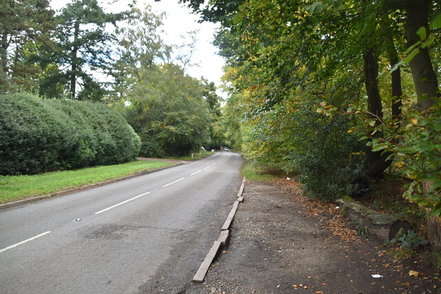
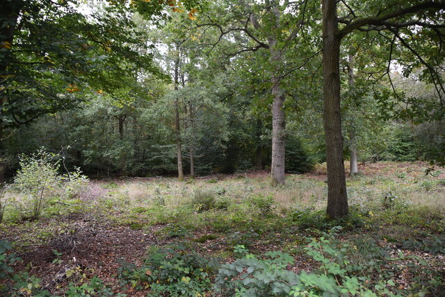
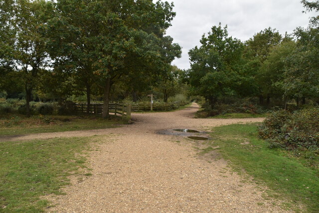
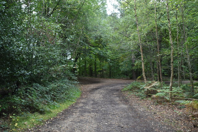
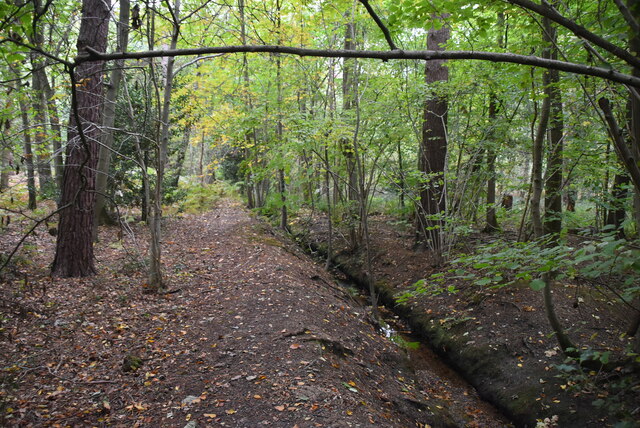
The Clump, located in Buckinghamshire, is a picturesque woodland area known for its dense and enchanting forest. Spanning approximately 30 acres, it is situated near the village of Wood and offers a serene and idyllic retreat for nature enthusiasts and visitors alike.

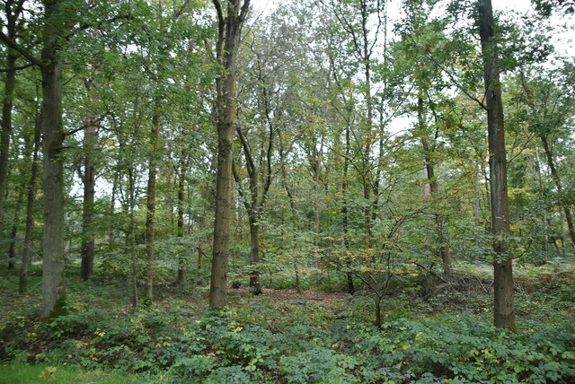
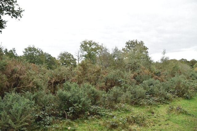
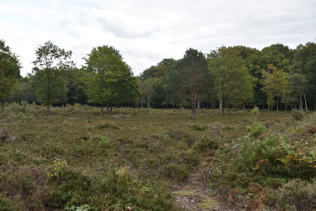
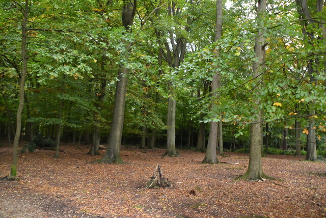
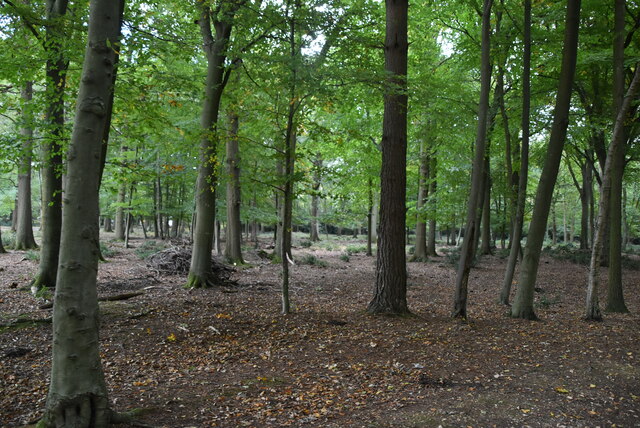
The woodland is characterized by a diverse range of trees, including oak, beech, and birch, which creates a captivating mosaic of colors throughout the year. The forest floor is covered with a thick blanket of ferns, wildflowers, and moss, giving The Clump a mystical and timeless feel. It is also home to a variety of wildlife, such as deer, foxes, and numerous bird species, making it a popular spot for birdwatchers and wildlife enthusiasts.

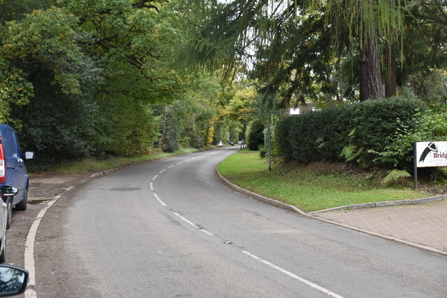
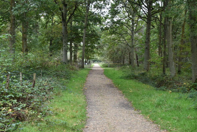
The Clump is a haven for outdoor activities, with several trails winding through the forest, allowing visitors to explore its natural beauty. These trails are suitable for both walkers and cyclists, providing a wonderful opportunity to immerse oneself in the tranquility of the surroundings. Additionally, there are designated picnic areas where visitors can relax and enjoy the peaceful ambiance of the woodland.

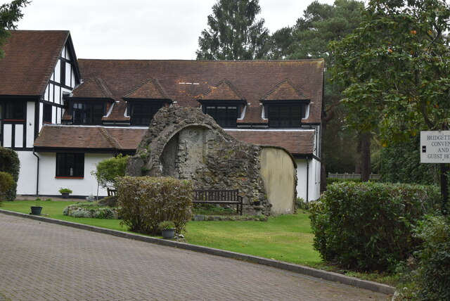
The Clump has a rich history, dating back to ancient times. It is believed to have been used as a hunting ground for local nobility, and remnants of old structures can still be found within the forest. The woodland has also been a source of inspiration for artists and writers, with its ethereal charm and timeless beauty serving as a muse for many.

Overall, The Clump in Buckinghamshire is a remarkable woodland area that offers a respite from the hustle and bustle of modern life. Its natural beauty, diverse wildlife, and historical significance make it an ideal destination for those seeking a peaceful and enchanting experience in the heart of nature.

If you have any feedback on the listing, please let us know in the comments section below.

The Clump Images

Images are sourced within 2km of 51.550406/-0.52609492 or Grid Reference TQ0284. Thanks to Geograph Open Source API. All images are credited.

Fulmer Common Rd
Fulmer Common Rd
Fulmer Common Rd
Fulmer Common Rd
Bridgettine Convent
Bridgettine Convent
COVID-19 Social distancing banner, Black Park Black Park is a 250 hectare country park in Buckinghamshire.
Wikipedia: <span class="nowrap"><a title="https://en.wikipedia.org/wiki/Black_Park" rel="nofollow ugc noopener" href="https://en.wikipedia.org/wiki/Black_Park">Link</a><img style="margin-left:2px;" alt="External link" title="External link - shift click to open in new window" src="https://s1.geograph.org.uk/img/external.png" width="10" height="10"/></span>
COVID-19 Social distancing banner, Black Park
Black Park is a 250 hectare country park in Buckinghamshire. Wikipedia: LinkExternal link
Strawberry Wood Black Park is a 250 hectare country park in Buckinghamshire.
Wikipedia: <span class="nowrap"><a title="https://en.wikipedia.org/wiki/Black_Park" rel="nofollow ugc noopener" href="https://en.wikipedia.org/wiki/Black_Park">Link</a><img style="margin-left:2px;" alt="External link" title="External link - shift click to open in new window" src="https://s1.geograph.org.uk/img/external.png" width="10" height="10"/></span>
Strawberry Wood
Black Park is a 250 hectare country park in Buckinghamshire. Wikipedia: LinkExternal link
Black Park Black Park is a 250 hectare country park in Buckinghamshire.
Wikipedia: <span class="nowrap"><a title="https://en.wikipedia.org/wiki/Black_Park" rel="nofollow ugc noopener" href="https://en.wikipedia.org/wiki/Black_Park">Link</a><img style="margin-left:2px;" alt="External link" title="External link - shift click to open in new window" src="https://s1.geograph.org.uk/img/external.png" width="10" height="10"/></span>
Black Park
Black Park is a 250 hectare country park in Buckinghamshire. Wikipedia: LinkExternal link
Strawberry Wood Black Park is a 250 hectare country park in Buckinghamshire.
Wikipedia: <span class="nowrap"><a title="https://en.wikipedia.org/wiki/Black_Park" rel="nofollow ugc noopener" href="https://en.wikipedia.org/wiki/Black_Park">Link</a><img style="margin-left:2px;" alt="External link" title="External link - shift click to open in new window" src="https://s1.geograph.org.uk/img/external.png" width="10" height="10"/></span>
Strawberry Wood
Black Park is a 250 hectare country park in Buckinghamshire. Wikipedia: LinkExternal link
Heathland, Black Park Black Park is a 250 hectare country park in Buckinghamshire.
Wikipedia: <span class="nowrap"><a title="https://en.wikipedia.org/wiki/Black_Park" rel="nofollow ugc noopener" href="https://en.wikipedia.org/wiki/Black_Park">Link</a><img style="margin-left:2px;" alt="External link" title="External link - shift click to open in new window" src="https://s1.geograph.org.uk/img/external.png" width="10" height="10"/></span>
Heathland, Black Park
Black Park is a 250 hectare country park in Buckinghamshire. Wikipedia: LinkExternal link
Track junction Black Park is a 250 hectare country park in Buckinghamshire.
Wikipedia: <span class="nowrap"><a title="https://en.wikipedia.org/wiki/Black_Park" rel="nofollow ugc noopener" href="https://en.wikipedia.org/wiki/Black_Park">Link</a><img style="margin-left:2px;" alt="External link" title="External link - shift click to open in new window" src="https://s1.geograph.org.uk/img/external.png" width="10" height="10"/></span>
Track junction
Black Park is a 250 hectare country park in Buckinghamshire. Wikipedia: LinkExternal link
Heathland, Black Park Black Park is a 250 hectare country park in Buckinghamshire.
Wikipedia: <span class="nowrap"><a title="https://en.wikipedia.org/wiki/Black_Park" rel="nofollow ugc noopener" href="https://en.wikipedia.org/wiki/Black_Park">Link</a><img style="margin-left:2px;" alt="External link" title="External link - shift click to open in new window" src="https://s1.geograph.org.uk/img/external.png" width="10" height="10"/></span>
Heathland, Black Park
Black Park is a 250 hectare country park in Buckinghamshire. Wikipedia: LinkExternal link
Black Park
Black Park
Black Park Black Park is a 250 hectare country park in Buckinghamshire.
Wikipedia: <span class="nowrap"><a title="https://en.wikipedia.org/wiki/Black_Park" rel="nofollow ugc noopener" href="https://en.wikipedia.org/wiki/Black_Park">Link</a><img style="margin-left:2px;" alt="External link" title="External link - shift click to open in new window" src="https://s1.geograph.org.uk/img/external.png" width="10" height="10"/></span>
Black Park
Black Park is a 250 hectare country park in Buckinghamshire. Wikipedia: LinkExternal link
Track, Black Park Black Park is a 250 hectare country park in Buckinghamshire.
Wikipedia: <span class="nowrap"><a title="https://en.wikipedia.org/wiki/Black_Park" rel="nofollow ugc noopener" href="https://en.wikipedia.org/wiki/Black_Park">Link</a><img style="margin-left:2px;" alt="External link" title="External link - shift click to open in new window" src="https://s1.geograph.org.uk/img/external.png" width="10" height="10"/></span>
Track, Black Park
Black Park is a 250 hectare country park in Buckinghamshire. Wikipedia: LinkExternal link
Black Park Black Park is a 250 hectare country park in Buckinghamshire.
Wikipedia: <span class="nowrap"><a title="https://en.wikipedia.org/wiki/Black_Park" rel="nofollow ugc noopener" href="https://en.wikipedia.org/wiki/Black_Park">Link</a><img style="margin-left:2px;" alt="External link" title="External link - shift click to open in new window" src="https://s1.geograph.org.uk/img/external.png" width="10" height="10"/></span>
Black Park
Black Park is a 250 hectare country park in Buckinghamshire. Wikipedia: LinkExternal link
Small stream, Black Park Black Park is a 250 hectare country park in Buckinghamshire.
Wikipedia: <span class="nowrap"><a title="https://en.wikipedia.org/wiki/Black_Park" rel="nofollow ugc noopener" href="https://en.wikipedia.org/wiki/Black_Park">Link</a><img style="margin-left:2px;" alt="External link" title="External link - shift click to open in new window" src="https://s1.geograph.org.uk/img/external.png" width="10" height="10"/></span>
Small stream, Black Park
Black Park is a 250 hectare country park in Buckinghamshire. Wikipedia: LinkExternal link
Black Park
Black Park
Black Park Black Park is a 250 hectare country park in Buckinghamshire.
Wikipedia: <span class="nowrap"><a title="https://en.wikipedia.org/wiki/Black_Park" rel="nofollow ugc noopener" href="https://en.wikipedia.org/wiki/Black_Park">Link</a><img style="margin-left:2px;" alt="External link" title="External link - shift click to open in new window" src="https://s1.geograph.org.uk/img/external.png" width="10" height="10"/></span>
Black Park
Black Park is a 250 hectare country park in Buckinghamshire. Wikipedia: LinkExternal link
Show me another place!

The Clump is located at Grid Ref: TQ0284 (Lat: 51.550406, Lng: -0.52609492)

Unitary Authority: Buckinghamshire

Police Authority: Thames Valley

What 3 Words

///quiz.tribal.gave. Near Iver Heath, Buckinghamshire

Nearby Locations

The Clump

Related Wikis

007 Stage

The Albert R. Broccoli 007 Stage is one of the largest sound stages in the world. It is located at Pinewood Studios, Iver Heath, Buckinghamshire, England...

Pinewood Studios

Pinewood Studios is a British film and television studio located in the village of Iver Heath, England. It is approximately 18 miles (29 km) west of central...

Heatherden Hall

Heatherden Hall is a Grade II-listed, Victorian country house located in Iver Heath, Buckinghamshire, England. It stands in the grounds of Pinewood Studios...

Kingcup Meadows and Oldhouse Wood

Kingcup Meadows and Oldhouse Wood is a 13.2-hectare (33-acre) biological Site of Special Scientific Interest south of Denham in Buckinghamshire.The site...

Colne Valley Regional Park

The Colne Valley Regional Park is 43 square miles (110 km2) of parks, green spaces and reservoirs alongside the often multi-channel River Colne and parallel...

New Ground, Uxbridge Moor

The New Ground, Uxbridge Moor near Uxbridge, Middlesex was used as a venue for cricket matches between 1740 and 1790. It was an occasional home ground...

Black Park

Black Park is a country park in Wexham, Buckinghamshire, England to the north of the A412 road. It is managed by Buckinghamshire Council, formerly County...

Baker's Wood

Baker's Wood is a hamlet 2 miles west of Denham (where at the 2011 Census the population was included) off the A40 in Buckinghamshire, England. The hamlet...

Nearby Amenities

Located within 500m of 51.550406,-0.52609492
Traffic Calming: cushion
Lat/Long: 51.5464641/-0.5267185
Traffic Calming: cushion
Lat/Long: 51.5478153/-0.529232
Traffic Calming: cushion
Lat/Long: 51.547523/-0.5300378
Traffic Calming: cushion
Lat/Long: 51.5473233/-0.5264807
Motorway Junction
Denham
Ref: 16
Lat/Long: 51.5545233/-0.5276119
Crossing
Lat/Long: 51.5486689/-0.532638
Crossing
Lat/Long: 51.5486629/-0.5327404
Crossing
Lat/Long: 51.5486559/-0.5325316
Crossing
Crossing: marked
Lat/Long: 51.5487952/-0.5319697
Crossing
Crossing: marked
Lat/Long: 51.5488885/-0.5319772
Crossing
Crossing: marked
Lat/Long: 51.5509189/-0.5295632
Crossing
Crossing: traffic_signals
Lat/Long: 51.5500025/-0.5319994
Street Lamp
Lamp Model: Urbis ZX3
Lamp Type: SON
Source: Mapillary (2019-02-15)
Lat/Long: 51.5500296/-0.5216971
Street Lamp
Lamp Model: Urbis ZX3
Lamp Type: SON
Source: Mapillary (2019-02-15)
Lat/Long: 51.5489156/-0.519597
Street Lamp
Lamp Model: Urbis ZX3
Lamp Type: SON
Source: Mapillary (2019-02-15)
Lat/Long: 51.5486503/-0.5196989
Street Lamp
Lamp Model: Urbis ZX3
Lamp Type: SON
Source: Mapillary (2019-02-15)
Lat/Long: 51.552408/-0.5255275
Street Lamp
Lamp Model: Urbis ZX3
Lamp Type: SON
Source: Mapillary (2019-02-15)
Lat/Long: 51.5509169/-0.5230758
Street Lamp
Lamp Model: Urbis ZX3
Lamp Type: SON
Source: Mapillary (2019-02-15)
Lat/Long: 51.5506852/-0.5227459
Street Lamp
Lamp Model: Urbis ZX3
Lamp Type: SON
Source: Mapillary (2019-02-15)
Lat/Long: 51.551921/-0.5242722
Street Lamp
Lamp Model: Urbis ZX3
Lamp Type: SON
Source: Mapillary (2019-02-15)
Lat/Long: 51.5521395/-0.5256374
Street Lamp
Lamp Model: Urbis ZX3
Lamp Type: SON
Source: Mapillary (2019-02-15)
Lat/Long: 51.5523913/-0.5259083
Street Lamp
Lamp Model: Urbis ZX3
Lamp Type: SON
Source: Mapillary (2019-02-15)
Lat/Long: 51.5502231/-0.5226654
Street Lamp
Lamp Model: Urbis ZX3
Lamp Type: SON
Source: Mapillary (2019-02-15)
Lat/Long: 51.5511588/-0.5233869
Street Lamp
Lamp Model: Urbis ZX3
Lamp Type: SON
Source: Mapillary (2019-02-15)
Lat/Long: 51.5488955/-0.5202353
Street Lamp
Lamp Model: Urbis ZX3
Lamp Type: SON
Source: Mapillary (2019-02-15)
Lat/Long: 51.5514056/-0.5236793
Street Lamp
Lamp Model: Urbis ZX3
Lamp Type: SON
Source: Mapillary (2019-02-15)
Lat/Long: 51.5511238/-0.523977
Street Lamp
Lamp Model: Urbis ZX3
Lamp Type: SON
Source: Mapillary (2019-02-15)
Lat/Long: 51.5499463/-0.5222041
Street Lamp
Lamp Model: Urbis ZX3
Lamp Type: SON
Source: Mapillary (2019-02-15)
Lat/Long: 51.5524748/-0.5248972
Street Lamp
Lamp Model: Urbis ZX3
Lamp Type: SON
Source: Mapillary (2019-02-15)
Lat/Long: 51.5505101/-0.5231187
Street Lamp
Lamp Model: Urbis ZX3
Lamp Type: SON
Source: Mapillary (2019-02-15)
Lat/Long: 51.5508085/-0.5235559
Street Lamp
Lamp Model: Urbis ZX3
Lamp Type: SON
Source: Mapillary (2019-02-15)
Lat/Long: 51.55046/-0.5224052
Street Lamp
Lamp Model: Urbis ZX3
Lamp Type: SON
Source: Mapillary (2019-02-15)
Lat/Long: 51.5514356/-0.5243929
Street Lamp
Lamp Model: Urbis ZX3
Lamp Type: SON
Source: Mapillary (2019-02-15)
Lat/Long: 51.5496677/-0.5217293
Street Lamp
Lamp Model: Urbis ZX3
Lamp Type: SON
Source: Mapillary (2019-02-15)
Lat/Long: 51.549139/-0.5207369
Street Lamp
Lamp Model: Urbis ZX3
Lamp Type: SON
Source: Mapillary (2019-02-15)
Lat/Long: 51.5493492/-0.5204875
Street Lamp
Lamp Model: Urbis ZX3
Lamp Type: SON
Source: Mapillary (2019-02-15)
Lat/Long: 51.5517543/-0.5247899
Street Lamp
Lamp Model: Urbis ZX3
Lamp Type: SON
Source: Mapillary (2019-02-15)
Lat/Long: 51.5491256/-0.5200503
Street Lamp
Lamp Model: Urbis ZX3
Lamp Type: SON
Source: Mapillary (2019-02-15)
Lat/Long: 51.5493959/-0.5212412
Street Lamp
Lamp Model: Urbis ZX3
Lamp Type: SON
Source: Mapillary (2019-02-15)
Lat/Long: 51.549581/-0.5209113
Street Lamp
Lamp Model: Urbis ZX3
Lamp Type: SON
Source: Mapillary (2019-02-15)
Lat/Long: 51.5521879/-0.5245807
Street Lamp
Lamp Model: Urbis ZX3
Lamp Type: SON
Source: Mapillary (2019-02-15)
Lat/Long: 51.5524164/-0.5250339
Street Lamp
Lamp Model: Urbis ZX3
Lamp Type: SON
Source: Mapillary (2019-02-15)
Lat/Long: 51.5520744/-0.5251707
Street Lamp
Lamp Model: Urbis ZX3
Lamp Type: SON
Source: Mapillary (2019-02-15)
Lat/Long: 51.5521611/-0.524755
Street Lamp
Lamp Model: Urbis ZX3
Lamp Type: SON
Source: Mapillary (2019-02-15)
Lat/Long: 51.5519044/-0.52446
Street Lamp
Lamp Model: Urbis ZX3
Lamp Type: SON
Source: Mapillary (2019-02-15)
Lat/Long: 51.5502415/-0.5220539
Street Lamp
Lamp Model: Urbis ZX3
Lamp Type: SON
Source: Mapillary (2019-02-15)
Lat/Long: 51.5516491/-0.5239609
Street Lamp
Lamp Model: Urbis ZX3
Lamp Type: SON
Source: Mapillary (2019-02-15)
Lat/Long: 51.554436/-0.527405
Street Lamp
Lamp Model: Urbis ZX3
Lamp Type: SON
Source: Mapillary (2019-02-15)
Lat/Long: 51.5540857/-0.5270966
Material: wood
Power: pole
Source: DigitalGlobe-Standard
Lat/Long: 51.5542859/-0.5278073
Street Lamp
Lamp Model: Urbis ZX3
Lamp Type: SON
Source: Mapillary (2019-02-15)
Lat/Long: 51.5537338/-0.5268122
Street Lamp
Lamp Model: Urbis ZX3
Lamp Type: SON
Source: Mapillary (2019-02-15)
Lat/Long: 51.5527149/-0.5258413
Street Lamp
Lamp Model: Philips SGS204
Lamp Type: SON
Source: Mapillary (2019-02-15)
Lat/Long: 51.5544561/-0.5273216
Street Lamp
Lamp Model: Urbis ZX3
Lamp Type: SON
Source: Mapillary (2019-02-15)
Lat/Long: 51.5530501/-0.5261873
Street Lamp
Lamp Model: Urbis ZX3
Lamp Type: SON
Source: Mapillary (2019-02-15)
Lat/Long: 51.5533903/-0.5264984
Street Lamp
Lamp Model: Urbis ZX3
Lamp Type: SON
Source: Mapillary (2019-02-15)
Lat/Long: 51.5548029/-0.527625
Street Lamp
Lamp Model: Urbis ZX3
Lamp Type: SON
Source: Mapillary (2019-02-15)
Lat/Long: 51.5533083/-0.5259445
Street Lamp
Lamp Model: Urbis ZX3
Lamp Type: SON
Source: Mapillary (2019-02-15)
Lat/Long: 51.5533804/-0.5257689
Street Lamp
Lamp Model: Urbis ZX3
Lamp Type: SON
Source: Mapillary (2019-02-15)
Lat/Long: 51.5530536/-0.5256962
Street Lamp
Lamp Model: Urbis ZX3
Lamp Type: SON
Source: Mapillary (2019-02-15)
Lat/Long: 51.554306/-0.5264287
Street Lamp
Lamp Model: Urbis ZX3
Lamp Type: SON
Source: Mapillary (2019-02-15)
Lat/Long: 51.5539541/-0.5266325
Street Lamp
Lamp Model: Urbis ZX3
Lamp Type: SON
Source: Mapillary (2019-02-15)
Lat/Long: 51.5545861/-0.5269222
Street Lamp
Lamp Model: Urbis ZX3
Lamp Type: SON
Source: Mapillary (2019-02-15)
Lat/Long: 51.5536839/-0.526021
Street Lamp
Lamp Model: Urbis ZX3
Lamp Type: SON
Source: Mapillary (2019-02-15)
Lat/Long: 51.5536611/-0.5262255
Street Lamp
Lamp Model: Urbis ZX3
Lamp Type: SON
Source: Mapillary (2019-02-15)
Lat/Long: 51.5530851/-0.5254765
Street Lamp
Lamp Model: Urbis ZX3
Lamp Type: SON
Source: Mapillary (2019-02-15)
Lat/Long: 51.5542592/-0.5268069
Street Lamp
Lamp Model: Urbis ZX3
Lamp Type: SON
Source: Mapillary (2019-02-15)
Lat/Long: 51.5527833/-0.5251627
Street Lamp
Lamp Model: Urbis ZX3
Lamp Type: SON
Source: Mapillary (2019-02-15)
Lat/Long: 51.5527115/-0.5253317
Street Lamp
Lamp Model: Urbis ZX3
Lamp Type: SON
Source: Mapillary (2019-02-15)
Lat/Long: 51.5539424/-0.5264019
Street Lamp
Lamp Model: Urbis ZX3
Lamp Type: SON
Source: Mapillary (2019-02-15)
Lat/Long: 51.5539823/-0.526257
Street Lamp
Lamp Model: Urbis ZX3
Lamp Type: SON
Source: Mapillary (2019-02-15)
Lat/Long: 51.5546361/-0.5265628
Bus Stop
Pinewood Studios (pickup)
Bench: yes
Bin: yes
Bus: yes
Network: Pinewood Studios Shuttle Bus
Operator: Passenger Plus Ltd
Public Transport: platform
Shelter: yes
Lat/Long: 51.5478149/-0.5315999
Crossing
Crossing: marked
Lat/Long: 51.5506496/-0.5306833
Crossing
Crossing: marked
Lat/Long: 51.5510502/-0.5317358
Access: no
Barrier: turnstile
Foot: private
Lat/Long: 51.5509721/-0.5319399
Access: no
Barrier: turnstile
Foot: private
Lat/Long: 51.5499669/-0.5321607
Access: private
Barrier: lift_gate
Lat/Long: 51.5511006/-0.5320239
Access: private
Barrier: lift_gate
Lat/Long: 51.5510077/-0.5320056
Access: private
Barrier: lift_gate
Lat/Long: 51.5518749/-0.532534
Access: private
Barrier: lift_gate
Lat/Long: 51.551855/-0.5324753
Access: private
Barrier: lift_gate
Lat/Long: 51.5518954/-0.5325939
Access: private
Barrier: turnstile
Lat/Long: 51.5524016/-0.5310536
Access: private
Barrier: turnstile
Lat/Long: 51.5526678/-0.5318423
Access: private
Barrier: turnstile
Lat/Long: 51.5515009/-0.5316895
Access: private
Barrier: lift_gate
Lat/Long: 51.5484519/-0.532575
Access: private
Barrier: lift_gate
Lat/Long: 51.5490998/-0.5328805
Access: private
Barrier: lift_gate
Lat/Long: 51.5490787/-0.5328275
Crossing
Lat/Long: 51.5475925/-0.5313889
Crossing
Lat/Long: 51.5478174/-0.5314235
Crossing
Crossing: marked
Lat/Long: 51.5489843/-0.5328135
Crossing
Crossing: marked
Lat/Long: 51.5489815/-0.5328718
Direction: 205
Generator Method: photovoltaic
Generator Output Electricity: yes
Generator Solar Modules: 12
Generator Source: solar
Generator Type: solar_photovoltaic_panel
Location: roof
Power: generator
Lat/Long: 51.5527143/-0.5231199
Traffic Calming: cushion
Lat/Long: 51.5466532/-0.5279441
Traffic Calming: cushion
Lat/Long: 51.5468691/-0.5293416
Direction: 85
Fixme: survey to verify panel count
Generator Method: photovoltaic
Generator Output Electricity: yes
Generator Solar Modules: 6
Generator Source: solar
Generator Type: solar_photovoltaic_panel
Location: roof
Power: generator
Lat/Long: 51.5470942/-0.5303475
Direction: 265
Generator Method: photovoltaic
Generator Output Electricity: yes
Generator Solar Modules: 12
Generator Source: solar
Generator Type: solar_photovoltaic_panel
Location: roof
Power: generator
Lat/Long: 51.5470933/-0.5303957
Direction: 185
Fixme: survey to verify panel count
Generator Method: photovoltaic
Generator Output Electricity: yes
Generator Source: solar
Generator Type: solar_photovoltaic_panel
Power: generator
Lat/Long: 51.5475365/-0.5287908
Direction: 185
Fixme: survey to verify panel count
Generator Method: photovoltaic
Generator Output Electricity: yes
Generator Solar Modules: 6
Generator Source: solar
Generator Type: solar_photovoltaic_panel
Location: roof
Power: generator
Lat/Long: 51.5478763/-0.5284429
Direction: 190
Fixme: survey to verify panel count
Generator Method: photovoltaic
Generator Output Electricity: yes
Generator Solar Modules: 14
Generator Source: solar
Generator Type: solar_photovoltaic_panel
Location: roof
Power: generator
Lat/Long: 51.5478095/-0.5279328
Traffic Calming: cushion
Lat/Long: 51.5476548/-0.5281404
Traffic Calming: cushion
Lat/Long: 51.5475335/-0.5273765
Traffic Sign: variable_message
Variable Message Model: AMI
Lat/Long: 51.5542741/-0.5267946
Phone
Emergency: phone
Operator: National Highways
Operator Wikidata: Q5760006
Lat/Long: 51.5492623/-0.5203445
Traffic Sign: variable_message
Variable Message Model: AMI
Lat/Long: 51.5512103/-0.5242112
Traffic Sign: variable_message
Variable Message Model: AMI
Lat/Long: 51.5511927/-0.5242454
Traffic Sign: variable_message
Variable Message Model: AMI
Lat/Long: 51.5511716/-0.5242861
Traffic Sign: variable_message
Variable Message Model: AMI
Lat/Long: 51.5511499/-0.5243281
Traffic Sign: variable_message
Variable Message Model: MS2
Lat/Long: 51.5511259/-0.5243745
Phone
Emergency: phone
Operator: National Highways
Operator Wikidata: Q5760006
Lat/Long: 51.5489083/-0.5207951
Tactile Paving: yes
Lat/Long: 51.5499764/-0.53205
Traffic Signals
Traffic Signals Direction: backward
Lat/Long: 51.5500277/-0.5320313
Traffic Signals
Traffic Signals Direction: forward
Lat/Long: 51.5499643/-0.5319495
Tactile Paving: yes
Lat/Long: 51.5500218/-0.5319583
Crossing
Crossing: marked
Lat/Long: 51.5532704/-0.5311032
Crossing
Crossing: marked
Lat/Long: 51.5530512/-0.5304458
Crossing
Crossing: marked
Lat/Long: 51.5525709/-0.5305935
Crossing
Crossing: marked
Lat/Long: 51.5524438/-0.5305244
Crossing
Crossing: marked
Lat/Long: 51.5524873/-0.5309907
Crossing
Crossing: marked
Lat/Long: 51.5527462/-0.5317749
Crossing
Lat/Long: 51.5518019/-0.532523
Crossing
Lat/Long: 51.5518216/-0.5325827
Crossing
Lat/Long: 51.5518427/-0.5326466
Crossing
Crossing: marked
Lat/Long: 51.5514277/-0.5315666
Crossing
Crossing: marked
Lat/Long: 51.5510652/-0.5313951
Crossing
Crossing: marked
Lat/Long: 51.5520046/-0.5295985
Crossing
Crossing: marked
Lat/Long: 51.5520038/-0.52921
Crossing
Crossing: unmarked
Lat/Long: 51.5514465/-0.530015
Crossing
Crossing: marked
Lat/Long: 51.5509491/-0.5304722
Crossing
Crossing: marked
Lat/Long: 51.5508493/-0.5302892
Crossing
Crossing: marked
Lat/Long: 51.5509842/-0.528949
Crossing
Crossing: unmarked
Lat/Long: 51.5505264/-0.5283817
Crossing
Crossing: unmarked
Lat/Long: 51.5503059/-0.5305303
Crossing
Crossing: marked
Lat/Long: 51.5503712/-0.5306112
Access: private
Barrier: lift_gate
Lat/Long: 51.5511188/-0.5320984
Access: private
Barrier: lift_gate
Bicycle: private
Horse: private
Motor Vehicle: private
Lat/Long: 51.5510526/-0.5321941
Turning Circle
Lat/Long: 51.5503929/-0.5314027
Parking Space
Capacity: 2
Parking Space: disabled
Lat/Long: 51.5506781/-0.5319986
Crossing
Crossing: unmarked
Lat/Long: 51.5505973/-0.5320059
Crossing
Crossing: marked
Lat/Long: 51.5482552/-0.5320852
Communication Mobile Phone: yes
Man Made: mast
Tower Type: communication
Lat/Long: 51.5503059/-0.532547
Communication Mobile Phone: yes
Man Made: mast
Tower Type: communication
Lat/Long: 51.5497982/-0.5321038
The data included in this document is from www.openstreetmap.org. The data is made available under ODbL.

Have you been to The Clump?

Leave your review of The Clump below (or comments, questions and feedback).