Flitwick Wood

Wood, Forest in Bedfordshire

England

Flitwick Wood

Houses by Dunstable Road, Flitwick
Houses by Dunstable Road, Flitwick Credit: David Howard

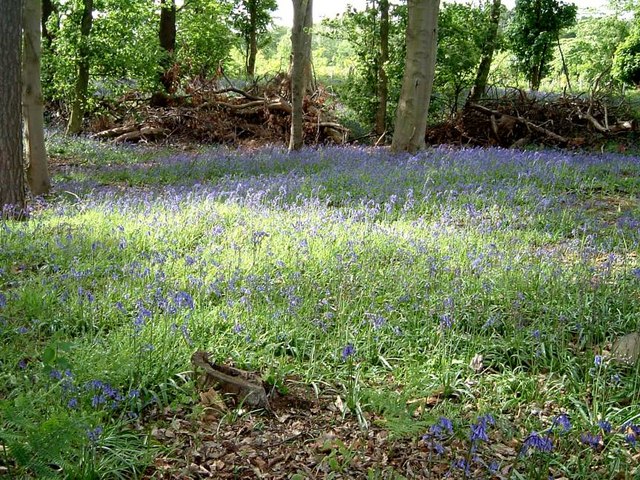
Flitwick Wood is a stunning woodland located in the county of Bedfordshire, England. Covering an area of approximately 160 acres, it is a designated Site of Special Scientific Interest (SSSI) and a popular destination for nature lovers and outdoor enthusiasts.

The woodland is predominantly composed of broadleaf trees, including oak, ash, and beech, which provide a diverse and vibrant habitat for a wide range of flora and fauna. Bluebells carpet the forest floor in spring, creating a mesmerizing display of color. The wood is also home to a variety of bird species, such as woodpeckers, thrushes, and owls, making it a haven for birdwatchers.

Flitwick Wood offers a network of well-maintained footpaths and trails, allowing visitors to explore its natural beauty. The paths wind through ancient woodlands, revealing picturesque vistas and secluded spots ideal for picnics or quiet contemplation. The wood is also intersected by the Flit River, adding to its charm and providing opportunities for riverside walks.

The wood is managed by the Bedfordshire, Cambridgeshire, and Northamptonshire Wildlife Trust, which works to protect and enhance its biodiversity. The trust organizes regular events and guided walks, providing visitors with the chance to learn about the wood's history, wildlife, and conservation efforts.

Overall, Flitwick Wood is a captivating destination for those seeking tranquility and a connection with nature. Its rich biodiversity, scenic landscapes, and well-preserved trails make it an excellent location for leisurely walks, photography, and wildlife spotting.

If you have any feedback on the listing, please let us know in the comments section below.

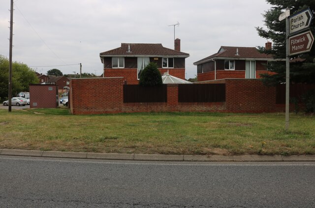
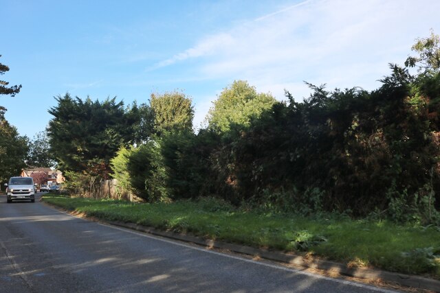
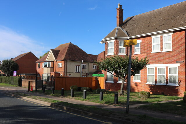
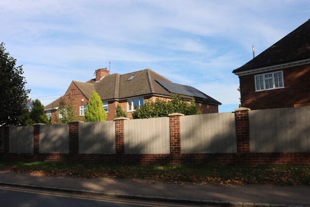
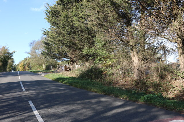
Flitwick Wood Images

Images are sourced within 2km of 52.000869/-0.511346 or Grid Reference TL0234. Thanks to Geograph Open Source API. All images are credited.

Houses by Dunstable Road, Flitwick
Houses on Dunstable Road, Flitwick
Houses on Ampthill Road, Flitwick
Footbridge crossing M1 southbound
Dunstable Road, Flitwick
Steppingley Road, Flitwick Flitwick Day Nursery is on the left.
Steppingley Road, Flitwick
Flitwick Day Nursery is on the left.
Houses on Dunstable Road, Flitwick The fence panels have just been added, replacing railings.
Houses on Dunstable Road, Flitwick
The fence panels have just been added, replacing railings.
Fordfield Road, Flitwick
Platform 1, Flitwick Railway Station Standing at the Northern end of Platform 1 with a train passing Platform 2 heading North towards Bedford.
Platform 1, Flitwick Railway Station
Standing at the Northern end of Platform 1 with a train passing Platform 2 heading North towards Bedford.
Pumping Station, Steppingley ... and a white van. Not one of the fine Victorian Gothic pumping stations - more Brutalist really ! The track continuing on past the pumping station is part of the John Bunyan Trail.
Pumping Station, Steppingley
... and a white van. Not one of the fine Victorian Gothic pumping stations - more Brutalist really ! The track continuing on past the pumping station is part of the John Bunyan Trail.
The French Horn, Steppingley Now Steppingley's only pub, as the other one is now an Indian restaurant called "Saffron"
The French Horn, Steppingley
Now Steppingley's only pub, as the other one is now an Indian restaurant called "Saffron"
Near Flitwick Plantation On the road between Steppingley and Eversholt. The North-Eastern border of Flitwick Plantation is just ahead to the left of the road while a bluebell wood (<a href="https://www.geograph.org.uk/photo/173716">TL0034 : Bluebells in Rod Wood</a>) on the right near Warren Farm stops a little further on.
Near Flitwick Plantation
On the road between Steppingley and Eversholt. The North-Eastern border of Flitwick Plantation is just ahead to the left of the road while a bluebell wood (TL0034 : Bluebells in Rod Wood) on the right near Warren Farm stops a little further on.
Peakes End, Steppingley Peakes End (no sign of an apostrophe) is a little back lane in Steppingley. It leads to Park Farm which is in the adjacent southern square ([TL0134])
Peakes End, Steppingley
Peakes End (no sign of an apostrophe) is a little back lane in Steppingley. It leads to Park Farm which is in the adjacent southern square ([TL0134])
Bluebells in Rod Wood I think (from looking at the map) that this wood is called Rod Wood. It is on the opposite side of the road to Flitwick Plantation (see <a href="https://www.geograph.org.uk/photo/171920">TL0034 : Near Flitwick Plantation</a>) and is near to Warren Farm.
Bluebells in Rod Wood
I think (from looking at the map) that this wood is called Rod Wood. It is on the opposite side of the road to Flitwick Plantation (see TL0034 : Near Flitwick Plantation) and is near to Warren Farm.
Steppingley Hospital This little hospital and nursing home is on the crossroads of Froghall Road and Steppingley Road. It is quite an unusual location for a hospital being a considerable distance from any large town, and has a look of the old Cottage Hospitals about it.
Steppingley Hospital
This little hospital and nursing home is on the crossroads of Froghall Road and Steppingley Road. It is quite an unusual location for a hospital being a considerable distance from any large town, and has a look of the old Cottage Hospitals about it.
Froghall Road Bridge Bridge No.154 carrying the railway over Froghall Road at Froghall near Flitwick.
Froghall Road Bridge
Bridge No.154 carrying the railway over Froghall Road at Froghall near Flitwick.
Priestley Plantation A view into the woods of Priestley Plantation which is on the southern side of a lane to the west of Flitwick. Flitwick Plantation is on the northern side of the lane.
Priestley Plantation
A view into the woods of Priestley Plantation which is on the southern side of a lane to the west of Flitwick. Flitwick Plantation is on the northern side of the lane.
Lanes, paths and bridleways junction The road changes gauge at this point, while a footpath and a bridleway strike off to the west and northwest and an unclassified track also diverges northeastwards. Considering all that, it's actually not very interesting !
Lanes, paths and bridleways junction
The road changes gauge at this point, while a footpath and a bridleway strike off to the west and northwest and an unclassified track also diverges northeastwards. Considering all that, it's actually not very interesting !
Show me another place!

Flitwick Wood is located at Grid Ref: TL0234 (Lat: 52.000869, Lng: -0.511346)

Unitary Authority: Central Bedfordshire

Police Authority: Bedfordshire

What 3 Words

///deaf.goes.remainder. Near Flitwick, Bedfordshire

Related Wikis

Flitwick Wood

Flitwick Wood is a 14.2 hectares (35 acres) Local Nature Reserve in Flitwick in Bedfordshire. It is owned and managed by Central Bedfordshire Council.The...

Flitwick Castle

Flitwick Castle was an 11th-century castle located in the town of Flitwick, in the county of Bedfordshire, England. It was a small, timber Motte-and-bailey...

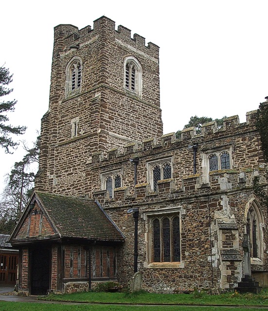
Church of St Peter & St Paul, Flitwick

The Church of St Peter & St Paul is the Church of England parish church in Flitwick, Bedfordshire, England. It became a Grade I listed building on 23 January...

Flitwick Manor

Flitwick Manor is a Georgian country house in the south of Flitwick, Bedfordshire, England. It is located on Church Road off the A5120 road. Now operating...

Nearby Amenities

Located within 500m of 52.000869,-0.511346
Post Box
Brand: Royal Mail
Brand Wikidata: Q638098
Brand Wikipedia: en:Royal Mail
Collection Times: Mo-Fr 16:30; Sa 10:45
Operator: Royal Mail
Operator Wikidata: Q638098
Post Box Type: lamp
Ref: MK45 65
Royal Cypher: EIIR
Royal Cypher Wikidata: Q33102113
Source: survey
Survey Date: 2016-12-23
Lat/Long: 51.9972417/-0.5075404
Bus Stop
Bus: yes
Public Transport: platform
Lat/Long: 52.0012679/-0.5068103
Turning Circle
Turning Circle: square
Lat/Long: 51.9976494/-0.5074361
Turning Circle
Turning Circle: square
Lat/Long: 51.9978741/-0.506735
Ele: 119.000000
Lat/Long: 52.0023668/-0.5062931
Turning Circle
Turning Circle: y-head
Lat/Long: 52.0029272/-0.5074727
Turning Circle
Turning Circle: knuckle
Lat/Long: 52.0016325/-0.5082768
Turning Circle
Turning Circle: square
Lat/Long: 52.0016116/-0.5074358
Turning Circle
Turning Circle: y-head
Lat/Long: 52.0010436/-0.5084712
Turning Circle
Turning Circle: knuckle
Lat/Long: 52.0000828/-0.5074476
Turning Circle
Turning Circle: knuckle
Lat/Long: 51.9983621/-0.5095145
Turning Circle
Turning Circle: knuckle
Lat/Long: 51.9991778/-0.5049841
Barrier: cattle_grid
Lat/Long: 51.9986687/-0.5138342
Barrier: cattle_grid
Lat/Long: 51.9966263/-0.5118904
Barrier: kissing_gate
Lat/Long: 51.9986973/-0.5100446
Barrier: kissing_gate
Lat/Long: 52.0022739/-0.5085869
Barrier: kissing_gate
Source: survey
Lat/Long: 52.0045372/-0.5084232
Bench
Source: survey
Lat/Long: 52.0029396/-0.5086786
Barrier: kissing_gate
Source: survey
Lat/Long: 52.0039378/-0.5121128
Barrier: kissing_gate
Source: survey
Lat/Long: 52.0032737/-0.513654
Turning Circle
Turning Circle: knuckle
Lat/Long: 52.0008511/-0.5049968
Noexit: yes
Lat/Long: 52.0014769/-0.5062963
Turning Circle
Turning Circle: knuckle
Lat/Long: 52.0012778/-0.5050349
Turning Circle
Turning Circle: knuckle
Lat/Long: 51.9995234/-0.5044318
Power: pole
Lat/Long: 51.9983245/-0.5101481
Power: pole
Lat/Long: 51.9976392/-0.5110171
Power: pole
Lat/Long: 51.9971025/-0.5118164
Power: pole
Lat/Long: 51.9969059/-0.5124575
Power: pole
Lat/Long: 51.9978852/-0.5138871
Power: pole
Lat/Long: 51.9985062/-0.5148742
Power: pole
Lat/Long: 51.9989619/-0.5163547
Power: pole
Lat/Long: 51.9995597/-0.5181465
Bench
Lat/Long: 52.0026206/-0.5099857
Turning Circle
Turning Circle: knuckle
Lat/Long: 52.0023107/-0.5056133
Turning Circle
Turning Circle: knuckle
Lat/Long: 52.0000084/-0.5047235
Turning Circle
Turning Circle: knuckle
Lat/Long: 52.0033723/-0.5071073
Direction: 145
Generator Method: photovoltaic
Generator Output Electricity: yes
Generator Solar Modules: 16
Generator Source: solar
Generator Type: solar_photovoltaic_panel
Location: roof
Power: generator
Lat/Long: 51.997126/-0.5081119
Direction: 235
Generator Method: photovoltaic
Generator Output Electricity: yes
Generator Solar Modules: 16
Generator Source: solar
Generator Type: solar_photovoltaic_panel
Location: roof
Power: generator
Lat/Long: 51.9968918/-0.5087387
Direction: 235
Generator Method: photovoltaic
Generator Output Electricity: yes
Generator Solar Modules: 16
Generator Source: solar
Generator Type: solar_photovoltaic_panel
Location: roof
Power: generator
Lat/Long: 51.9969494/-0.5089377
Turning Circle
Turning Circle: knuckle
Lat/Long: 51.9976217/-0.5089536
Direction: 235
Generator Method: photovoltaic
Generator Output Electricity: yes
Generator Solar Modules: 14
Generator Source: solar
Generator Type: solar_photovoltaic_panel
Location: roof
Power: generator
Lat/Long: 51.9975333/-0.5093221
Direction: 145
Generator Method: photovoltaic
Generator Output Electricity: yes
Generator Solar Modules: 16
Generator Source: solar
Generator Type: solar_photovoltaic_panel
Location: roof
Power: generator
Lat/Long: 51.9976879/-0.5093803
Fixme: thermal panels?
Lat/Long: 51.9976415/-0.5094903
Direction: 210
Generator Method: photovoltaic
Generator Output Electricity: yes
Generator Solar Modules: 15
Generator Source: solar
Generator Type: solar_photovoltaic_panel
Location: roof
Power: generator
Lat/Long: 51.9980973/-0.5078714
Turning Circle
Turning Circle: knuckle
Lat/Long: 51.9988686/-0.5090958
Direction: 225
Generator Method: photovoltaic
Generator Output Electricity: yes
Generator Solar Modules: 16
Generator Source: solar
Generator Type: solar_photovoltaic_panel
Location: roof
Power: generator
Lat/Long: 51.9988075/-0.5095472
Direction: 130
Generator Method: photovoltaic
Generator Output Electricity: yes
Generator Solar Modules: 16
Generator Source: solar
Generator Type: solar_photovoltaic_panel
Location: roof
Power: generator
Lat/Long: 51.9988906/-0.5088161
Direction: 225
Generator Method: photovoltaic
Generator Output Electricity: yes
Generator Solar Modules: 16
Generator Source: solar
Generator Type: solar_photovoltaic_panel
Location: roof
Power: generator
Lat/Long: 51.9996527/-0.5076459
Turning Circle
Turning Circle: knuckle
Lat/Long: 51.9997357/-0.5083272
Bus Stop
Bus: yes
Public Transport: platform
Lat/Long: 51.9995321/-0.5069033
Direction: 200
Generator Method: photovoltaic
Generator Output Electricity: yes
Generator Solar Modules: 20
Generator Source: solar
Generator Type: solar_photovoltaic_panel
Location: roof
Power: generator
Lat/Long: 51.9998694/-0.5072572
Direction: 185
Generator Method: photovoltaic
Generator Output Electricity: yes
Generator Solar Modules: 16
Generator Source: solar
Generator Type: solar_photovoltaic_panel
Location: roof
Power: generator
Lat/Long: 52.0002139/-0.5076546
Bus Stop
Bus: yes
Naptan AtcoCode: 021020109
Naptan NaptanCode: ahlagjap
Public Transport: platform
Lat/Long: 52.000305/-0.5067581
Direction: 120
Generator Method: photovoltaic
Generator Output Electricity: yes
Generator Solar Modules: 7
Generator Source: solar
Generator Type: solar_photovoltaic_panel
Location: roof
Power: generator
Lat/Long: 52.0009473/-0.5063755
Direction: 210
Generator Method: photovoltaic
Generator Output Electricity: yes
Generator Solar Modules: 5
Generator Source: solar
Generator Type: solar_photovoltaic_panel
Location: roof
Power: generator
Lat/Long: 52.0009024/-0.5063948
Turning Circle
Turning Circle: knuckle
Lat/Long: 52.0004377/-0.5081963
Direction: 180
Generator Method: photovoltaic
Generator Output Electricity: yes
Generator Solar Modules: 6
Generator Source: solar
Generator Type: solar_photovoltaic_panel
Location: roof
Power: generator
Lat/Long: 52.0011496/-0.5082627
Direction: 90
Generator Method: photovoltaic
Generator Output Electricity: yes
Generator Solar Modules: 3
Generator Source: solar
Generator Type: solar_photovoltaic_panel
Location: roof
Power: generator
Lat/Long: 52.001127/-0.5082334
Direction: 270
Generator Method: photovoltaic
Generator Output Electricity: yes
Generator Solar Modules: 2
Generator Source: solar
Generator Type: solar_photovoltaic_panel
Location: roof
Power: generator
Lat/Long: 52.0011245/-0.508304
Direction: 215
Generator Method: photovoltaic
Generator Output Electricity: yes
Generator Solar Modules: 16
Generator Source: solar
Generator Type: solar_photovoltaic_panel
Location: roof
Power: generator
Lat/Long: 51.9988221/-0.505795
Turning Circle
Turning Circle: knuckle
Lat/Long: 51.9987093/-0.5055819
Turning Circle
Turning Circle: square
Lat/Long: 51.9981388/-0.506189
Turning Circle
Turning Circle: knuckle
Lat/Long: 52.0030825/-0.5063035
Direction: 125
Generator Method: photovoltaic
Generator Output Electricity: yes
Generator Solar Modules: 8
Generator Source: solar
Generator Type: solar_photovoltaic_panel
Location: roof
Power: generator
Lat/Long: 52.0045845/-0.5075045
Direction: 215
Generator Method: photovoltaic
Generator Output Electricity: yes
Generator Solar Modules: 8
Generator Source: solar
Generator Type: solar_photovoltaic_panel
Location: roof
Power: generator
Lat/Long: 52.0000631/-0.5063272
Turning Circle
Turning Circle: knuckle
Lat/Long: 51.9977097/-0.5064864
Direction: 185
Generator Method: photovoltaic
Generator Output Electricity: yes
Generator Solar Modules: 16
Generator Source: solar
Generator Type: solar_photovoltaic_panel
Location: roof
Power: generator
Lat/Long: 52.000224/-0.5077259
The data included in this document is from www.openstreetmap.org. The data is made available under ODbL.

Have you been to Flitwick Wood?

Leave your review of Flitwick Wood below (or comments, questions and feedback).