Ashurst

Settlement in Sussex Horsham

England

Ashurst

Rusty gate hinge
Rusty gate hinge Credit: Ian Cunliffe

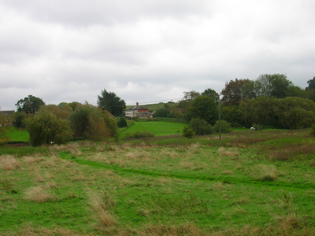
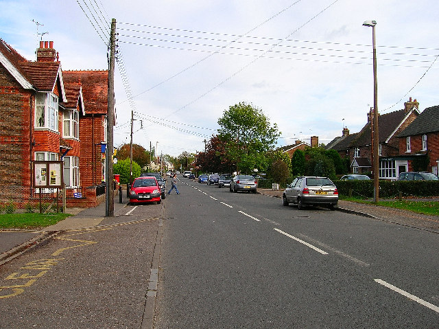
Ashurst is a small village located in the county of Sussex, England. Situated approximately 50 miles south of London, it falls within the administrative district of Horsham. With a population of around 1,100 residents, Ashurst offers a peaceful and picturesque environment surrounded by lush greenery and scenic countryside.

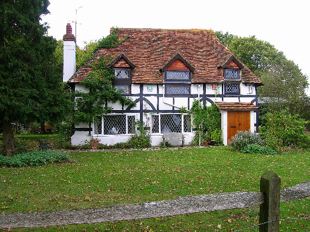
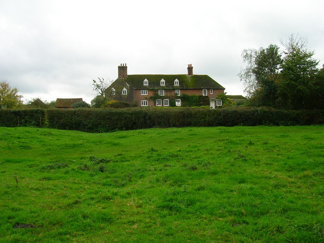
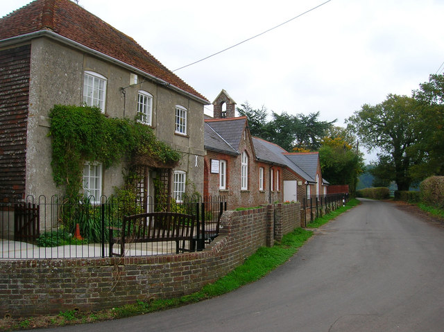
The village is known for its quaint and traditional charm, with a collection of historic buildings that reflect its rich heritage. St. James' Church, dating back to the 12th century, stands as a prominent landmark, showcasing stunning architecture and serving as a reminder of Ashurst's long history.

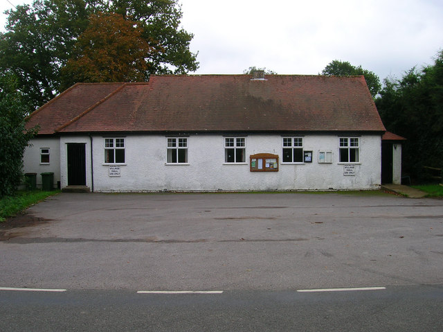
Despite its small size, Ashurst offers a range of amenities to its residents and visitors. These include a village hall, a primary school, and a local pub, providing a sense of community and meeting places for social gatherings. The village also benefits from a local shop, ensuring essential goods are easily accessible.

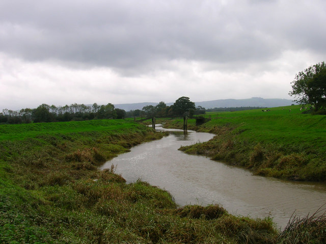
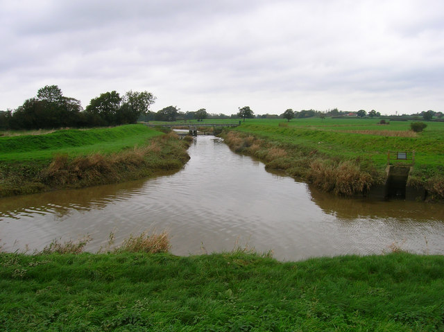
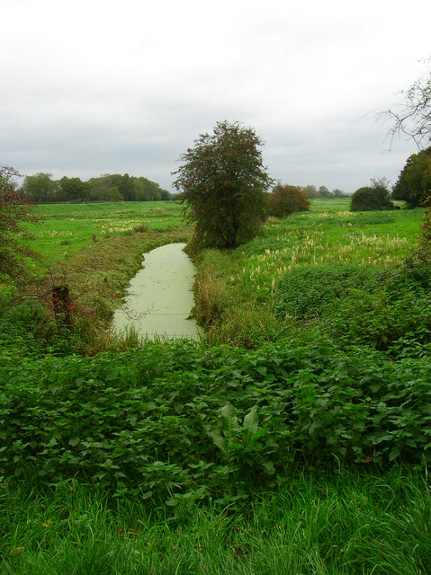
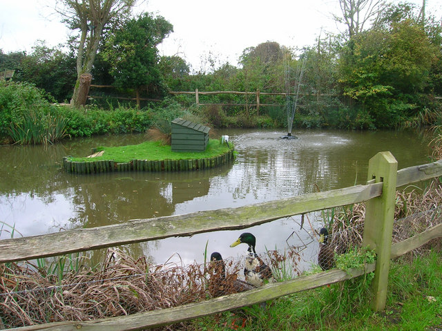
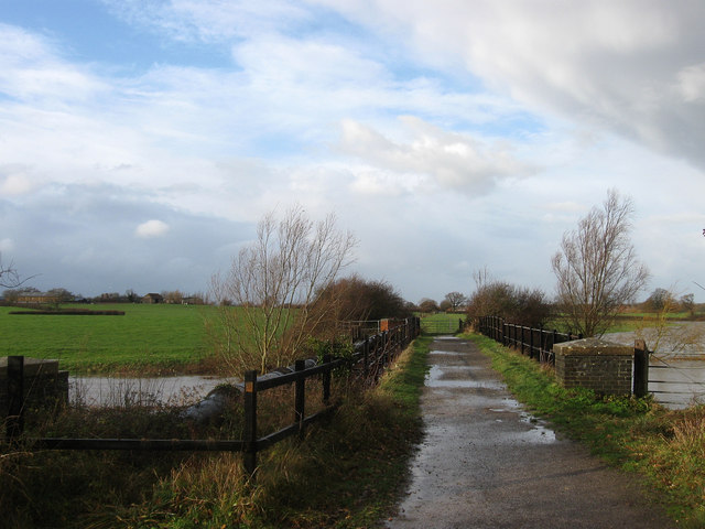
In terms of natural beauty, Ashurst is surrounded by picturesque landscapes, offering ample opportunities for outdoor activities and exploration. The nearby Ashdown Forest, a designated Area of Outstanding Natural Beauty, provides a haven for nature enthusiasts, with its rolling hills, woodlands, and diverse wildlife.

Ashurst's location also offers convenient access to nearby towns and cities. Horsham, a bustling market town, is just a short distance away and provides a wider range of services, shopping facilities, and leisure activities.

In conclusion, Ashurst is a charming and idyllic village in Sussex, offering a peaceful setting, rich history, and access to beautiful natural surroundings.

If you have any feedback on the listing, please let us know in the comments section below.
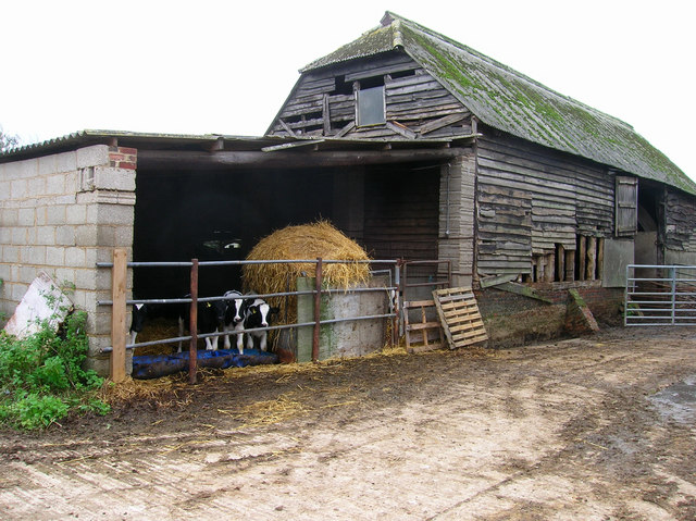
Ashurst Images

Images are sourced within 2km of 50.932262/-0.32283042 or Grid Reference TQ1716. Thanks to Geograph Open Source API. All images are credited.

Rusty gate hinge
Rusty gate hinge
Nutwood House and meadows Towards E of square where footpath crosses fields to reach road.
Nutwood House and meadows
Towards E of square where footpath crosses fields to reach road.
Sweethill Farm and pastures Taken from South looking right across the gridsquare towards the farm.
Sweethill Farm and pastures
Taken from South looking right across the gridsquare towards the farm.
Northover Stables Sheds and stables near Northover farm, close to the middle of this gridsquare.
Northover Stables
Sheds and stables near Northover farm, close to the middle of this gridsquare.
Tractor Jam Nice collection of tractors outside New Wharf farm at Horsebridge Common on the West side of the square.
Tractor Jam
Nice collection of tractors outside New Wharf farm at Horsebridge Common on the West side of the square.
Canons, Hollands Lane, Henfield Looking north.
Canons, Hollands Lane, Henfield
Looking north.
Outbuildings, Honeybridge Farm Known as Starkers Farm on the 1940s map. Taken from the footpath that links Daylands Farm with Kings Barn Farm.
Outbuildings, Honeybridge Farm
Known as Starkers Farm on the 1940s map. Taken from the footpath that links Daylands Farm with Kings Barn Farm.
Small Hill near Furzfield Cottage Taken from Spithandle Lane path. The peak should have had Upper Barn on it but this did not appear to be either there or visible.
Small Hill near Furzfield Cottage
Taken from Spithandle Lane path. The peak should have had Upper Barn on it but this did not appear to be either there or visible.
Eatons Bridge Footbridge over the River Adur with the South Downs on the horizon in the background.
Eatons Bridge
Footbridge over the River Adur with the South Downs on the horizon in the background.
Confluence of the two River Adurs Straight ahead is the western branch whilst the eastern branch heads off to the right.
Confluence of the two River Adurs
Straight ahead is the western branch whilst the eastern branch heads off to the right.
Lashmars Hall 17th century house viewed from the footpath on the eastern side of the River Adur.
Lashmars Hall
17th century house viewed from the footpath on the eastern side of the River Adur.
River Adur Flood Plain Taken from the footpath leading to Grays Farm and looking to the east of Eaton Bridge.
River Adur Flood Plain
Taken from the footpath leading to Grays Farm and looking to the east of Eaton Bridge.
Eatons Farm Taken from the footpath linking Eaton Bridge to Ashurst village. The other farm buildings are behind the farm house
Eatons Farm
Taken from the footpath linking Eaton Bridge to Ashurst village. The other farm buildings are behind the farm house
Ashurst Village Hall On the B2135 near the south west corner of the grid square.
Ashurst Village Hall
On the B2135 near the south west corner of the grid square.
Inquisitive Calves, Yokenclose Farm Noisy too, perhaps it was near feeding time.
Inquisitive Calves, Yokenclose Farm
Noisy too, perhaps it was near feeding time.
Ashurst County Primary School Built on the site of the old workhouse in 1872. The house adjoining the school building is older from the 18th century and may have been part of the workhouse. It was spared demolition for use as the masters house and is now the reception area for the school. The lane itself was once known as Workhouse Lane but was renamed School Lane.
Ashurst County Primary School
Built on the site of the old workhouse in 1872. The house adjoining the school building is older from the 18th century and may have been part of the workhouse. It was spared demolition for use as the masters house and is now the reception area for the school. The lane itself was once known as Workhouse Lane but was renamed School Lane.
The Fountain Inn, Ashurst 18th century inn once known as the Red Lion but has been the Fountain since the 1830s. Hilaire Belloc once enjoyed some good beer here in 1902 and waxed lyrical about it, whilst in 1979 Paul McCartney filmed the video for 'Wonderful Christmastime' inside.
The Fountain Inn, Ashurst
18th century inn once known as the Red Lion but has been the Fountain since the 1830s. Hilaire Belloc once enjoyed some good beer here in 1902 and waxed lyrical about it, whilst in 1979 Paul McCartney filmed the video for 'Wonderful Christmastime' inside.
Pub Ducks, Fountain Inn Small pond to the south of the inn is home to these ducks. Obviously used to being feed as the first thing they did when they viewed me was swim over to the fence and make plenty of noise.
Pub Ducks, Fountain Inn
Small pond to the south of the inn is home to these ducks. Obviously used to being feed as the first thing they did when they viewed me was swim over to the fence and make plenty of noise.
Show me another place!

Ashurst is located at Grid Ref: TQ1716 (Lat: 50.932262, Lng: -0.32283042)

Administrative County: West Sussex

District: Horsham

Police Authority: Sussex

What 3 Words

///patrol.pastels.croutons. Near Ashurst, West Sussex

Nearby Locations

Ashurst Ashurst

Related Wikis

Ashurst, West Sussex

Ashurst is a village and civil parish in the Horsham District of West Sussex, England, about 2 miles (3.2 km) west of Henfield, and 11 miles (18 km) south...

Fountain Inn, Ashurst

The Fountain Inn is a 16th-century public house in the village of Ashurst, in the Horsham district of West Sussex, England. After a period as a farmhouse...

St James's Church, Ashurst

St James's Church is a Church of England parish church in Ashurst, West Sussex. The church is a grade I listed building and it dates from the early 12th...

Bines Green

Bines Green is a hamlet in the Horsham District of West Sussex, England. It lies 1.9 miles (3.1 km) north west of Henfield on the B2135 road between Ashurst...

Betley Bridge

Betley Bridge is a disused railway bridge, now a rail trail bridge, which crosses the confluence of the East and West Adur rivers North of Henfield in...

Henfield railway station

Henfield was a railway station on the Steyning Line which served the village of Henfield. It was equipped with a siding which received coal to serve the...

Partridge Green railway station

Partridge Green was a railway station on the Steyning Line which served the village of Partridge Green. The station closed as a result of the Beeching...

Partridge Green

Partridge Green is a village in the Horsham District of West Sussex, England. It lies on the B2135 road 2.5 miles (4 km) north-west of Henfield. It is...

Nearby Amenities

Located within 500m of 50.932262,-0.32283042
Ashurst
Is In: West Sussex, England, UK
Place: village
Source: npe
Wikidata: Q2658590
Lat/Long: 50.932525/-0.3227667
Horsham Road
Naptan AtcoCode: 4400HR0801
Naptan Bearing: NW
Naptan BusStopType: CUS
Naptan CommonName: Horsham Road
Naptan Indicator: HAR
Naptan Landmark: Hail & Ride
Naptan NaptanCode: wsxdwjwg
Naptan Street: Horsham Road
Naptan Verified: no
Source: naptan_import
Lat/Long: 50.9277679/-0.3230532
Horsham Road
Naptan AtcoCode: 4400HR0802
Naptan Bearing: SE
Naptan BusStopType: CUS
Naptan CommonName: Horsham Road
Naptan Indicator: HAR
Naptan Landmark: Hail & Ride
Naptan NaptanCode: wsxdwjwj
Naptan Street: Horsham Road
Naptan Verified: no
Source: naptan_import
Lat/Long: 50.9278195/-0.3228571
Post Box
Collection Times: Mo-Fr 16:45; Sa 09:00
Operator: Royal Mail
Operator Wikidata: Q638098
Ref: BN44 1565
Lat/Long: 50.9327169/-0.3225681
Barrier: stile
Lat/Long: 50.933216/-0.324949
Barrier: stile
Lat/Long: 50.9327102/-0.3226131
Bus Stop
Bearing: SW
Naptan AtcoCode: 4400HR0366
Naptan NaptanCode: wsxawdwt
Lat/Long: 50.9335216/-0.3215677
Bench
Lat/Long: 50.9316026/-0.325898
Power: pole
Lat/Long: 50.9345865/-0.3169574
Power: pole
Lat/Long: 50.9339097/-0.3192382
Power: pole
Lat/Long: 50.9339428/-0.3216186
Power: pole
Lat/Long: 50.9339725/-0.3241928
Power: pole
Lat/Long: 50.9338137/-0.325145
Power: pole
Lat/Long: 50.9337771/-0.3272348
Power: pole
Lat/Long: 50.9336486/-0.3261262
Power: pole
Lat/Long: 50.9339568/-0.3228448
Power: pole
Lat/Long: 50.93429/-0.3179566
Barrier: stile
Lat/Long: 50.9311271/-0.3292767
Bench
Lat/Long: 50.9309107/-0.3277432
Bench
Lat/Long: 50.9347242/-0.3272427
Bench
Lat/Long: 50.9347428/-0.3273412
The data included in this document is from www.openstreetmap.org. The data is made available under ODbL.

Have you been to Ashurst?

Leave your review of Ashurst below (or comments, questions and feedback).