Gutteridge Wood
Wood, Forest in Hertfordshire Dacorum
England
Gutteridge Wood
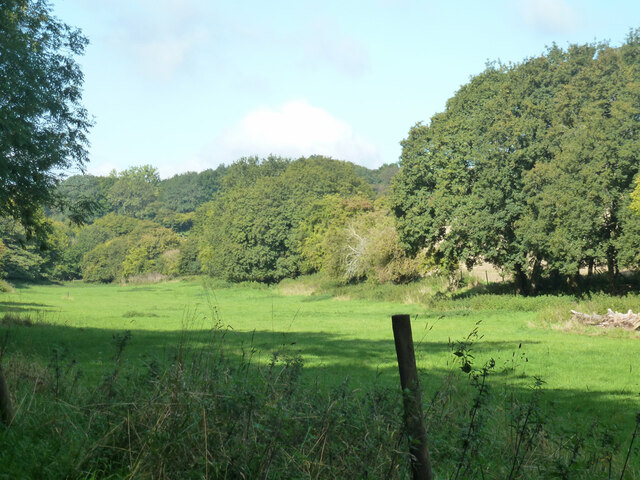
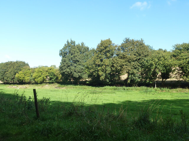
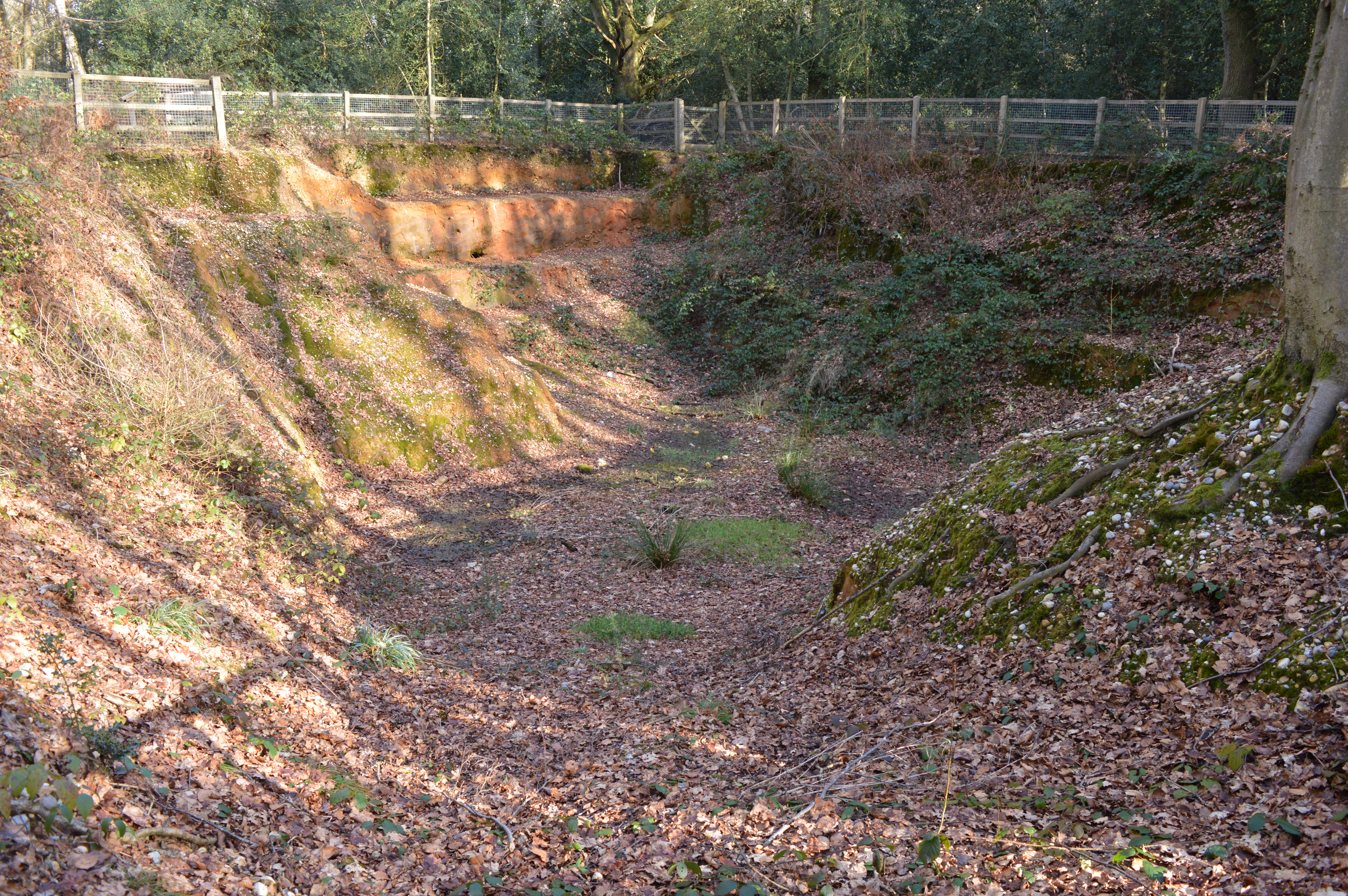
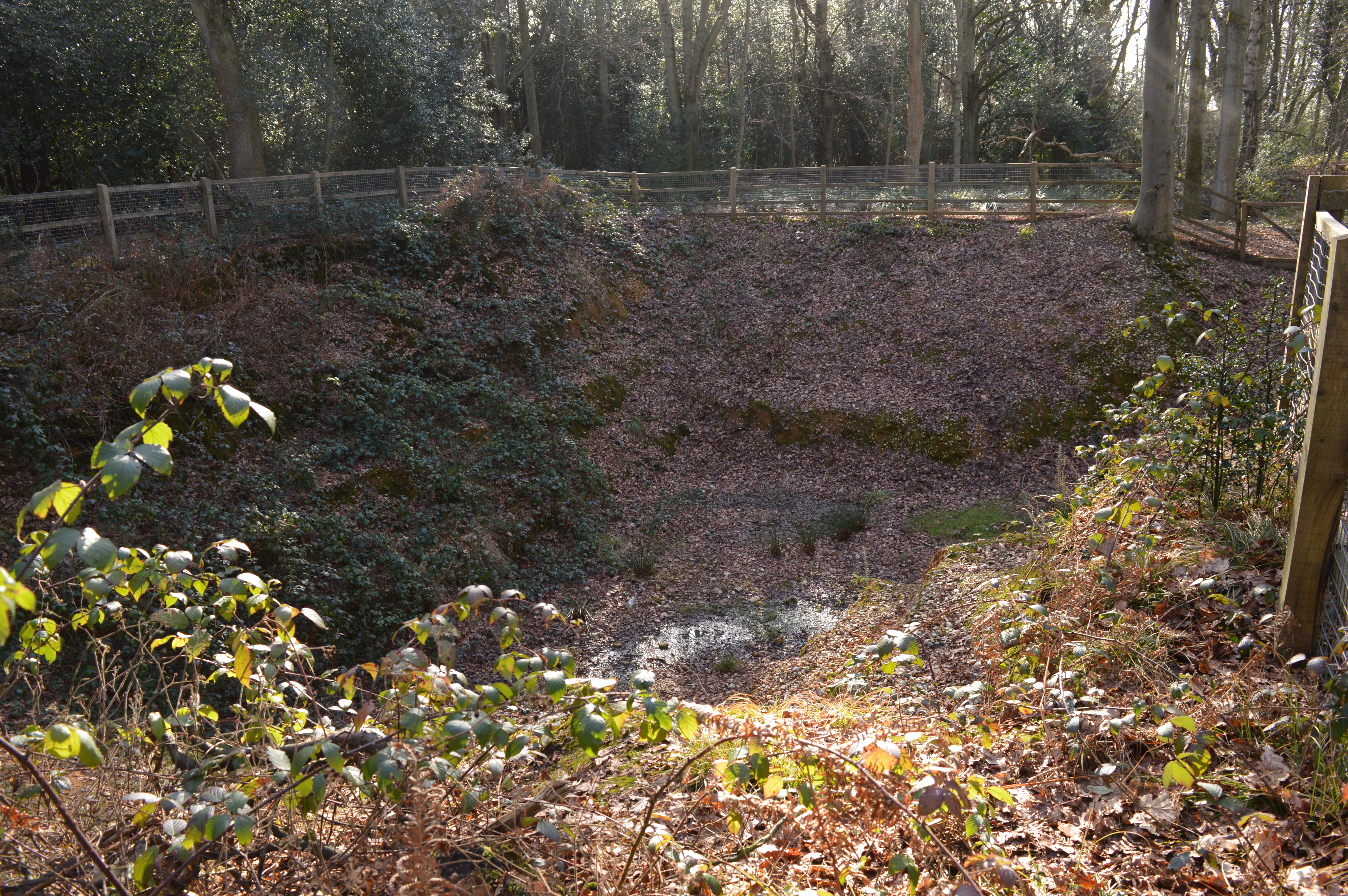
Gutteridge Wood is a beautiful woodland located in Hertfordshire, England. Covering an area of approximately 20 hectares, it is a popular destination for nature enthusiasts and outdoor enthusiasts alike. The wood is managed by the Woodland Trust, a leading conservation charity in the United Kingdom, which ensures its preservation and protection.
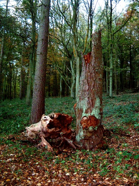
The wood is characterized by a diverse range of flora and fauna, offering a rich and vibrant natural environment. Ancient oak and beech trees dominate the landscape, creating a dense canopy that provides shade and shelter for a variety of wildlife. Bluebells carpet the forest floor in the spring, creating a stunning display of color and fragrance.
The wood is crisscrossed by a network of well-maintained footpaths and trails, allowing visitors to explore and appreciate its natural beauty. Walking through Gutteridge Wood, one may encounter various bird species, including woodpeckers, song thrushes, and tawny owls. Squirrels can be spotted darting between the trees, while foxes and badgers are occasionally seen in the early morning or evening.
In addition to its ecological significance, Gutteridge Wood also holds historical value. It was once part of the ancient Manor of Gutteridge, and remnants of its past can still be found within the wood. The remains of an old moat and fishponds provide a glimpse into the area's rich history.
Overall, Gutteridge Wood is a tranquil and enchanting woodland, offering a haven for wildlife and a place of relaxation and exploration for visitors. Its natural beauty and historical importance make it a cherished asset of Hertfordshire's countryside.
If you have any feedback on the listing, please let us know in the comments section below.
Gutteridge Wood Images
Images are sourced within 2km of 51.763313/-0.53586565 or Grid Reference TL0108. Thanks to Geograph Open Source API. All images are credited.


Gutteridge Wood is located at Grid Ref: TL0108 (Lat: 51.763313, Lng: -0.53586565)
Administrative County: Hertfordshire
District: Dacorum
Police Authority: Hertfordshire
What 3 Words
///swan.summer.lease. Near Berkhamsted, Hertfordshire
Nearby Locations
Related Wikis
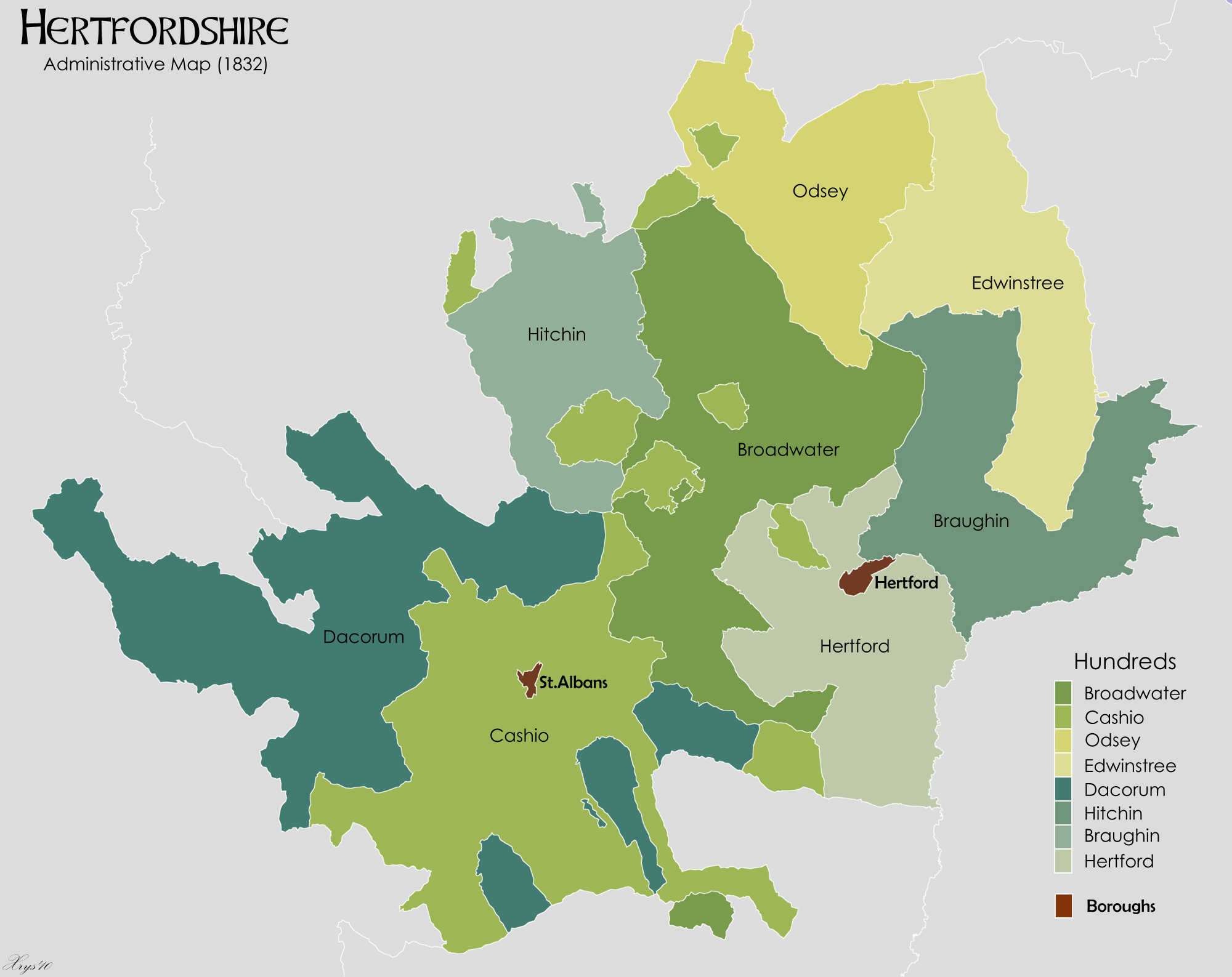
Danais (hundred)
Danais (Latinised as Dacorum) Hundred was a judicial and taxation subdivision (a hundred) of Hertfordshire, in the west of the county, that existed from...

Dacorum
Dacorum is a local government district with borough status in Hertfordshire, England. The council is based in Hemel Hempstead. The borough also includes...
Little Heath, near Hemel Hempstead, Hertfordshire
Little Heath is a partly wooded area with scattered housing, just south of the village of Potten End, Hertfordshire, England. It represents the top of...
Little Heath Pit
Little Heath Pit is a 0.3-hectare (0.74-acre) geological Site of Special Scientific Interest at Little Heath near Potten End in Hertfordshire. It is part...
Nearby Amenities
Located within 500m of 51.763313,-0.53586565Have you been to Gutteridge Wood?
Leave your review of Gutteridge Wood below (or comments, questions and feedback).