Hurlands Copse

Wood, Forest in Surrey Waverley

England

Hurlands Copse

Woodland track going southwards from the Sussex Border Path(2)
Woodland track going southwards from the Sussex Border Path(2) Credit: Shazz

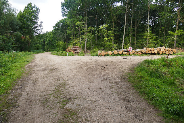
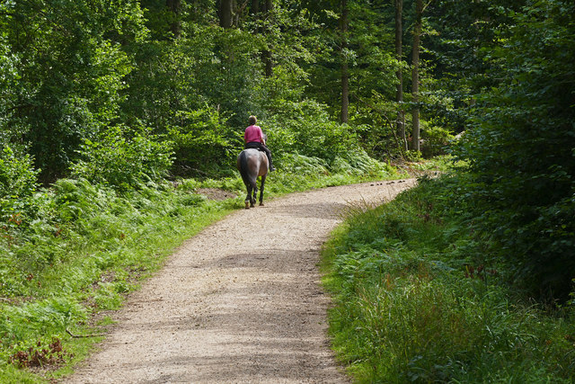
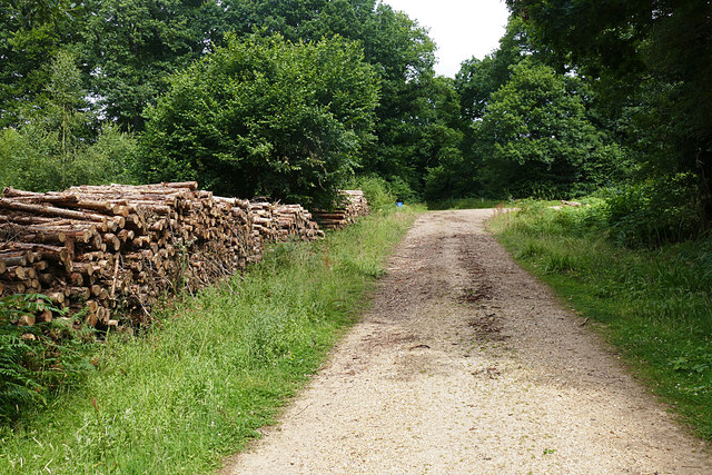
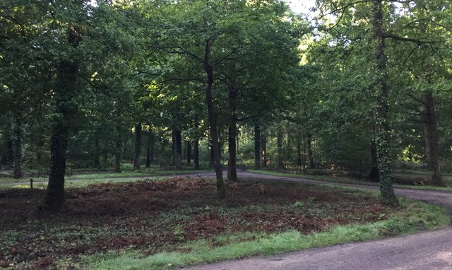
Hurlands Copse is a picturesque woodland located in Surrey, England. Situated on the outskirts of the village of Hurlands, this copse covers an area of approximately 50 acres and is a popular destination for nature enthusiasts and walkers alike.

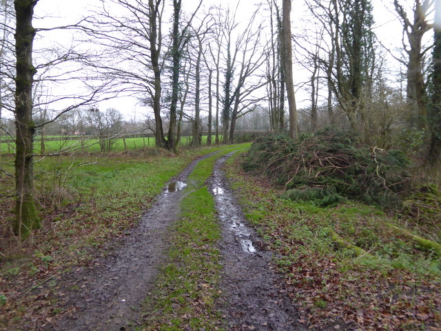
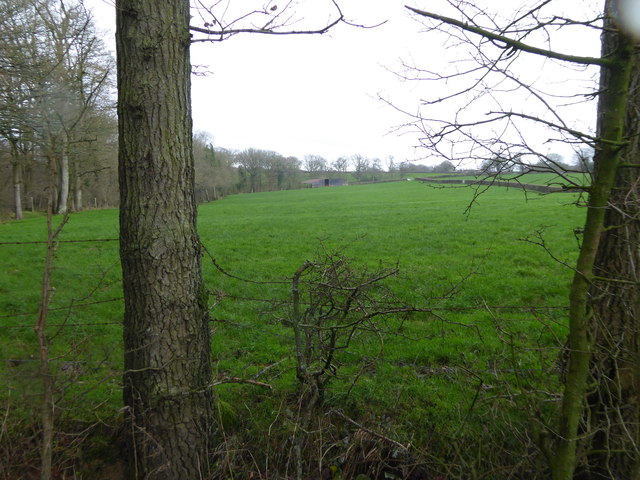
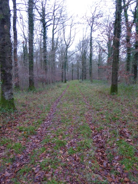
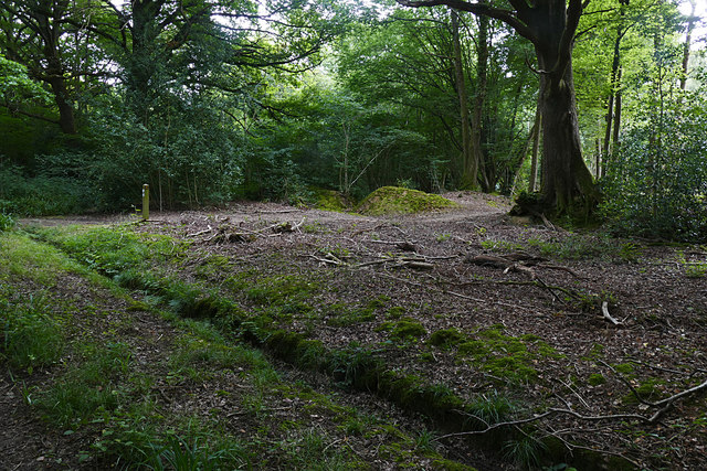
The copse is predominantly composed of native deciduous trees, such as oak, beech, and birch, creating a rich and diverse habitat for a variety of wildlife. The dense canopy of the trees provides ample shade, making it a perfect retreat during the hot summer months.

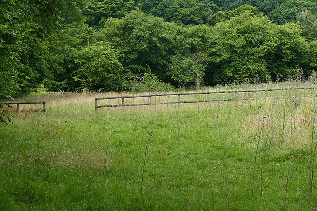
The forest floor is covered in a lush carpet of moss, ferns, and wildflowers, which burst into a riot of colors during the spring and summer seasons. This vibrant display attracts a myriad of butterflies, bees, and other pollinators, creating a lively and buzzing atmosphere.

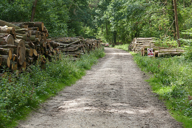
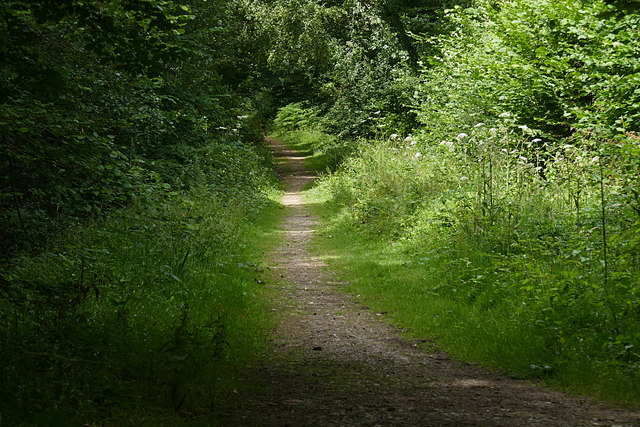
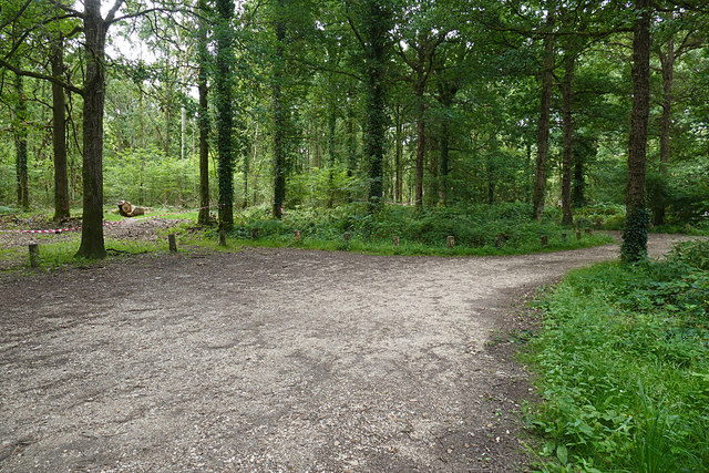
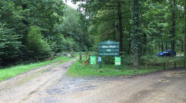
Hurlands Copse is crisscrossed by a network of footpaths and trails, allowing visitors to explore the beauty of this natural haven. Many of these paths wind their way through the ancient trees, offering glimpses of enchanting wildlife, such as deer, squirrels, and a variety of bird species.

A small stream meanders through the copse, providing a peaceful and serene soundtrack to accompany the tranquil surroundings. The babbling water invites visitors to take a moment of reflection and enjoy the soothing sounds of nature.

Overall, Hurlands Copse is a breathtaking woodland retreat that offers a true escape from the hustle and bustle of modern life. With its diverse flora and fauna, scenic trails, and tranquil atmosphere, it is a must-visit destination for nature lovers in Surrey.

If you have any feedback on the listing, please let us know in the comments section below.

Hurlands Copse Images

Images are sourced within 2km of 51.096719/-0.55973139 or Grid Reference TQ0034. Thanks to Geograph Open Source API. All images are credited.

Woodland track going southwards from the Sussex Border Path(2)
View across field to large barn On the left is the western edge of Weald Barkfold Copse.
View across field to large barn
On the left is the western edge of Weald Barkfold Copse.
Woodland track going south from the Sussex Border Path (1)
Howicks, Hurlands Lane, Dunsfold Grade II listed building (incorrectly listed as 'Lowicks') <span class="nowrap"><a title="http://www.heritagegateway.org.uk/Gateway/Results_Single.aspx?uid=1044357&resourceID=5" rel="nofollow ugc noopener" href="http://www.heritagegateway.org.uk/Gateway/Results_Single.aspx?uid=1044357&resourceID=5">Link</a><img style="margin-left:2px;" alt="External link" title="External link - shift click to open in new window" src="https://s1.geograph.org.uk/img/external.png" width="10" height="10"/></span>
Howicks, Hurlands Lane, Dunsfold
Grade II listed building (incorrectly listed as 'Lowicks') LinkExternal link
Wood piles, Sidney Wood A track lined with recently harvested wood in this Forest Enterprise wood near Dunsfold.
Wood piles, Sidney Wood
A track lined with recently harvested wood in this Forest Enterprise wood near Dunsfold.
Overgrown track, Sidney Wood A shaded track through Sidney Wood. The left hand side was clear felled in the 1990s, now it is impenetrable.
Overgrown track, Sidney Wood
A shaded track through Sidney Wood. The left hand side was clear felled in the 1990s, now it is impenetrable.
Old paddock, Sidney Wood One of the paddocks off Sachell Hill, a public right of way near Sidney Wood.
Old paddock, Sidney Wood
One of the paddocks off Sachell Hill, a public right of way near Sidney Wood.
Sidney Wood car park The car park in the Forest Enterprise Sidney Wood.
Sidney Wood car park
The car park in the Forest Enterprise Sidney Wood.
Forest Tracks, Sidney Wood The junction of two of the main forest tracks through Sidney Wood.
Forest Tracks, Sidney Wood
The junction of two of the main forest tracks through Sidney Wood.
Sachellhill Lane The junction of Sachelhill Lane, a footpath running along the east side of Sidney Wood, with the footpath off to the right towards Alfold.
Sachellhill Lane
The junction of Sachelhill Lane, a footpath running along the east side of Sidney Wood, with the footpath off to the right towards Alfold.
Paddocks, Sedgehurst The Paddocks of Sedgehurst, a property enclosed within the Forest Enterprise Sidney Wood.
Paddocks, Sedgehurst
The Paddocks of Sedgehurst, a property enclosed within the Forest Enterprise Sidney Wood.
Horse rider, Sidney Wood A horse rider on one of the main forestry tracks running through Sidney Wood.
Horse rider, Sidney Wood
A horse rider on one of the main forestry tracks running through Sidney Wood.
Sidney Wood, Dunsfold The main north south forestry track through Sidney Wood approaching the junction with the east west track.
Sidney Wood, Dunsfold
The main north south forestry track through Sidney Wood approaching the junction with the east west track.
Hog Wood from the air Woods and fields northwest of Ifold, with many bocage fields close to the wood. Left of centre is Sydney Farm.
Hog Wood from the air
Woods and fields northwest of Ifold, with many bocage fields close to the wood. Left of centre is Sydney Farm.
Sidney Wood Car Park Early morning at the car park.
Sidney Wood Car Park
Early morning at the car park.
Entrance to Sidney Wood Car Park The Forestry Commission Car Park at Sidney Wood.
Entrance to Sidney Wood Car Park
The Forestry Commission Car Park at Sidney Wood.
Wey and Arun Canal Footbridge A wooden footbridge over the disused Wey and Arun Canal close to the fishing lakes.
Wey and Arun Canal Footbridge
A wooden footbridge over the disused Wey and Arun Canal close to the fishing lakes.
High Bridge A property at High Bridge which stands beside the disused Wey and Arun Canal.
High Bridge
A property at High Bridge which stands beside the disused Wey and Arun Canal.
Show me another place!

Hurlands Copse is located at Grid Ref: TQ0034 (Lat: 51.096719, Lng: -0.55973139)

Administrative County: Surrey

District: Waverley

Police Authority: Surrey

What 3 Words

///mandolin.rider.truth. Near Chiddingfold, Surrey

Related Wikis

Fir Tree Copse

Fir Tree Copse is a 6-hectare (15-acre) nature reserve south-east of Dunsfold in Surrey. It is managed by the Surrey Wildlife Trust and is part of the...

Chiddingfold Forest

Chiddingfold Forest is a 542.5-hectare (1,341-acre) biological Site of Special Scientific Interest in Chiddingfold in Surrey and West Sussex. One part...

Dunsfold

Dunsfold is a village in the borough of Waverley, Surrey, England, 8.7 miles (14.0 kilometres) south of Guildford. It lies in the Weald and reaches in...

Top Gear test track

The Top Gear test track is used by the BBC automotive television programme Top Gear. It is located at Dunsfold Aerodrome in Surrey, United Kingdom. The...

Dunsfold Aerodrome

Dunsfold Aerodrome (former ICAO code EGTD) is an unlicensed airfield in Surrey, England, near the village of Cranleigh. It extends across land in the villages...

Alfold

Alfold is a village and civil parish in Surrey, England on the West Sussex border. Alfold is a dispersed or polyfocal village in the Green Belt, which...

Plaistow, West Sussex

Plaistow ( PLAST-oh) is a village and civil parish in the north of the Chichester District of West Sussex, England. There is a village green, a recreation...

Alfold F.C.

Alfold Football Club is a football club based in Alfold, Surrey, England. They are currently members of the Southern Combination Division One and play...

Nearby Amenities

Located within 500m of 51.096719,-0.55973139
Hurland Farm
Landuse: farm
Note Retag: CS #48756035
Source: npe
Lat/Long: 51.101047/-0.5601393
Howicks
Building: yes
Lat/Long: 51.0997602/-0.5619245
Hurst Hill
Building: yes
Wikidata: Q26296405
Lat/Long: 51.0993856/-0.5640045
Barrier: stile
Foot: yes
Lat/Long: 51.0939801/-0.5633287
Barrier: stile
Foot: yes
Lat/Long: 51.097811/-0.5624047
Addr Housename: Old Knightons Cottage
Lat/Long: 51.0957883/-0.552928
Addr Housename: Stable Cottage
Lat/Long: 51.0983518/-0.5534378
Addr Housename: Knightons Lodge
Lat/Long: 51.098461/-0.5555408
The data included in this document is from www.openstreetmap.org. The data is made available under ODbL.

Have you been to Hurlands Copse?

Leave your review of Hurlands Copse below (or comments, questions and feedback).