Ifold Copse

Wood, Forest in Sussex Chichester

England

Ifold Copse

Fields near Hardnip's Copse
Fields near Hardnip's Copse Credit: James Emmans

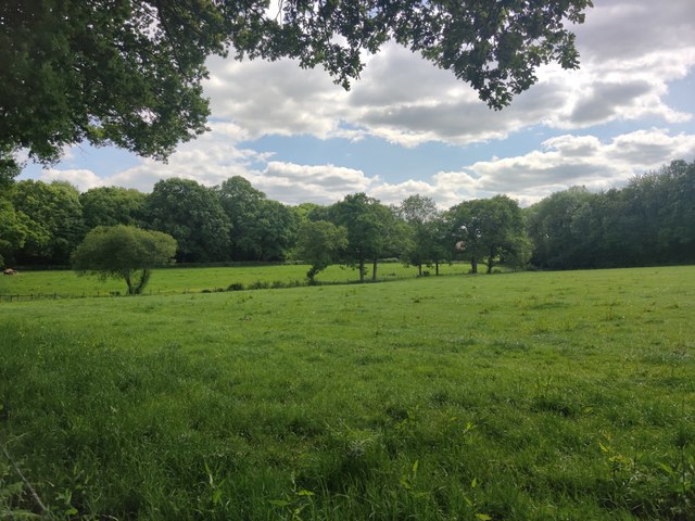
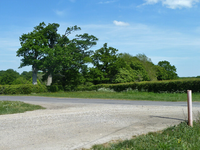
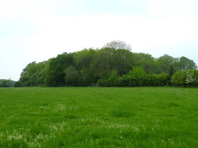
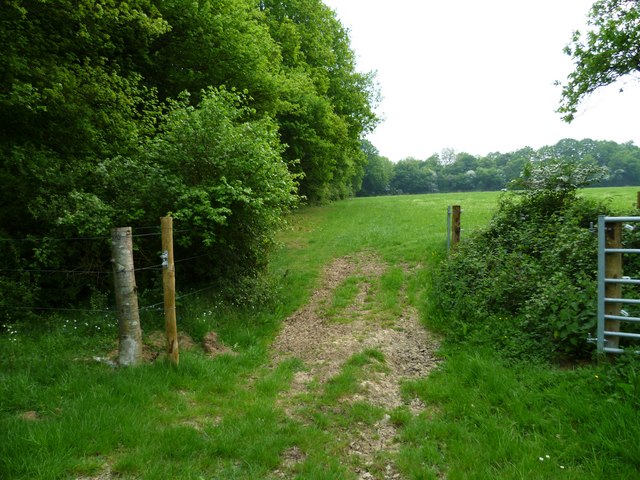
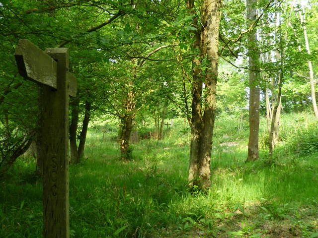
Ifold Copse is a picturesque woodland located in the county of Sussex, England. Covering an area of approximately 100 acres, this enchanting wood is a haven for nature enthusiasts and offers a tranquil escape from the hustle and bustle of everyday life.

The copse is primarily composed of a variety of deciduous trees, including oak, beech, and ash, which create a dense canopy overhead, providing shade and shelter for the diverse range of flora and fauna that call Ifold Copse their home. The woodland floor is covered in a lush carpet of bluebells during the spring, adding a burst of color to the already verdant landscape.

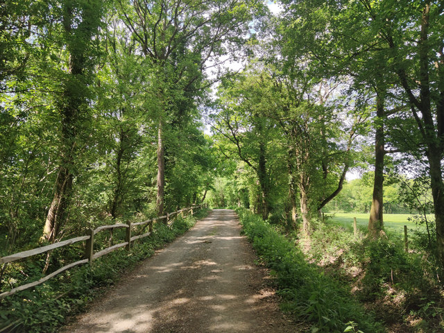
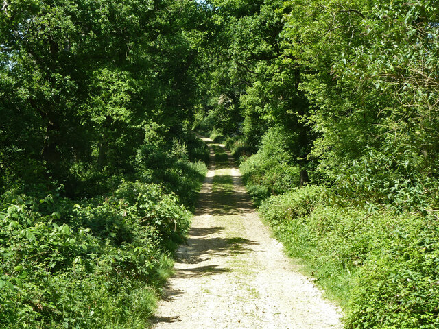
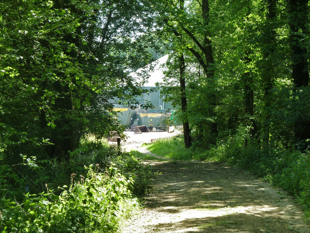
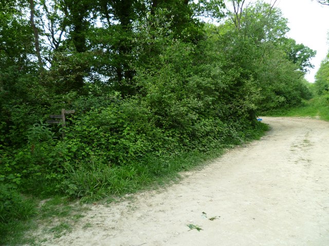
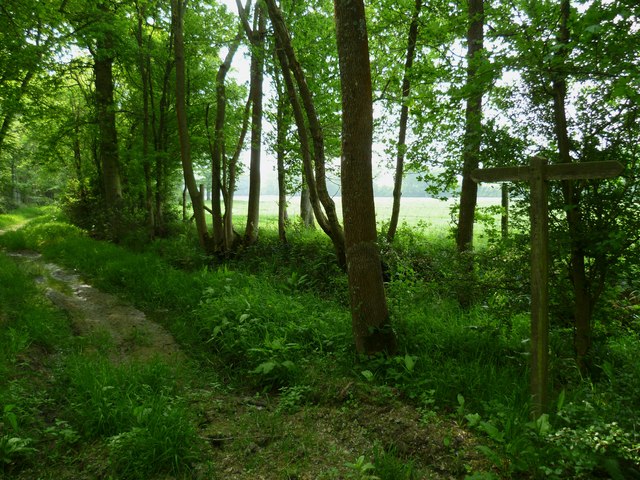
Visitors to Ifold Copse can explore the numerous winding footpaths that crisscross the woodland, providing opportunities for leisurely walks and hikes. The tranquil atmosphere is further enhanced by the soothing sounds of birdsong and the rustling of leaves in the gentle breeze.

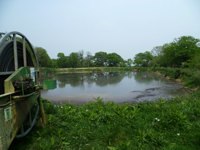
The copse also boasts a small stream that winds its way through the woods, adding to the natural beauty of the surroundings. This stream provides a refreshing spot for wildlife, including small mammals and birds, to drink and bathe.

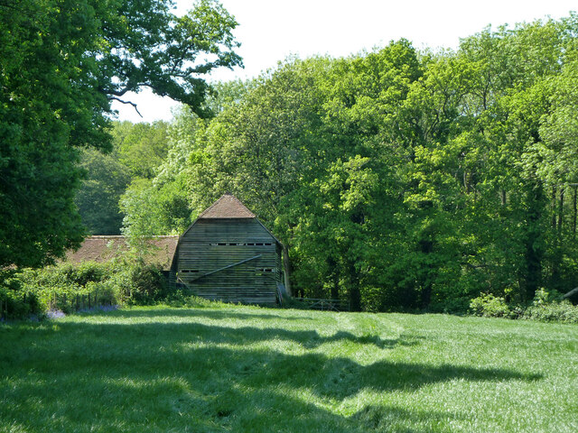
Ifold Copse is a popular destination for nature lovers, with its rich biodiversity and stunning scenery. It offers a peaceful retreat for those seeking solace in nature, as well as ample opportunities for photography, birdwatching, and simply enjoying the serenity of the woodland environment.

If you have any feedback on the listing, please let us know in the comments section below.
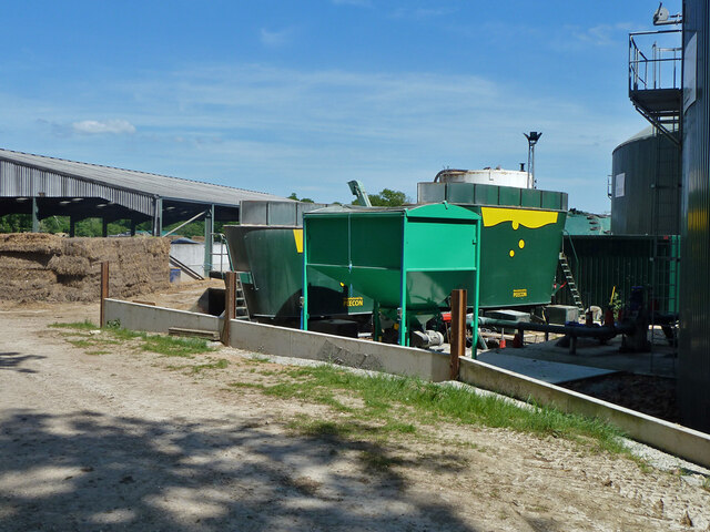
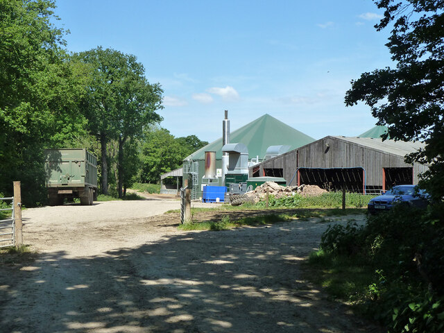
Ifold Copse Images

Images are sourced within 2km of 51.067204/-0.5772463 or Grid Reference SU9930. Thanks to Geograph Open Source API. All images are credited.

Fields near Hardnip's Copse
Bridleway next to Hardnip's Copse
Restricted byway 633 from Mackerel's Common to Plaistow
Hardnip's Barn
Hardnip's Barn
Restricted byway 633 from Plaistow to Mackerel's Common Approaching Crouchland Farm.
Restricted byway 633 from Plaistow to Mackerel's Common
Approaching Crouchland Farm.
Crouchland Farm A large and fairly new installation where no farm was before.
Crouchland Farm
A large and fairly new installation where no farm was before.
Cattle shed, Crouchland Farm The farm is a large and fairly new installation where no farm was before.
Cattle shed, Crouchland Farm
The farm is a large and fairly new installation where no farm was before.
Anaerobic digesters, Crouchland Farm The site was given planning permission to generate electricity fuelled by anaerobic digestion of the farm's waste. These appear to be the digesters for the permitted use. Not long after, and after this view (I think), the plant was extended with another larger digester and much extra feedstock was imported by road from elsewhere. This was beyond the planning permission, and after a few years fighting and frequent serious water pollution episodes the plant closed down and the company went bust.
Anaerobic digesters, Crouchland Farm
The site was given planning permission to generate electricity fuelled by anaerobic digestion of the farm's waste. These appear to be the digesters for the permitted use. Not long after, and after this view (I think), the plant was extended with another larger digester and much extra feedstock was imported by road from elsewhere. This was beyond the planning permission, and after a few years fighting and frequent serious water pollution episodes the plant closed down and the company went bust.
Anaerobic digestion equipment, Crouchland Farm The site was given planning permission to generate electricity fuelled by anaerobic digestion of the farm's waste. Not long after, and after this view (I think), the plant was extended with another larger digester and much extra feedstock was imported by road from elsewhere. This was beyond the planning permission, and after a few years fighting and frequent serious water pollution episodes the plant closed down and the company went bust.
Anaerobic digestion equipment, Crouchland Farm
The site was given planning permission to generate electricity fuelled by anaerobic digestion of the farm's waste. Not long after, and after this view (I think), the plant was extended with another larger digester and much extra feedstock was imported by road from elsewhere. This was beyond the planning permission, and after a few years fighting and frequent serious water pollution episodes the plant closed down and the company went bust.
Crouchland Farm The site was given planning permission to generate electricity fuelled by anaerobic digestion of the farm's waste. Not long after, and after this view (I think), the plant was extended with another larger digester and much extra feedstock was imported by road from elsewhere. This was beyond the planning permission, and after a few years fighting and frequent serious water pollution episodes the plant closed down and the company went bust.
Crouchland Farm
The site was given planning permission to generate electricity fuelled by anaerobic digestion of the farm's waste. Not long after, and after this view (I think), the plant was extended with another larger digester and much extra feedstock was imported by road from elsewhere. This was beyond the planning permission, and after a few years fighting and frequent serious water pollution episodes the plant closed down and the company went bust.
Drive to Crouchland Farm meets Rickman's Lane The drive is a public bridleway.
Drive to Crouchland Farm meets Rickman's Lane
The drive is a public bridleway.
Field and woodland near Plaistow The wood is named as The Mount on Get-a-map.
Field and woodland near Plaistow
The wood is named as The Mount on Get-a-map.
Field and gateway near Plaistow
Farm reservoir near Plaistow This is the same reservoir as in <a title="https://www.geograph.org.uk/photo/2164832" href="https://www.geograph.org.uk/photo/2164832">Link</a> taken five months earlier but the island is not so easy to see as the water level is considerably higher.
Farm reservoir near Plaistow
This is the same reservoir as in Link taken five months earlier but the island is not so easy to see as the water level is considerably higher.
Byway with footpath signpost near Plaistow The byway goes straight ahead through the trees and not round to the left as you might suppose.  The footpath is to the left at the signpost.
Byway with footpath signpost near Plaistow
The byway goes straight ahead through the trees and not round to the left as you might suppose. The footpath is to the left at the signpost.
Byway through trees south of Plaistow The signpost is unmarked but Get-a-map confirms that this route is a byway.
Byway through trees south of Plaistow
The signpost is unmarked but Get-a-map confirms that this route is a byway.
Byway signpost near Plaistow The signpost in the foreground is the same as that shown in 
<a href="https://www.geograph.org.uk/photo/2383846">TQ0028 : Byway through trees south of Plaistow</a>.  Another signpost is visible ahead.
Byway signpost near Plaistow
The signpost in the foreground is the same as that shown in TQ0028 : Byway through trees south of Plaistow. Another signpost is visible ahead.
Large water trough at byway junction south of Plaistow
Show me another place!

Ifold Copse is located at Grid Ref: SU9930 (Lat: 51.067204, Lng: -0.5772463)

Administrative County: West Sussex

District: Chichester

Police Authority: Sussex

What 3 Words

///stutter.scrapped.lovely. Near Chiddingfold, Surrey

Related Wikis

Plaistow, West Sussex

Plaistow ( PLAST-oh) is a village and civil parish in the north of the Chichester District of West Sussex, England. There is a village green, a recreation...

Chiddingfold Forest

Chiddingfold Forest is a 542.5-hectare (1,341-acre) biological Site of Special Scientific Interest in Chiddingfold in Surrey and West Sussex. One part...

Ifold

Ifold is a hamlet in West Sussex and part of the civil Parish of Plaistow, of which it is the largest settlement. Ifold is classified as a hamlet, because...

Shillinglee Lake

Shillinglee Lake is a 17-hectare (42-acre) biological Site of Special Scientific Interest west of Plaistow in West Sussex.The lake has been designated...

The Farm (recording studio)

The Farm (also known as Fisher Lane Farm) was a recording studio in Chiddingfold, Surrey owned by the rock band Genesis. The group bought the property...

Shillinglee

Shillinglee is an 18th-century house and estate in West Sussex, England near the Surrey border, in between the villages of Chiddingfold and Plaistow. It...

Ebernoe Horn Fair

Ebernoe Horn Fair is held in the small Sussex village of Ebernoe, the location of which is about five miles north of Petworth (grid reference SU975280...

St Ronan's School

Saint Ronan's School is an independent co-educational preparatory school for boys and girls from 3 to 13 years located in Hawkhurst in Kent, England. It...

Nearby Amenities

Located within 500m of 51.067204,-0.5772463
Information: guidepost
Source: survey
Tourism: information
Lat/Long: 51.0692034/-0.5714004
Barrier: stile
Lat/Long: 51.0658464/-0.5732479
Barrier: stile
Lat/Long: 51.0667344/-0.5704641
Barrier: stile
Lat/Long: 51.067477/-0.5710286
Barrier: stile
Lat/Long: 51.0675294/-0.5717767
The data included in this document is from www.openstreetmap.org. The data is made available under ODbL.

Have you been to Ifold Copse?

Leave your review of Ifold Copse below (or comments, questions and feedback).