Kingspark Wood

Wood, Forest in Sussex Chichester

England

Kingspark Wood

Fields near Hardnip's Copse
Fields near Hardnip's Copse Credit: James Emmans

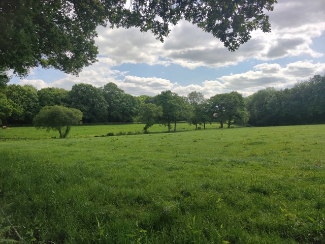
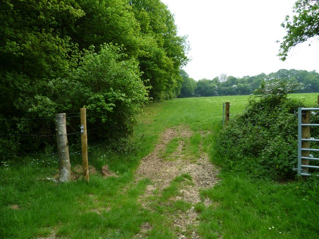
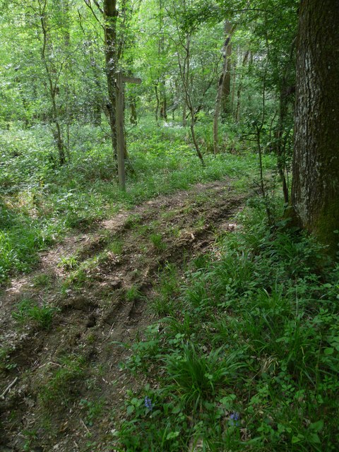
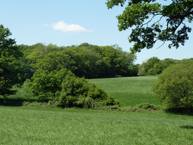
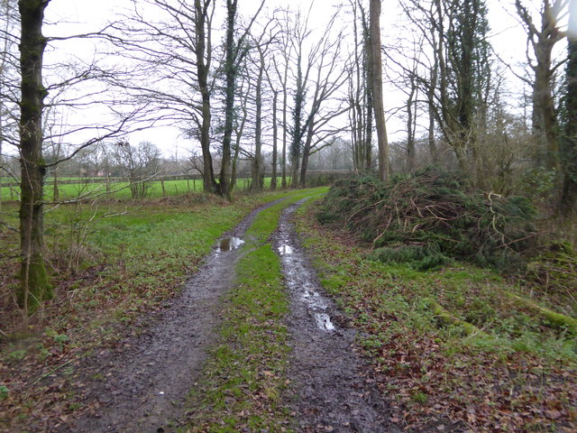
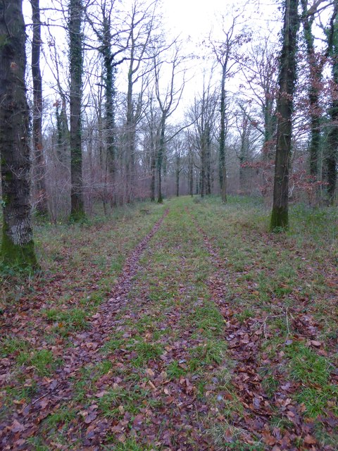
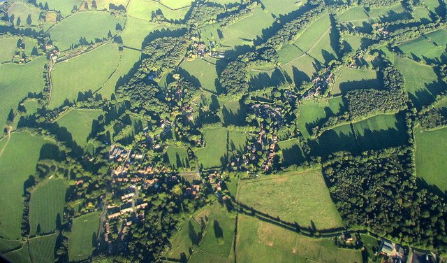
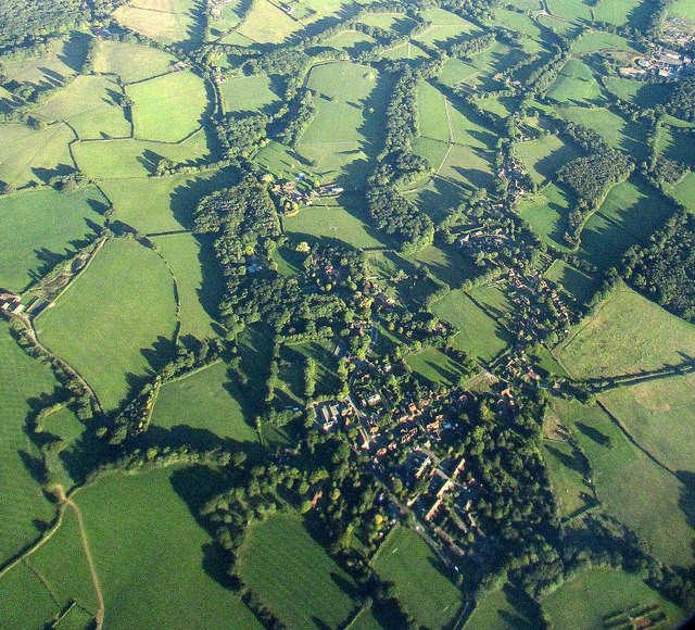
Kingspark Wood, located in Sussex, England, is a stunning woodland area that covers approximately 100 acres. This enchanting forest is known for its natural beauty and diverse range of flora and fauna. It is a popular destination for nature lovers, hikers, and wildlife enthusiasts alike.

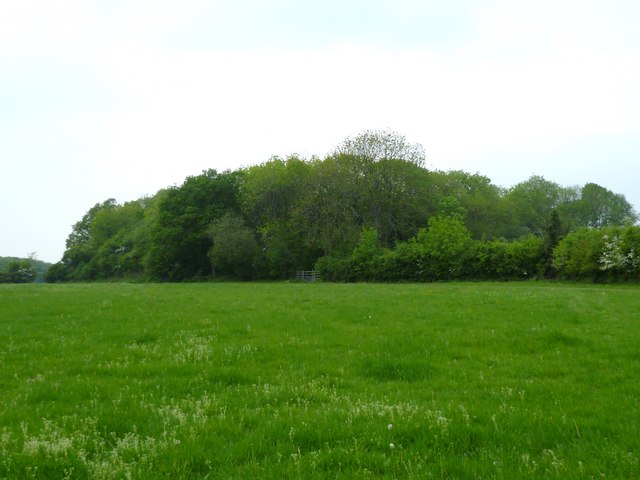
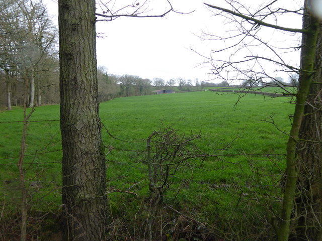
The woodland is mainly composed of mature deciduous trees, including oak, beech, and ash, which create a rich and dense canopy. The forest floor is covered with a vibrant carpet of wildflowers, ferns, and mosses, adding to the overall charm of the area. The diverse ecosystem supports a wide variety of wildlife, including deer, squirrels, and numerous bird species.

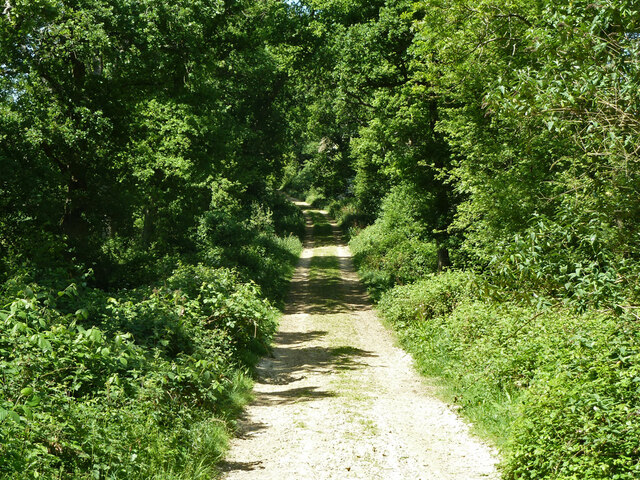
Kingspark Wood offers a network of well-maintained trails and pathways, making it a perfect location for leisurely walks and hikes. Visitors can explore the forest at their own pace, immersing themselves in the tranquil surroundings. The woodland also serves as a fantastic spot for birdwatching, with various species nesting and foraging within its boundaries.

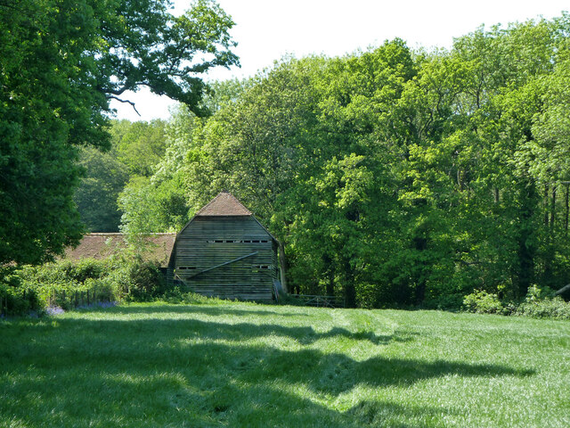
In addition to its natural beauty, Kingspark Wood holds historical significance. It is believed that the woodland has existed for centuries, providing a glimpse into the region's rich past. The forest has been carefully preserved and is managed by local authorities to ensure its protection and sustainability.

Overall, Kingspark Wood is a captivating destination, offering a serene escape from the bustling city life. With its picturesque scenery, diverse wildlife, and historical significance, it is a place that appeals to both nature enthusiasts and those seeking a peaceful retreat.

If you have any feedback on the listing, please let us know in the comments section below.

Kingspark Wood Images

Images are sourced within 2km of 51.069438/-0.58501367 or Grid Reference SU9930. Thanks to Geograph Open Source API. All images are credited.

Fields near Hardnip's Copse
Restricted byway 633 from Mackerel's Common to Plaistow
Hardnip's Barn
Hardnip's Barn
Field and woodland near Plaistow The wood is named as The Mount on Get-a-map.
Field and woodland near Plaistow
The wood is named as The Mount on Get-a-map.
Field and gateway near Plaistow
Farm reservoir near Plaistow This is the same reservoir as in <a title="https://www.geograph.org.uk/photo/2164832" href="https://www.geograph.org.uk/photo/2164832">Link</a> taken five months earlier but the island is not so easy to see as the water level is considerably higher.
Farm reservoir near Plaistow
This is the same reservoir as in Link taken five months earlier but the island is not so easy to see as the water level is considerably higher.
Footpath changes direction in woodland near Plaistow The signpost states the obvious.
Footpath changes direction in woodland near Plaistow
The signpost states the obvious.
Footpath in unnamed wood near Plaistow (2)
Break in unnamed wood near Plaistow The official footpath is in the foreground.
Break in unnamed wood near Plaistow
The official footpath is in the foreground.
Fields near Hardnip's Barn These seem to belong to Crouchlands Farm, which is a dairy farm. There were no cows in the fields, only a field of bullocks, but a lot of cows in the modern, well-equipped barns. It thus appears that the fields are now mostly used for growing grass for silage rather than direct grazing.
Fields near Hardnip's Barn
These seem to belong to Crouchlands Farm, which is a dairy farm. There were no cows in the fields, only a field of bullocks, but a lot of cows in the modern, well-equipped barns. It thus appears that the fields are now mostly used for growing grass for silage rather than direct grazing.
Woodland track going southwards from the Sussex Border Path(2)
View across field to large barn On the left is the western edge of Weald Barkfold Copse.
View across field to large barn
On the left is the western edge of Weald Barkfold Copse.
Woodland track going south from the Sussex Border Path (1)
Piper's cottages
Piper's cottages
Southeast of Plaistow from the air The edge of Plaistow is on the left. On the extreme right is Crouchlands Farm, also shown in <a href="https://www.geograph.org.uk/photo/5151386">TQ0129 : Woodland near Ifold from the air</a>. The U-shaped woodland consists of Rumbold Wood (left) and Limekiln Wood.
Southeast of Plaistow from the air
The edge of Plaistow is on the left. On the extreme right is Crouchlands Farm, also shown in TQ0129 : Woodland near Ifold from the air. The U-shaped woodland consists of Rumbold Wood (left) and Limekiln Wood.
Plaistow from the air Partly also shown in <a href="https://www.geograph.org.uk/photo/5151464">TQ0030 : Southeast of Plaistow from the air</a>; Rumbold Wood and Rumbold's Farm are at lower right, along a byway from the village. See also <a href="https://www.geograph.org.uk/photo/5151473">TQ0030 : Plaistow from the air</a>.
Plaistow from the air
Partly also shown in TQ0030 : Southeast of Plaistow from the air; Rumbold Wood and Rumbold's Farm are at lower right, along a byway from the village. See also TQ0030 : Plaistow from the air.
Plaistow from the air <a href="https://www.geograph.org.uk/photo/5151470">TQ0030 : Plaistow from the air</a> from a different angle, as the aircraft I am on, from Luxembourg, takes a sharp turn towards Gatwick over the village.
Plaistow from the air
TQ0030 : Plaistow from the air from a different angle, as the aircraft I am on, from Luxembourg, takes a sharp turn towards Gatwick over the village.
Nell Ball, Plaistow
Nell Ball, Plaistow
Show me another place!

Kingspark Wood is located at Grid Ref: SU9930 (Lat: 51.069438, Lng: -0.58501367)

Administrative County: West Sussex

District: Chichester

Police Authority: Sussex

What 3 Words

///standing.passenger.blocking. Near Chiddingfold, Surrey

Related Wikis

Plaistow, West Sussex

Plaistow ( PLAST-oh) is a village and civil parish in the north of the Chichester District of West Sussex, England. There is a village green, a recreation...

Chiddingfold Forest

Chiddingfold Forest is a 542.5-hectare (1,341-acre) biological Site of Special Scientific Interest in Chiddingfold in Surrey and West Sussex. One part...
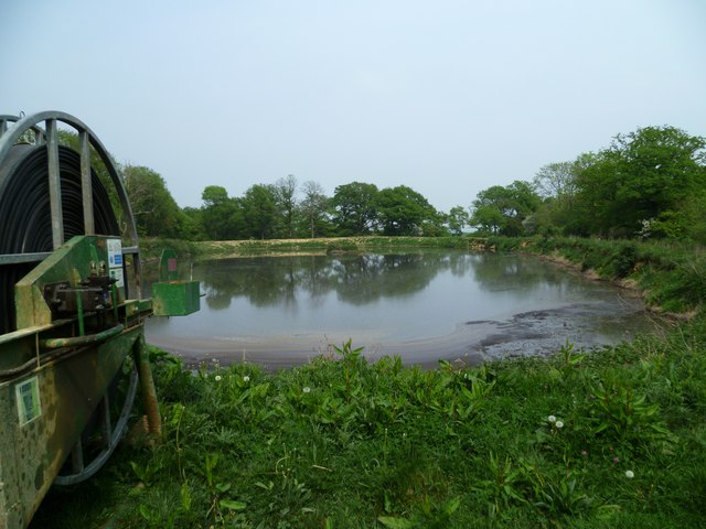
Shillinglee Lake

Shillinglee Lake is a 17-hectare (42-acre) biological Site of Special Scientific Interest west of Plaistow in West Sussex.The lake has been designated...

The Farm (recording studio)

The Farm (also known as Fisher Lane Farm) was a recording studio in Chiddingfold, Surrey owned by the rock band Genesis. The group bought the property...

Shillinglee

Shillinglee is an 18th-century house and estate in West Sussex, England near the Surrey border, in between the villages of Chiddingfold and Plaistow. It...

Ifold

Ifold is a hamlet in West Sussex and part of the civil Parish of Plaistow, of which it is the largest settlement. Ifold is classified as a hamlet, because...

Ebernoe Horn Fair

Ebernoe Horn Fair is held in the small Sussex village of Ebernoe, the location of which is about five miles north of Petworth (grid reference SU975280...

Ebernoe

Ebernoe is a hamlet and civil parish in the District of Chichester in West Sussex, England, and 4 miles (6 km) north of Petworth near the A283 road. The...

Nearby Amenities

Located within 500m of 51.069438,-0.58501367
Kingspark Wood
Natural: wood
Source: npe
Lat/Long: 51.0698679/-0.5862912
The data included in this document is from www.openstreetmap.org. The data is made available under ODbL.

Have you been to Kingspark Wood?

Leave your review of Kingspark Wood below (or comments, questions and feedback).