Woodcock Rew
Wood, Forest in Surrey Waverley
England
Woodcock Rew

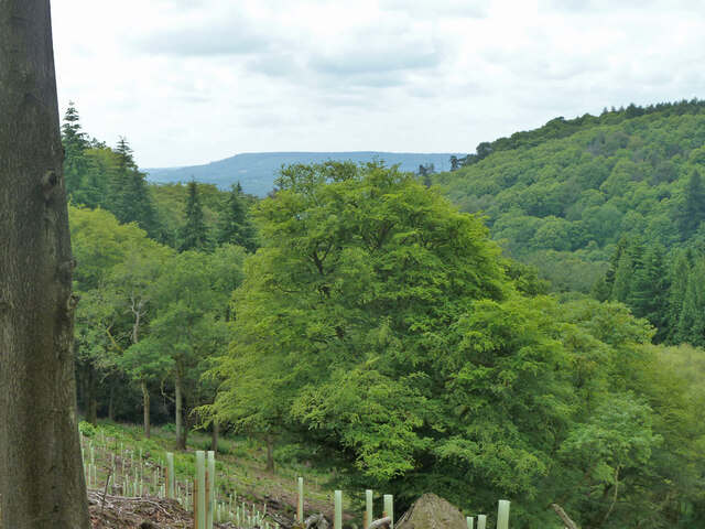
Woodcock Rew is a small village located in the county of Surrey, England. Situated within the larger Forest of Surrey, Woodcock Rew is known for its picturesque woodlands and rural charm. The village is surrounded by dense forests, making it an ideal destination for nature lovers and outdoor enthusiasts.
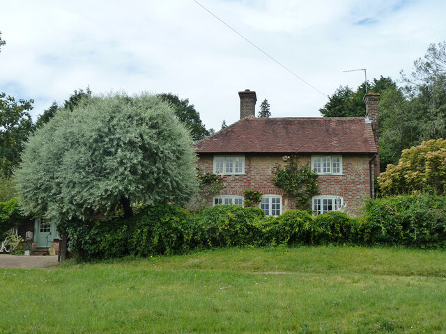
Woodcock Rew is home to a small population of around 200 residents, who enjoy a peaceful and close-knit community. The village is characterized by its quaint cottages and traditional architecture, creating a timeless atmosphere. The surrounding forest provides ample opportunities for activities such as hiking, cycling, and birdwatching.
One of the main attractions in Woodcock Rew is the Woodcock Rew Forest Park, which covers a vast area of woodland. The park offers various walking trails, picnic spots, and wildlife viewing opportunities. Visitors can explore the forest's diverse flora and fauna, including ancient trees and rare plant species.
In addition to its natural beauty, Woodcock Rew also has a rich history. The village dates back centuries and has witnessed various historical events. Some notable landmarks in the area include the historic St. Mary's Church, which showcases stunning architecture and serves as a reminder of the village's heritage.
Woodcock Rew is a hidden gem in Surrey, offering a tranquil escape from the hustle and bustle of city life. With its beautiful woodlands, charming village atmosphere, and rich history, Woodcock Rew attracts both locals and tourists looking to immerse themselves in nature and experience the serenity of country living.
If you have any feedback on the listing, please let us know in the comments section below.
Woodcock Rew Images
Images are sourced within 2km of 51.125352/-0.58703575 or Grid Reference SU9837. Thanks to Geograph Open Source API. All images are credited.


Woodcock Rew is located at Grid Ref: SU9837 (Lat: 51.125352, Lng: -0.58703575)
Administrative County: Surrey
District: Waverley
Police Authority: Surrey
What 3 Words
///torso.jumps.aviators. Near Chiddingfold, Surrey
Related Wikis

Dunsfold
Dunsfold is a village in the borough of Waverley, Surrey, England, 8.7 miles (14.0 kilometres) south of Guildford. It lies in the Weald and reaches in...

Hascombe Hill
Hascombe Hill or Hascombe Camp is the site of an Iron Age multivallate hill fort close to the village of Hascombe in Surrey, England. == History == The...

Hambledon, Surrey
Hambledon is a rural scattered village in the Waverley borough of Surrey, situated south of Guildford. It is dominated by a buffer zone of fields and woodland...

Hydon's Ball
Hydon's Ball is a 179-metre-high (587 ft) hill covering most of Hydon Heath in Hydestile, Surrey, England. == Description == The hill on Hydon Heath, Hydestile...
Nearby Amenities
Located within 500m of 51.125352,-0.58703575Have you been to Woodcock Rew?
Leave your review of Woodcock Rew below (or comments, questions and feedback).