Furzefield Copse

Wood, Forest in Sussex Arun

England

Furzefield Copse

Path in Slindon Woods
Path in Slindon Woods Credit: PAUL FARMER

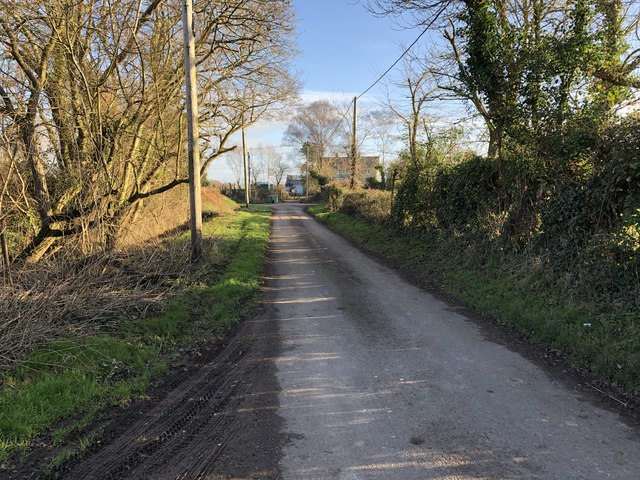
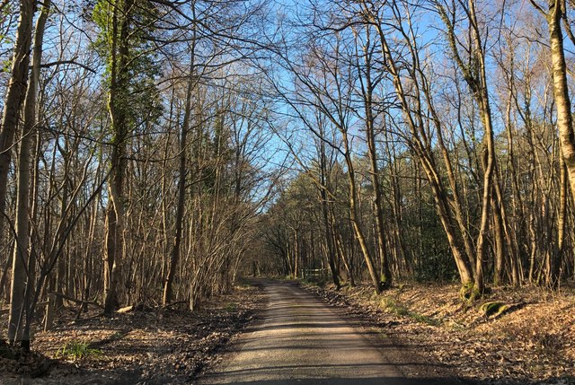
Furzefield Copse is a picturesque woodland located in Sussex, England. Covering an area of approximately 50 hectares, it is known for its natural beauty and diverse ecosystem. The copse is predominantly made up of deciduous trees, including oak, beech, and birch, which create a canopy of lush green foliage during the summer months.

The forest floor of Furzefield Copse is adorned with a rich carpet of wildflowers, including bluebells, primroses, and wood anemones, which bloom in abundance during the springtime. This vibrant display of colors attracts a variety of wildlife, making the copse a haven for nature enthusiasts.

Visitors to Furzefield Copse can enjoy a network of well-maintained walking trails that wind their way through the woodland, allowing for peaceful strolls and opportunities to spot the copse's diverse wildlife. The copse is home to a range of bird species, such as woodpeckers, thrushes, and warblers, which can be heard singing their melodious tunes throughout the day.

In addition to its natural beauty, Furzefield Copse also holds historical significance. It is believed that the copse has been in existence for hundreds of years and has served as a source of timber for local communities throughout history.

Overall, Furzefield Copse offers a tranquil escape from the hustle and bustle of everyday life. Its combination of scenic beauty, diverse flora and fauna, and historical significance make it a must-visit destination for nature lovers and history enthusiasts alike.

If you have any feedback on the listing, please let us know in the comments section below.

Furzefield Copse Images

Images are sourced within 2km of 50.851019/-0.59835173 or Grid Reference SU9806. Thanks to Geograph Open Source API. All images are credited.

Path in Slindon Woods
Track, Rewell Wood Looking from one of the eight-way junctions that are a feature of this geometrically laid out wood.
Track, Rewell Wood
Looking from one of the eight-way junctions that are a feature of this geometrically laid out wood.
Bridleway near Rewell House Heading towards Arundel.
Bridleway near Rewell House
Heading towards Arundel.
Bridleway near Rewell House Heading away from Aundel, and entering the actively managed Rewell Wood.
Bridleway near Rewell House
Heading away from Aundel, and entering the actively managed Rewell Wood.
Path, Rewell Wood Through chestnut coppice.
Path, Rewell Wood
Through chestnut coppice.
Path junction, Rewell Wood The path from left to right is a public bridleway.
Path junction, Rewell Wood
The path from left to right is a public bridleway.
Bridleways. Rewell and Madehurst Woods Rewell Wood is to the right.
Bridleways. Rewell and Madehurst Woods
Rewell Wood is to the right.
Bridleway along ancient earthwork A bank and ditch extends for some considerable distance. Most of it, together with some nearby earthworks, are in an area scheduled as an Ancient Monument. This seems to be because they look likely to be of archaeological interest, although their origin and purpose remain obscure. Surmises range from Romano-British to mediaeval times.
Bridleway along ancient earthwork
A bank and ditch extends for some considerable distance. Most of it, together with some nearby earthworks, are in an area scheduled as an Ancient Monument. This seems to be because they look likely to be of archaeological interest, although their origin and purpose remain obscure. Surmises range from Romano-British to mediaeval times.
Madehurst - Arundel parish boundary The boundary here follows an ancient earthwork, and is further marked with a string of cast-iron plates. These have 'N' on the Arundel side, and 'F' on the Madehurst side. 'N' must be for Norfolk, the Duke of Norfolk has owned most of Arundel for centuries. 'F' probably stands for Fletcher, a Fletcher bought the Madehurst manor in the 1850s. No earlier landowner was an 'F'.
Madehurst - Arundel parish boundary
The boundary here follows an ancient earthwork, and is further marked with a string of cast-iron plates. These have 'N' on the Arundel side, and 'F' on the Madehurst side. 'N' must be for Norfolk, the Duke of Norfolk has owned most of Arundel for centuries. 'F' probably stands for Fletcher, a Fletcher bought the Madehurst manor in the 1850s. No earlier landowner was an 'F'.
The Garden Lodge The Garden Lodge Conference Centre at Avisford Park.
The Garden Lodge
The Garden Lodge Conference Centre at Avisford Park.
Entrance to Walberton Church The Lych Gate Entrance to the Church.
Entrance to Walberton Church
The Lych Gate Entrance to the Church.
Approaching the A27 On Binsted Lane, beside Brickkiln Copse, heading northwards to the A27.
Approaching the A27
On Binsted Lane, beside Brickkiln Copse, heading northwards to the A27.
Old Flint Barn The barn at Binsted Nursery.
Old Flint Barn
The barn at Binsted Nursery.
Binsted Lane On Binsted Lane just south of Binsted Nursery.
Binsted Lane
On Binsted Lane just south of Binsted Nursery.
Approaching Slate Barn Farm On Binsted Lane nearing the farm on the corner of the lane.
Approaching Slate Barn Farm
On Binsted Lane nearing the farm on the corner of the lane.
Binsted Church St Mary’s Church in Binsted.
Binsted Church
St Mary’s Church in Binsted.
Binsted Lane Heading towards Binsted Park.
Binsted Lane
Heading towards Binsted Park.
B2132 turning, A27 The A27 runs 103 miles from Whiteparish near Salisbury to Pevensey near Eastbourne. It runs parallel with the south coast and the South Downs. <span class="nowrap"><a title="http://www.sabre-roads.org.uk/wiki/index.php?title=A27" rel="nofollow ugc noopener" href="http://www.sabre-roads.org.uk/wiki/index.php?title=A27">Link</a><img style="margin-left:2px;" alt="External link" title="External link - shift click to open in new window" src="https://s1.geograph.org.uk/img/external.png" width="10" height="10"/></span>
B2132 turning, A27
The A27 runs 103 miles from Whiteparish near Salisbury to Pevensey near Eastbourne. It runs parallel with the south coast and the South Downs. LinkExternal link
Show me another place!

Furzefield Copse is located at Grid Ref: SU9806 (Lat: 50.851019, Lng: -0.59835173)

Administrative County: West Sussex

District: Arun

Police Authority: Sussex

What 3 Words

///molars.test.neatly. Near Walberton, West Sussex

Related Wikis

A27 road

The A27 is a major road in England. It runs from its junction with the A36 at Whiteparish (near Salisbury) in the county of Wiltshire, follows the south...

Walberton

Walberton is a village and civil parish in the Arun District of West Sussex, England, 5 miles (8 km) north-west of Littlehampton, and south of the A27...

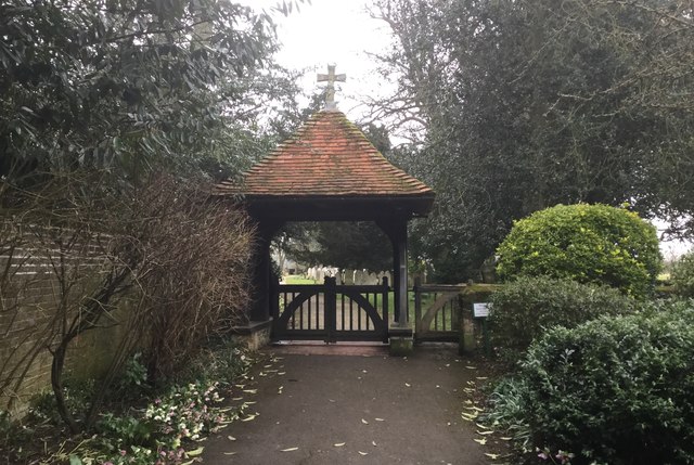
St Mary's Church, Walberton

St Mary's Church is an Anglican church in the village of Walberton in the district of Arun, one of seven local government districts in the English county...

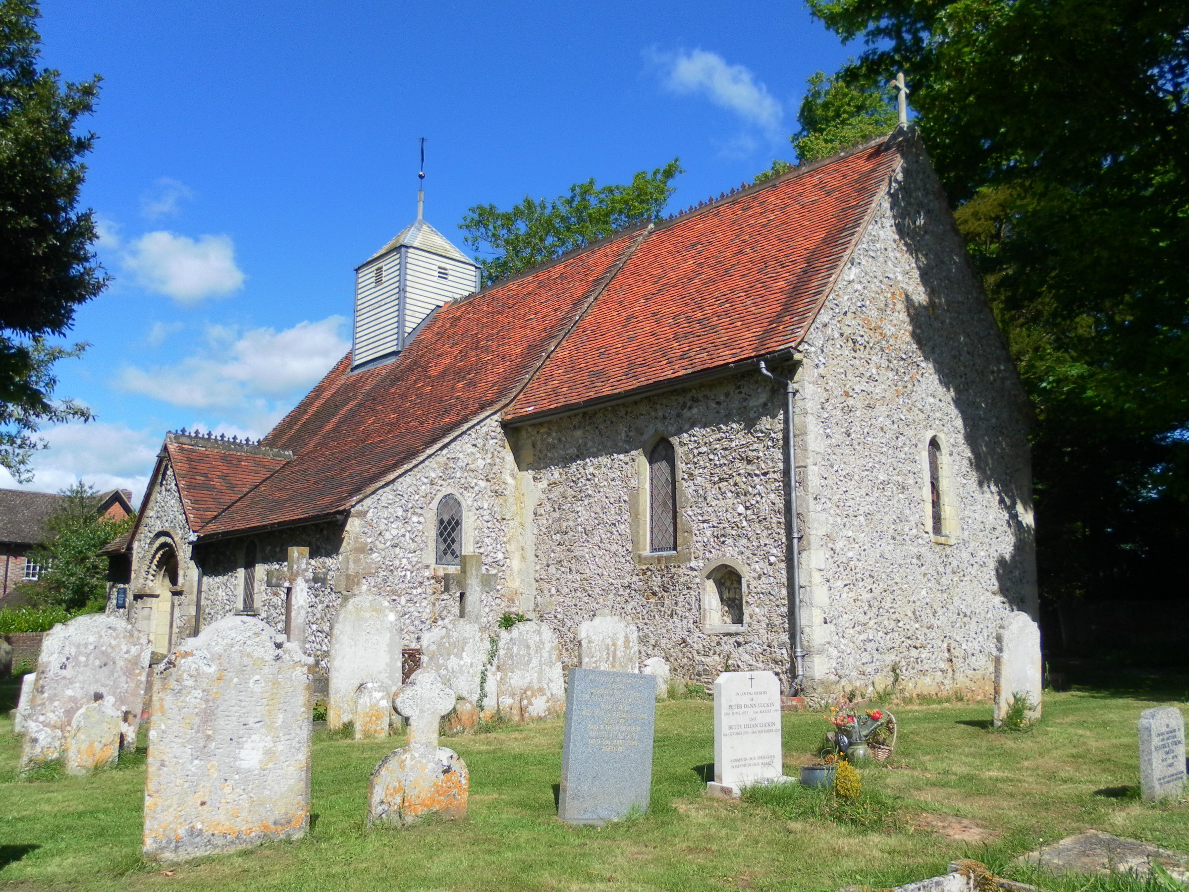
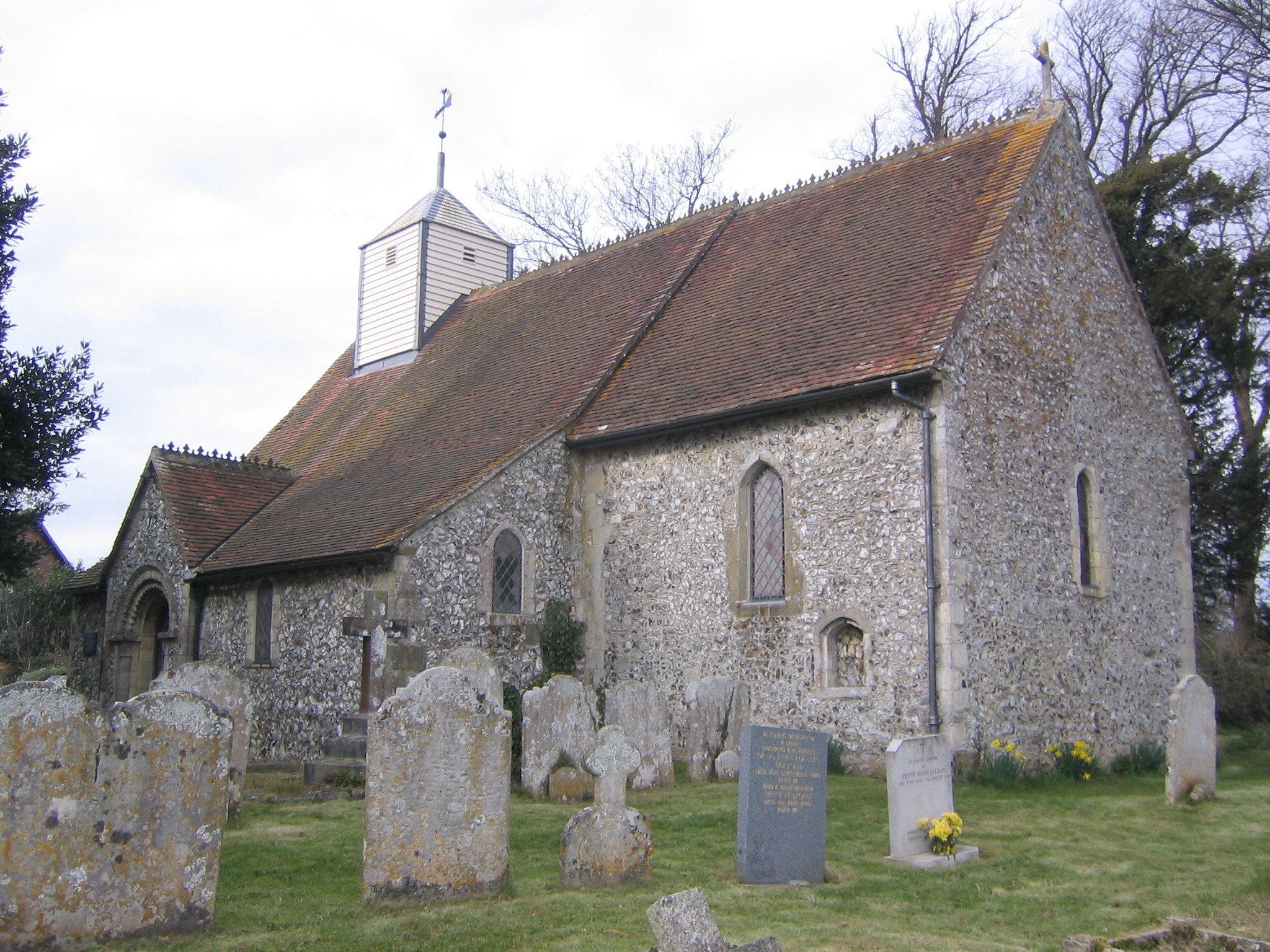
St Mary Magdalene's Church, Tortington

St Mary Magdalene's Church is the former Anglican parish church of the hamlet of Tortington in the district of Arun, one of seven local government districts...

Tortington

Tortington is a small village and former civil parish, now in the parish of Arundel, in the Arun district of West Sussex, England. It lies between the...

Arundel and District Hospital

Arundel and District Hospital is a health facility in Chichester Road, Arundel, West Sussex, England. It is managed by the Sussex Community NHS Foundation...

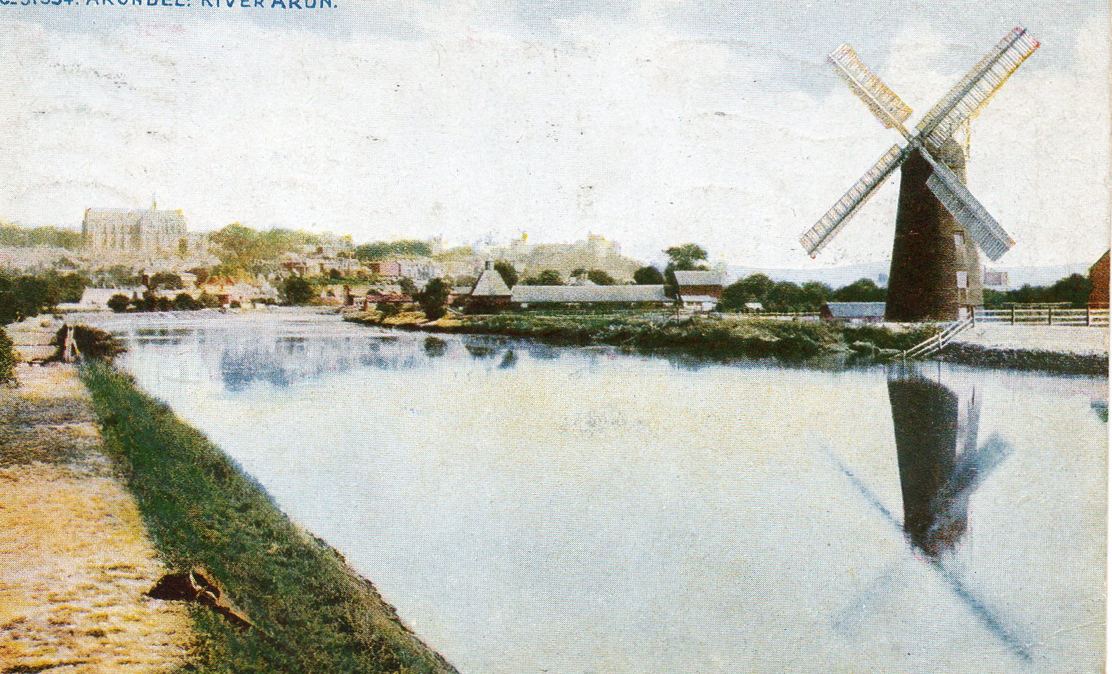
South Marsh Mill, Arundel

South Marsh Mill is a grade II listed tower mill at Arundel, Sussex, England which has been converted to residential use. == History == South Marsh Mill...

Ford railway station

Ford railway station is a railway station in Ford, West Sussex, England. It is located on the West Coastway Line which runs between Brighton and Southampton...

Have you been to Furzefield Copse?

Leave your review of Furzefield Copse below (or comments, questions and feedback).