Barn's Copse

Wood, Forest in Sussex Arun

England

Barn's Copse

Path in Slindon Woods
Path in Slindon Woods Credit: PAUL FARMER

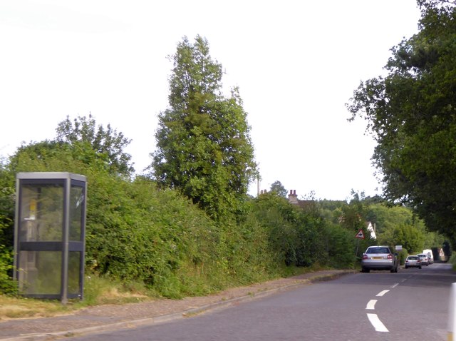
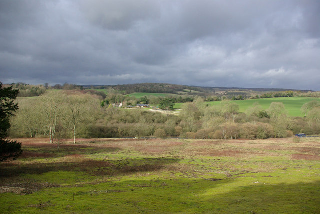
Barn's Copse is a picturesque woodland located in the county of Sussex, England. Spanning an area of approximately 100 acres, it is a charming example of a traditional English copse. The woodland is characterized by its diverse range of trees, including oak, beech, birch, and ash, which create a stunning display of colors throughout the seasons.

Situated on gently undulating terrain, Barn's Copse offers visitors a tranquil and peaceful ambiance. The forest floor is covered in a thick carpet of fallen leaves, providing a soft and natural path for walkers and hikers to explore the area. The copse is intersected by a network of well-maintained footpaths, allowing visitors to easily navigate through the woodland and discover its hidden treasures.

Wildlife enthusiasts will be delighted by the abundance of flora and fauna in Barn's Copse. The woodland is home to a variety of bird species, including woodpeckers, owls, and thrushes, making it a haven for birdwatchers. Squirrels can be spotted darting between the trees, and if lucky, visitors may even catch a glimpse of a timid deer or fox.

Barn's Copse is not only a haven for nature lovers but also a popular destination for families and outdoor enthusiasts. The well-equipped picnic areas and designated camping spots make it an ideal location for a day out or even an overnight stay. Whether it is exploring the woodland trails, capturing the beauty of the landscape through photography, or simply immersing oneself in the peacefulness of nature, Barn's Copse offers a truly enchanting experience for all who visit.

If you have any feedback on the listing, please let us know in the comments section below.

Barn's Copse Images

Images are sourced within 2km of 50.853898/-0.60902017 or Grid Reference SU9806. Thanks to Geograph Open Source API. All images are credited.

Path in Slindon Woods
The Spur at Slindon An inn on the A29 adjacent to a van dealership <a href="https://www.geograph.org.uk/photo/2209486">SU9708 : Spur of Slindon</a>
The Spur at Slindon
An inn on the A29 adjacent to a van dealership SU9708 : Spur of Slindon
Mill Road, Slindon Cars parked for car-sharing by drivers on the A29
Mill Road, Slindon
Cars parked for car-sharing by drivers on the A29
Houses at Slindon Common This row of houses is next to the junction crossroads of Reynolds Lane, Mill Road and Fairmile Bottom
Houses at Slindon Common
This row of houses is next to the junction crossroads of Reynolds Lane, Mill Road and Fairmile Bottom
Second Hand Van Sales This business known as Spur of Slindon sells vans and commercial vehicles from the site of an old petrol station on Fairmile Bottom the A429 close to the junction with Shellbridge Rd
Second Hand Van Sales
This business known as Spur of Slindon sells vans and commercial vehicles from the site of an old petrol station on Fairmile Bottom the A429 close to the junction with Shellbridge Rd
Lay-by A29
Lay-by A29
Bridleway, Rewell Wood Somewhat hazardous, with the fallen tree supported on a splinter of its trunk on the left.
Bridleway, Rewell Wood
Somewhat hazardous, with the fallen tree supported on a splinter of its trunk on the left.
Track junction, Rewell Wood Looking along a public bridleway, which continues half right down to Fairmile Bottom.
Track junction, Rewell Wood
Looking along a public bridleway, which continues half right down to Fairmile Bottom.
Track, Rewell Wood Looking from one of the eight-way junctions that are a feature of this geometrically laid out wood.
Track, Rewell Wood
Looking from one of the eight-way junctions that are a feature of this geometrically laid out wood.
Bridleway near Rewell House Heading towards Arundel.
Bridleway near Rewell House
Heading towards Arundel.
Bridleway near Rewell House Heading away from Aundel, and entering the actively managed Rewell Wood.
Bridleway near Rewell House
Heading away from Aundel, and entering the actively managed Rewell Wood.
Path, Rewell Wood Through chestnut coppice.
Path, Rewell Wood
Through chestnut coppice.
Path junction, Rewell Wood The path from left to right is a public bridleway.
Path junction, Rewell Wood
The path from left to right is a public bridleway.
Bridleways. Rewell and Madehurst Woods Rewell Wood is to the right.
Bridleways. Rewell and Madehurst Woods
Rewell Wood is to the right.
Bridleway along ancient earthwork A bank and ditch extends for some considerable distance. Most of it, together with some nearby earthworks, are in an area scheduled as an Ancient Monument. This seems to be because they look likely to be of archaeological interest, although their origin and purpose remain obscure. Surmises range from Romano-British to mediaeval times.
Bridleway along ancient earthwork
A bank and ditch extends for some considerable distance. Most of it, together with some nearby earthworks, are in an area scheduled as an Ancient Monument. This seems to be because they look likely to be of archaeological interest, although their origin and purpose remain obscure. Surmises range from Romano-British to mediaeval times.
Madehurst - Arundel parish boundary The boundary here follows an ancient earthwork, and is further marked with a string of cast-iron plates. These have 'N' on the Arundel side, and 'F' on the Madehurst side. 'N' must be for Norfolk, the Duke of Norfolk has owned most of Arundel for centuries. 'F' probably stands for Fletcher, a Fletcher bought the Madehurst manor in the 1850s. No earlier landowner was an 'F'.
Madehurst - Arundel parish boundary
The boundary here follows an ancient earthwork, and is further marked with a string of cast-iron plates. These have 'N' on the Arundel side, and 'F' on the Madehurst side. 'N' must be for Norfolk, the Duke of Norfolk has owned most of Arundel for centuries. 'F' probably stands for Fletcher, a Fletcher bought the Madehurst manor in the 1850s. No earlier landowner was an 'F'.
Bridleway along the Madehurst - Arundel boundary The boundary bank has clumps of Butcher's-broom at intervals.
Bridleway along the Madehurst - Arundel boundary
The boundary bank has clumps of Butcher's-broom at intervals.
A29 The A29 runs for 34 miles from the A24 at Capel, south of Dorking, through Billingshurst and Pulborough, crossing the South Downs at Bury Hill and passing Fontwell Park Racecourse before terminating on the B2166 on Bognor Regis sea front.
From Capel to Hardham, south of Pulborough, the road largely follows the path of the old Roman road, Stane Street.
A29
The A29 runs for 34 miles from the A24 at Capel, south of Dorking, through Billingshurst and Pulborough, crossing the South Downs at Bury Hill and passing Fontwell Park Racecourse before terminating on the B2166 on Bognor Regis sea front. From Capel to Hardham, south of Pulborough, the road largely follows the path of the old Roman road, Stane Street.
Show me another place!

Barn's Copse is located at Grid Ref: SU9806 (Lat: 50.853898, Lng: -0.60902017)

Administrative County: West Sussex

District: Arun

Police Authority: Sussex

What 3 Words

///kilt.amber.surfacing. Near Walberton, West Sussex

Related Wikis

A27 road

The A27 is a major road in England. It runs from its junction with the A36 at Whiteparish (near Salisbury) in the county of Wiltshire, follows the south...

Walberton

Walberton is a village and civil parish in the Arun District of West Sussex, England, 5 miles (8 km) north-west of Littlehampton, and south of the A27...

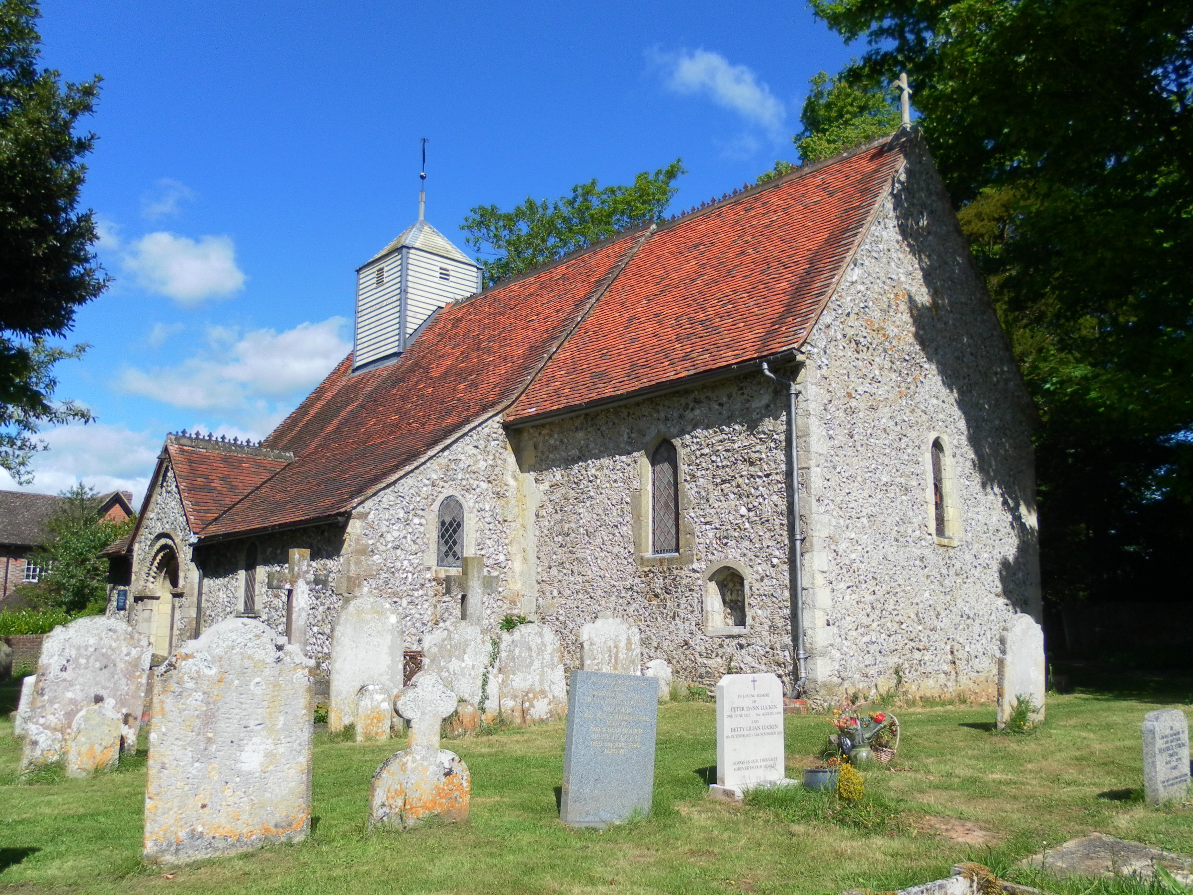
St Mary's Church, Walberton

St Mary's Church is an Anglican church in the village of Walberton in the district of Arun, one of seven local government districts in the English county...

Fontwell (electoral division)

Fontwell is an electoral division of West Sussex in the United Kingdom and returns one member to sit on West Sussex County Council. The current County...

Slindon

Slindon is a mostly rural village and civil parish in the Arun District of West Sussex, England, containing a developed nucleus amid woodland. Much of...

Fairmile Bottom

Fairmile Bottom is a 70.2-hectare (173-acre) biological Site of Special Scientific Interest north-west of Arundel in West Sussex. An area of 61.3 hectares...

St Mary Magdalene's Church, Tortington

St Mary Magdalene's Church is the former Anglican parish church of the hamlet of Tortington in the district of Arun, one of seven local government districts...

Arundel and District Hospital

Arundel and District Hospital is a health facility in Chichester Road, Arundel, West Sussex, England. It is managed by the Sussex Community NHS Foundation...

Nearby Amenities

Located within 500m of 50.853898,-0.60902017
Crossing
Bicycle: yes
Crossing: unmarked
Crossing Markings: no
Horse: yes
Kerb: lowered
Lat/Long: 50.8541626/-0.6129133
Crossing
Bicycle: yes
Crossing: unmarked
Crossing Markings: no
Horse: yes
Kerb: lowered
Lat/Long: 50.8540104/-0.6130163
The data included in this document is from www.openstreetmap.org. The data is made available under ODbL.

Have you been to Barn's Copse?

Leave your review of Barn's Copse below (or comments, questions and feedback).