Wing Plantations
Wood, Forest in Rutland
England
Wing Plantations

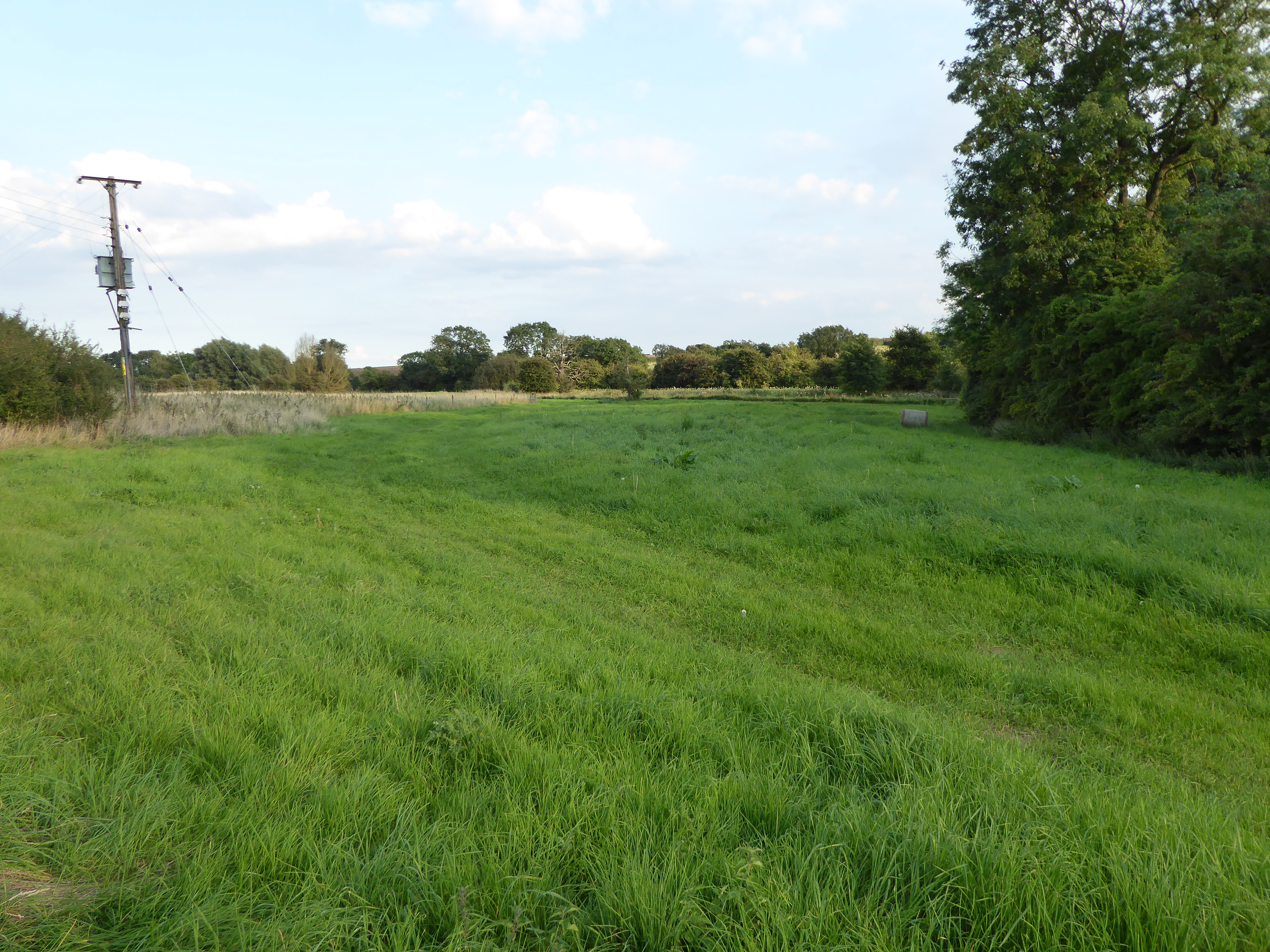
Wing Plantations, located in Rutland, is a sprawling woodland area that covers a vast expanse of land. The plantation is primarily known for its dense forest and abundant wood resources. Spanning over several hundred acres, Wing Plantations offers a picturesque landscape, making it a popular destination for nature enthusiasts and outdoor enthusiasts alike.
The woodland is predominantly composed of various tree species, including oak, ash, beech, and pine. These trees not only contribute to the aesthetic appeal of the area but also serve as an important habitat for a diverse range of wildlife. Visitors to Wing Plantations can often catch glimpses of numerous bird species, small mammals, and insects that call this forest their home.
Wing Plantations is also notable for its sustainable forestry practices. The management of the woodland is focused on responsible and renewable timber production. This ensures the long-term health and vitality of the forest ecosystem while also meeting the demand for wood resources.
The plantation is open to the public, offering a network of well-maintained trails and paths for walking, hiking, and cycling. These paths wind through the woodland, providing visitors with stunning views of the surrounding countryside and opportunities to immerse themselves in nature.
In addition to its natural beauty, Wing Plantations also provides educational opportunities. The site offers workshops and guided tours that highlight the importance of sustainable forestry and conservation efforts. These initiatives aim to raise awareness and promote a deeper understanding of the delicate balance between human activities and the natural environment.
Overall, Wing Plantations in Rutland is a captivating woodland area that offers a harmonious blend of natural beauty, sustainable forestry practices, and recreational opportunities for all to enjoy.
If you have any feedback on the listing, please let us know in the comments section below.
Wing Plantations Images
Images are sourced within 2km of 52.684011/-0.56177933 or Grid Reference SK9710. Thanks to Geograph Open Source API. All images are credited.


Wing Plantations is located at Grid Ref: SK9710 (Lat: 52.684011, Lng: -0.56177933)
Unitary Authority: Rutland
Police Authority: Leicestershire
What 3 Words
///gobblers.above.surveyed. Near Tickencote, Rutland
Nearby Locations
Related Wikis

Bloody Oaks Quarry
Bloody Oaks Quarry is a 1.3-hectare (3.2-acre) biological Site of Special Scientific Interest north-west of Great Casterton in Rutland. It is owned and...
Tickencote Marsh
Tickencote Marsh is a three hectare biological Site of Special Scientific Interest west of Tickencote and Great Casterton in Rutland.This site in the valley...

Battle of Losecoat Field
The Battle of Losecoat Field (also known as the Battle of Empingham) was fought on 12 March 1470, during the Wars of the Roses. Spellings of "Losecoat...

Tickencote
Tickencote is a small village and civil parish in the county of Rutland in the East Midlands of England. It is noted for St Peter's Church, with its Norman...
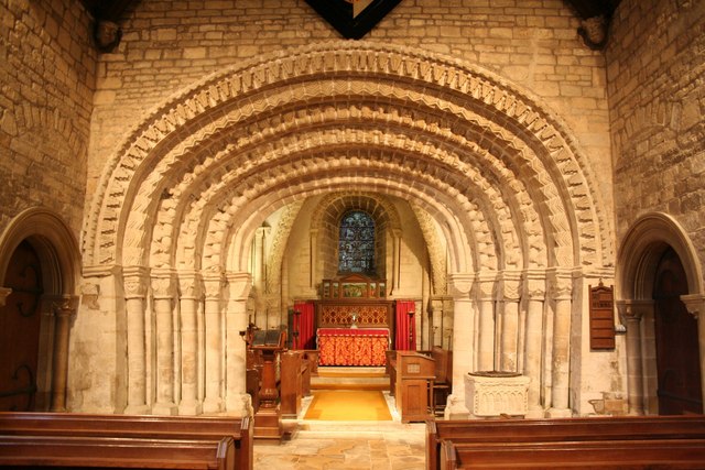
St Peter's Church, Tickencote
St Peter's Church, Tickencote is a Church of England parish church in Tickencote, Rutland. Apart from the chancel arch and the sexpartite vaulting in the...
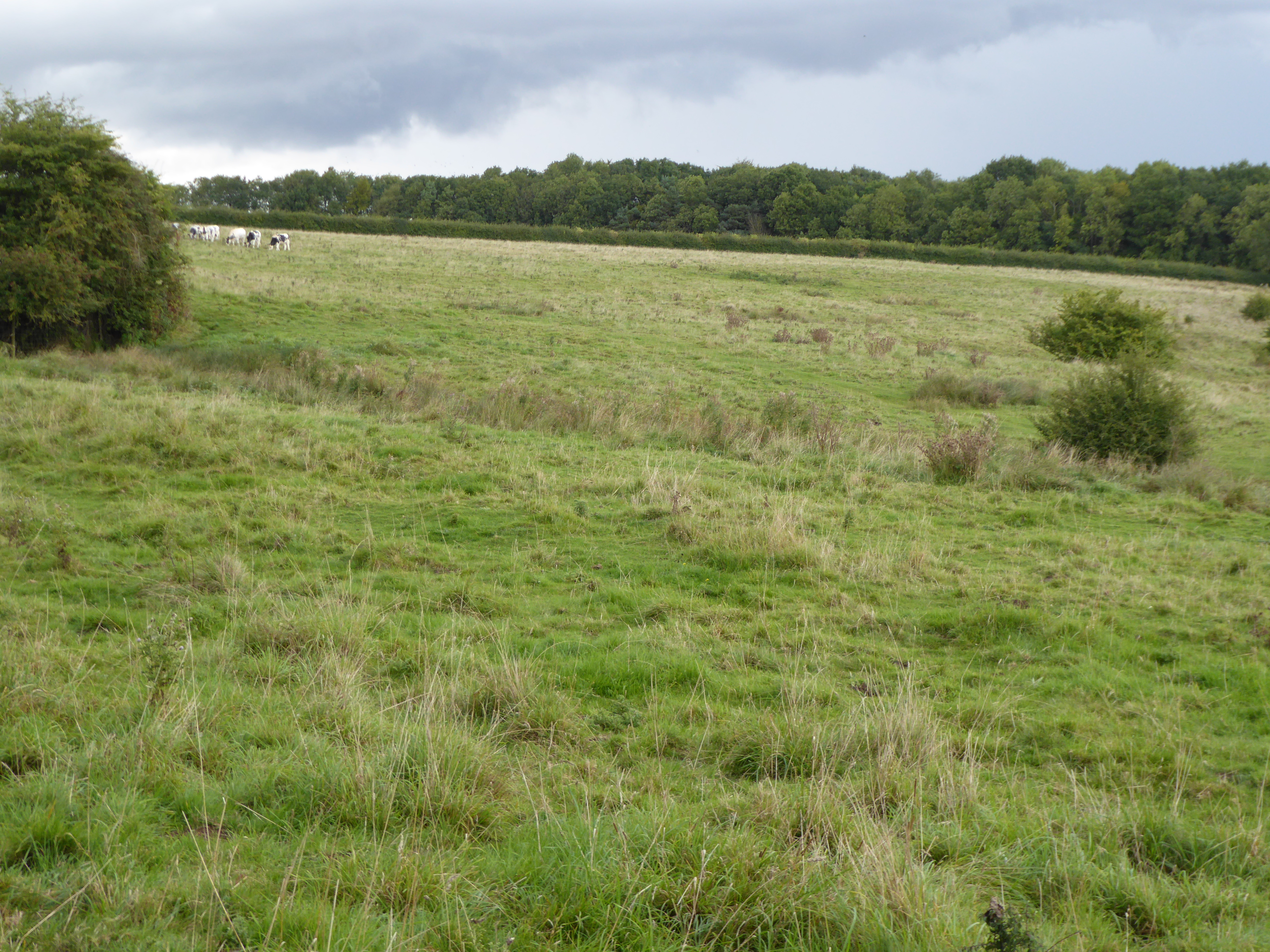
Empingham Marshy Meadows
Empingham Marshy Meadows is a 14 hectare biological Site of Special Scientific Interest north of Empingham in Rutland.This site in the valley of the North...

Horn, Rutland
Horn is a former civil parish, now in the parish of Exton and Horn, in the county of Rutland, England. In 2001 it had a population of 9, which was included...
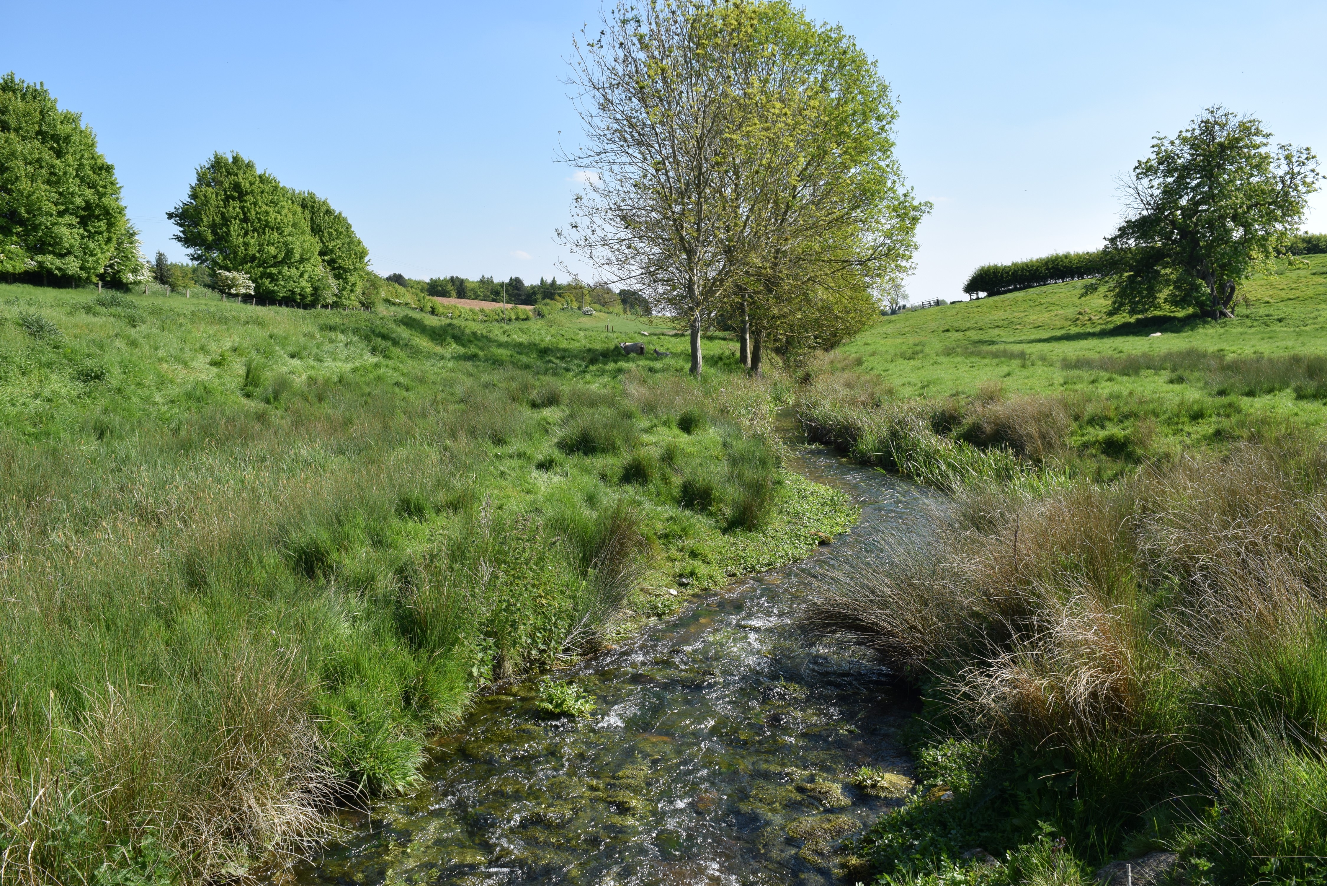
North Brook, Rutland
The North Brook is a small watercourse in Rutland in the East Midlands of England. It is a tributary of the River Gwash and part of the River Welland catchment...
Nearby Amenities
Located within 500m of 52.684011,-0.56177933Have you been to Wing Plantations?
Leave your review of Wing Plantations below (or comments, questions and feedback).