Alder Cover

Wood, Forest in Surrey Runnymede

England

Alder Cover

Totem Pole, Windsor Great Park The 100-foot pole bears traditional First Nations carvings and was a gift from the Canadian province of British Columbia to the Queen in 1958.
Totem Pole, Windsor Great Park Credit: Mark Percy

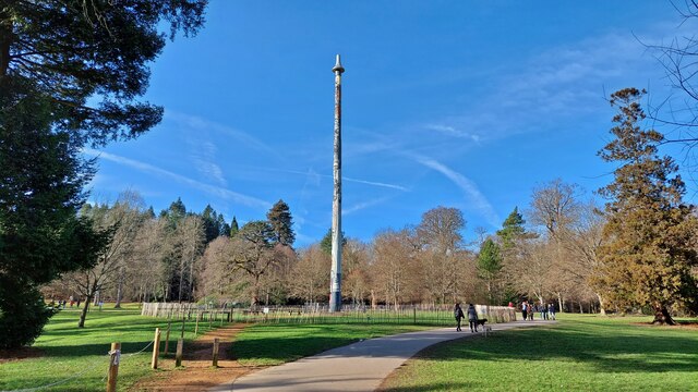
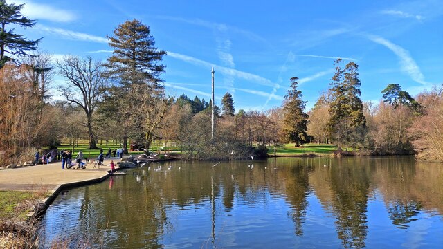
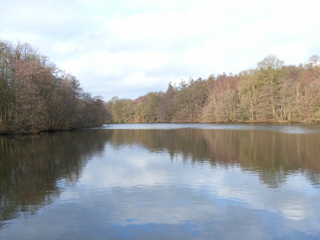
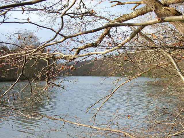
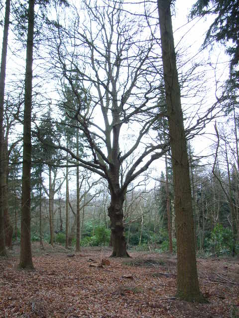
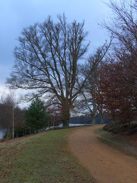
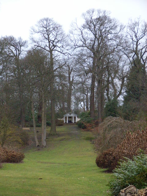
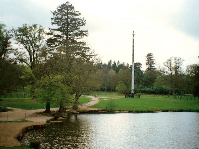
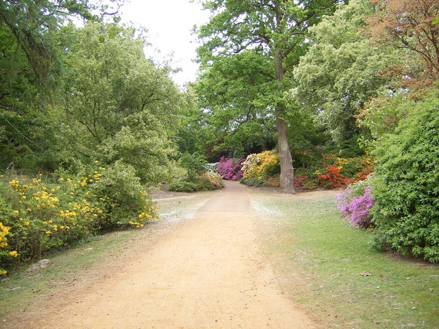
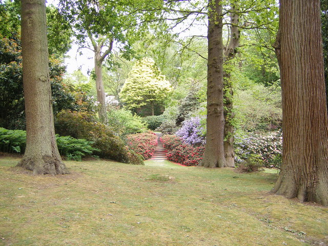
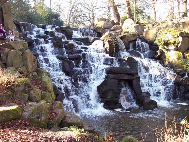
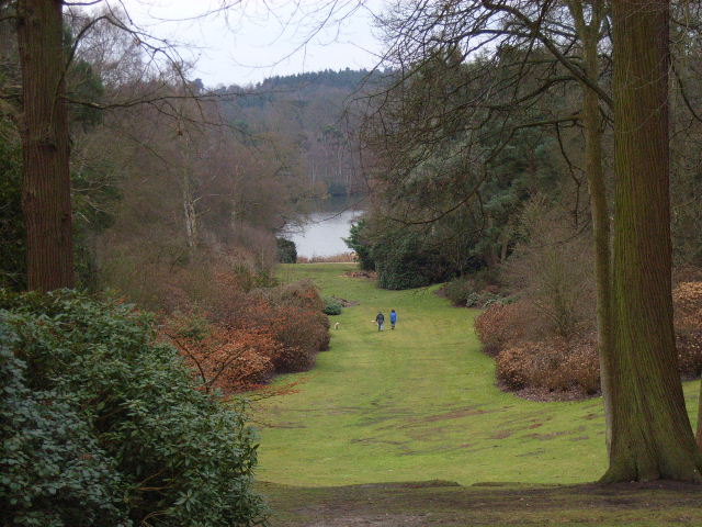
Alder Cover is a picturesque woodland located in Surrey, England. This charming forest is known for its dense population of alder trees, which give the area its name. The woodland covers an expansive area and is a popular destination for nature enthusiasts and hikers.

Alder Cover boasts a rich ecosystem, with a diverse range of flora and fauna. The alder trees dominate the landscape, creating a dense canopy that provides shade and shelter for a variety of plant species. Ferns, mosses, and wildflowers can be found flourishing underneath the towering alders, adding to the area's natural beauty.

The forest is also home to a diverse range of wildlife. Visitors may spot deer, foxes, rabbits, and an array of bird species as they explore the woodland. The tranquil atmosphere and peaceful surroundings make Alder Cover a perfect spot for birdwatching and wildlife observation.

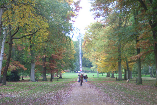
There are well-maintained walking trails throughout the forest, offering visitors the opportunity to fully immerse themselves in the natural splendor of Alder Cover. These trails wind through the woodland, providing stunning views of the alder trees and allowing visitors to explore the forest at their own pace.

Alder Cover is a true gem in the Surrey countryside, offering a peaceful retreat from the hustle and bustle of everyday life. Whether it's a leisurely stroll, a birdwatching adventure, or simply a moment of tranquility in nature, this woodland sanctuary has something for everyone to enjoy.

If you have any feedback on the listing, please let us know in the comments section below.

Alder Cover Images

Images are sourced within 2km of 51.424515/-0.60154762 or Grid Reference SU9770. Thanks to Geograph Open Source API. All images are credited.

Totem Pole, Windsor Great Park The 100-foot pole bears traditional First Nations carvings and was a gift from the Canadian province of British Columbia to the Queen in 1958.
Totem Pole, Windsor Great Park
The 100-foot pole bears traditional First Nations carvings and was a gift from the Canadian province of British Columbia to the Queen in 1958.
Wick Pond, Windsor Great Park Looking across Wick Pond to the totem pole.
Wick Pond, Windsor Great Park
Looking across Wick Pond to the totem pole.
Virginia Water This Totem Pole is located on the extreme western edge of the square in Virginia Water.
Virginia Water
This Totem Pole is located on the extreme western edge of the square in Virginia Water.
Wentworth The entrance to the world famous championship golf course.
Wentworth
The entrance to the world famous championship golf course.
Johnson's Pond, Windsor Great Park A small waterfall connects this to Virginia Water.
Johnson's Pond, Windsor Great Park
A small waterfall connects this to Virginia Water.
The Valley Gardens, Windsor Great Park The view from a gazebo in the gardens down to Virginia Water.
The Valley Gardens, Windsor Great Park
The view from a gazebo in the gardens down to Virginia Water.
Virginia Water Looking west from near the bridge that crosses the lake.
Virginia Water
Looking west from near the bridge that crosses the lake.
Woodland in Windsor Great Park Near American Clump to the north of Virginia Water.
Woodland in Windsor Great Park
Near American Clump to the north of Virginia Water.
The banks of Virginia Water in Valley Gardens
Gazebo in Valley Gardens
Totem pole at Virginia Water The totem pole is situated at the northern end of Virginia Water lake in Windsor Great Park
Totem pole at Virginia Water
The totem pole is situated at the northern end of Virginia Water lake in Windsor Great Park
Totem pole, Virginia Water, Surrey Autumn in the park
Totem pole, Virginia Water, Surrey
Autumn in the park
Virginia Water Aerial view of the Lake
Virginia Water
Aerial view of the Lake
Totem Pole, Virginia Water Given to The Queen in 1958.
Totem Pole, Virginia Water
Given to The Queen in 1958.
Valley Gardens, Virginia Water
Devil's Punchbowl, Valley Gardens Virginia Water
Devil's Punchbowl, Valley Gardens
Virginia Water
The Cascade, Virginia Water The Cascade was constructed in the 18ct, reputedly using stones taken from the site of a Saxon settlement on Bagshot Heath. For a view of the Cascade taken in Nov 2013 refer to picture <a href="https://www.geograph.org.uk/photo/3734030">SU9768 : The Cascade, Virginia Water</a>.
The Cascade, Virginia Water
The Cascade was constructed in the 18ct, reputedly using stones taken from the site of a Saxon settlement on Bagshot Heath. For a view of the Cascade taken in Nov 2013 refer to picture SU9768 : The Cascade, Virginia Water.
Leptis Magna, Virginia Water, (left view) The remains of a Roman Temple from Leptis Magna, near Tripoli, Libya, were given to the Prince Regent, (later King George IV), in 1816. After languishing at the British Museum for 10 years they were erected, not necessarily correctly, in Virginia Water by Sir Jeffery Wyatville. Refer to picture <a href="https://www.geograph.org.uk/photo/2660610">SU9768 : Leptis Magna</a> for a view of Leptis Magna taken in Oct 2011.
Leptis Magna, Virginia Water, (left view)
The remains of a Roman Temple from Leptis Magna, near Tripoli, Libya, were given to the Prince Regent, (later King George IV), in 1816. After languishing at the British Museum for 10 years they were erected, not necessarily correctly, in Virginia Water by Sir Jeffery Wyatville. Refer to picture SU9768 : Leptis Magna for a view of Leptis Magna taken in Oct 2011.
Show me another place!

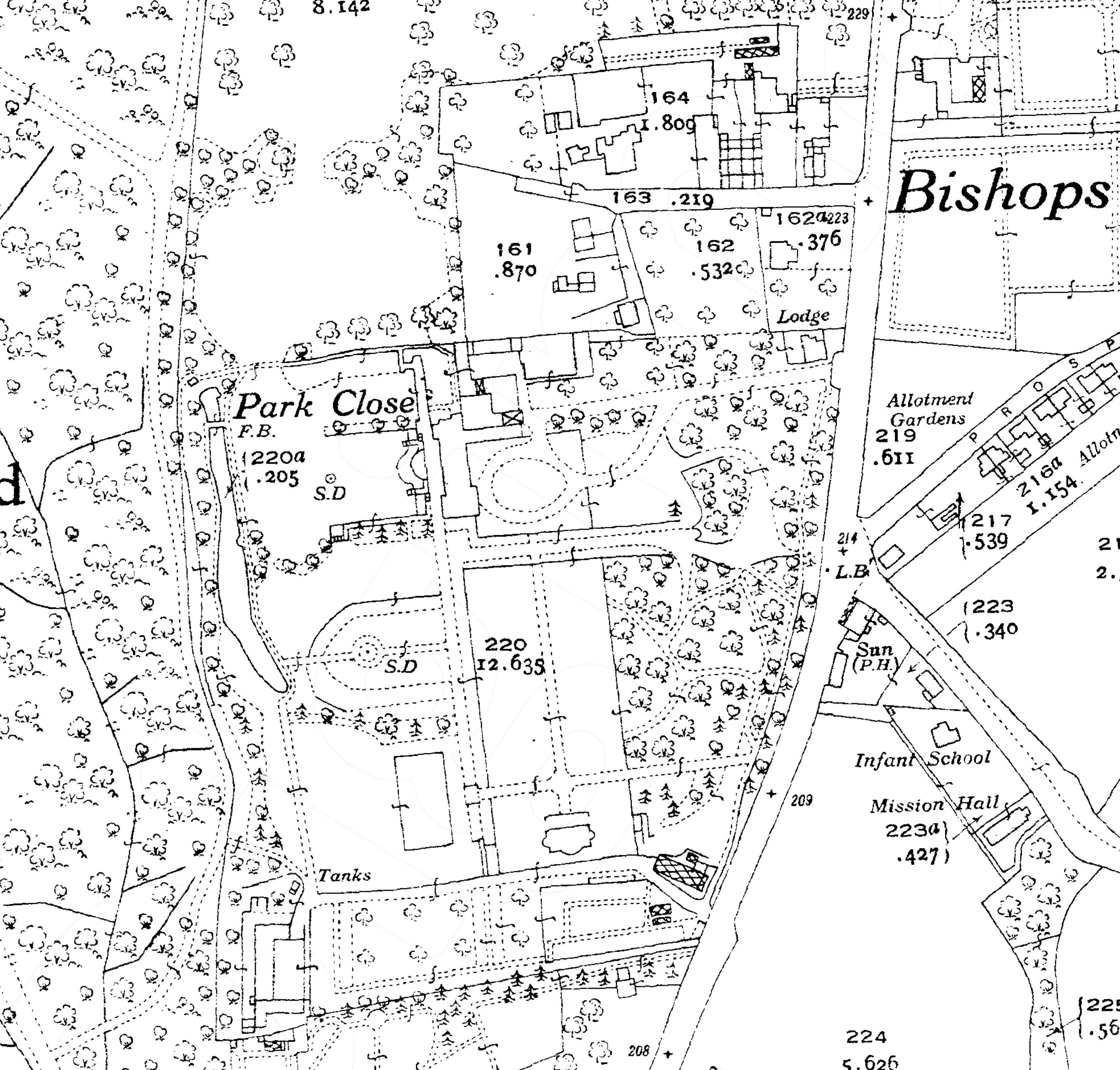
Alder Cover is located at Grid Ref: SU9770 (Lat: 51.424515, Lng: -0.60154762)

Administrative County: Surrey

District: Runnymede

Police Authority: Surrey

What 3 Words

///input.green.plants. Near Virginia Water, Surrey

Related Wikis

Savill Building

The Savill Building is a visitor centre at the entrance to The Savill Garden in Windsor Great Park, Surrey, England designed by Glen Howells Architects...

Savill Garden

The Savill Garden is an enclosed part of Windsor Great Park in England, created by Sir Eric Savill in the 1930s. It is managed by the Crown Estate and...

Valley Gardens

The Valley Gardens are 220 acres (0.89 km2) of woodland garden, part of the Crown Estate located near Englefield Green in the English county of Surrey...

Zodiac (ride)

Zodiac is an Enterprise ride at Thorpe Park, Surrey, United Kingdom. == History == The ride originally opened in 2000 as 'Enterprise', though it came to...

Samurai (ride)

Samurai is a Mondial Top Scan ride located at Thorpe Park in the United Kingdom. It was originally installed at nearby Chessington World of Adventures...

Windsor Court

Windsor Court is a large country house in, Englefield Green, Surrey, England. The mansion adjoins Windsor Great Park. == History == The 37,000 sq ft house...

Shelley's Cottage

Shelley's Cottage is a Grade II listed early 19th-century large cottage in west Englefield Green, Surrey, England within 100 metres of Windsor Great Park...

Cumberland Lodge

Cumberland Lodge is a 17th-century Grade II listed country house in Windsor Great Park 3.5 miles south of Windsor Castle. Since 1947 it has been occupied...

Nearby Amenities

Located within 500m of 51.424515,-0.60154762
Cumberland Obelisk
Historic: monument
Wikidata: Q26658475
Lat/Long: 51.4247274/-0.5976528
Cafe
Lat/Long: 51.4265456/-0.5970402
Shop: garden_centre
Lat/Long: 51.4262979/-0.5973901
Created By: Potlatch 0.10a
Tourism: picnic_site
Lat/Long: 51.4247569/-0.598089
Toilets
Lat/Long: 51.4263405/-0.5972318
Savill Garden, Valley Gardens, Virginia Water
Information: map
Map Size: site
Map Type: scheme
Tourism: information
Lat/Long: 51.4250736/-0.5961624
Savill Garden, Valley Gardens, Virginia Water
Information: map
Map Size: site
Map Type: scheme
Tourism: information
Lat/Long: 51.4253756/-0.5973441
Tourism: picnic_site
Lat/Long: 51.4244579/-0.5969287
Barrier: lift_gate
Bicycle: yes
Foot: yes
Motorcar: yes
Motorcycle: yes
Lat/Long: 51.4257749/-0.5969766
Tourism: viewpoint
Lat/Long: 51.4258313/-0.5988697
Barrier: lift_gate
Lat/Long: 51.4259991/-0.5953266
Alder Cover
Natural: wood
Lat/Long: 51.4243108/-0.601176
Fuzzy Clump
Natural: wood
Lat/Long: 51.4234931/-0.6036763
Barrier: tick
Lat/Long: 51.4265833/-0.5975603
Bicycle Parking
Bicycle Parking: stands
Capacity: 8
Covered: no
Lat/Long: 51.4263041/-0.5965469
Bicycle Parking
Bicycle Parking: stands
Capacity: 8
Covered: no
Lat/Long: 51.4263688/-0.5967168
Bicycle Parking
Bicycle Parking: stands
Capacity: 8
Covered: no
Lat/Long: 51.4264305/-0.596695
Bench
Lat/Long: 51.4272886/-0.5978383
Bench
Lat/Long: 51.4280794/-0.5984994
Barrier: lift_gate
Lat/Long: 51.4257385/-0.595367
Restaurant
Lat/Long: 51.4266704/-0.5971748
Entrance: yes
Lat/Long: 51.4265786/-0.5974856
Entrance: main
Lat/Long: 51.4264919/-0.5971176
Vending Machine
Vending: parking_tickets
Lat/Long: 51.4264352/-0.5966146
Vending Machine
Vending: parking_tickets
Lat/Long: 51.4263398/-0.5966567
Entrance: yes
Lat/Long: 51.4261083/-0.597519
Barrier: bollard
Bollard: fixed
Colour: White
Material: concrete
Lat/Long: 51.4214892/-0.6035754
Barrier: bollard
Bollard: fixed
Colour: White
Material: concrete
Lat/Long: 51.4215068/-0.6035455
Barrier: bollard
Bollard: fixed
Colour: White
Material: concrete
Lat/Long: 51.4215238/-0.6035017
Barrier: bollard
Bollard: fixed
Colour: White
Material: concrete
Lat/Long: 51.4215319/-0.6034537
Barrier: bollard
Bollard: fixed
Colour: White
Material: concrete
Lat/Long: 51.4215293/-0.6034162
Barrier: bollard
Bollard: fixed
Colour: White
Material: concrete
Lat/Long: 51.4215208/-0.6033816
Barrier: bollard
Bollard: fixed
Colour: White
Material: concrete
Lat/Long: 51.4215133/-0.6033487
Barrier: bollard
Bollard: fixed
Colour: White
Material: concrete
Lat/Long: 51.4214968/-0.6033242
Barrier: bollard
Bollard: fixed
Colour: White
Material: concrete
Lat/Long: 51.4214761/-0.6032884
Barrier: bollard
Bollard: fixed
Colour: White
Material: concrete
Lat/Long: 51.421461/-0.6032593
Barrier: bollard
Bollard: fixed
Colour: White
Material: concrete
Lat/Long: 51.4214377/-0.603226
The data included in this document is from www.openstreetmap.org. The data is made available under ODbL.

Have you been to Alder Cover?

Leave your review of Alder Cover below (or comments, questions and feedback).