Hazelbridge Hanger

Wood, Forest in Surrey Waverley

England

Hazelbridge Hanger

Ridgley Road at the junction of Coxcomb Lane
Ridgley Road at the junction of Coxcomb Lane Credit: David Howard

Hazelbridge Hanger is a picturesque woodland located in Surrey, England. Situated in the heart of the county, this hanger is part of the larger Surrey Hills Area of Outstanding Natural Beauty. The hanger is named after the abundant hazel trees that populate the area, providing a unique and captivating landscape for visitors.

Covering an area of approximately 100 acres, Hazelbridge Hanger is known for its dense woodland and diverse flora and fauna. The woodland is predominantly composed of broadleaf trees, including oak, birch, and beech, creating a vibrant and colorful canopy throughout the seasons. Bluebells carpet the forest floor in spring, creating a breathtaking spectacle of blue hues.

The hanger is a popular destination for nature enthusiasts, hikers, and photographers. Numerous footpaths and trails wind through the woodland, offering visitors the chance to explore its beauty and discover its hidden gems. The tranquil atmosphere and peaceful ambiance make it an ideal spot for relaxation and escape from the hustle and bustle of everyday life.

Wildlife thrives in Hazelbridge Hanger, making it a haven for nature lovers. Deer, foxes, and numerous bird species can often be spotted within the woodland. The area is also home to a variety of rare and protected species, including the hazel dormouse and the purple emperor butterfly.

Overall, Hazelbridge Hanger in Surrey is a captivating woodland that offers an immersive experience in nature. With its rich biodiversity and scenic beauty, it is a beloved destination for both locals and tourists alike.

If you have any feedback on the listing, please let us know in the comments section below.

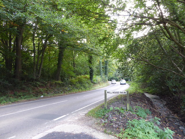
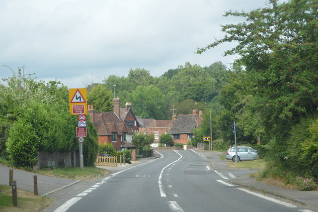
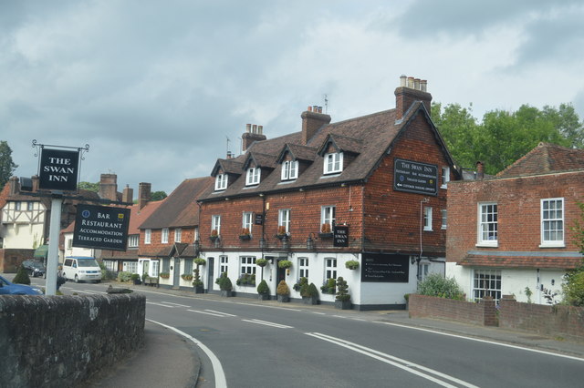
Hazelbridge Hanger Images

Images are sourced within 2km of 51.103186/-0.62022054 or Grid Reference SU9634. Thanks to Geograph Open Source API. All images are credited.

Ridgley Road at the junction of Coxcomb Lane
Cottage on Combe Lane, Chiddingfold
Shops on The Green, Chiddingfold
Shops on The Green, Chiddingfold A very small Boots, one of the few large chains who kept their village shops as well.
Shops on The Green, Chiddingfold
A very small Boots, one of the few large chains who kept their village shops as well.
House on The Green, Chiddingfold
The Winterton Arms, Chiddingfold
Houses on Petworth Road, Chiddingfold
Petworth Road, Chiddingfold
Old house on Petworth Road, Chiddingfold
Exploring eastwards along the Bashire (5) Guess where I am on the A283!
Running total: 24 B points
Exploring eastwards along the Bashire (5)
Guess where I am on the A283! Running total: 24 B points
Exploring eastwards along the Bashire (6) Looking from Shillinglee Park Road into Pickhurst Road
Running total: 25 B points
Exploring eastwards along the Bashire (6)
Looking from Shillinglee Park Road into Pickhurst Road Running total: 25 B points
Exploring eastwards along the Bashire (7) Footpath sign opposite Robin Farm Racing Stables
Exploring eastwards along the Bashire (7)
Footpath sign opposite Robin Farm Racing Stables
A283, northbound The A283 runs 37 miles from Milford near Guildford south to Shoreham-on-Sea across rural Surrey and West Sussex.
<span class="nowrap"><a title="https://www.sabre-roads.org.uk/wiki/index.php?title=A283" rel="nofollow ugc noopener" href="https://www.sabre-roads.org.uk/wiki/index.php?title=A283">Link</a><img style="margin-left:2px;" alt="External link" title="External link - shift click to open in new window" src="https://s1.geograph.org.uk/img/external.png" width="10" height="10"/></span>
A283, northbound
The A283 runs 37 miles from Milford near Guildford south to Shoreham-on-Sea across rural Surrey and West Sussex. LinkExternal link
Entering Chiddingfold, A283 Chiddingfold is a village and civil parish in the heart of The Weald in the Waverley district of Surrey. It lies on the A283 between Milford and Petworth.
Wikipedia: <span class="nowrap"><a title="http://en.wikipedia.org/wiki/Chiddingfold" rel="nofollow ugc noopener" href="http://en.wikipedia.org/wiki/Chiddingfold">Link</a><img style="margin-left:2px;" alt="External link" title="External link - shift click to open in new window" src="https://s1.geograph.org.uk/img/external.png" width="10" height="10"/></span>
Entering Chiddingfold, A283
Chiddingfold is a village and civil parish in the heart of The Weald in the Waverley district of Surrey. It lies on the A283 between Milford and Petworth. Wikipedia: LinkExternal link
A283, Chiddingfold The A283 runs 37 miles from Milford near Guildford south to Shoreham-on-Sea across rural Surrey and West Sussex.
<span class="nowrap"><a title="https://www.sabre-roads.org.uk/wiki/index.php?title=A283" rel="nofollow ugc noopener" href="https://www.sabre-roads.org.uk/wiki/index.php?title=A283">Link</a><img style="margin-left:2px;" alt="External link" title="External link - shift click to open in new window" src="https://s1.geograph.org.uk/img/external.png" width="10" height="10"/></span>
A283, Chiddingfold
The A283 runs 37 miles from Milford near Guildford south to Shoreham-on-Sea across rural Surrey and West Sussex. LinkExternal link
The Swan Inn
The Swan Inn
Show me another place!

Hazelbridge Hanger is located at Grid Ref: SU9634 (Lat: 51.103186, Lng: -0.62022054)

Administrative County: Surrey

District: Waverley

Police Authority: Surrey

What 3 Words

///cheek.ogre.infects. Near Chiddingfold, Surrey

Related Wikis

Pickhurst

Pickhurst is a grade II* listed house set in 130 acres (53 ha) of land near Chiddingfold, Surrey, England. == History == It was designed by the Scottish...

Chiddingfold

Chiddingfold is a village and civil parish in the Weald in the Waverley district of Surrey, England. It lies on the A283 road between Milford and Petworth...

St Teresa of Avila Church, Chiddingfold

St Teresa of Avila Church is a Roman Catholic Parish church in Chiddingfold, Surrey. It is situated on the corner of Petworth Road and Woodside Road in...

The Farm (recording studio)

The Farm (also known as Fisher Lane Farm) was a recording studio in Chiddingfold, Surrey owned by the rock band Genesis. The group bought the property...

Shillinglee

Shillinglee is an 18th-century house and estate in West Sussex, England near the Surrey border, in between the villages of Chiddingfold and Plaistow. It...

Ramster

Ramster Garden is an open garden, near Chiddingfold, Surrey, covering over 20 acres (81,000 m2). First landscaped and laid out in the 1890s by Gauntlett...

Ramsnest Common

Ramsnest Common is a hamlet in the far south of the Borough of Waverley, the largest district of Surrey, England centred on the A283 1.5 miles (2.4 km...

Netherside Stream Outcrops

Netherside Stream Outcrops is a 2.9-hectare (7.2-acre) geological Site of Special Scientific Interest north-east of Haslemere in Surrey. It is a Geological...

Nearby Amenities

Located within 500m of 51.103186,-0.62022054
Barrier: stile
Lat/Long: 51.1045159/-0.6180325
Post Box
Ref: GU8 97
Lat/Long: 51.1061294/-0.6194758
The data included in this document is from www.openstreetmap.org. The data is made available under ODbL.

Have you been to Hazelbridge Hanger?

Leave your review of Hazelbridge Hanger below (or comments, questions and feedback).